Lewis and Clark Lake
Coordinates: 42 ° 51 ′ 45 " N , 97 ° 29 ′ 30" W.
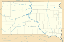
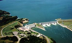
The Lewis and Clark Lake is an artificial lake on the border between Nebraska and South Dakota in the United States of America. The Missouri is dammed over a length of 40 kilometers from Gavins Point Dam , has an area of 130 km² and is up to 14 meters deep. The reservoir was named after the famous American explorers Meriwether Lewis and William Clark .
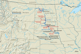
The dam is located near Yankton, South Dakota . It was built as part of the Pick Sloan program from 1952 by the US Army Corps of Engineers and has been operated by the latter since 1957. The reservoir flooded parts of the Yankton Reservation and the Santee Sioux Reservation . To enforce the construction project, the Army Corps illegally expropriated the Yankton Sioux for a small amount of compensation that did not even cover their resettlement costs. Years later, they were granted additional compensation.
Web links
- Lewis and Clark Lake on the US Army Corps of Engineers website
Individual evidence
- ↑ Michael L. Lawson: Dammed Indians: The Pick-Sloan Plan and the Missouri River Sioux, 1944-1980 . University of Oklahoma Press, 1994. ISBN 9780806126722


