List of natural monuments in Dessau-Roßlau
The list of natural monuments in Dessau-Roßlau contains all natural monuments of the city of Dessau-Roßlau and its districts which are protected by statutory instrument. Natural monuments are individual creations of nature whose preservation is in the public interest because of their outstanding beauty, rarity or individuality or their ecological, scientific, historical, folkloric or local history. A distinction is made between natural monuments, planar natural monuments and planar natural monuments. (As of December 31, 2010)
Explanation
- Reg.Nr .: registration number according to the published list
- Designation: Name of the natural monument
- Location: states the location of the natural monument in the respective location and, if applicable, the coordinates of the natural monument
- Year: indicates the year of protection
- Image: Illustration of the natural monument
Natural monuments
| Registration number. | designation | Location | year | image |
|---|---|---|---|---|
| ND_0001DE_ | Bald cypress group on Lake Kühnau | Dessau-Rosslau | 1981 |

|
| ND_0002DE_ | English oaks from 4 m chest height (approx. 555 trees) | Dessau-Rosslau | 1986 |

|
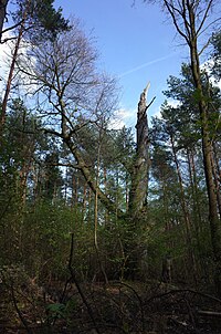
| ND_0003DE_ | European beech near Königendorf | Dessau-Rosslau | 1986 |
|
| ND_0004DE_ | Forest pine near Königendorf | Dessau-Rosslau | 1986 |

|
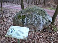
| ND_0005DE_ | Boulder in the Mosigkauer Heide | Dessau-Roßlau 51 ° 46 ′ 15 ″ N , 12 ° 11 ′ 38.3 ″ E |
1988 |
|
| ND_0006DE_ | Boulder group in the forest pool | Dessau-Rosslau | 1988 |

|
| ND_0007DE_ | Lindenallee between Kochstedt and Schälwerk | Dessau-Rosslau | 1981 |

|
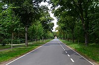
| ND_0008DE_ | Ebertallee (linden and horse chestnut) | Dessau-Rosslau | 1981 |
|
| ND_0009DE_ | Platanenallee (Heidestrasse) | Dessau-Rosslau | 1981 |

|
| ND_0010DE_ | Eichenallee (Landhausallee or Eichendom) | Dessau-Rosslau | 1981 |

|
| ND_0011DE_ | 37 old oaks / Croatian oaks | Dessau-Rosslau | 1986 | |
| ND_0012DE_ | 2 English oaks in Sollnitz | Dessau-Rosslau | 1986 |

|
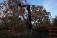
| ND_0013DE_ | Pedunculate Oak Hofsee | Dessau-Rosslau | 1986 |
|
| ND_0014DE_ | 2 English oak stillings 1. – 2. pond | Dessau-Rosslau | 1986 | |
| ND_0015DE_ | 2 English oak stillings 2. Pond | Dessau-Rosslau | 1986 | |
| ND_0016DE_ | Pedunculate Oak Stillinge 1. Pond | Dessau-Rosslau | 1986 | |
| ND_0017DE_ | 10 English oaks in the Mühlbruch area | Dessau-Rosslau | 1986 | |
| ND_0018DE_ | Pedunculate oak goat cord | Dessau-Rosslau | 1986 | |
| ND_0019DE_ | 7 European beech leek meadows | Dessau-Rosslau | 1986 | |
| ND_0020DE_ | 2 English oaks New Meadows | Dessau-Rosslau | 1986 | |
| ND_0021DE_ | Pedunculate Oak Black Pool | Dessau-Rosslau | 1986 |

|
| ND_0022DE_ | Pedunculate oak old badger burrow | Dessau-Rosslau | 1986 | |
| ND_0023DE_ | Pedunculate oak Kirchweg | Dessau-Rosslau | 1986 | |
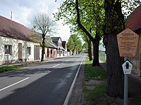
| ND_0024DE_ | 23 horse chestnuts, 47 winter linden trees in Sollnitz | Dessau-Rosslau | 1986 |
|
| ND_0025DE_ | Pedunculate Oak High Bank | Dessau-Rosslau | 1986 | |
| ND_0026DE_ | 14 English oaks at the edge of the forest Neue Wiesen | Dessau-Rosslau | 1986 | |
| ND_0027DE_ | 11 Solitary oaks New meadows | Dessau-Rosslau | 1986 | |
| ND_0028DE_ | Pedunculate Oak New Meadows | Dessau-Rosslau | 1986 | |
| ND_0029DE_ | Pedunculate oak leaf guard | Dessau-Rosslau | 1986 | |
| ND_0030DE_ | 17 Red beech Kleutscher Aue | Dessau-Rosslau | 1986 | |
| ND_0031DE_ | 7 beech stillings | Dessau-Rosslau | 1986 | |
| ND_0032DE_ | 2 winter linden trees in Möhlau | Dessau-Rosslau | 1986 | |
| ND_0033DE_ | Galgenberg boulder group near Neeken | Dessau-Rosslau | 1979 |

|
| ND_0035DE_ | Plane trees, maples, horse chestnuts (avenue) | Dessau-Rosslau | 1979 | |
| ND_0042DE_ | Lindenallee on Anhalter Strasse | Dessau 51 ° 48 ′ 26.4 ″ N , 12 ° 9 ′ 14 ″ E |
2008 |

|
| ND_0043DE_ | Allee on Breitscheidstrasse | Dessau | 2008 |

|
| ND_0044DE_ | Lindenallee of Elballee | Dessau | 2008 |

|
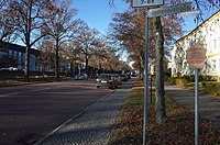
| ND_0045DE_ | Lindenallee of Gropiusallee | Dessau | 2008 |
|
| ND_0046DE_ | Obstbaumallee Kleutsch-Schwarzer Stamm | Dessau | 2008 |

|
| ND_0047DE_ | Winter linden avenue on the Alter Möhlauer Weg | Dessau | 2008 |

|
| ND_0048DE_ | Jonitzer Allee | Dessau | 2008 |

|
| ND_0049DE_ | Oak alley between grandmother and cow bridge | Dessau | 2008 |

|
| ND_0050DE_ | Alleys in the Vorderen Tiergarten | Dessau | 2008 |

|
Extensive natural monuments
| Registration number. | designation | Location | year | image |
|---|---|---|---|---|
| NDF0001DE_ | Front Moch-Hau | Dessau-Roßlau 51 ° 45 ′ 29.2 ″ N , 12 ° 20 ′ 4.2 ″ E |
1990 |

|
| NDF0002DE_ | Moch ponds | Dessau-Roßlau 51 ° 45 ′ 17.3 ″ N , 12 ° 20 ′ 4.2 ″ E |
1990 |

|
| NDF0003DE_ | Kleutsch | Dessau-Roßlau 51 ° 48 ′ 13.3 ″ N , 12 ° 17 ′ 16.1 ″ E |
1992 |

|
| NDF0004DE_ | Mochwiese | Dessau-Roßlau 51 ° 44 ′ 45.6 ″ N , 12 ° 20 ′ 30.5 ″ E |
1992 |

|
| NDF0005DE_ | Flood protection wall at Akenschen Torhaus | Dessau-Roßlau 51 ° 50 ′ 49.2 ″ N , 12 ° 8 ′ 31.6 ″ E |
1998 |

|
| NDF0006DE_ | Diederings spruces | Dessau-Roßlau 51 ° 49 ′ 25.7 ″ N , 12 ° 9 ′ 23.4 ″ E |
1998 |

|
| NDF0007DE_ | Flow ditch part I | Dessau-Roßlau 51 ° 51 ′ 54.7 ″ N , 12 ° 16 ′ 45.1 ″ E |
1998 |

|
| NDF0008DE_ | Flow ditch part II | Dessau-Roßlau 51 ° 52 ′ 8.8 ″ N , 12 ° 16 ′ 22.1 ″ E |
1998 |

|
| NDF0010DE_ | Brillenschötchen hill in Kühnauer Park | Dessau-Roßlau 51 ° 50 ′ 57.5 ″ N , 12 ° 11 ′ 28.7 ″ E |
1998 |

|
| NDF0011DE_ | Kreuzberge | Dessau-Roßlau 51 ° 48 ′ 41 ″ N , 12 ° 15 ′ 38.2 ″ E |
1998 |

|
| NDF0012DE_ | Lorkwiese | Dessau-Roßlau 51 ° 47 ′ 33 ″ N , 12 ° 14 ′ 50.3 ″ E |
1998 |

|
| NDF0013DE_ | New ditch | Dessau-Roßlau 51 ° 52 ′ 2.6 ″ N , 12 ° 17 ′ 4.6 ″ E |
1998 |

|
| NDF0015DE_ | Schilflachenhau | Dessau-Roßlau 51 ° 52 ′ 21.4 ″ N , 12 ° 9 ′ 27.7 ″ E |
1998 |

|
| NDF0016DE_ | Sweden water | Dessau-Roßlau 51 ° 50 ′ 36.6 ″ N , 12 ° 18 ′ 24.8 ″ E |
1998 |

|
| NDF0017DE_ | Soolbruch at Törten | Dessau-Roßlau 51 ° 47 ′ 56.4 ″ N , 12 ° 15 ′ 38.2 ″ E |
1998 |

|
| NDF0018DE_ | Warden | Dessau-Roßlau 51 ° 51 ′ 22.7 ″ N , 12 ° 13 ′ 34 ″ E |
1998 |

|
| NDF0019DE_ | Upper course of the pigeon | Dessau-Roßlau 51 ° 47 ′ 12.8 ″ N , 12 ° 15 ′ 37.1 ″ E |
1998 |

|
| NDF0020DE_ | Kümmerlingsbach | Dessau-Roßlau 51 ° 47 ′ 10.3 ″ N , 12 ° 15 ′ 14.8 ″ E |
1998 |

|
Area natural monuments
| Registration number. | designation | Location | year | image |
|---|---|---|---|---|
| FND0001DE_ | Raumer meadow | Dessau-Roßlau 51 ° 48 ′ 11.9 ″ N , 12 ° 12 ′ 28.1 ″ E |
1968 |

|
| FND0003DE_ | Half moon catching ducks | Dessau-Roßlau 51 ° 48 ′ 16.6 ″ N , 12 ° 16 ′ 26.4 ″ E |
1981 |

|
| FND0004DE_ | Trockenhegersee | Dessau-Roßlau 51 ° 48 ′ 42.5 ″ N , 12 ° 16 ′ 24.2 ″ E |
1981 |

|
| FND0005DE_ | Black lake | Dessau-Roßlau 51 ° 48 ′ 42.5 ″ N , 12 ° 16 ′ 35.4 ″ E |
1981 |

|
| FND0006DE_ | Brückhau | Dessau-Roßlau 51 ° 47 ′ 48.5 ″ N , 12 ° 15 ′ 38.5 ″ E |
1981 |

|
| FND0007DE_ | Big glass house | Dessau-Roßlau 51 ° 51 ′ 28.1 ″ N , 12 ° 16 ′ 26.8 ″ E |
1981 |

|
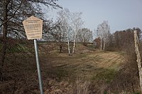
| FND0009DE_ | Summer meadow | Dessau-Roßlau 51 ° 49 ′ 2.6 ″ N , 12 ° 9 ′ 42.1 ″ E |
1981 |
|
| FND0010DE_ | New pond meadow | Dessau 51 ° 47 '39.1 " N , 12 ° 7' 40.4" O |
1981 |

|
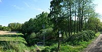
| FND0012DE_ | Back pond meadow | Dessau-Roßlau 51 ° 47 ′ 9.6 ″ N , 12 ° 8 ′ 51.7 ″ E |
1981 |
|
| FND0013DE_ | Red house bush | Dessau-Roßlau 51 ° 46 ′ 48.7 ″ N , 12 ° 9 ′ 53.6 ″ E |
1981 |

|
| FND0014DE_ | Zoberberg spring | Dessau-Roßlau 51 ° 48 ′ 14.4 ″ N , 12 ° 10 ′ 23.9 ″ E |
1981 |

|
| FND0015DE_ | Bohemia | Dessau-Roßlau 51 ° 51 ′ 34.2 ″ N , 12 ° 14 ′ 34.8 ″ E |
1989 |

|
| FND0016DE_ | Dry hedge | Dessau-Roßlau 51 ° 48 ′ 10.1 ″ N , 12 ° 15 ′ 33.8 ″ E |
1989 |

|
| FND0044AZE | Mühlstedter coal mine | Dessau-Roßlau, OT Mühlstedt 51 ° 55 ′ 19.6 ″ N , 12 ° 14 ′ 47 ″ E |
1984 |

|
See also
Web links
Commons : Natural monuments in Dessau-Roßlau - Collection of images, videos and audio files
- Map with all protected areas in Saxony-Anhalt on the website of the State Office for Surveying and Geoinformation Saxony-Anhalt (see under map content, 04/19 protected areas)
swell