Lower Usuma
| Lower Usuma Kubwa Resevoir |
|||||||||
|---|---|---|---|---|---|---|---|---|---|
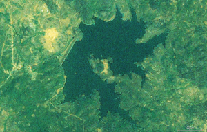
| Satellite image of the reservoir | |||||||||
|
|||||||||
|
|
|||||||||
| Coordinates | 9 ° 12 '27 " N , 7 ° 25' 10" E | ||||||||
| Data on the structure | |||||||||
| Lock type: | Earthfill dam | ||||||||
| Construction time: | -1990 | ||||||||
| Height of the barrier structure : | 47 m | ||||||||
| Crown length: | 1 350 m | ||||||||
| Crown width: | 10 m | ||||||||
| Data on the reservoir | |||||||||
| Water surface | 840,000 km² | ||||||||
| Reservoir length | 3 km | ||||||||
| Reservoir width | 3.5 km | ||||||||
| Storage space | 120 million m³ | ||||||||
Lower Usuma is the name of a dam on the Usuma River in Nigeria . It was built in 1990 north of Abuja , the new capital of Nigeria, and supplies the city with drinking water .
The dam
The barrier consists of two embankments. The main dam has a length of 1.3 kilometers and a height of 47 meters. Its crown is 10 meters wide. The secondary dam is 470 meters long and 15 meters high.
The reservoir
The dam is located about 15 kilometers northwest of Abuja at an altitude of 570 meters. The lake is 3.5 kilometers wide and 3 kilometers long and holds 120 million cubic meters of raw water. The water flows to five waterworks , where the water is treated before it is sent to Abuja. The total capacity of the waterworks is 10,000 cubic meters per hour.


