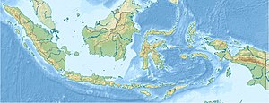
Maninjau lake
| Maninjau lake | ||
|---|---|---|

|
||
| Maninjau lake | ||
| Geographical location | Sumatra | |
| Drain | Antokan | |
| Location close to the shore | Bukittinggi | |
| Data | ||
| Coordinates | 0 ° 19 ′ S , 100 ° 12 ′ E | |
|
|
||
| Altitude above sea level | 459 m | |
| surface | 99.5 km² | |
| Maximum depth | 165 m | |
|
particularities |
||
The Maninjau Lake (indones. Danau Maninjau ) is a crater lake in the west of the Indonesian island of Sumatra . It is located about 30 km west of Bukittinggi .
The lake is located in a volcanic basin - a caldera - the crater rim of which is 600 m above the lake level of 459 m.
Its area is 99.5 km², its maximum depth is 165 m. The Antokan is its natural drain. Lake Maninjau is considered one of the most beautiful natural sights in Sumatra and offers various tourist recreational opportunities.
