
Monterey Bay National Marine Sanctuary
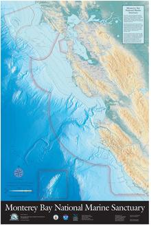
The Monterey Bay National Marine Sanctuary (MBNMS) is an American, state-protected National Marine Sanctuary in the Monterey Bay area . It is the largest national marine reserve in the United States and has a coastline of 444 km (276 miles) and 15,783 km² in area, which extends from immediately north of the Golden Gate Bridge in San Francisco to Cambria in San Luis Obispo County . It protects one of the most diverse marine ecosystems in the world and is home to numerous mammals, sea birds, fish, invertebrates and plants in a remarkably productive coastal environment. The MBNMS was designated in 1992 with the aim of ensuring resource protection, research, education and public use. The National Marine Sanctuary consists of two parts. In addition to the area directly on the coast, the protected area includes the deep-sea mountain Davidson Seamount and the surrounding area, which is separate from the main area in the sea. The sanctuary is administered by the National Oceanic and Atmospheric Administration (NOAA).
All rocks, reefs and islands within the area have been part of the California Coastal National Monument since 2000 and are administered by the Bureau of Land Management .
description
The seaward border averages 48 km from the coast and goes all the way to the coast. The deepest point in the Monterey Submarine Canyon is 3,250 feet. The average sea surface temperature is 13 ° C.
The sanctuary is home to 34 species of marine mammals, 94 species of seabirds, 345 species of fish, 4 species of turtles, 31 species of invertebrates and more than 450 species of marine algae. Historic sites include 1,276 reported shipwrecks and 718 prehistoric sites. The Monterey Bay National Marine Sanctuary has large programs for research and monitoring and another one for education and outreach.
Reassessment of protection status
On April 28, 2017, the US Department of Commerce received Executive Order 13795 from President Donald Trump to reassess the protection status of marine protected areas. In the area of the Monterey Bay National Marine Sanctuary , this applies in particular to the area of the Davidson Seamount .
Web links
- National Oceanic and Atmospheric Administration : Monterey Bay National Marine Sanctuary (official site )
Individual evidence
- ↑ Executive Order 13795-Implementing an America-First Offshore Energy Strategy
- ^ Review of National Marine Sanctuaries and Marine National Monuments Designated or Expanded Since April 28, 2007; Notice of Opportunity for Public Comment
- ↑ Panetta Newsletter
Coordinates: 36 ° 43 ′ 3.4 " N , 122 ° 18 ′ 26.6" W.