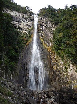
Nachi waterfall
| Nachi waterfall | ||
|---|---|---|
| Coordinates | 33 ° 40 ′ 31 " N , 135 ° 53 ′ 15" E | |
|
|
||
| place | Nachikatsuura , Japan | |
| height | 133 m | |
| width | 13 m | |
| Number of fall levels | 1 | |
| flow | Nachi | |
The Nachi Waterfall ( Japanese 那 智 滝 , Nachi-no-taki , also 那 智 大 滝 , Nachi-no-ōtaki ) is the highest waterfall in Japan with a drop of 133 m . The mean width of the Nachi waterfall is about 13 m. It is located within Yoshino-Kumano National Park in Wakayama Prefecture , near the Kumano Nachi-Taisha Shrine .
Together with the Kegon Falls and the Fukuroda Waterfall , it is one of the "Three Famous Waterfalls of Japan" ( 日本 三名 瀑 , Nihon sanmeibaku ).
See also
Web links
Commons : Nachi Falls - collection of images, videos and audio files

