
Natelsheidesee
| Natelsheidesee | ||
|---|---|---|
_IMG_5715.jpg)
|
||
| Geographical location | Lower Saxony , Wedemark | |
| Places on the shore | Wennebostel-Wietze | |
| Data | ||
| Coordinates | 52 ° 30 '56 " N , 9 ° 46' 34" E | |
|
||
| Altitude above sea level | 44 m | |
| surface | 2 ha | |
| length | 203 m | |
| Maximum depth | 3.5 m | |
|
particularities |
||

The Natelsheidesee (also Natels-Heidesee ) is a quarry pond in the community Wedemark in Hanover region . The lake, which was created through the construction of the A 352 , is located southeast of Bissendorf in the Bissendorf-Wietze district, directly on the A 352.
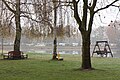
The lake has been used as a bathing lake for a campsite and as a public bathing lake since 1964 . On the east bank there is a swimming area around 140 meters long with a sandy beach and a shallow water zone in front as a non-swimmer area. The lake has a large lawn with two tepees that can be rented.
The swimming lake and campsite have been run as a family business since 1964.

View of the lawn
View from the lawn
_IMG_5430.jpg)
_IMG_5712.jpg)
Web links
Commons : Natelsheidesee - collection of images, videos and audio files
- Natelsheidesee , Hanover region
- Natelsheidesee , Bathing Water Atlas Lower Saxony
Individual evidence
- ↑ Natals-Heidesee campsite . Retrieved January 30, 2017.