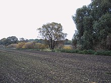
Niendorf (desert)
Niendorf was a place in what is now the area of the city of Magdeburg .
The village was north of Klein Ottersleben, north of the Klinke stream . Geographical position (estimated from the map by Gustav Reischel): 52 ° 6 ′ 4.7 " N , 11 ° 33 ′ 39.2" E . In the 14th century , the village, like Stemmern further to the west , became a desert . The field corridor essentially came to Klein Ottersleben.
The naming of the streets Niendorfer Gartenweg and Niendorfer Straße in Klein Ottersleben still reminds of the existence of the place .
source
- Gustav Reischel : Historical map of the districts Wolmirstedt and Wanzleben . Graphic arts institute Louis Koch, Halberstadt 1912, (1: 100,000).
