Nordmannsgrund
| Nordmannsgrund | ||
|---|---|---|
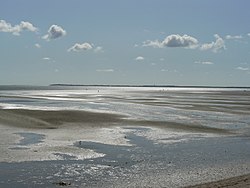
| Nordmannsgrund with a view of Amrum | ||
| Waters | North Sea | |
| Geographical location | 54 ° 40 ′ 12 " N , 8 ° 25 ′ 40" E | |
|
|
||
| length | 10 km | |
| width | 3 km | |
| surface | 15 km² | |
The Nordmannsgrund is a 15 km² mudflat south of the island of Föhr . It is surrounded by the Amrumtief in the south and the Norderaue in the east.

