Nugent Island
| Nugent Island | |
|---|---|
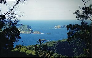
| View from Raoul Island to Nugent and the larger neighboring islands Meyer Islands and Dayrell Island , Nugent behind the trees on the left | |
| Waters | Pacific Ocean |
| Archipelago | Kermadec Islands |
| Geographical location | 29 ° 13 '54 " S , 177 ° 52' 9" W |
| length | 100 m |
| width | 100 m |
| Nugent Island to the northeast of the 1887 nautical chart | |
Nugent Island is the northernmost island of the Kermadec Islands , making it the northernmost area in New Zealand . Located northeast of New Zealand, it is roughly circular and about 100 meters in diameter. Nugent Island belongs to the group of islands around Raoul Island .
The island's rock is approximately 600,000 to 1.4 million years old; it consists of raised and tilted pillow lava and was formed during submarine volcanic eruptions .

