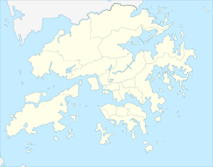
Peng Chau
|
坪洲 Peng Chau |
||
|---|---|---|
| Waters | South China Sea | |
| Geographical location | 22 ° 17 ′ N , 114 ° 2 ′ E | |
|
|
||
| Highest elevation |
Finger Hill 95 m |
|
| Residents | 6487 (2016) | |
Peng Chau ( Chinese 坪洲 ) is a small island off the northeast coast of Lantau Island , Hong Kong . As the island is car-free, the majority of the population lives near the port. The island is known locally for its temples, fishing industry and seafood. Peng Chau developed into an industrial center of Hong Kong in the 1970s and 1980s. Nowadays only abandoned workshops, an empty theater and village temples remind of the past.
In the 19th and 20th centuries there were over 100 factories from 30 industries on the island, including a match factory and a lime kiln . The lime distillery consisted of two buildings with a total of 11 distilleries and was one of the largest factories on the island. The match factory existed until the triumph of the lighter .
geography
Peng Chau covers an area of 0.99 square kilometers. The highest point on the island is Finger Hill , which is 95 meters high. The hill is popular with hikers because of its 360 ° panoramic view of Lamma Island , Discovery Bay and the south wing.
The populated area mainly extends around the port. The rest of the island is uninhabited.
Attractions
There are several temples on Peng Chau including:
- Tin Hau Temple ( 天后 廟 ), built in 1792
- Golden Flower Shrine, dedicated to Lady Kam Fa ( 金花 娘娘 )
- Lung-Mo Temple ( 龍 母 廟 )
- Seven Sisters Temple ( 仙姐 廟 ), also known as Chek-Tset Temple
The island is also home to the now disused Peng Chau Theater ( 坪洲 戲院 ).
traffic
The main mode of transport on the island is by bike or on foot. In general, motor vehicles are not allowed on the island, with the exception of emergency services, construction and village vehicles, which are used to transport goods on the island.
Peng Chau can be reached by ferry from nearby islands. Helicopters are sometimes used in medical emergencies.
Peng Chau is connected to Tai Lei Island by a bridge. The bridge is part of Peng Lei Road. It is a popular fishing spot.
government
Politically, Peng Chau belongs to the Islands District and the Peng Chau & Hei Ling Chau constituency of the District Council of the Island District. For the years 2015 to 2019, the seat was occupied by Josephine Tsang Sau-ho.
The local police station is part of the Cheung Chau Division of the Marine Police .
Individual evidence
- ↑ Peng Chau | Hong Kong Tourism Board. Retrieved November 10, 2019 .
- ↑ PENG CHAU - HONG KONG EXTRAS 3. Retrieved November 10, 2019 .
- ↑ Former lime distillery and match factory | Hong Kong Tourism Board. Retrieved November 10, 2019 .
- ↑ Finger Hill | Hong Kong Tourism Board. Retrieved November 10, 2019 .
- ^ Finger Hill - Highest Point of Peng Chau Island, Hong Kong. In: I Love Hong Kong. Retrieved November 10, 2019 (American English).
- ↑ Golden Flower Shrine | Hong Kong Tourism Board. Retrieved November 10, 2019 .
- ^ Lung Mo Temple | Hong Kong Tourism Board. Retrieved November 10, 2019 .
- ^ Seven Sisters Temple | Hong Kong Tourism Board. Retrieved November 10, 2019 .
- ↑ 9 Fun Things To Do In Peng Chau, Hong Kong On Your Summer Holidays - Updated 2019. August 21, 2017, accessed November 10, 2019 .
- ^ Former Peng Chau Theater | Hong Kong Tourism Board. Retrieved November 10, 2019 .
- ↑ Contact us. Retrieved November 10, 2019 .


