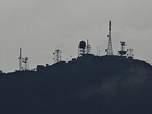
Pidurutalagala
| Pidurutalagala | ||
|---|---|---|
| height | 2534 m | |
| location | Sri Lanka | |
| Coordinates | 7 ° 0 '5 " N , 80 ° 46' 27" E | |
|
|
||
| particularities | Highest mountain in Sri Lanka | |
The Pidurutalagala (pronounced ˌpidurutaˈlaːgələ , literally straw plateau rock , also known as Mount Pedro ) is a mountain in the central highlands of Sri Lanka near the city of Nuwara Eliya .
With a height of 2,534 meters, it is the highest point in the country. It is not allowed to climb the summit on foot as the route to it leads through a restricted military area. But it is possible, for example, to take a taxi to the top; for this purpose, personal details including the passport number must be given at the military checkpoint.
There is a radio and radar station on the summit of Pidurutalagala.


