Puerto Quito
|
||
|---|---|---|

|
||
| Puerto Quito Canton | coat of arms | |
| flag | ||
| Data | ||
| country |
|
|
| province | Pichincha | |
| Canton | Puerto Quito | |
| language | Spanish | |
| climate | tropical, humid | |
| Residents in the place | 2,297 ( as of 2001) | |
| Residents in the canton | 17,129 ( as of 2001) | |
| Population density of the canton | 26.7 / km² | |
| Area of the canton | 719 km² | |
| localization | 0 ° 13 "S / 78 ° 31" E | |
| The highest point | 160 m | |
| Lowest point | 120 m | |
| Mayoress | Narciza Parraga de Monar ( since 2005) | |
| Time zone | ECT (UTC-5) | |
| Postal code of the place | EC170950 | |
|
Website town hall |
Homepage of Puerto Quito | |
Puerto Quito is a 719 km² canton in the northwest of the Ecuadorian province of Pichincha . The seat of government is the town of the same name, Puerto Quito. In addition to Puerto Quito, the canton includes 92 other villages and smaller, remote settlements. In 2001 the canton had 17,129 inhabitants.
place
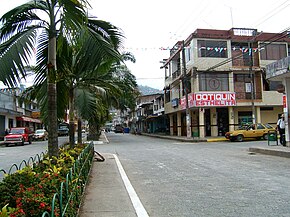
Puerto Quito is the parish and seat of government of the canton of the same name. Puerto Quito had 2,297 inhabitants at the last census (2001). In Puerto Quito, next to the town hall, there are secondary schools and a public health center. Puerto Quito is also a stop for several intercity buses, as it is about halfway between Quito and the coast.
Geography and history
Puerto Quito is dominated by agriculture. The majority of the population are simple farmers. Cultivated products are cocoa, oil palms, milk and livestock. Puerto Quito is located at a height of approx. 200 m in hilly, (partly former) rainforest areas, which is why it is also the goal of increasing ecotourism. The place was created in the 1960s and 1970s by settlers from the Andean provinces. Via the state settlement institute, the place should actually arise at the confluence of the Caoní and Silanche rivers , which Pedro Vicente Maldonado had called "Puerto de Quito" ( Port of Quito ) when building his transport route from Quito to Esmeraldas . The place was soon made a parish and has been the capital of its own canton since 1996, which includes the area of the parish.
The Oleoducto de Crudos Pesados (OCP) pipeline has been running through the canton since 2003.
The rivers Caoni, Achiote, Achutillu (Achotillo), Río Blanco (Yuraqmayu), Macallares, Abundancia, Bravo, Inga, Mojarrero, Sábalo and Silanche (Silanchi) flow through the canton.
government
Acting mayor (term of office from 2005 to 2009) is Narciza Parraga de Monar from PRIAN , the Álvaro Noboas party .
Web links
- Homepage of Puerto Quito - Town Hall and Canton (Spanish)
- Information about Puerto Quito in the educational portal Edufuturo of the prefecture of the Pichincha province (Spanish)
- (Eco) tourism in Puerto Quito incl. Travel & Hotel Guide, as well as information on volunteering (English & Spanish)
- Map Map of the Pichincha region with Puerto Quito
Coordinates: 0 ° 8 ′ N , 79 ° 15 ′ W


