Pulau Kapas
| Pulau Kapas | ||
|---|---|---|
| Waters | South China Sea | |
| Geographical location | 5 ° 13 ′ N , 103 ° 16 ′ E | |
|
|
||
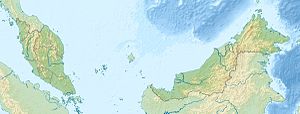
Kapas (Malay: Pulau Kapas ) is a jungle- covered island , 10 kilometers southeast of the coast of Kuala Terengganu , Malaysia . In the north, a few 100 m away, is the much smaller secondary island Gemia .
Kapas Island is only sparsely populated and lives primarily from tourism. Fishing is prohibited within a radius of five kilometers.
The beaches of Kapas are white sand beaches. There is clear water around the island, which draws snorkel divers to the coral reefs and wrecks. Kapas can be reached by ferry from the fishing village of Marang , six kilometers away .
Web links
Commons : Pulau Kapas - collection of images, videos and audio files

