Puma Yumco
|
Puma Yumco Phuma Yumco |
||
|---|---|---|

|
||
| Satellite image from Puma Yumco (January 6, 2006) | ||
| Geographical location | Nagarzê County in Shannan Administrative Region in Tibet ( PR China ) | |
| Drain | → Yamdrok Tso (temporarily) | |
| Location close to the shore | Pumajiangtangxiang | |
| Data | ||
| Coordinates | 28 ° 34 ′ N , 90 ° 24 ′ E | |
|
|
||
| Altitude above sea level | 5030 m | |
| surface | 285 km² | |
| length | 31.7 km | |
| width | 14 km | |
| Catchment area | 1815 km² | |
|
particularities |
temporary outflow |
|

|
||
| Satellite image: Puma Yumco in the lower center, above Lake Yamdrok Tso (Nov. 1997) | ||
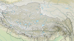
The Puma Yumco ( Chinese 普莫雍错 , Pinyin Pǔmò Yōngcuò ; or Phuma Yumco ) is a lake in county Nagarze in the district of Shannan of the Tibet Autonomous Region of the People's Republic of China .
The lake is 18 km south of Yamdrok Tso Lake . The Puma Yumco has an area of 285 km². It lies at an altitude of 5030 m . Its catchment area of 1,815 km² extends in the south to the main Himalayan ridge 50 km away on the border with Bhutan . The Zongophu Kang ( 7047 m ) in the west and the Gejag Kangri ( 6970 m ) in the east limit the catchment area in the south. The meltwater of the glaciers (with an area of 153 km², that is 8.4% of the total catchment area) on the northern flank of the Himalayan main chain form the main part of the annual inflow of the lake system. During floods, there is a (seasonal) runoff from the northern bank of the Puma Yumco to the northern Yamdrok Tso.
