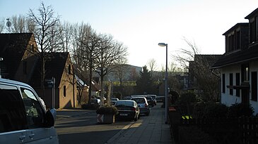
Richthofensiedlung
Coordinates: 51 ° 24 ′ 22.8 " N , 6 ° 55 ′ 52.1" E
The Richthofensiedlung is an aviation settlement in Mülheim an der Ruhr at Essen-Mülheim Airport . Today it is also known as the Mülheim airport settlement.
Emergence
In 1925, a traffic airfield was built in a purely agricultural area between the cities of Mülheim an der Ruhr and Essen , which was expanded in 1935 to become the central landing area for the entire Rhenish-Westphalian industrial area. This made it one of the most important German airports at that time, far ahead of Düsseldorf Airport , which was administered from here. For the administration, flight and maintenance personnel, a so-called aviation settlement was built in the immediate vicinity of the airfield at the end of the 1920s .
Naming
The settlement is named after Manfred von Richthofen , a German fighter pilot and flying ace of the First World War, known as the Red Baron. Most of the street names refer to courtyards and corridors that existed at the time, but one street in the settlement is named after Heini Dittmar , a German glider and test pilot who, in 1941, was the first person to exceed the 1000 km / h mark in a Messerschmitt aircraft. After the Second World War, the name Richthofensiedlung was used less often and was often replaced by the term airport settlement. People who are not resident there and who are not familiar with the history of the settlement usually use the name airport settlement.
location
Essen / Mülheim Airport is located on the border between Essen and Mülheim an der Ruhr in the south-west of the Ruhr area, about a quarter on Essen and three quarters on Mülheim. The Richthofensiedlung, on the other hand, belongs entirely to Mülheim. It is located in the Raadt district.
Streets: Windmühlenstraße, Brunshofstraße, Heini-Dittmar-Straße, Beekkamp, Scheifhackenweg, Schürfeld, Bertholdstraße, Kamperhofweg, Kugenbergweg
Others
A short distance away, but no longer part of the Richthofensiedlung, the names Parsevalstrasse , Eckenerstrasse and Zeppelinstrasse refer to three pioneers of airship travel.
Lilienthalstrasse, named after Otto Lilienthal , runs around the north side of the airport, who was the first to successfully and repeatably glide with an airplane.
The highest point in the urban area of Mülheim an der Ruhr measures 152.7 m above sea level and is located on the airport grounds very close to the Richthofensiedlung.
Between June 1941 and March 1945, the Essen / Mülheim airport labor education camp was located on Brunshofstrasse . "Western workers" from the occupied territories served in the armaments industry under inhumane conditions. A plaque on reminds of the location.
During the air raid on December 24, 1944 , the bunker on Windmühlenstrasse was hit by a 1,000-kilo bomb. The bomb hit the ceiling and exploded inside. 50 people seeking protection lost their lives. However, it is assumed that there were more deaths, as stationed soldiers were not on the Mülheim victim list. Today there are houses on the site.
swell
District plan Holthausen-Menden-Raadt
www.Heimatsammlung-Essen.de - Labor education camp at Essen-Mülheim airfield
spurensuche-wiedeking.de - Attack on Essen - Mülheim airport
Frank Radzicki - 80 years of Essen-Mülheim Airport, Sutton - Verlag, 2006, online. ISBN 978-3897028098
