Runestone from Sædinge
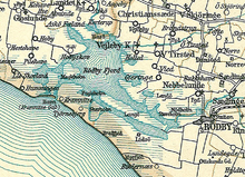
The runestone of Sædinge ( Danish Sædingesten ) - DR 217) is a runestone made of granite from the 10th century, which was discovered in a rubbish heap next to the rectory of Nebbelunde on Lolland in Denmark in 1859 . Today it stands together with the “Skovlængesten” discovered between Skovlænge Præstegård and Gurreby in 1627 in the Lolland-Falster Abbey Museum (Banegårdspladsen 5) in Maribo .
Research revealed that around 1830 the stone was in a field near the border between the parishes of Holeby and Sædinge, where it was endangered by agricultural activities. Therefore a hole was dug into which the stone was sunk. But it was not deep enough, because in 1854 the stone was back on the surface. It was too heavy to move, so it was split into pieces to be transported to Nebbelunde.
The debris was later taken to the Maribo Diocesan Museum and bonded with cement. However, two smaller pieces have been lost. The stone is made of coarse-grained red-gray granite , the 1.75 m high stone has a cross-section of 0.80 × 0.68 m. The runes have been carved into all four sides. The text begins with:
"Thyre put this stone after Krog, her husband and he was the strongest of all". The rest of the text shows that Krog was killed by "Swedish Northmen".
Historical context
Adam von Bremen reports that a Swedish Viking named Olaf conquered parts of Denmark at the beginning of the 10th century. The existence of a Swedish colony on Lolland is also attested by the inscription on the stone of Tirsted (DR 216). There is a testimony to the presence of Swedish Vikings on the Cimbrian Peninsula , on the small Sigtryggstein in Haithabu .
literature
- Frank Hübler: Swedish rune poetry of the Viking Age . Ed .: Institutions för nordiska språk, Uppsala universitetet. Runron 10. Uppsala 1996.
- Karsten Kjer Michaelsen: Politics bog om Danmarks oldtid . Copenhagen 2002 ISBN 87-567-6458-8 , p. 216
- Anne Brigitte Villadsen: Runeindskrifterne efter Runesten på Lolland-Falster . In: Lolland-Falsters Historiske Samfunds Årbog . 1989.
Web links
Coordinates: 54 ° 46 ′ 35.9 ″ N , 11 ° 30 ′ 5.2 ″ E
