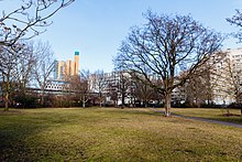
Schöneberg harbor
The Schöneberger Hafen was an inland port on the Landwehr Canal in Berlin .
The harbor basin was on the Landwehr Canal between Köthener Strasse and Schöneberger Strasse. Today the site belongs to the district of Kreuzberg . The port was laid out in 1852 shortly after the Landwehr Canal was built in what was then Friedrichsvorstadt and had siding, loading streets and storage areas. It lost its economic importance just a few years after its inauguration. After the Second World War , the harbor basin was filled in. The Mendelssohn-Bartholdy-Park is located on the site today . The Uferstraße Hallesches Ufer also runs between Köthener Straße and Schöneberger Straße over the former port area. The street Hafenplatz, which was originally a square and formed the north-eastern boundary of the harbor basin, still reminds of the former harbor.
See also
Individual evidence
- ↑ www.tagesspiegel.de: Berlins Häfen - Where loading takes place and where quays are transformed , from June 28, 2007, accessed on January 8, 2020
Coordinates: 52 ° 30 ′ 10.6 ″ N , 13 ° 22 ′ 35.9 ″ E

