
Berlin-Kreuzberg
|
Kreuzberg district of Berlin |
|
|---|---|
  |
|
| Coordinates | 52 ° 29 '15 " N , 13 ° 23' 0" E |
| height | ≈ 52 m above sea level NN |
| surface | 10.38 km² |
| Residents | 154,351 (Dec. 31, 2019) |
| Population density | 14,870 inhabitants / km² |
| Start-up | Oct. 1, 1920 |
| Postcodes | 10961, 10963, 10965, 10967, 10997, 10999, 10969 |
| District number | 0202 |
| structure | |
| Administrative district | Friedrichshain-Kreuzberg |
| Locations |
|

Kreuzberg is a district in the Friedrichshain-Kreuzberg district of Berlin . Until the merger with the neighboring Friedrichshain district in the course of the 2001 administrative reform , there was an independent Kreuzberg district , which is congruent with today's district of Kreuzberg. The name of the district comes from the 66 meter high Kreuzberg in Viktoriapark .
According to the postcodes valid until 1993 , there are two different locations in Kreuzberg , named after the numbers of the delivery post offices at the time: the larger Kreuzberg 61 (formerly: Südwest 61 ) and the smaller SO 36 (SO = southeast) . At the time of the Berlin Wall , SO 36 was enclosed on three sides and developed an alternative culture of its own on the eastern edge of West Berlin . Kreuzberg has a lively nightlife and cultural life that is known beyond the city limits. Numerous artists and literary institutions have their residence or their place of business in the district. Due to the ambivalent-tolerant local politics , the district of Kreuzberg, in particular the location "Berlin SO 36" ( Görlitzer Park ), is considered to be drug traffickers and drug users friendly and is partially tolerated by the residents.
environment
Along with Neukölln , Friedrichshain , Gesundbrunnen and Prenzlauer Berg, Kreuzberg is one of the very densely populated districts of Berlin. This is explained by the building principle followed since the early days of the greatest possible use of the property with a front building, side wings and adjoining - up to four - rear buildings . Even today, up to 150 tenants live in these " tenements " in houses with an eaves height of 22 meters. Due to frequent tenant changes, the curiosity has arisen that lower rent is paid for long-term front-building apartments than for rear-building apartments.
history

Painting by Johann Heinrich Hintze, 1829

In the Middle Ages , the area of today's Kreuzberg district was outside the city walls of the twin cities of Berlin - Cölln . When the urban area of Berlin expanded in the 18th century and the customs and excise wall became the new city boundary, a new city quarter was created behind the Hallescher Tor (today located in the northern part of Kreuzberg).
19th century
In the course of the 19th century Berlin continued to grow and the Tempelhofer Vorstadt (incorporated in 1861) and Luisenstadt (incorporated in 1841) were added in this area . Important streets and squares in the new districts were dedicated to the Prussian military as part of the so-called general train and battles won against Napoleon during the wars of liberation (1813–1815) . It was named after officers Gebhard Leberecht von Blücher (Blücherstraße and Blücherplatz), Ludwig Yorck von Wartenburg ( Yorckstraße ) and August Neidhardt von Gneisenau ( Gneisenaustraße ) as well as the battles near Waterloo (Waterloo-Ufer and Belle-Alliance-Straße , renamed in 1947 to Mehringdamm ) and Möckern ( Möckernstrasse and Möckernbrücke ). A thematic and urban planning point of reference was the national monument on the Kreuzberg , inaugurated in 1821 , which at that time, however, was still in its original conception in the open field in front of the city on the edge of the Teltow plateau . On the 66 meter high elevation - at that time still called Tempelhofer Berg - a monument in the basic shape of the Iron Cross was erected according to a design by Karl Friedrich Schinkel to commemorate the Wars of Liberation.
Formation of the district
The Kreuzberg district was formed in 1920 from the Tempelhofer Vorstadt, the Upper Friedrichsvorstadt , the southern Friedrichstadt and a large part of the Luisenstadt . The former district and today's district was named after Kreuzberg, located in the southwest in today's Viktoriapark . After Greater Berlin was founded in 1920, the district was initially called Hallesches Tor.
Second World War
In the air raid on February 3, 1945 the USAAF the area of the southern Friedrichstadt between today was Halle Gate in the south, the Prince Street to the east and the Koch Street in the north almost completely destroyed.
With the crossing of the Oder on April 16, 1945, at the end of the Second World War, the Red Army's major attack on Berlin began. After hard fighting in the run-up to Berlin, the armies of Marshal Zhukov first penetrated the east of the city on April 21.
Friedrichshain and Kreuzberg were in the area of General Bersarin's Soviet 5th shock army during the Battle of Berlin .

Shortly before the approaching Soviet troops, the middle arch of the Oberbaum Bridge was blown up on April 23 to prevent the passage there. The Red Army managed to cross the Spree from Oberschöneweide to Treptow on April 24th .
On April 25, the 9th Corps of the 5th Shock Army had crossed the Landwehr Canal from Treptow and was then involved in violent fighting in the area around the Görlitz station , which dominated the center of their front.
From the southeast, from Neukölln, another wedge reached Hermannplatz . On April 25, in the evening, which blew SS the Karstadt department store . The 8th Guard Army moved over the Hasenheide to Mehringplatz and Tempelhof Airport .

After lengthy fighting at Görlitzer Bahnhof , the units of the 5th Shock Army, operating further north, reached Moritzplatz on April 27 along Oranienstrasse and into the city center area along Köpenicker Strasse .
After hard fighting in Tempelhof, the left wing of Shukov's 8th Guard Army branched off to Schöneberg under General Tschuikow , Viktoriapark in the middle was occupied and from there the Anhalter Bahnhof was shot at from sight. The right wing of the army was approaching the Landwehr Canal .
Since the bridges over the canal were blown up by a Wehrmacht commando in the evening on April 26th, the attackers paused in front of the canal, pulled artillery after them and on April 27th prepared to cross the water barrier.
“Chuikov's preparations for the attack over the Landwehr Canal envisaged a massive use of heavy artillery and rocket launchers for accompanying support. These were put into position after fogging during the day. There was no shortage of ammunition and the order was given not to use it sparingly. "
In the course of April 28, the attack on the canal succeeded over the rubble of the Möckernbrücke high station . Most of the defenders withdrew further into the city center . Since the Anhalter Bahnhof, the bunker and the S-Bahn systems were overcrowded with thousands of people seeking protection, the isolation there resulted in unbearable conditions and dramatic scenes until May 1st.

At the Hallescher Tor, the troops crossing the canal could also pull tanks to Belle-Alliance-Platz . The Anhalter Bahnhof was no longer the focal point of the fighting - the next center of defense was the RLM building ( Reich Aviation Ministry , today: Detlev-Rohwedder-Haus ) Wilhelmstrasse 97 / Leipziger Strasse 5-7. On the evening of April 29th, Kreuzberg was completely in Soviet hands.
post war period
Only the Tempelhofer Vorstadt and Luisenstadt survived the Second World War largely undamaged.
In July 1945, most of the then district was assigned to the American Sector . The main crossing to East Berlin was after the building of the wall of Checkpoint Charlie .
In 1968, today's Rudi-Dutschke-Strasse (part of what was then Kochstrasse) was one of the main scenes of the so-called " Easter riots " when angry students tried to prevent the Axel Springer Verlag newspapers from being delivered after the assassination attempt on Rudi Dutschke .
Kreuzberg owes its national fame primarily to the eventful history of the smaller eastern area (and post district) SO 36 , later Berlin 36, which - surrounded on three sides by the Berlin Wall - became legendary in the 1970s and 1980s as the center of the alternative movement and squatting has been.
_Abriss_1980.png)
At the end of the 1970s, SO 36 became the focus of area renovation , the operators of which encountered massive resistance here. The Kottbusser Tor became a symbol of deforestation and new construction , but in 1981 this form of urban renewal was stopped by the squatting on Heinrichplatz . The block 104 marks the reversal and the 1983 completed changes to the concept of Gentle Urban Redevelopment .
In June 1981, 165 occupied houses were counted in Berlin, 86 of them in Kreuzberg 36 and 61. The reconciliation policy initiated by the governing mayor Richard von Weizsäcker after the death of an occupier and supported by the Evangelical Church and the organization Netzwerk Selbsthilfe was successful until 1987 Legalization of 60 squatted houses in West Berlin . Thanks to the preservation of the “ neighborhood structures ”, SO 36 is a popular tourist destination, especially for young visitors.
SO 36 extends between the Spree , north of the Lohmühleninsel and the Landwehr Canal and east of the Luisenstadt Canal, which is now filled in . This area is still currently considered to be one of the lowest-income parts of Berlin. The greater part of Kreuzberg is formed by the north-west, heavily damaged southern Friedrichstadt (the newspaper district at the time ) and the entire southern half ( Kreuzberg 61 ). A number of well-known artists lived and live here around the Südstern .

View from the platform apron to the Anhalter Bahnhof , 1955

Ruins of the Anhalter Bahnhof, 2015

Evangelical Holy Cross Church , completed in 1888

Removed stucco corner house from the 19th century on Landwehr Canal, corner of Johanniter and Tempelherrenstrasse, built around 1875
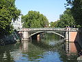
The Admiralbrücke on the Landwehr Canal is a popular meeting place to linger

Aerial view, Tempelhofer Ufer at the corner of Möckernstrasse


Almost a third of the roughly 160,000 inhabitants are migrants , many of whom are of Turkish origin and their descendants. Kreuzberg is also known far beyond Berlin's borders for this demographic peculiarity. The population of Turkish origin is mainly concentrated in the eastern area SO 36 and here the Wrangelkiez . Since the beginning of the 21st century, the population structure of Kreuzberg has changed due to gentrification effects , since the district is one of the trendy districts of Berlin.
From 1987 onwards, Kreuzberg (SO 36) regularly hit the headlines on May 1st due to sometimes severe street battles . The starting point for the riots was usually a clash between participants in the May rallies and the police. Today the violence has become more and more ritualized and is accompanied by a large media presence . In 1987, starting from Lausitzer Platz , the riots at that time concentrated around Kottbusser Tor and Oranienplatz . At the Skalitzer road a branch of the food market was in that year Bolle in flames, was up to the foundation walls destroyed and not rebuilt. An Islamic community center ( Maschari Center ) with a mosque was built on the site in 2004 . A decline in violence has been observed since 2005, although this is related to a shift to other major German cities.

At the time of the Berlin Wall, Kreuzberg led an economic niche existence due to its peripheral location. With German reunification , it moved to the center of Berlin: In 1997, the center of gravity of Berlin was marked with a granite slab on Alexandrinenstrasse 12-14 at the corner of the connecting path to Wassertorstrasse ( Lage ), on which the coordinates are shown. The altered living conditions Kreuzberg has as a business location to appeal won. Numerous companies and organizations move to the bank of the Spree at the Oberbaumbrücke .
The Kreuzberger Chronik magazine has been published monthly since 1998 .
On January 1, 2001, the former districts of Kreuzberg and Friedrichshain were combined to form the new district of Friedrichshain-Kreuzberg .
District Mayor of Kreuzberg
| Period | Surname | Political party |
|---|---|---|
| 1921-1925 | Martin Kahle | USPD |
| 1926-1933 | Carl heart | USPD / SPD |
| 1933-1934 | Max Brandt | DNVP |
| 1934-1939 | Wilhelm Hafemann | NSDAP |
| 1939-1945 | Gerhard Sudheimer | NSDAP |
| May 8, 1945 - May 31, 1945 | Nikolai Kickull | |
| June 1, 1945 - December 16, 1946 | Willi Klimm | |
| December 17, 1946 - February 9, 1949 | Georg Henschel | SPD |
| February 9, 1949 - December 13, 1962 | Willy Kressmann | SPD |
| Jan. 9, 1963 - January 8, 1975 | Günther Abendroth | SPD |
| Jan. 9, 1975 - January 31, 1981 | Rudi Pietschker | SPD |
| February 5, 1981 - June 30, 1981 | Waldemar Schulze | SPD |
| June 30, 1981 - July 24, 1985 | Günter Funk | CDU |
| July 24, 1985 - April 26, 1989 | Wolfgang Kruger | CDU |
| April 26, 1989 - October 21, 1992 | Günter König | SPD |
| October 21, 1992 - January 24, 1996 | Peter Strieder | SPD |
| March 15, 1996 - December 31, 2000 | Franz Schulz | Green |
Population development in the Kreuzberg district
As of December 31, 2019, Kreuzberg had 154,351 inhabitants.

| year | Residents |
|---|---|
| 1925 | 377.253 |
| 1933 | 339.198 |
| 1939 | 332,635 |
| 1946 | 204,867 |
| 1950 | 211.154 |
| 1961 | 191,898 |
| 1970 | 158,445 |
| 1987 | 140.938 |
| 2000 | 147.384 |
| 2013 | 151.430 |
| 2017 | 154.010 |
Institutions, parks and buildings

SW 61
- Prinz-Albrecht-Palais ( Topography of Terror Memorial ; previously Gestapo headquarters )
- Checkpoint Charlie (former border between East and West Berlin , as well as between the districts of Friedrichshain-Kreuzberg and Mitte )
- Berlinische Galerie
- Willy-Brandt-Haus (Federal Headquarters of the SPD )
- Hebbel am Ufer (Abbreviation: HAU, Theater)
- English Theater Berlin
- Tempodrom (venue)
- Jewish Museum Berlin
- Bundesdruckerei in Oranienstrasse (largest industrial company in Kreuzberg)
- Riehmers Hofgarten ( listed building ensemble from Berlin's early days )

- St. Bonifatius Church , Yorckstrasse
- Tommy Weisbecker House
- Viktoriapark (am Kreuzberg )
- Lapidarium (former pumping station, until May 2009 storage for still images , especially Siegesallee )
- Böcklerpark
- listed former Gertraudenhospital
- Urban port
- Gasometer Fichtestrasse
- Headquarters of the Federal Youth Organization of the AWO
- Anhalter Bahnhof (ruin)
- Hitchhiker's bunker
- German Museum of Technology Berlin
- Park at the Gleisdreieck
- Martin-Gropius-Bau
- America Memorial Library
- Holy Cross Church
- Cemeteries in front of Hallesches Tor
- Cemeteries on Bergmannstrasse
- Karstadt department store on Hermannplatz
- Urbank Hospital
- The Leierkasten , former artists' pub
- International Franz Fühmann Circle of Friends [1]
- Working group of literary societies and memorials
- Kurt Mühlenhaupt Museum
- Lettrétage
SO 36

- Görlitzer Park , formerly Görlitzer Bahnhof
- Park in block 104
- Ballhaus Naunynstrasse
- Bethany
- Emmaus Church
- Market hall IX
- Club SO36
- Friedrichshain-Kreuzberg-Museum in Adalbertstraße 95a
- Healthy house
- Tree house on the wall
- Cuvrybrache

awaits with a mixture of new and old architecture, August 2007
Events

sports clubs
In the Kreuzberg district, despite its small size, most of the football clubs in the city of Berlin are located, although the district with only one grass sports field, the Willy Kressmann Stadium , is relatively poorly equipped. Long-established Kreuzberg soccer clubs are SC Berliner Amateure , FSV Hansa 07 , BFC Südring and BSC Eintracht / Südring 1931 . The most successful and well-known football club in Kreuzberg is Türkiyemspor Berlin . Kreuzberg's multicultural population structure is also reflected in the broad spectrum of many other associations, some of which have existed since the 1960s.
With the THC Franziskaner FC eV also declared Kreuzberger Linke their club and in the sport club Seitenwechsel e. V. meet women, especially lesbians .
The SC Kreuzberg presented the German chess champions several times .
Kreuzberg in the film
- (Selection)
- Berlin Chamissoplatz . Directed by Rudolf Thome , Federal Republic of Germany 1980
- Kanakerbraut . Director: Uwe Schrader , Germany 1983
- Darling Kreuzberg . Directed by Werner Masten , Germany 1986–1998. Main role: Manfred Krug as a Berlin lawyer; Season 4 takes place in Berlin-Mitte
- The little punk . Directed by Michael Schaack , Germany 1992
- Prince in Hellland . Directed by Michael Stock, Germany 1993
- Siblings - Kardeşler . Director: Thomas Arslan , Germany 1996/1997
- Mr. Lehmann . Director: Leander Haußmann , Germany 2003
- Princess bath . Director: Bettina Blümner , Germany 2007
- KDD - permanent criminal service . TV series, Germany 2007
- May 1st - Heroes at work . Director: Jan-Christoph Glaser, Carsten Ludwig, Germany 2008
- Moral courage . Directed by Dror Zahavi , Germany 2010
- Times change you . Director: Uli Edel , Germany 2010
- Kaddish for a friend . Directed by Leo Khasin , Germany 2012
See also
_Margot_Bendheim.jpg)
- List of streets and squares in Berlin-Kreuzberg
- List of cultural monuments in Berlin-Kreuzberg
- List of stumbling blocks in Berlin-Kreuzberg
- List of cinemas in Berlin-Kreuzberg
- Kreuzberg Patriotic Democrats / Realistic Center
- Kreuzberg temple
- Kreuzberg nights
literature
- Eva Brücker, Hasso Spode et al. : Kreuzberg , Nicolai-Verlag, Berlin 1994 (Geschichtslandschaft Berlin, Vol. V, edited by the Historical Commission in Berlin).
- Peter Frischmuth: Berlin Kreuzberg SO 36. Photo documentation. 2nd Edition. Berlin Story Verlag , Berlin 2007, ISBN 978-3-929829-68-6 .
- Hanno Hochmuth: Neighborhood history. Friedrichshain and Kreuzberg in divided Berlin. Wallstein 2017, ISBN 978-3835330924 .
- Gerhardt Hoffmann: Kreuzberg Stories. Stories from the milieu. 3rd, expanded edition. Verlag Theodor Kastel, Berlin 2008, ISBN 978-3-9812651-0-1 .
- Dieter Kramer, Kreuzberg 1968-2013. Demolition, departure, upheaval , Nicolai, Berlin 2013, ISBN 978-3894798055
- Hans W. Korfmann & Michael Hughes (photos): Kreuzberger - 15 portraits. Verlag an der Spree, Berlin 2004, ISBN 3-9809951-0-0 .
- Barbara Lang: The Myth of Kreuzberg. Ethnography of a district (1961–1995). Campus-Verlag, Frankfurt am Main u. a. 1998, ISBN 3-593-36106-X (also: Berlin, Humboldt-Univ., Diss., 1996).
- Jörg Sundermeier , Verena Sarah Diehl, Werner Labisch (eds.): Kreuzbergbuch. Verbrecher-Verlag , Berlin 2002, ISBN 3-935843-06-2 .
- Marina Wesner: Kreuzberg and its churches. Churches - mosques - synagogues - temples. Berlin Story Verlag, Berlin 2007, ISBN 978-3-929829-75-4 .
- Falk-Rüdiger Wünsch: Kreuzberg. Tell old pictures. Sutton, Erfurt 1998, ISBN 3-89702-034-3 .
- Jochen Ziem : Boris, Kreuzberg, 12 years. Erika Klopp Verlag, Berlin a. a. 1988, ISBN 3-7817-2377-1 (numerous editions).
Web links
- Website of the Friedrichshain-Kreuzberg district of Berlin
- Kreuzberg memorial plaque for victims of the Nazi regime
- Picture gallery of Kreuzberg places / squares
References and comments
- ↑ The deal with the dealers. Documentation & report. In: rbb-online.de. Rundfunk Berlin-Brandenburg , September 4, 2019, accessed on December 24, 2019 (see detailed 28-minute video documentary report).
- ↑ Detlef Kuhlbrodt : Living is something for warm showerers. In: Die Tageszeitung , January 15, 2011, p. 27.
- ↑ On April 28, 1945, Zhukov appointed Bersarin as the first city commandant of Berlin.
- ↑ Tony le Tissier: Der Kampf um Berlin 1945 , Ullstein Verlag, Berlin 1991, p. 135. T. Le Tissier cites Rocolle, Götterdämmerung , p. 53.
- ↑ April 27, 1945: "The 9th Corps [... Bersarins] invaded Kreuzberg and built Moritzplatz." (T. Le Tessier, p. 156).
- ↑ T. Le Tessier, p. 148.
- ↑ Bernd Laurisch: No abstract under this number. (Werkbund archive no.7), Verlag Anabas, Giessen 1981, p. 224, ISBN 3-87038-088-8 .
- ↑ The Story Fisherman . In: taz , September 3, 2008
- ^ Statistical yearbooks of Berlin
- ^ Kurt Mühlenhaupt Museum
- ^ Website of the Friedrichshain-Kreuzberg Museum (FHXB Museum)


Middle (1) | Tiergarten (2) | Wedding (3) | Prenzlauer Berg (4) | Friedrichshain (5) | Kreuzberg (6) | Charlottenburg (7) | Spandau (8) | Wilmersdorf (9) | Zehlendorf (10) | Schöneberg (11) | Steglitz (12) | Tempelhof (13) | Neukölln (14) | Treptow (15) | Köpenick (16) | Lichtenberg (17) | Weissensee (18) | Pankow (19) | Reinickendorf (20) | Marzahn (21) | Hohenschönhausen (22) | Hellersdorf (23)