
Spree

The Spree ( Sorbian Sprjewja , Lower Sorbian also simply Rěka , river '; Czech Spréva ), known in sections as the Great Spree , is an almost 400-kilometer-long left tributary of the Havel in eastern Germany , which runs through the upper reaches of the Czech Republic for a short distance flows. Since the Spree at the confluence of the Spree and the Upper Havel in Berlin-Spandau is both longer and richer in water than the upper reaches of the Havel, from a hydrological point of view the Spree and the Lower Havel form a river, and the Upper Havel is its tributary.
numbers
The length of the Spree is around 400 kilometers (stated 382, 398 and 403 kilometers), of which around 182 kilometers are navigable. The Spree is the longest German third-order river . The catchment area of the river covers around 10,000 square kilometers.
The Spree is managed with the water code 582 as a tributary of the Havel (GKZ 58). However, it is longer than this, and at its mouth it carries more than twice as much water (36 cubic meters per second, Sophienwerder gauge ) than its nominal main river (15 cubic meters per second, Spandau-Schleuse gauge).
Surname
The oldest known written mention of the Spree is found in 965 as Sprewa in a document from Otto I. According to the Brandenburg name book , the name comes from the Germanic basic form chaff , stieben, sow, sprinkle, spread, spray. The Germanic name Sprēw- was then adopted as Sprěva or Sprěv'a in Slavonic , which in turn led to the German form Spree . As a rule, the name is interpreted as 'the spraying one'.
“The Germans are called the river the Spree, the Wends Sprowa, and the Bohemians Spro. […] Wannenhero more likely to believe that the name Spree comes from the German language, and from Spreuen, or Spröen, sparger , as they say: it Spreuet, or it brittle, has its acquisition because the main source is not like others heavily bobs, or bubbles up, like something the Bober , [...] but which like a quiet, gentle rain gently sweeps its clear water, and flows away unnoticed. "
In view of the predominantly sluggish flow and the result of inland deltas, it should be remembered that the verbs nhd. Spreading , engl. belong to spread . Various authors therefore interpret the name as an indication of the large number of scattered sources. The five sources of the Ebersbacher Oberbach ( Oberspree ) on the Kottmar (Räumigtbrunnen, Rabenbrunnen, Jacobs-Brunnen, Benjamin's Hut-Brunnen and Hennings-Brunnen) are called "Spree springs" . The so-called "Spreegraben" comes from the nearby Neugersdorf , the sources of which are on the Neugersdorfer Kuhzahl.
In Lower Sorbian , the Spree is often simply referred to as Rěka ('river'), as it is by far the largest river in the Sorbian part of Lower Lusatia.
River course
The river rises from three sources in the Lusatian Bergland near the border with the Czech Republic: at Kottmar in the Walddorf district of the municipality of Kottmar and in the districts of Ebersbach and Neugersdorf of the city of Ebersbach-Neugersdorf . The Spree flows through the federal states of Saxony , Brandenburg and Berlin . In its upper reaches, after the confluence of the Ebersbacher and Neugersdorfer springs between Neugersdorf and Ebersbach, it forms the German- Czech border for a few hundred meters and also flows through Czech territory for about 500 meters. Then it unites at the city park in Ebersbach with the water of the Kottmarer spring. In its lower reaches it is shaped by a series of natural inland deltas and artificial branches.
swell
The following legend has been preserved in the Upper Lusatian Sagenschatz about the origins of the three Spree springs, which is reproduced here in a more recent version and in abbreviated form: The giant Sprejnik, to which the land between Bautzen and Upper Lusatia was subject in the distant past, once carved a large and strong arch so that he could better protect his kingdom and its inhabitants. To see how far his arrows would fly, he shot some to the southeast. When his subjects searched for it, they found the arrows high up in the mountains in a valley. They could not be pulled out of the ground with their hands, but had to be dug up. Fresh water began to flow from the holes. The three Spree springs at Kottmar, Neugersdorf and Ebersbach were born. This created a river that still flows through the Lausitz today. Our ancestors named it in honor of the benevolent giant Sprejnik Spree . The later towns of Neusalza-Spremberg and Spremberg in Lausitz received their names from the Spree.
Source in Ebersbach


One of the three arms of the Spree spring begins in the historic Spreeborn ( 50 ° 59 ′ 15 ″ N , 14 ° 36 ′ 23 ″ E ), a few meters after that the confluence with the Neugersdorfer spring takes place. The Spreeborn lies on the Ebersbach-Neugersdorfer local border. It is the oldest historically well documented source of the Spree. The other two springs were called Spree springs much later.
“The main source of the Spree river lies on Oberlausitzer Grund und Boden, on EE Raths zu Zittau Vorwerke of the very populous and house-rich village of Ebersbach, soon at the entrance to the neighboring village of Neugersdorff [...] The fountain is exposed in the ground with wooden bolts in a square , 2 Ellen long and 7 / 4 yards wide, even to 2 Ellen deep, completely full of water until the top of the rim, bright and clear and has sees from below a bottom kießlichten "
In 1887 General Field Marshal Helmuth Karl Bernhard von Moltke officially confirmed this on the basis of old military maps. In 1736 the old well, which was rich in water, was built over by a little house with an onion roof, resting on wooden pillars. King Friedrich II donated 50 thalers for the building. In 1848 the City Commune Zittau had this house demolished because it was in disrepair. A simple wooden hut replaced the older building. After this hut, too, had become dilapidated and the community had no money for a new building, the Spreequellenverein was constituted . After collecting donations, a cast-iron , eight-sided pavilion was built over the spring in 1896 , showing the coats of arms of the cities on the Spree and former countries (Germany, Austria, Saxony and Prussia).

Source in Neugersdorf
A second spring is located at the entrance of the Neugersdorfer Bad ( 50 ° 58 ′ 59 ″ N , 14 ° 37 ′ 9 ″ E ). Originally the source was located south of the Volksbad on the Spreequellstraße. In 1888 it was made of wrought iron and moved a little to the side during the construction of the Neugersdorfer Spreequellbad in 1926. The former spring meadows on the outskirts were drained beforehand and some houses were built on. In 1996 the spring version had to be restored. The so-called Spreegraben , coming from the Neugersdorfer Quelle, runs approx. 50 meters past the Spreeborn, the Ebersbacher Spreequelle. The Neugersdorfer Quelle is considered to be the most productive of all three sources.
Source at the Kottmar
The highest source of the Spree is located on the western slope of the Kottmar at 478 m above sea level. NN ( 51 ° 0 ′ 34 " N , 14 ° 39 ′ 1" E ). In a slope niche on the Kottmar, from which the Eibauer Spree spring, also called Buchenborn, emerges, a semicircular phonolite stone wall was built around the spring in 1921 . It lists the hometowns of those killed in the First World War who were members of the Lusatia Mountain Association. The plant in the middle of beech and spruce was renewed in 1957. The source stream that rises on the Kottmar is known as the Oberspree , Ebersbacher Dorfbach or Oberbach .
Upper reaches (Saxony and the Czech Republic)

In Neusalza-Spremberg the young mountain stream flows through the Spreepark , a scenic area. Between Neusalza and Taubenheim, the Fugau tip, which belongs to the Czech Republic, extends from the south to the north bank of the river. The Spree crosses Czech territory over a length of 700 meters before reaching Taubenheim. The Spree flows a few kilometers out of the mountains over a plateau, between Großpostwitz and Bautzen then in a deeply cut valley, which it finally leaves as a lowland river on the northern edge of the city and behind the Bautzen dam .

In Sohland in Lausitzer Bergland

Spree in front of the old town of Bautzen

.jpg)
Lusatian lowlands (Saxony and Brandenburg)
The first inland delta begins nine kilometers further : the Kleine Spree branches off to the west, gains a distance of up to ten kilometers and flows about 30 kilometers downstream at Spreewitz into the main river, which up to this point is also called the Große Spree for better differentiation. Approximately from the junction the area through which it flows is wooded and remains so, with the exception of the Oberspreewald and the Beeskow area, to Berlin-Köpenick . The Spreelauf was relocated north of Uhyst because of the Bärwalde open- cast lignite mines (since the 1990s Bärwalder See ) and Nochten . In Sprey which flows from east Schwarze Schöps whose only ten kilometers from the mouth of inflowing tributary White Schöps in the suburbs of Goerlitz up to four km of the Neisse has approached. The Neißewasserüberleitung transports Neißewasser over the Weißen Schöps into the Spree. After 111 kilometers, the Spree has reached the state border and is approaching the Brandenburg town of Spremberg / NL , which, like the village of Spremberg / OL, takes its name from the river. After the Spree has crossed the city, it is dammed in the Spremberg dam.
In this section, the Spree is affected by iron hydroxide ocher as a result of lignite mining and the rise in groundwater in the former open-cast mines . In addition, the sulphate pollution of the river in the entire lower reaches below the opencast mining region up to Berlin's Müggelsee has been well above the drinking water limit values since around 2013. The Spremberg dam holds back most of the Eisenockers, but not the sulphate dissolved in the water.

Branch of the Kleine Spree at Großdubrau , view upstream

The confluence of the Great and Small Spree near Spreewitz

The "brown Spree" in Spremberg


Cottbus and Spreewald (Brandenburg)
The next town on its banks is Cottbus , the center of Niederlausitz , located on the southern edge of the Glogau-Baruther glacial valley .
The next branch of the Spreelauf can already be found in the south of the city, which always has parallel runs from here to the Havel. The Priorgraben was created by the city of Cottbus in the 15th century, not least to feed fish ponds. It leads from the Madlower Mühle south past the city center, immediately after the Kolkwitzer ponds , takes up the Koselmühlenfließ coming from Neupetershain and flows into the Greifenhainer Fließ at Babow (zu Kolkwitz) , which in turn on the southern edge of Burg-Kolonie in the southern floodplain of the Oberspreewald ends (the mouth is currently missing in the DTK25 and DTK10).
After the floods in 1981, the course of the river was straightened in the locality, now oxbow lakes are being reconnected and fish passes are being installed at the weirs, starting with the Great Spree Weir in 2018/19.
Two kilometers downstream from the old town of Cottbus, the Hammergraben branches off to the right , which irrigates and drains the Peitzer ponds . From these it flows to the west and unites at Fehrow with the Malxe, which originally came from the Neisse valley, to form the Great River . Five kilometers further west at Schmogrow , the Spree branches out to form an inland delta more than 30 kilometers long and more than ten kilometers wide , the Oberspreewald . There are more meadows than forests and typical Sorbian wooden houses in the small villages. In Lübben , the Berste, which rises from a series of source streams on the Lausitz border wall, flows into the Spree along the glacial valley. To reduce the risk of flooding in the Oberspreewald, there are two bypass canals that make it possible to divert a considerable part of the water from the Spree and its lateral tributaries past. The Greifenhainer Fließ and the Vetschauer Mühlenfließ flow into the Südumfluter . Behind Lübben, the actually forested Unterspreewald follows as the next much smaller inland delta . From this the Pretschener Spree branches off to the east , which is separated by the sands of the Schadow Forest and has its own lowland, but after about 20 km flows back into the main river. At the northern end of the Spreewald, the Dahme-Umflutkanal branches off to the west , designed to better drain the Spreewald during floods.

Wilhelmsmühle in Cottbus

Oberspreewald near Burg

The Spree near Leibsch in the Unterspreewald


Brandenburg north of the Lausitz
North of the Spreewald, the Spree flows around almost three sides of a rectangle, first eastwards to the north end of the Schwielochsee , then northwards through Beeskow to the Berlin glacial valley , then west-northwest to Berlin. The Oder-Spree Canal was built into the glacial valley . Its eastern part branches off to the east with the Kersdorf lock from the Spree. From there to the former Große Tränke lock , the Spree flows northwest as the Fürstenwalder Spree and forms a 19 km section of the Spree-Oder waterway, which is designated as a federal waterway . Then it meanders as the Müggelspree towards Müggelsee , while the western part of the Oder-Spree Canal leads to the Seddinsee , which belongs to the Dahme .

Ferry at Tauche - Ranzig north of the Schwielochsee

Wernsdorf lock at the confluence of the Oder-Spree Canal with the Seddinsee


Berlin
The Spree flows 44 kilometers through Berlin . The section from Dämeritzsee through the Müggelsee to Berlin-Köpenick is also known as the Müggelspree , which borders the European Müggelspree bird sanctuary to the north after the state border . In Köpenick the Dahme flows into the Spree. From here on, the Spree, up to its confluence with the Havel , is part of the Spree-Oder waterway with around 32 kilometers, namely as Treptower Spree (up to the branch of the Britzer connecting canal also Oberspree) and from the Landwehr Canal as Berlin Spree . The Mediaspree investor project is on the banks of the Spree in Friedrichshain-Kreuzberg between the Elsenbrücke and the Jannowitzbrücke .
In the center of Berlin, to the west of the Spree, the Spree Canal ( called Kupfergraben in the northern section ) goes off for about 1.8 km and flows around the Spreeinsel on the left next to the street Am Kupfergraben . Shortly after the Weidendammer Bridge , coming from the north, the original course of the Panke flows into the Spree. After the branch at the Humboldthafen to the Berlin-Spandau shipping canal, the Spree meanders along the Great Tiergarten , is called Untere Spree in Charlottenburg and finally flows into the Havel in Spandau .

Former warehouses on the Kreuzberg bank of the Osthafen

Oberbaumbrücke : left Kreuzberg , right Friedrichshain
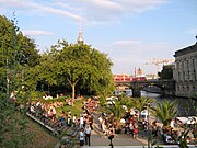
Oldest Spreestrand opposite the Museum Island

Northern tip of Museum Island, from the Weidendamm Bridge from

Junction to Humboldthafen , behind it the main station

The Spree between Moabit (left) and Hansaviertel (right)


The Oberhavel is from the source to the mouth of the Spree with 165 km significantly shorter than the Spree, and their average outflow is not even half the size of the creek.
From 1882 to 1885 the Spree in Berlin was expanded as a shipping route. It was straightened and in the city center the bank was fortified with walls.
Hydrology and hydrography
Because of its very low gradient , the Spree flows very slowly, an average of around 50 centimeters per second. Between Cottbus and Berlin-Köpenick there are only 17 centimeters per second and on the 44 kilometers through Berlin even only nine centimeters per second.
In the 1960s to 1970s, considerable amounts of groundwater were pumped out and discharged into the Spree due to the open-cast lignite mining. Most of the water from the Lusatian area of 2,500 square kilometers (13 billion cubic meters) flowed off over the course of the decades via the Spree. Since the end of lignite mining, the groundwater level has risen again and the Spree lacks water until a new equilibrium has been reached. Especially in the summer months there can be a considerable shortage of fresh water. Between the existing barrages, the Spree is a largely stagnant body of water. At the Leibsch gauge (Unterspreewald), a runoff of 0 cubic meters is regularly recorded in dry summers. In summer 2003 it was observed that the Spree in Köpenick flowed backwards. Since treated wastewater is discharged into the Spree in the Berlin area, it can happen that in dry summers the Spree in the Berlin area consists almost entirely of treated wastewater.
Since 1997, Berlin and Brandenburg have been creating reservoirs that are supposed to guarantee a minimum inflow. About thirty years ago've been Spremberg dam and a little later the Bautzen which have been created, further dam Quitzdorf on the Black Schöps.
Spree, canals and Havel in Berlin

Bright blue: Havel-Oder waterway , Spree-Oder waterway and lower Havel waterway ; deep blue other federal waterways, gray blue other waters
| Flow or discharge values [m³ / s] - Direction of flow from top to bottom "across the horizontal field boundaries" - |
||||||
|---|---|---|---|---|---|---|
| Oberhavel ( Borgsdorf ) 11.1 |
Fürstenwalder Spree Lock Fürstenwalde [3.71–17.1–42] |
Dahme ( Neue Mühle ) 7.14 [0.259– 7.75–26.3] |
Nuthe 7.25 |
|||
|
Müggelspree weir Large drinking troughs 11.4 [2.38–11.3–23.2] |
Oder-Spree Canal ( lock Wernsdorf ) [0.800–5.81–20.8] |
|||||
|
Dahme ( Seddinsee , Langer See ) |
||||||
| Treptower Spree ("Oberspree") | Teltow Canal | |||||
| Treptower Spree |
Britzer connection channel |
|||||
| Berlin Spree |
Landwehr Canal (lower lock ) 3.72 [1.18–3.54–6.57] |
Teltow Canal ( Lichterfelde ) 7.7 ( Kleinmachnow lock ) [3.72–8.63–15.0] |
||||
| Berlin Spree ( Mühlendamm ) 21.8 [4.07– 22.2–67.2] |
Spree Canal (Mühlendamm) ? |
|||||
| Berlin Spree (calculated) 21.9 |
||||||
| Unterspree ( Sophienwerder ) 25.6 |
||||||
|
Unterhavel ( Heerstrasse : Freybrücke + Stößenseebrücke ) 36.2 ( Spandau - Potsdam ) [5.28–46.8–124] |
Griebnitz Canal (Alsen Bridge) 1.83 |
Griebnitzsee (calculated) 5.9 |
||||
| Unterhavel ( Jungfernsee , calculated) 38.0 |
||||||
| Berlin total runoff (calculated) 43.9 [9–55.4–139] | ||||||
|
Sacrow-Paretzer Canal (Potsdam ( Nedlitz ) –Marquardt) [5–45–95] |
Potsdam Havel (Potsdam (city center) - Phöben ) [1, 2–18–45] |
|||||
| Unterhavel ( Göttinsee - Ketzin / Havel ) [2.72–62.7–145] |
||||||
- Blue-green and in square brackets: Wasserstraßen- und Schifffahrtsamt Berlin ,
average for the years 2001-2010 for the river values MNQ (at medium low water), MQ (at medium water) and MHQ (at medium high water) - Purple in square brackets: Brandenburg Waterways and Shipping Office ,
flow rates, speeds, gradients, mean values for 2005–2014 (generally names not measuring points, but measuring distances for the other authorities) - Black figures: Senate Department for Urban Development, Berlin,
annual average of the long-term monthly averages given for the 2010 monthly reports
Conditional comparability of the figures from the various sources:
The values of both the Berlin state authority and the Berlin Waterways and Shipping Office, both from series of measurements in the first decade of the 21st century, harmonize well with each other. The values of the Brandenburg Waterways and Shipping Office, based on series of measurements from 2005 to 2014, show about ten m³ / s more for the mean water distance from Spandau downstream.
The MQ for the Nuthe is currently only available without specifying the measurement date or measurement period, but it does contribute to understanding the measurement results of the Brandenburg Waterways and Shipping Office.
tourism
- The Spreeradweg follows the course of the river from the source to Erkner on the southeastern outskirts of Berlin .
- In addition to its water-rich landscape, the Spreewald also has Sorbian culture to offer and attracts tourists from near and far.
- The lakes in the Treptow-Köpenick district are an important local recreation area for Berliners.
particularities

- The benefits of the Sohlander Dam , built from 1937 onwards , were questioned from the start. Since 2004, the Spree has flowed past the reservoir to the west.
- The rehabilitation as a bathing river is part of the Spree2011 project .
- The urban development project Flussbad Berlin , supported by a non-profit association, intends to develop the Spree Canal in the center of Berlin as a public recreational area and to make the ecologically cleaned river swimable.
- Every year on Easter weekend has been held since 1996 on the Spree between Neu Zittau and the Erkner Spree bustle held in which the participants on possible unusual rafts drifting downward spree. The most famous participant was the former Minister for Labor, Social Affairs, Health and Women of the State of Brandenburg, Regine Hildebrandt .
- In winter, attempts are made to keep the Spree in the Berlin urban area always navigable by using several icebreakers.
- Fifteen Spree tunnels for the most varied of purposes cross under the river in Berlin.
- The banks on both sides of the Spree in the Friedrichshain-Kreuzberg district are to be developed as part of the Mediaspree investor project . The citizens' initiative Mediaspree is resisting sinking .
- In order to preserve the eel population , glass eels caught in the sea are released .
Side waters
Downstream order. The length or catchment area of the water body concerned is given:
|
Above Cottbus:
|
Spreewald: Upper Spreewald:
Lower Spreewald:
|
Spreewald – Dahm estuary:
|
Below the Dahm estuary:
|
literature
- Spree, river. In: Johann Heinrich Zedler : Large complete universal lexicon of all sciences and arts . Volume 39, Leipzig 1744, columns 481-483.
- Gerd Conradt: On the Spree - the river, the people . Transitverlag, Berlin 2005, ISBN 3-88747-201-2 .
- Heinz Götze: 398 kilometers of the Spree: from the sources in Upper Lusatia to the mouth in Spandau . Stapp Verlag, Berlin 1993, ISBN 3-87776-007-4 .
- Thomas Böttger: Along the Spree - 400 km from Oberlausitz to the Havel . Bildverlag Böttger, Witzschdorf 2010, ISBN 978-3-937496-36-8 .
- Lutz Mohr : Neusalza-Spremberg - A small town in Upper Lusatia. Highlights from history and legend. Special edition No. 1/2012 of the series: History and stories from Neusalza-Spremberg. Greifswald u. Neusalza-Spremberg 2012.
- Klaus Muche: Why the Spree is called Havel . Klaus Muche, Cottbus 2013
Web links
- The Spree ( memento from December 19, 2014 in the Internet Archive ) at the BUND river office
- Spree near Berlin - interactive 360 ° panorama
- Spree locks
Individual evidence
- ↑ Profile Spree Land Brandenburg - Ministry for Environment, Health and Consumer Protection (MUGV)
- ^ German Hydrological Yearbook Elbe Region, Part II 1999 Brandenburg State Environment Agency, p. 118, accessed on November 3, 2018, at: lugv.brandenburg.de (PDF, German).
- ↑ Spree on dolnoserbski.de, accessed on July 29, 2019
- ↑ Monumenta Germaniae Historica . The documents of the German kings and emperors . Volume 1: The documents Konrad I, Heinrich I and Otto I. Edited by Theodor Sickel. Hanover 1879–1884. Quoted from the Brandenburg name book .
- ↑ Brandenburg name book. Part 10. The names of the waters of Brandenburg . Founded by Gerhard Schlimpert, edited by Reinhard E. Fischer . Edited by K. Gutschmidt, H. Schmidt, T. Witkowski. Berlin contributions to name research on behalf of the Humanities Center for History and Culture of East Central Europe. V. Verlag Hermann Böhlaus Successor, Weimar 1996, ISBN 3-7400-1001-0 , p. 268.
- ↑ Johann Benedict Carpzov : Newly opened temple of honor of Merckworthy Antiquities of the Marggraffthum Ober-Lausitz . David Richter, Leipzig and Budissin 1719, CAPUT XII. Of which rivers and streams, with which Ober-Lausitz is watered , p. 214 ( digitized version of the Munich digitization center ).
- ↑ L. Mohr, 2012, p. 69
- ↑ Johann Benedict Carpzov : Newly opened temple of honor of Merckworthy Antiquities of the Marggraffthum Ober-Lausitz . David Richter, Leipzig and Budissin 1719, CAPUT XII. Of which rivers and streams, with which Ober-Lausitz is watered , p. 215 ( digitized version of the Munich digitization center ).
- ↑ Sulphate pollution of the Spree ( Memento from May 18, 2016 in the Internet Archive ) (PDF) Leibniz Institute for Freshwater Ecology and Inland Fisheries, May 2016; accessed on May 18, 2016
- ^ Günter Bayerl : Periphery as fate and chance: Studies on the recent history of Niederlausitz , p. 190 ( limited preview in the Google book search).
- ^ Peggy Kompalla: Spree becomes a river construction site in Cottbus . In: Lausitzer Rundschau , Senftenberg edition, March 14, 2018, accessed on March 16, 2018
- ↑ a b c structure of federal waterways ( memento of January 21, 2016 in the Internet Archive ), Federal Waterways and Shipping Administration.
- ↑ a b Directory E, Ser. No. 55 of the Chronicle ( memento of July 22, 2016 in the Internet Archive ), Federal Waterways and Shipping Administration.
- ↑ 400 kilometers of rivers and canals and 1000 kilometers of banks. In: Berliner Morgenpost . February 17, 2007, wards. ( paid online access to the article ).
- ↑ Torsten Hampel: The crazy river . In: Der Tagesspiegel . August 5, 2003.
- ↑ Why the Spree flows backwards . Science Information Service , August 25, 2003.
- ^ Sebastian children, Haik Thomas Porada: Brandenburg an der Havel and the surrounding area: an inventory of the country . P. 233 (Google Book Search Use the middle drain)
- ↑ a b In warm, dry weather, considerable water losses through evaporation over the Havel lakes and through abstraction from agriculture
- ↑ Registered as "Marquardt-Ketzin". An indicator entered at Marquardt is of course diluted with the water from the Potsdam Havel flowing into the Göttinsee.
- ^ Wasserstraßen- und Schifffahrtsamt Berlin: Outflows
- ↑ Overview diagram of level, gradient, speed, flow 2005–2014 . ( Memento from March 24, 2016 in the Internet Archive ) (PDF) Waterways and Shipping Office Brandenburg
- ^ Monthly water management report . Senate Department for Urban Development, Berlin
- ↑ Over two million glass eels released in Berlin waters. In: berlin.de . March 7, 2019, accessed March 17, 2019 .