
Castle (Spreewald)
| coat of arms | Germany map | |
|---|---|---|
.png)
|
Coordinates: 51 ° 50 ' N , 14 ° 9' E |
|
| Basic data | ||
| State : | Brandenburg | |
| County : | Spree-Neisse | |
| Office : | Castle (Spreewald) | |
| Height : | 57 m above sea level NHN | |
| Area : | 35.26 km 2 | |
| Residents: | 4242 (Dec. 31, 2019) | |
| Population density : | 120 inhabitants per km 2 | |
| Postal code : | 03096 | |
| Area code : | 035603 | |
| License plate : | SPN, FOR, GUB, SPB | |
| Community key : | 12 0 71 032 | |
| Office administration address: | Hauptstrasse 46 03096 Burg (Spreewald) |
|
| Website : | ||
| Mayoress : | Ira Frackmann ( CDU ) | |
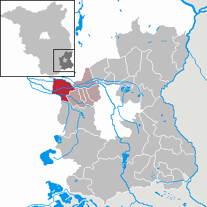
| Location of the municipality of Burg (Spreewald) in the Spree-Neisse district | ||
 _in_SPN.png) |
||

Burg (Spreewald) , Bórkowy (Błota) in Lower Sorbian , is a municipality in the Spree-Neisse district in the east of Brandenburg . It has been a state-approved site with a mineral spring spa since 2005 . Burg is administered by the Burg (Spreewald) office, whose seat is in the municipality.
geography

Burg as a typical scattered settlement on 35 km² is located in the center of the Oberspreewald about 20 km northwest of Cottbus . It is one of the largest rural communities in Germany.
In the intact Spreewald landscape there are 300 watercourses called rivers . One of the longest is the Große Fließ , which crosses the high forest in the north of the district and forms part of the northern border. The approximately 1000 km² high forest was declared a unique landscape area by UNESCO as protection zone 1 (highest protection class).
Due to the low gradient, the Spree has branched into an inland delta with many rivers and canals and thus formed Kaupen . Burg is part of the Spreewald Biosphere Reserve . The community lies in the traditional settlement area of the Sorbs . Public buildings and facilities, streets, paths, squares and bridges are gradually being labeled in two languages.
While the districts of Burg-Dorf and Müschen have the normal development of a village, the former communities of Burg-Kauper and Burg-Kolonie emerged as scattered settlements . Due to the relief and water conditions, the farmsteads are laid out on Kaupen , spatially distributed over a wide area and surrounded by fields, meadows and forest areas, so that the impression of a park landscape rather than a closed village arises.
Community structure
In addition to the core town of Burg (Spreewald), the community includes the district
- Müschen , Myšyn in Lower Sorbian - 21.4% of the population have knowledge of Sorbian (as of 1995). Paulicks Mill ( Pawlikojc Młyn ) also belongs to the district of Müschen.
as well as the parts of the municipality belonging to Burg (Spreewald):
- Castle Village ( Wobsedne Bórkowy )
- Burg-Kauper ( Kupaŕske Bórkowy ) - 15.7% of the population with knowledge of Sorbian
- Castle Colony ( Prizaŕske Bórkowy ) - 20.6% of the population with knowledge of Sorbian
The parts of the municipality of Burg (Spreewald) do not have the status of a district with a local advisory board .
history
Early to the 17th century


The oldest signs of settlement in the Neolithic and Bronze Age can be found on the Schlossberg (62 m) north of Burg-Dorf. During regulation work on the Spree in 1876, workers found a Bronze Age, three-wheeled cult car. Its age has been determined by experts to be over 3000 years and is therefore evidence of the settlement of this region in the Spreewald. According to the Germanic Semnones , Sorbs , also called Wends , settled here around the year 600 . Around the year 1000, the Polish King Bolesław I. Chrobry had a castle built on this site , which at that time was one of the largest castle complexes north of the low mountain range. The German place name may also be derived from this castle.
Given the harsh living conditions at the time, clearing the fen area in the Burg area was very difficult, as almost everything had to be done with boats . The houses were built from wooden planks and covered with thatch , many of which are still up to 300 years old.
The castle was first mentioned in a document dated September 29, 1315, when a property from the Lübbenau lordship was sold. With that the right to fish passed to the new owner. At that time around 300 people lived in the village, in which a mill was already mentioned. The place came from the possession of Bodo the Elder of Ileburg to the knight Christian von Langen and his sons. Chroniclers suggest that a flood followed by famine forced Bodo the elder to take this step. In 1535 the Reformation was introduced in Burg. In the same year is Schriftsässigkeit assigned to Cottbus. In 1602 Friedrich von Brandenburg had a hoof roll created . It resulted in six hoofers , 51 gardeners, three kötter and a miller who manage a total of 28.5 hooves for the castle . A school was first handed down from 1637. In the years 1691 to 1699 there was an annual flood that destroyed considerable parts of the harvest.
18th and 19th centuries
In the 18th century, the Prussian King Friedrich Wilhelm I began to settle his disused soldiers in the Burger area. They settled on natural, flood-free heights (Kaupen) and began to reclaim the area. Large areas were used for agricultural purposes through clearing . They were fertilized by the annual floods and therefore proved to be extremely fertile. Burg Kauper was founded in 1725 (since 1960 part of Burg). In the years 1748 to 1750 weaver families from neighboring towns settled in Burg, which started a linen weaving mill.
It was not until 1749 that Burg received its first house of prayer, before that the believers had to go to the Lübbenau church and from 1635 to the village church of Werben . However, the first house of prayer was soon too small, so that a half-timbered church was built in 1753 , but it burned down on September 30, 1766. Then a house of prayer was provisionally established and in 1799 the foundation stone for the present in the 21st century evangelical church as early neoclassical hall building with four-sided gallery put that on November 11, 1804 inaugurated was.
Frederick II continued the settlements and enabled the establishment of Burg Kolonie in 1766 by awarding 100 mostly foreign settlers. The plan was successful: only twelve years later the population had grown to 375 people. The first canals were built between 1771 and 1804 in order to better regulate the water balance in the region. They were supplemented by studies by the Prussian and Saxon governments on the regulation of water conditions in the 1830s. It is recorded from 1817 that Christian Müller rebuilt the mill and that it must have been destroyed beforehand. On December 5, 1836, there was a fire in the building, which was subsequently rebuilt. The first village school was opened in 1844. Heinrich Kleefeld opened the first pharmacy in 1852 ; on July 1, 1856, a third-class mail expedition that developed into a post office . In 1870 a gymnastics club was founded, which in 1881 became a gymnast fire brigade . In 1879 a telegraph line was put into operation. On July 7th, 1881 the volunteer fire brigade was founded in Burg. At first she only moved into a simple shed before being equipped with the first manual pressure syringe in 1882. In 1874, a men's choir, the Concordia choir, was the first to be founded in Burg .
In the late 1860s, workers on the Schlossberg removed earth to reclaim damp arable land. In the process, they came across numerous artifacts that archaeologists dated to the Bronze Age. One of the works of art was a bronze cart that Rudolf Virchow purchased from a tailor Purko in 1880 . It is located in the Museum of Prehistory and Early History in Berlin in the 21st century and is proof that the region was settled over 3000 years ago. Virchow became aware of the region, but saw a ground monument in danger due to the wild treasure hunt on the mountain . In 1871 Virchow traveled with his Berlin Society for Anthropology, Ethnology and Prehistory to a conference in Burg. In 1880 part of the International Anthropological Congress took place there with his participation. When extensive earthworks were planned on the Schlossberg for the construction of the Spreewald Railway in 1897 , he reappeared and convinced District Administrator Wackerbarth to buy the five- hectare area. From 1898 the Spreewald Railway ran through Burg, but it was shut down again in 1970.
In addition to the better connection by rail, it was also Theodor Fontane's stories in his hikes through the Mark Brandenburg , which also led to an increase in tourism in Burg. In 1882 the Burg teacher Paul Fahlisch had the idea of introducing tourists to the region on a boat trip. He is considered to be the founder of tourism in the community. The first homeopathic practice opened in 1884 . The population continued to rise: In 1885, 4533 people lived in Burg. In addition there were 97 horses, 2300 cattle, 1300 pigs and 371 beehives. A total of 97 dealers livened up the place. In 1887 the first telephone connection with advertising was set up. At the same time, craftsmen set up a road connection to Cottbus. Around 1900, on the initiative of the Warrior Association, the idea of building a Bismarck tower on the Schlossberg , which would also serve as a lookout tower, came up. This made the Spreewaldverein's considerations to build a viewing platform at the Gasthaus Eiche obsolete . In 1917 the tower was opened to the public.
During this time, Burg was repeatedly hit by floods, some of which were devastating. When the Spree was straightened for the first time in the 1870s, the situation worsened as the throughput times of the flood peak were drastically reduced. Nevertheless, in 1879 the community refused to join the newly founded water cooperative Lübbenau . She feared falling groundwater levels and water deficits. The construction of a canal to serve as a floodwater was also rejected in 1886 . But already in 1897 there was another flood, which caused considerable damage. Further floods in 1899, 1900, 1901, 1915, 1917, 1919, 1920, 1926, 1927 and 1930 followed. It was only when the river was expanded between 1926 and 1936 that the flood protection was improved. In 1899 an agricultural association was founded, which in the following years contributed to the cultural life in Burg through numerous lectures.
20th and 21st centuries
On October 24, 1901, the municipality of Burg-Kauper decided to build five paths with a total length of 20 km. This was intended to establish a connection to the towns of Burg-Dorf, Burg-Kolonie, Byhleguhre and Schmorgrow. On the night of August 3rd to 4th, 1903, there was a flour dust explosion in the mill in Burg , in which the structure was destroyed except for the water wheel. A year later it was replaced by a new building with a water turbine . On June 23, 1905, the first telephone network with 14 participants went into operation. On April 4, 1908, the United Barge Ferrymen were founded , which until 1935 had a total of 288 members. In 1911 the volunteer fire department inaugurated a syringe house. The old shed was sold and the proceeds distributed to the three parishes. The infrastructure continued to grow - in 1913, craftsmen built the port facility in the mill pit. A short time later, the first residents were connected to the electrical power grid, which was expanded from 1919 to 1936. The first film screening took place on March 7, 1920. A film about the life of Charlotte Corday was shown that evening in the restaurant Zum Spreehafen . The mixed choir was founded in 1925 and merged with the male choir . From 1920 to 1933 roads and connections were paved and expanded. Previously there were only a few narrow pavements. Planks were laid across the trenches; There were high bridges, also called banks , over the larger rivers with boat traffic . However, the work progressed only with difficulty because there was a lack of gravel to fill the paths accordingly. The required sand was extracted from the tiles and transported to the construction sites by barge. The residents were used for 35 to 40 days of manual and clamping services. When the roads that had just been completed were destroyed again by floods in 1926 and 1927, the community decided to dismantle the Windmühlenberg. 66,000 m³ of sand were transported to Burg-Kolonie by light rail. In 1929 the fire brigade in Burg-Kauper received its first vehicle, which was in service until 1959. In 1930 craftsmen erected a permanent school building with four rooms in Bahnhofstrasse, and from 1934 to 1936 the Ringchaussee.
In the time of National Socialism , Hermann Göring had the plan to depopulate the economically weak region and at the same time to settle bison and elk . This was intended to create a hunting ground for the National Socialists in the Spreewald . In this context, considerations arose to drain the region, which was plagued by numerous floods, over a large area. However, with the outbreak of World War II , the plans were no longer implemented. Rather, a flood protection concept was implemented from 1951 to 1975, which consists of several floods and retention basins. In 1952, 10,000 hectares of land could be protected in this way. In the same year, on May 23rd, the community of Wendish / Sorbian Spreewaldfischer Burg and the surrounding area was founded. Until 1991 it comprised a total of 17 fishing groups with around 160 members. The united barge ferrymen were renamed the working group of the barge ferrymen .
In 1951 the community renamed the Bismarck Tower the Tower of Youth . Because of the increasing motorized traffic, construction workers in Burg-Kauper built a total of twelve massive bridges between 1953 and 1955. On May 3, 1960, the first agricultural production cooperative Spreeland was founded under the chairmanship of Max Fiedermann . Six more LPGs followed, which in 1975 were combined into a single LPG of Type III.
In 1965 the place celebrated its 650th anniversary. In 1972 craftsmen enlarged the syringe house so that a new vehicle could be stationed there. In 1976 the second port facility was opened at Waldschlösschen. In 1982 the ten-class Polytechnische Oberschule Hans Beimler Burg (Spreewald) started operations. It replaced the village schools in the individual localities with a central offer. The high school made intensive efforts by a first computer in 1984, finally, for 4000 Marks of the GDR in-store purchase and sale was purchased: a Commodore 64 .
The official spelling of the place name was Burg / Spreewald until the end of the GDR . After the fall of the Wall , the LPG was also privatized in Burg. On October 3, 1990, the Tower of Youth was renamed the Bismarck Tower again. The main street, the Bahnhofstrasse and other connecting routes were completely rebuilt or given a new surface. The volunteer fire brigade received two used Robur trucks which, in addition to fire-fighting equipment, received a portable pump trailer . In 1991 the producer group Spreewaldmarkt was founded . A year later, numerous measures to improve drinking water quality were successfully completed. For this purpose, an extensive pipeline network was laid and a waterworks started up. In 1992 the high school was converted into a comprehensive school. There was also the opportunity to take the Abitur. In 1994 a sewage treatment plant went online. The place continued to develop: boarding houses, hotels and restaurants opened and focused on tourism. A rehab clinic was added in 1994 . A decade-old idea was thus implemented: As early as the 1960s, geologists found out during drilling operations that warm and salty water could be extracted in Burg for health purposes. The thermal brine is located in Burg at 1350 meters. The municipality then decided on July 7th, 1994 to apply to be allowed to use the predicate climatic health resort in the future; this was granted in 1996. In 1997 the community redesigned the fairground. On April 3, 1998, the community received state recognition as a resort . On October 14, 2000, a new fire and rescue station opened, while the old syringe house has served as a fire-fighting technology museum since then.
In 2005 the Spreewaldtherme opened and in the same year the place was recognized as a state-approved place with a mineral spring spa. In 2008, the boat ferrymen celebrated their 100th anniversary with a parade. In 2010 the upper school level was given up because the number of pupils had fallen sharply. Since then there has been a primary and secondary school in Burg. In 2012 the Spreewald fishermen celebrated their 60th anniversary. In 2014, the municipal council decided on a “Burg2020” model with a framework for future health resort development. In 2015, Burg celebrated its 700th anniversary.
Administrative history
Burg has belonged to the Cottbus district in the Prussian province of Brandenburg since 1816 and to the Cottbus-Land district in the GDR district of Cottbus from 1952 .
With effect from January 1, 1960, the previously independent communities of Burg-Kauper, Burg-Dorf and Burg-Kolonie merged. This was preceded by intensive discussions over several years about the pros and cons of such a merger. At that time, Burg-Spreewald became the largest village in the GDR with an area of around 30 km².
The community has been in the Spree-Neisse district of Brandenburg since 1993.
The previously independent community of Müschen was incorporated into Burg (Spreewald) on December 31, 2001.
Population development
|
|
|
|
|
Territory as of December 31, 2005, population: as of December 31 (from 1991), as of 2011 based on the 2011 census
politics
Community representation
The community council consists of 16 community representatives and the honorary mayor. Since the local elections on May 26, 2019 , the seats have been distributed among the individual parties and groups as follows:
| Party / group of voters | Share of votes | Seats |
| Alliance for Burg | 30.6% | 5 |
| CDU | 22.4% | 4th |
| Together for Burg | 21.8% | 3 |
| SPD | 9.0% | 1 |
| Individual applicant Hans-Jürgen Dreger | 6.5% | 1 |
| Individual applicant Alexander Wach | 5.6% | 1 |
| Agriculture and the environment | 4.1% | 1 |
| Turnout: 64.4% | ||
mayor
- 1998–2014: Martin Schmidt ( PDS )
- since 2014: Ira Frackmann (CDU)
In the mayoral election on June 16, 2019, Frackmann was elected for a further five-year term with 51.8% of the valid votes.
badges and flags
The Ministry of the Interior of the State of Brandenburg granted the municipality of Burg (Spreewald) permission to use a coat of arms on May 15, 2007 and to use a flag on August 14, 2007. The coat of arms and flag were designed by the graphic artist and heraldist Uwe Reipert from Beeskow.
- Description of coat of arms
- "In green a gold-crowned silver snake, which winds around a golden column base and from whose throat a silver gush of water pours into the basin lying on it; each with two golden marsh marigolds. "
The snake motif is based on the mythological representation of Hygieia , daughter of Asklepios , who stands for a healthy lifestyle. The usual depiction of the snake writhing around the cup with medicinal content is extended to include the regionally significant attributes of the crown as a symbol of the snake king and the spouted water as an indication of the brine source . The main motif of the coat of arms thus indicates the status of the municipality of Burg (Spreewald) as a health resort.
The four flowers of the Spreewald-typical marsh marigold symbolize the four community or districts village, colony, Kauper and Müschen. The spacious distribution of the flowers brings the aspect of scattered settlement into play.
- Flag description
- "Three-striped green-white-green (green-silver-green) in a ratio of 1: 4: 1 with the municipal coat of arms in the median."
Parish partnership
After the turn, the community tried Hatten in the district of Oldenburg to community partnerships in the new federal states. A resident of Hattern who was born in Burg spoke to the mayor of the city. The contact led to the establishment of partnership contacts in 1990.
Attractions
_-_Bismarckturm.jpg)

The monument list of Burg contains all buildings under monument protection standing.
- Parish church , built between 1799 and 1804 in an early classical style. The Luther oak in front of it is registered as a natural monument.
- Bismarck Tower on the Schlossberg , built from 1915 to 1917 on a prehistoric rampart, serves as a memorial for soldiers who fell in World War I. The platform at a height of 28 meters was once used as a fire bowl and is open to the public.
- Weidenburg - Arena Salix near the Bismarck tower, a building made of living willow branches, created by the Swiss architect Marcel Kalberer , a tree monument on an area of 7,878 m²
- Spa and legend park near the medical rehabilitation center with sculptures from the Sorbian / Wendish legends, a herb and picking garden as well as a rose garden and several orchards
- Burg Heimatstube in a thatched log house typical of the region, provides information about prehistory and church history as well as house and agriculture in the region. In addition, Sorbian / Wendish costumes are shown. The permanent exhibition is supplemented by changing exhibitions on past and present life in Burg.
- Old station Burg (Spreewald) of the Spreewaldbahn from 1898, converted into a restaurant
The soil monuments are listed in the list of soil monuments in Burg (Spreewald) . Burg is a member of the working group “Historic Village Centers in the State of Brandenburg” .
Economy and Infrastructure
traffic
_Bahnhof_2005_by-RaBoe_01.jpg)
Burg lies on the national roads L 51 between Straupitz (Spreewald) and Cottbus and L 54 to Vetschau . The closest motorway junction is Vetschau on the A 15 ( Spreewald triangle - Polish border).
Vetschau station in the neighboring town of the same name on the Berlin – Görlitz railway line is served by the RE 2 Wismar – Berlin– Cottbus regional express line .
Burg can be reached with a PlusBus and other regional bus routes through the Dahme-Spreewald regional transport company .
In 1898 the Spreewaldbahn was opened, a narrow-gauge railway that ran from Cottbus via Burg (Spreewald) and Straupitz (Spreewald) to Lübben (Spreewald) . This railway line was shut down and dismantled in 1970. In Burg, the train station converted into an inn , next to which there is again a piece of track with museum wagons and parts of an old steam locomotive of the Spreewald Railway , reminds of this route. The restaurant itself is set up as a museum for the Spreewald Railway. A development association is now planning to rebuild the Spreewaldbahn.
Burg can be reached by bike via the Gurken-Radweg and Hofjagd-Radweg .
Until the middle of the 20th century, in large parts of Burg the Spreewaldkahn - a long, shallow boat with a shallow draft that is pegged with a long pole (“pack”) and can also be steered through narrow and shallow canals - was the only one Mode of Transport. Only then did it lose its economic importance through the expansion of paths and bridges and is now primarily used for tourism purposes.
Leisure and sports facilities

Burg is suitable as a starting point for water hiking tours through the rivers of the Spreewald. Visitors to Burg can take a paddle boat themselves, but also let a ferryman poke themselves through the rivers of the biosphere reserve with the Spreewald barge . Driving on the inner part of the biosphere reserve is not permitted.
The Schlossberghof information center provides information about the Spreewald biosphere reserve. In addition to an exhibition, the offer includes a nature experience clock and a medicinal and aromatic plant garden.
Inline skaters and cyclists can find new routes throughout the Burg area. There are also developed routes between Cottbus and Burg, which largely follow the previous route of the disused Spreewald Railway.
Since 2005 the place with the Spreewald-Therme has offered a bathing facility with brine water and has a rehabilitation center, which led to the state recognition as a place with a mineral spring spa . The bathing and sauna area as well as the fitness and wellness area are also operated in cooperation with hotels and guest houses.
In Burg there is a sports club, the SG Burg, which, in addition to football, also offers billiards, gymnastics, volleyball and darts. The club was founded in 1921. In 2004, the soccer team was promoted to the Brandenburg League. After the withdrawal at the end of the 2006/2007 season, the club played in the regional class south and since promotion in 2008 in the regional league south. After relegation to the national class in 2018, the 1st team was disbanded. The game was then continued with the 2nd team in the Niederlausitz district league. Immediate promotion to the regional league, in which the team will start in 2019/2020, was achieved.
Personalities
Sons and daughters of the church

- Johannes Noack (1878–1942), born in Burg-Kauper , Protestant pastor, victim of National Socialism
- Mina Witkojc (1893–1975), Lower Sorbian poet
- Fritz During (1910–1993), sculptor and artisan
- Günter Gollasch (1923–2011), band leader
Personalities associated with the community
- Wilibald von Schulenburg (1847–1934), landscape painter and folklorist, lived from 1876 to 1879 with the small farmer Badarak
- Heinrich Steffen (1849–1926), doctor in Burg and part-time photographer, whose photo plates were shown for the 700th anniversary of the community
- Gertrud Eitner (1880–1955), member of the Reichstag 1930–1932 ( CSVD ), lived in Burg from 1920 to 1928. At that time, her husband was a pastor in the Burger Church.
literature
- Amt Burg (Spreewald) (Ed.): 1315–2015, 700 years Burg im Spreewald , 2015, p. 110
- Office Burg (Spreewald) Subject Tourism (Ed.): Leisure offers in Burg Spreewald , no date, p. 60.
Web links
Individual evidence
- ↑ Population in the State of Brandenburg according to municipalities, offices and municipalities not subject to official registration on December 31, 2019 (XLSX file; 223 KB) (updated official population figures) ( help on this ).
- ↑ a b Tourismusverband Spreewald (publisher): Tourist information Gurkenradweg im Spreewald . 2006, p. 38 .
- ↑ a b c Tourismusverband Spreewald (Ed.): Touristinformation Kahnfahrt Spreewald . 2005, p. 6 .
- ↑ Ralf Jodelbauer, Gunter Spieß, Han Steenwijk: The current situation of the Lower Sorbian language. Domowina-Verlag, Bautzen / Budyšin 2000; Pp. 30-33.
- ↑ Service portal of the state administration of the state of Brandenburg: Municipality of Burg (Spreewald)
- ^ Time table Burg (Spreewald). In: burgimspreewald.de. Retrieved March 24, 2019 .
- ^ Directory of the municipalities of the GDR, Berlin 1989.
- ↑ StBA: Changes in the municipalities in Germany, see 2001
- ↑ Yumpu.com: Historical commune register of the country ... - Brandenburg.de. Retrieved February 29, 2020 .
- ↑ Historical municipality register of the state of Brandenburg 1875 to 2005. District Spree-Neisse . Pp. 14-17
- ↑ Population in the state of Brandenburg from 1991 to 2017 according to independent cities, districts and municipalities , Table 7
- ^ Office for Statistics Berlin-Brandenburg (Ed.): Statistical report AI 7, A II 3, A III 3. Population development and population status in the state of Brandenburg (respective editions of the month of December)
- ^ Result of the local election on May 26, 2019
- ↑ Results of the municipal elections in 1998 (mayoral elections) for the Spree-Neisse district ( memento of the original from April 17, 2018 in the Internet Archive ) Info: The archive link was inserted automatically and has not yet been checked. Please check the original and archive link according to the instructions and then remove this notice.
- ^ Result of the mayoral election on May 25, 2014
- ↑ Brandenburg Local Election Act, Section 73 (1)
- ↑ Ira Frackmann wins head-to-head races. In: Lausitzer Rundschau , June 16, 2019
- ^ Statutes of the municipality of Burg (Spreewald) on the use of the coat of arms and the flag
- ↑ Brandenburg state main archive : coat of arms municipality Burg (Spreewald)
- ↑ a b § 2 of the main statute of the municipality of Burg (Spreewald)
- ^ Website of SG Burg (Spreewald). Archived from the original on March 29, 2016 ; accessed on November 12, 2016 .
Briesen (Brjazyna) | Castle (Spreewald) (Bórkowy (Błota)) | Dissen-Striesow (Dešno-Strjažow) | Döbern (Derbno) | Drachhausen (Hochoza) | Drebkau (Drjowk) | Drehnow (Drjenow) | Felixsee (Feliksowy jazor) | Forest (Lausitz) (Baršć) | Groß Schacksdorf-Simmersdorf (Tšěšojce-Žymjerojce) | Guben (Gubin) | Guhrow (Góry) | Heinersbrück (Móst) | Jämlitz-Klein Düben (Jemjelica-Źěwink) | Jänschwalde (Janšojce) | Kolkwitz (Gołkojce) | Neisse-Malxetal (Dolina Nysa-Małksa) | Neuhausen / Spree (Kopańce) | Peitz (Picnjo) | Schenkendöbern (Derbno) | Schmogrow-Fehrow (Smogorjow-Prjawoz) | Spremberg (Grodk) | Tauer (Turjej) | Teichland (Gatojce) | Tschernitz (Cersk) | Turnow-Preilack (Turnow-Pśiłuk) | Welzow (Wjelcej) | Advertise (Vjerbno) | Meadow bottom (Łukojce)