
Flood


Flood (scientific / mathematical abbreviation HQ from " H och" and discharge - index Q ) is the condition of water bodies in which their water level is significantly above the level of their mean water . The counterpart is " low water ".
When using the term, a distinction must be made between the main cause of the water flowing in:
- tide-dependent due to the tides (water from below)
- Normal case: a state between nipp tide and spring tide
- Extreme case of storm surge : winds that increase the normal periodic flood due to their strength and direction
- Independent of the tide due to heavy rain or snowmelt (water from above)
Depending on the tide
In seas and waters that are dependent on tides ("tides"), "high water" refers to the periodic entry of the highest water level after the high tide has entered (correctly referred to as rising water ) and before the transition to ebb (correctly referred to as running water ) (" apex ") ). High and low tides alternate every 6 to 6½ hours on average, caused by the gravitation of the sun and especially the moon . Particularly high tides at full or new moon are called “ spring tide ”, also “spring tide” or “spring high tide”. Normal floods can be intensified by wind ( drift current ) to form a storm surge that can penetrate for kilometers inland on a flat coast . In waters without noticeable tides, pure storm floods can occur.
Heavy rain or snow melt
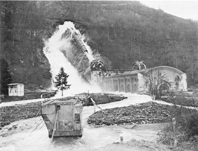
In the case of rivers and smaller rivers , one speaks of flooding when their water level exceeds their normal level for a long time (several days). Depending on the type of catchment area , they usually have a seasonal increase, for example when the snow melts or after heavy summer rain . In the event of severe flooding, river navigation must first be stopped; if the water rises further, flooding can occur. Swelling torrents can carry away bridges and trigger mudslides or landslides . In the case of particularly rapid floods, one speaks of flash floods .
General


Basically, floods are part of natural occurrences. They become a catastrophe ( flood disaster ) when human values are affected. A distinction can be made between regularly recurring floods, triggered for example by tides or snowmelt ( spring floods ), and irregular or one-off events such as tsunamis , storm surges and so-called " floods of the century " (as such, the Elbe floods in 2002 and the floods in Central Europe in 2013 ; some other floods that put this designation into perspective). Such particularly strong floods are referred to as “millennia floods” (e.g. Magdalenen floods in 1342 or Oder floods in 1997 ).
The contribution of global warming to flooding cannot be clearly identified and depends on local conditions (increase in extreme events, shift from snow to rain, etc.). For some regions an increase in annual precipitation is forecast, for others a decrease or a different distribution. Nevertheless, the IPCC assumes that flood risks will increase in the future.
Countries with low relief heights as the Netherlands , Germany (especially in the north) and Denmark to attempt by massive dikes measures and flood barriers (such as the Ems barrier in Emden ) to protect against sea flooding. If there is no intensive flood protection , catastrophes with many thousands of deaths can occur more frequently at the mouth of the Ganges, as in Bangladesh .
Flood situations also arise inland due to the swelling of rivers and lakes and the dangers of the torrent . Floods can also arise from ice jams or winds (e.g. Hamburg storm surge ).
The floods (peaks) of a river and a tributary can work together. Example: If a Moselle and a Rhine flood wave meet in Koblenz, the Rhine flood increases from there. When the Rhine floods at the end of 1993, floods from the Neckar, Main, Nahe and Moselle co-operated.
Flood risk


In the course of advancing land use, the areas used that are exposed to the risk of flooding also grew. In some places this could or can be compensated by structural flood protection. Today, compared to previous centuries, floods are much rarer. Their effects are often felt to be catastrophic; floods also provide “telegenic” and “photogenic” images. In the 19th century floods were seen as less catastrophic than they are today, as the built-up areas were less, and floods were sometimes seen as weather events comparable to snow today; the painter Gustav Schönleber found this a "pleasant change".
Today, human land use ( surface sealing ) and the improper development of bodies of water (linear regulation, reduction of retention areas ) can exacerbate flood levels. The usual, carefully planned expansion of watercourses ensures lower flood levels (expansion of the drainage cross-section, see measures for flood protection below). In addition, existing regulations can lose their performance due to insufficient maintenance (e.g. due to vegetation, landings) if this reduces the cross-section of the discharge. Significant changes in runoff due to soil sealing are only to be expected in small catchment areas .
The flood risk can be described by four components / factors:
- (Heavy) rainfalls in the historical past and their duration,
- Geomorphology of the affected rainy area,
- the vulnerability, i.e. the sensitivity of the affected facility or use to flooding and
- the extent and frequency of flooding.
In war
In war situations, deliberate flooding can be used as an offensive or defensive weapon against attackers. Among other things, this strategy has often brought success to the Netherlands against attackers. See: Eighty Years War , Alkmaar , Inundation . In 1943 the British Air Force destroyed some German dams . There were further attacks on dam walls on the Dnjeprostroj - and the Supung dam . In 1945 soldiers of the Wehrmacht opened the Rurtalsperre ; On February 10, 1945, they blew up the seals in the Kermeter tunnel at the Heimbach power station , whereupon the dam drained to the level of the Kermeter tunnel. They also blew up the closures of the bottom drain tunnels of the Schwammenauel dam ( Rursee ). Both of these together created weeks of flooding downstream, which silted up the floodplain and made it difficult for the Western Allies to advance. The Rur was transformed from a small river into a raging body of water; this delayed the start of Operation Grenade (transfer of the 9th US Army over the Rur).
From December 2, 1944, the Wehrmacht blew up dikes on the Lower Rhine to prevent the advancing Western Allies from crossing. The operation Veritable (8 to 21 February 1945) came by to a halt, especially since the winter of 1944-45 was very cold.
Dithmarschen in the Middle Ages : In February 1500, the Dithmarschers under Wulf Isebrand defeated a Danish-Schleswig-Holstein army under King Johann in the battle of Hemmingstedt. The invading Danish army consisted mainly of a specialized marching war infantry troops consisting of mercenaries assembled Black Guard , and some noble equestrian units, but was poorly managed. The peasants were able to destroy this army surprisingly. At first they avoided an open battle, opened the dikes in the marshland and let the advancing army fall into a wet trap on the narrow embankment of the road from Meldorf to Heide at Dusenddüwelswarft near Hemmingstedt.
Qualification of floods


Floods are mostly given a statistical evaluation. Long-term series of measurements at levels form the basis . The maximum annual values are selected from these and the probabilities of exceedance are determined. Their reciprocal value is the annuality . These annualities designate the statistical return interval .
In rivers, a single level is not very meaningful for general conditions (it depends on the local shape of the river bed), which is why the flow rate at the level is calculated here , which is largely the same over the entire river section and can be added up over the respective river system .
This flow rate (or flow rate below a gauge point) is referred to in hydrography with “Q” (from Latin quantitas , amount ), the water level with “W”, flood with “H”, which is why flow parameters and thus for the Designation of the flood itself the notation "HQ" or "HW" naturalized on lakes and coasts. For example, “HQ100” or “HW100” (also HQ 100 notated) denotes a flood event that occurs every 100 years, a “flood of the century ”.
The typical reference values on rivers are:
- Mean flood discharge (MHQ): The arithmetic mean of the highest discharge (HQ) for similar periods of time for the years of the observation period. In case of doubt, the time period and the period under consideration should be added, for example, "HQ 1971/1980" is the highest discharge from the years 1971 to 1980, "SoHQ 1971/1980" the highest in the summers 1971 to 1980, "JulHQ 1971 / 1980 “the highest runoff that occurred in the July months from 1971 to 1980.
- Highest ever measured flood discharge (HHQ, "Highest ever measured flood"): Historically documented maximum flood
- Mathematically highest flood discharge (RHHQ): The hydraulic engineering calculation variable of the highest flood
In the process, values from the modeling (" precipitation-runoff ", "NA models") are increasingly displacing the measured values, since in the context of global warming it is no longer certain to what extent the known - and comparatively short - measurement intervals are meaningful, and the models can be easily adapted.
Older is a phenomenological classification based on the extent of the respective impact such as overflows, overflows of barrages or extent of flooding. Today, these flood warning levels are mostly linked to the discharge parameters (similar to the Beaufort scale for wind strengths , which is classified according to wind speeds):
- The German cross-border portal hochwasserzentralen.de, for example, uses a four-level system that corresponds to the warning levels of the individual countries , within the limits HQ2, HQ10, HQ20, HQ100:
- "Small flood → Medium flood → Large flood → Very large flood"
- the inland flood and storm surge warnings are increasingly correlated
- In Austria, current data are generally related to the period 1981–2010 hydrological year (30-year mean). Common is:
- "Extreme flood" / extremely rare: HQ100 – RHHQ (100-year to mathematically highest flood)
- "Very large flood" / very rare: HQ30 – HQ100 (30 to 100 year flood)
- "Large flood" / rare: HQ10 – HQ30 (10 to 30 year flood)
- "Medium flood" / seldom-often: HQ5 – HQ10 (5 to 10 year flood)
- "Small flood" / frequent: HQ1 – HQ5 (1 to 5 year flood)
- "Increased mean water" (increased water flow) / very common: MQ – HQ1 ( mean to 1-year flood)
- Today, however, the flood warning levels (discharge categories) 1–3, within the limits> HQ1,> HQ10 and> HQ30, such as the federal hydrographic service, eHYD , are used (level 1 corresponds to small and medium floods). The particularly complex widening of the Rhine at Vorarlberg is designed for a 300-year flood at HQ 300 .
- Switzerland uses the FOEN , a risk level system:
- for rivers in the limits HQ2, HQ10, HQ30, HQ100
- for the lakes, the ratio of “ Sommerkote ” (SK) to high water limit (HWG) within the limits SK + 1 ⁄ 3 , SK + 2 ⁄ 3 , HWG and HWG + 25 cm
A term “medium high water” for one of the levels is unusual there.
Flood protection

Flood protection measures can include the following aspects:
- Adaptation of use to the flood hazard (evacuation, change in agricultural use, safe and low-damage design of structures)
- Protection from flooding through
- Retention of rainwater in the area or by rainwater retention basins
- Groyne structures , restoration of the natural river geometry (a large bank length due to many arches)
- Protection of affected areas or objects by dykes (also known as flood protection dams in Austria)
- Increase in the discharge capacity of the water body by widening the cross-section and troughs
- Timely warnings and alarms through automatic level measuring stations and flood warning services
There are dependencies between the individual measures. For example, regulations and dyke construction measures can aggravate the risk of flooding for those lying below or neighboring residents. The construction of flood retention basins (retention basins ) reduces the risk of frequent flooding at the expense of a rare but catastrophic dam failure due to a total failure of the retention basin.
Flood management provides a comprehensive strategy for reducing the consequences of a flood .
State protective measures in individual countries
With all flood protection measures, it should be noted that there is always a residual risk (system failure, exceeding the design flood ).
Germany

The Water Management Act (WHG) has been defining floods for the first time since 2010 as: “a temporary flooding of land that is normally not covered with water” (Section 72 WHG) by surface waters (rivers, lakes, sea). In Germany, floods from sewage systems are expressly not defined as floods. Additional regulations can be found in some of the state water laws of the federal states. There is no legally stipulated level of protection.
Since 2009, several federal states have launched information campaigns for more natural hazard protection. They mainly rely on voluntary provision by citizens.
Austria
The following protection goals are pursued in Austria:
- HQ 30 child objects
- HQ 100 standard protection
- HQ 150 expansion degree Wildbach
Degrees of protection that go beyond this are strived for if there is a special need for protection (e.g. for the City of Vienna ).
The Ministry of the Environment has a flood simulation created by VRVis . It is based on a survey of the site and shows the risk of damage for objects in 3 categories. From autumn 2020, all municipalities are to be covered and available on the website hora.gv.at.
Netherlands
Different levels of protection are used in the Netherlands. While in some parts of the country there is a level of protection against an HQ 1,250, a large part of the Randstad , for example , is protected against an event that statistically occurs once every 10,000 years. While Rijkswaterstaat is responsible for national flood protection (i.e. for large waterways and coastal protection), the regional protection goals are pursued by the 26 Waterschappen (similar to the water associations in North Rhine-Westphalia).
United States
In the USA , flood protection was set at the level of a 230-year flood by the responsible US Army Corps of Engineers . This level is also guaranteed, but the flooding of New Orleans has led to the realization that this level of protection is insufficient.
Organization of flood protection

Germany
In order to assess the dangers associated with the floods both on the German coasts and on the rivers, the federal states have set up a flood portal on the Internet. There are different warning and alarm levels regionally and locally. The reporting systems are mostly computer-assisted and are able to provide flood forecasts or estimates for several hours in advance. Short-term weather changes mean that longer-term forecasts are subject to errors.
The disaster control falls under the responsibility of the respective interior authorities, which for rescue measures on the fire brigades , the THW , the Bundeswehr etc. a. To fall back on. Various water rescue organizations such as the DLRG and the water rescue service are currently working in Germany .
Austria
The local fire brigade provides immediate help and defense in the event of a flood . Long-term help is provided by the disaster relief service of the fire brigade and assistance operations by the armed forces .
Here, too, the most widely used flood protection aid is the sandbag .
The establishment, maintenance and operation of flood protection measures is carried out by those individually affected, water cooperatives , municipalities and water associations .
See also
- List of flood events
- List of national and international hydrographic and flood services - with links to water level values worldwide
Web links
- Portal of the flood control centers in Germany
- Federal Institute for Hydrology (BfG) Koblenz
- Natural Hazard Overview & Risk Assessment Austria
- Swiss Federal Office for the Environment: Hydrological data and forecasts
- Flood and flood protection
- Link catalog on the topic of floods at curlie.org (formerly DMOZ )
- Flood Competence Center (HKC)
- German Association for Water Management, Sewage and Waste e. V. (DWA)
Individual evidence
- ↑ Hartmann, T. & Juepner, R. (2014): Editorial: The flood risk management plan between spatial planning and water engineering. Journal of Flood Risk Management, doi: 10.1111 / jfr3.12101 .
- ↑ IPCC (2014): Climate Change. Impacts, Adaptation, & Vulnerability: WGII AR5. Retrieved from www.ipcc.ch.
- ^ Wolf Eiermann, Helmuth Mojem, Staatsgalerie Stuttgart: Württemberg: Painters discover the country and people 1750-1900. Staatsgalerie Stuttgart 2001, p. 46.
- ↑ spiegel.de , June 6, 2013: Causes and prognoses: Ten facts about the flood .
- ↑ cedim.de (PDF; 4.1 MB) June floods 2013 in Central Europe - focus on Germany. As of June 3, 2013 (7 pages).
- ^ Kermeter tunnel 1945. Retrieved September 29, 2012 .
- ↑ http://hochwasserplattform.de/ Hochwasser 1809 - Hochwasserplattform , pages 33–44.
- ↑ hochwasserzentralen.de: Information on the Internet offer, cross-border flood portal , accessed on Aug. 3, 2014.
- ↑ cf. for example ktn.gv.at: Current runoff situation on Carinthia's rivers , Hydrographic Service - Carinthia; vorarlberg.at: discharge measuring stations in Vorarlberg , Vorarlberg , both legend , accessed on August 3, 2014.
- ↑ ehyd.gv.at: Current level data Austrian Waters , information sheet to the service eHYD: level Currently , Federal Ministry of Agriculture, Section The outflow Categories: flood , p 2 f (PDF, accessed on August 3, 2014); Burgenland uses it because of the transnational work of the Austro-Hungarian Water Commission.
- ↑ hydrodaten.admin.ch: The 5 danger levels for floods , Federal Office for the Environment , accessed on August 3, 2014.
- ↑ Hartmann, T. & Albrecht, J. (2014): From flood protection to flood risk management: condition-based and performance-based regulations in German water law. Journal of Environmental Law , 26 (2), 243-268. doi: 10.1093 / jel / equ015 .
- ↑ Information campaigns of individual federal states: Recognize and act on natural hazards ( Memento from June 3, 2013 in the Internet Archive )
- ↑ http://www.orf.at
- ↑ Hartmann, T. & Spit, TJM (2012): Managing riverside property: Spatial water management in Germany from a Dutch perspective. In T. Hartmann & B. Needham (Eds.), Planning by law and property rights reconsidered (pp. 97-116). Farnham, Surrey: Ashgate (English).
- ↑ Cross-border flood portal hochwasserzentralen.de , accessed on June 7, 2013.