
Weser
| Weser | ||
 Course of the Weser (with source rivers) |
||
| Data | ||
| Water code | EN : 4 | |
| location | In Hesse , Lower Saxony , North Rhine-Westphalia , Bremen |
|
| River system | Weser | |
| Start by name | Confluence of the Werra and Fulda in Hann. Münden 51 ° 25 '17 " N , 9 ° 38' 53" E |
|
| Source height |
116.5 m above sea level NHN (Werra 797 m , Fulda 850 m )
|
|
| muzzle | near Bremerhaven in the North Sea coordinates: 53 ° 32 '8 " N , 8 ° 33' 56" E 53 ° 32 '8 " N , 8 ° 33' 56" E |
|
| Mouth height | 0 m above sea level NHN | |
| Height difference | 116.5 m | |
| Bottom slope | 0.26 ‰ | |
| length | 451.4 km (with Werra 751 km) |
|
| Catchment area | 45,792.4 km² (up to Bremerhaven gauge) 46,259 km² (up to hydrographic limit)
|
|
| Discharge at the Hann. Münden A Eo : 12,444 km² Location: 450.7 km above the mouth |
NNQ (11/02/1949) MNQ 1941/2014 MQ 1941/2014 Mq 1941/2014 MHQ 1941/2014 HHQ (02/10/1946) |
18.7 m³ / s 37 m³ / s 114 m³ / s 9.2 l / (s km²) 621 m³ / s 1540 m³ / s |
| Discharge at the Intschede A Eo gauge: 37,720 km² Location: 120.1 km above the mouth |
NNQ (15.09.1959) MNQ 1941/2014 MQ 1941/2014 Mq 1941/2014 MHQ 1941/2014 HHQ (12.02.1946) |
59.7 m³ / s 116 m³ / s 322 m³ / s 8.5 l / (s km²) 1200 m³ / s 3500 m³ / s |
| Discharge A Eo : 45,809 km² at the mouth |
MQ Mq |
383 m³ / s 8.4 l / (s km²) |
| Left tributaries | Diemel , Nethe , Emmer , Humme , Exter , Kalle , Werre , Große Aue , Ochtum , Hunte | |
| Right tributaries | Schwülme , Lenne , Hamel , Bückeburger Aue , Gehle , Meerbach , Aller , Lesum , Lune (Weser) , Geeste | |
| Big cities | Bremen , Bremerhaven | |
| Medium-sized cities | Achim , Bad Oeynhausen , Geestland , Hameln , Hann. Münden , Höxter , Holzminden , Minden , Nienburg , Nordenham , Petershagen , Porta Westfalica , Rinteln | |
| Small towns | Bodenwerder , Brake , Elsfleth , Hoya , Vlotho | |
| Navigable | 430 km (shortened by the lock canals of the Middle Weser), noteworthy cargo shipping to Minden (Mittelland Canal) | |
 The young Weser between Hilwartshausen and Gimte |
||
The Weser ( low German Werser or Wersern ; lat. Bisurgis , Visurgis ; ahd. Wisera , Wisura ; weserfriesisch Wißuhr ) is a current , the north direction, the highland threshold and the North German lowland flows. He bears his name from Hann. Münden , where its two major source rivers, Werra and Fulda , unite.
The common origin of the river names Weser and Werra indicates that today's Werra was once considered the upper reaches of the Weser, whereas the larger but shorter Fulda was only a tributary . The separation of the names Weser and Werra came about in early New High German . Also in the hydrographic survey, the Werra is classified as the upper reaches and the Fulda as a major tributary. The Fulda is richer in water than the Werra at the confluence, but above the mouth of its tributary Eder, which is only 45 kilometers away, it is not as rich and long as this (and therefore not even half as strong as in Hann. Münden). The Weser is the only river in Germany with an exclusively domestic catchment area. It affects the federal states of Hesse , North Rhine-Westphalia , Lower Saxony and Bremen . Thuringia , Saxony-Anhalt and, to a lesser extent, Bavaria also have a share in their catchment area of around 46,000 km² (around 13% of the area of Germany) . The entire length of the Weser is a federal waterway .
At the confluence with the North Sea there are two different border lines: The (downstream) nautical kilometers of the Lower Weser ends at the old lighthouse in Bremerhaven . The hydrographic stationing running upstream, on the other hand, includes parts of the Outer Weser and has its zero point as the crow flies between Langwarden in Butjadingen and the Wurster North Sea coast . The old lighthouse is then at km 18.2.
Origin of name
The Latinized form Visurgis in Tacitus allows Germanic * Visuri to be developed with the genitive * Visurjos . This name comes like that of the French Vézère (tributary of the Dordogne ) and the Vesdre in Belgium (tributary of the Ourthe , 915 also known as the Wesere , and called Weser in East Belgium ) ultimately from the Indo-European root * u̯eis- "flow, dissolve", which is documented in almost all Indo-European language groups - especially in Celtic , Germanic , Romanic and Baltic . Other river names of the same origin as Weser / Werra are La Vis in France, Wear (from * Visuria ) in Northern England, Vesouze (tributary of the Meurthe), Wiesaz in Württemberg, Vesonze in Wallis, Visance in France, Dep. Orne, Bisenzio in Etruria, Besançon in France, Viešintà in Lithuania, Visa in Norway and Sweden, as well as the Vistula , today Wisła " Vistula ".
From the 8th century, Old High German name forms such as Wesera, Wisura, Wisera, Wisora, Wisara have been handed down for both the Weser and the Werra , also with an appended -aha - "flowing water" - Wiseraha or Wisuraha . In 1075 Adam von Bremen stated: “The most outstanding rivers in Saxony are the Elbe , Saale and Wisara, which are now also known as Wissula or Wirraha.” So it can be assumed that the Weser and Werra were in ancient times dealt with one and the same name, whereby in the course of time regional linguistic differentiation resulted in a conceptual separation of the upper reaches from the rest of the river by aligning / sr / to / rr /. The assumption is supported by the fact that the border between the Low and High German language areas (the Benrath line ) is pretty much in Hann. Open (more specifically through its district Hedemünden ) proceeded, wherein from the high German form Wirra to Werra has developed. The Low German form de Wersern or de Werser still contains both middle consonants today. It was not until New High German that the names Werra and Weser were clearly separated and used as a designation for the upper and lower reaches of the same river.
course

Source rivers

The Werra, which flows from the Thuringian Forest , and the Fulda , which comes from the Rhön , unite between the southeastern Kaufunger Wald , western Reinhardswald and northern Bramwald in Hann. Münden at 116.5 m above sea level. NHN to the Weser. The Weserstein with the inscription has stood on the Tanzwerder river island at the confluence since 1899 :
“Where Werra and Fulda kiss
you have to atone for their names,
And here, through this kiss,
the Weser river is created in German up to the sea.
Hann. Münden, d. July 31, 1899 "
The Werra has an average water flow of 51.0 m³ / s and a length of around 300 km. With an average water flow of 66.9 m³ / s, the Fulda is richer in water and should therefore be viewed hydrologically as the upper reaches of the Weser. At 221 km, it is shorter than the Werra, which drains a long, narrow catchment area. The Fulda, on the other hand, would be hydrologically a tributary of the Eder , which brings more water at the confluence than the Fulda above.
Historically, however, the Werra and Weser had the same name and the Fulda was viewed as a tributary.
Upper Weser


In Hann. Münden is the zero point of the inland waterway kilometers of the Weser. Its water level is 116.5 m high. As the Upper Weser, it flows through the Weserbergland in the Upper Weser Valley to Porta Westfalica . The slopes of the Upper Weser Valley are predominantly forested. In many places, red sandstone was and is being quarried , from which numerous historical buildings were built. Many localities are characterized by half-timbering with a gradual transition from Hessian to Lower Saxony-Westphalian construction. From Hann. Münden to Bad Karlshafen, the Weser is a long stretch of the border between Lower Saxony and Hesse, from there to behind Holzminden the partial border between Lower Saxony and North Rhine-Westphalia. It then flows through Lower Saxony, behind Rinteln through North Rhine-Westphalia.
At Hann. The Oberweser breakthrough valley begins in Münden, initially leading northwards between Reinhardswald and Bramwald , before turning sharply to the west on the Kahlberg before the Solling . The Weser has dug up to 300 m deep between Reinhardswald and Solling. It passes Bad Karlshafen and the Hanover cliffs and bends north on the southwest edge of the Solling. The valley widens here, for example at Höxter , Holzminden and between Hameln and Rinteln , but in between there are always narrow sections with steep slopes, for example “ Rühler Schweiz ”. Between Holzminden and Bodenwerder , the Weser passes the mountain ranges of Burgberg and Vogler , which, like the Solling, belong to the Solling-Vogler Nature Park . To the north of Bodenwerder, the Weser crosses the Weserbergland Schaumburg-Hameln Nature Park . The only barrage of the Upper Weser is in Hameln. It is also the oldest barrage on the entire river, a result of a medieval mill dam . Below Hameln the course of the river turns increasingly westwards, at Vlotho it turns north again. After the Werre has been absorbed, the Weser flows through the approximately 200 m deep Weser breakthrough Porta Westfalica between the Weser Mountains and Wiehen Mountains (Weser km 199; water level around 40 m height) into the North German lowlands . It cuts through a small eastern part of the Nördlicher Teutoburger Wald-Wiehengebirge nature park , which comes from the distant Teutoburg Forest over the Wiehengebirge to shortly before Bückeburg in the Weser Mountains.
Mittelweser

On the northern edge of Minden , the Weser is crossed by the Mittelland Canal . From this waterway intersection , it is referred to as the Central Weser according to the definition of the Waterways and Shipping Office. From a geographical point of view, the Porta Westfalica is sometimes mentioned as the border between the Upper and Middle Weser. Until Schlüsselburg it continues to flow through North Rhine-Westphalia, then from Stolzenau by Lower Saxony. Here in the north German lowlands one also speaks of the Weser lowlands . This is also known as the Middle Weser Valley up to Hoya . Apart from a few very small slopes, it is not really a valley. The Mittelweser is regulated by seven barrages and partially shortened by lock canals. The largest cities in the predominantly rural Middle Weser region between Minden and Bremen are Petershagen, Nienburg , Verden and Achim.
Between 1919 and 1922, the Bremen hydraulic engineer Ludwig Plate presented plans for a canal to the public that should have led from Bramsche to Stade . This canal, called the Hansa Canal, would have crossed the Weser at Achim. Such plans were finally abandoned in the 1950s.
Hydro Graphically Mittelweserbahn ends on Weserwehr in Bremen-Hastedt at Weser-km 362.3 and a water level of 4.5 m height above the weir.
Weser estuary
The Weser estuary as a transitional body of water includes the tidal area of the river and its path from the coastline to the end of the accompanying mudflats .
Lower Weser
.jpg)
The section of the river from the Bremen Weser weir in Hastedt to the mouth of the North Sea is subject to the tides and is called the Lower Weser. The kilometers of the inland waterway, however, extend into the tidal area of the Lower Weser up to 50 m below the Wilhelm Kaisen Bridge. Here at Weser-km 366.72, where a Weser bridge marked the upper end of maritime shipping since the 13th century, is the zero point of the Lower Weser kilometers. Since 1946, the inland shipping route has changed to the sea shipping route, but only at the Bremen railway bridge at Unterweser-km 1.375. As a result of the Weser correction and subsequent measures, the tidal range in Bremen has risen from around 1 m in the 19th century to more than 4 m today, which is significantly higher than on the North Sea. The Lower Weser ends shortly after the mouth of the Geeste, at Unterweser km 65, and becomes the inner Outer Weser.
Outer Weser

The inner Outer Weser cuts through the Lower Saxony Wadden Sea National Park . Two mudflats, one behind the other in the Outer Weser, Robbenplate and Tegeler Plate , divide it into two arms: Wurster Arm / Tegeler Rinne in the northeast and Fedderwarder Fahrwasser / Hohewegrinne in the southwest. Nowadays only this western arm is used as a fairway , the width of which increases from one to five kilometers. At the mouth of the Weser in the North Sea, 452 river kilometers from Hann. Münden away, at Unterweser km 85.248 is the seaward boundary as an inland waterway to the North Sea (according to WaStrG). The Lower Saxony municipality of Misselwarden is located on the east bank . The course of the fairway beyond this point is referred to as the outer area of the Outer Weser and belongs to the North Sea sea waterway.
Hydrographically , the streams that flow on the Wurster coast between Bremerhaven and Arensch are still included in the catchment area of the Weser.
In the area of the Outer Weser, in addition to the key buoy, first mentioned in 1664, there are several lighthouses in the Wadden Sea, including the Hohe Weg lighthouse and the Robbenplate lighthouse . At its northwest end is the Tegeler Plate lighthouse , and further northwest in the North Sea are the Roter Sand (out of order) and Alte Weser lighthouses .
The first lightship was laid out in the Outer Weser in 1818 ( the pilot at position 53 ° 51 ′ 33 ″ N, 7 ° 53 ′ 13 ″ E). It also served as a pilot ship and was replaced in 1830 by a new building of the same name. Lightships with the name Bremen followed later (first position 53 ° 48 ′ 30 ″ N, 8 ° 8 ′ 24 ″ E, repealed June 22, 1966) and since 1840 with the name Weser at a position near the Bremen beacon (repealed in 1981) .
See also the list of beacons on the Outer and Lower Weser
Catchment area
For the catchment area of the Weser an area of 46 259 km² is given under the water code number 4 . However, this also includes 468.3 km² which flow into the Outer Weser from the east beyond the Bremerhaven gauge, i.e. into the sea. Without these areas, the catchment area of the Weser, including the Werra and Fulda source rivers, measures 45,792.4 km².
Information on the catchment area of the Weser that is accurate to the square kilometer is methodologically questionable; on the one hand the upper part Hase to its bifurcation into the Ems flowing (lower) Hase and to Werre flowing and Weser Else to the catchment areas of both streams, on the other hand, there are at the edge of the catchment area lowland regions without sharp watershed whose drainage networks to temporarily drainage of neighboring areas such as the Jade Bay ( Stadland and Butjadingen ) or the Elbe ( Teufelsmoor ).
The Werra , the longer source river, has its source in Thuringia on the south side of the Thuringian Forest . It also receives water from parts of the north side of the mountains and adjacent areas of the Thuringian Basin . The Fulda , the source river with around 30% more water, has its source in the Hessian Rhön. Its largest tributary, the Eder , which rises in the Rothaargebirge ( North Rhine-Westphalia ) , in turn surpasses the Fulda in terms of water flow. As a result, the Edersee, the largest dam for flood control in the Weser catchment area , was built on the Eder . The largest tributary of the Weser is the Aller , which rises in the Magdeburger Börde in Saxony-Anhalt and, together with its longest tributary, the Leine, receives all of the water from the western Harz.
River system

If you divide the catchment area of the Weser into five sub-areas, one of which is that of the Aller and the remaining four that are below the mouth of the Aller, those of the source rivers Werra and Fulda, as well as that of the Weser between their junction and the mouth of the All, the area is the Aller by far the largest, larger than that of the Weser above with one or the other of the two source rivers and greater than that of the two source rivers combined. And the catchment area of the Leine in the Aller area is still larger than that of the Werra and almost as big as that of the Fulda.
From the catchment area of the Weser up to and including the Aller estuary, the Aller including the Leine has 41.45%, the Weser including the Werra and Fulda just under 58.55%. Although the western Harz, which is drained by the Aller and its tributaries, is known for its rich rainfall, the Aller only contributes 36.7% to the flow rates at the confluence, 120 m³ / s from 327 m³ / s.

In the following small list of sub- catchment areas , the five mentioned above are highlighted with the letters A to E:
- 8 353 km² - ( E , GKZ: 491–4992) Weser below the Aller (up to and including Geeste only 7 884.65 km²)
- 37,924.35 km² - Weser with source rivers up to and including Aller (GKZ: 41–48)
- 15 721.01 km² - ( D , GKZ: 48) All total (= 41.45% of the 37,924 km²)
- 1 760.95 km² - Aller unter der Leine (GKZ: 489)
- 6 517.35 km² - Leine (GKZ: 488)
- 7 442.71 km² - Aller above the Leine (GKZ: 481–487)
- 22 203.34 km² - ( A – C , GKZ: 41–47) Weser above the Aller with source rivers (= 58.55% of the 37 924 km²)
- 15 721.01 km² - ( D , GKZ: 48) All total (= 41.45% of the 37,924 km²)
Tributaries
The following partial list contains all tributaries of the Weser with a catchment area of at least
- 40 km² on the upper Upper Weser at the Weser breakthrough valley ( Solling, Bramwald and Reinhardswald ; to Weser km 47) or to the mouth of the Diemel (Weser km 44.7; code numbers on 43 ),
- 60 km² on the Oberweser from the aforementioned Weser breakthrough valley to the Weser breakthrough Porta Westfalica (Weser km 198) or to the mouth of the Werre (Weser km 190.1; code numbers on 45 ),
- 100 km² on the Mittelweser (to Weser-km 366.7) or to the mouth of the Aller (Weser-km 326.4; code numbers on 47 ) and
- 200 km² on the Lower Weser:
| Surname |
location |
Length [km] |
Catchment area [km²] |
Discharge (MQ) [m³ / s] |
Mouth height [m. ü. NHN ] |
at Weser km |
Estuarine place (in) |
GKZ |
|---|---|---|---|---|---|---|---|---|
| Schede | right | 13.2 | 48.7 | 115 | 3.0 | below gimtes | 4-32 | |
| No one | right | 16.7 | 40.4 | 108 | 18.4 | Bursfelde | 4-34 | |
| Sultry | right | 32.0 | 289.7 | 3.5 | 103 | 31.3 | Lippoldsberg | 4-36 |
| Diemel | Left | 110.5 | 1,760.0 | 15.732 | 96 | 44.7 | Bad Karlshafen | 4-4 |
| Bever | Left | 18.2 | 76.8 | 93 | 52.4 | Beverungen | 4-512 | |
| Nethe | Left | 50.4 | 460.4 | 6.11 | 90 | 63.9 | below Fürstenberg | 4-52 |
| Holzminde | right | 17.4 | 60.4 | 84 | 80.1 | Holzminden | 4-536 | |
| Forstbach | right | 19.9 | 63.9 | 0.78 | 80 | 87.3 | above Heinsens | 4-538 |
| Lenne | right | 23.7 | 124.7 | 1.34 | 72 | 111.9 | Kemnade | 4-54 |
| Emmer | Left | 61.7 | 535.1 | 7.71 | 65 | 128.1 | Emmern | 4-56 |
| Hamel | right | 26.9 | 207.6 | 2.01 | 65 | 135.9 | Hameln (additional estuary below the Humme) | 4-572 |
| Humme | Left | 18.8 | 137.6 | 1.39 | 65 | 133.9 | Hamelin | 4-574 |
| External | Left | 26.1 | 108.7 | 1.51 | 51 | 163.1 | Rinteln | 4-58 |
| Kalle | Left | 19.6 | 82.7 | 46 | 180.3 | above Vlothos | 4-596 | |
| Werre | Left | 71.9 | 1,485.4 | 19.8 | 42 | 190.1 | Rehme ( Bad Oeynhausen ) | 4-6 |
| Bastau | Left | 19.2 | 117.4 | 38 | 202.8 | Minden | 4-714 | |
| Bückeburg Aue | right | 38.9 | 173.0 | 1.5 | 34 | 215.2 | Petershagen | 4-72 |
| Walk | right | 26.9 | 163.5 | 1.47 | 31 | 228.6 | Ilvese | 4-74 |
| Big floodplain | Left | 88.0 | 1,522.4 | 10.19 | 22nd | below Estorfs | 4-76 | |
| Steinhuder Meerbach | right | 34.4 | 355.9 | 2.23 | 21st | Nienburg / Weser | 4-78 | |
| All | right | 214.8 | 15,721.0 | 120 | 10 | 326.4 | Verden - Eissel | 4-8 |
| pus | Left | 22.2 | 249.2 | 1.99 | 6th | below Achims | 4-916 | |
| Ochtum | Left | 46.1 | 916.9 | 6.63 | 2 | 379.5 | below Bremen | 4-92 |
| Lesum | right | 131.2 | 2,187.2 | 20.5 | 2 | 384.2 | HB- Vegesack | 4-94 |
| Hunte | Left | 173.4 | 2,635.3 | 17.4 | 2 | 398.8 | Elsfleth | 4-96 |
| Lune | right | 41.4 | 383.4 | 417.5 | Büttel and ( Alte Lune ) directly above Bremerhaven | 4-98 | ||
| Geeste | right | 40.1 | 338.1 | 432.4 | Bremerhaven | 4-992 |
history
Aquatic history
Until the middle of the Elster Cold Age , the Weser flowed from Hameln through the Deisterpforte and the Hallertal over a period of one and a half million years . East of Adensen at the Hallerbrücke of Bundesstrasse 3 , the Leine flows into the Weser. The former common course of the Leine and Weser can be reconstructed through the Weserkies sites. The towns of Nordstemmen , Rössing , Barnten , Sarstedt , Gleidingen , Rethen , Laatzen , Höver , Altwarmbüchen , Burgwedel , Mellendorf and Brelingen are located on the former course of the river . Weserkiese can be followed via Hagen bei Neustadt towards Nienburg .

The ice age of the Pleistocene completely redesigned the landscape and also influenced the course of the Weser . Finds of Weser rubble in Holland indicate that the Weser followed the northern edge of the Wiehengebirge from today's Minden and then continued to flow towards the IJsselmeer . The retreating Ice Ages opened the way again, and the Weser changed its course to the north. Meltwater from the glaciers and rainwater from the low mountain ranges combined to form primary streams , to which the Weser also flowed. The valley of the Aller Weser Urstrom, located farthest south, extended from the central Oder over the central reaches of the Elbe to the mouth of the Weser . Around the height of today's town of Hoya on the Mittelweser, they merged with the Weser and then flowed into the Bremen basin. But the estuary into the North Sea also fluctuated between Wangerooge and Helgoland over the millennia .
From the middle of the 14th to the beginning of the 16th century, the Weser had an estuary delta with several side arms in the Jade Bay, which was essentially formed in the 12th century . These waters were created by sea invasions, which however then mainly led to the Weser water. The Heete flowed westward from the area where Nordenham is today, and the ancestor and Lockfleth ran from the area near today's Brake to the northwest; At times the Liene , originally a small left tributary of the Weser, widened to a wide flood channel that connected the area of the Huntes estuary with the Jade . Large areas of today's peninsula between the Lower Weser and Jade were thus islands. As a result, the area between Hunte and Langwarden does not have a uniform name. The northernmost part is called Butjadingen (= land outside the jade), the south of it is called Stadland (from Gestade = shore). In the past, the area between the Stadland and the Hunte Niederstedingen , while the area southeast of the Hunte was called Oberstedingen . As Steding Erland only the area of the Hunte is now considered southeast.

With the silting up, embankment, backfilling and piping of the former estuary arms of the Weser, the process of their "becoming land" is by no means final. So z. B. in the city of Brake regularly in heavy rain, streets flooded with groundwater, which were built on the filled in former Lockfleth.
The first port of the city of Bremen was on an arm of the Weser called Balge . It is questionable whether it was at times the main arm in Carolingian times. In the 12th century the bellows was still deep enough for ships of that time. The old town extended to the islands between Belge and the actual Weser. It was not until the 13th century that the banks of the Weser were also used as a harbor and the Schlachte was built as a (wooden) bank fortification. From the 14th century onwards, the bellows only served as an inland port. It was filled in at the beginning of the 19th century. The Kleine Weser in Bremen had long called no regular water supply from the Middle Weser and was therefore formerly Ohle Weser (old Weser) before the construction of the 19th century. Until the 19th century there was a connecting ditch used for military defense from the Weser, which separated the Teerhof from the Stadtwerder. Up until the end of the 19th century, when (river) floods occurred, Weser water on the southern edge of Bremen flowed through a gap in the dune ridge accompanying the Weser into the Wümmen lowlands (eastern border of Bremen), from where it returned to Vegesack 26 km down the Weser through the Lesum the Weser came. In the 1920s, the Weser water was so heavily polluted by sewage from the potash industry further upstream that it was hardly suitable as drinking water, whereupon the state of Bremen initiated proceedings against the states of Prussia , Thuringia and Braunschweig before the State Court for the German Reich . The deterioration in water quality is also evident from the fact that around 1900 there were still 200 professional fishermen in the Lower Weser, the number of which had dropped to six by 1980.
In the 1950s, the flood channel was expanded above the small Weser and the Werdersee was created. Since 1968 a weir has separated the Kleine Weser about 200 m from its confluence with the Lower Weser. During the redesign in the 1980s, the bottleneck between Kleiner Weser and Werdersee was removed so that both hydrologically form a unit. At the same time a trench was dug to supply this lake with fresh water from the Middle Weser.
Settlement and State History
Antiquity and Great Migration

The valley of the Upper Weser was Celtic settled before the advance of the Germanic peoples .
At the time of the Roman attempts at conquest from Caesar's Gaul campaign to the Varus Battle , the Weser area was already inhabited by Teutons . Tacitus and other Roman chroniclers name Chauken on the lower reaches of the river , and further upstream among others Angrivarians and Cheruscans . Ancient as well as early medieval authors based their descriptions of the Germanic tribes essentially on oral tradition. Because of contradictions and obvious errors, today's historians evaluate the ancient texts with caution. The Saxons are first mentioned at the end of the 2nd century in today's Holstein . In the 4th century they lived in the Weser area and even drove the Salfranken away from the IJssel further west . Since the Saxon settlement area coincided to a large extent with that of the Chauken at the time, without there being any evidence of armed conflicts between the two peoples, it is assumed that the Chauken were a sub-tribe of the Saxons, including the later Westphalia and Engern . Numerous finds of typical fibulae confirm the residence of the Saxons in the Elbe Weser triangle and on the Central Weser in the 4th and 5th centuries.
middle Ages

The Saxon sub-tribe of the Engern in the catchment area of the Weser was only mentioned by name from 775 due to conflicts with the expansion of the Franconian Empire , from the tributary of the Diemel to the coastal area north of Bremen . Closely divided into numerous districts of different sizes, which as settlement areas were at the same time the basis for its political organization. When Charlemagne had conquered the country and banned the Saxons from public assemblies in 782/783, the political life of the Saxon armies of Engern, Westphalia and Ostfalen was over.
Market settlements arose at the bishops' seats in Minden, Verden (which was first established under Ludwig the German in 849) and Bremen. Hameln and Höxter emerged as market settlements next to monasteries in the 9th century. However, these cities only received real town charter in the 12th, Hameln and Verden in the 13th century.
In 1127 the Bavarian Duke Heinrich X. acquired the Duchy of Saxony by marriage. His powerful son Heinrich the Lion came into opposition to Emperor Friedrich Barbarossa and was then gradually disempowered. This began the political fragmentation of the Weser area. Numerous families of counts and nobles developed dynastic self-interests. It was similar with the territorial ownership of the dioceses of Paderborn , Minden and Verden and the Archdiocese of Bremen . However, branches of the Welfenhaus remained the most important sovereigns in the Weser region until 1866.
The Frisians, who settled on the left bank of the Weser below the mouth of the Huntes, had for centuries preserved their independence under the roof of the Holy Roman Empire. In the 15th century the city of Bremen tried to get it under their control. In 1499, however, Stadland and Butjadingen were conquered by the Counts of Oldenburg.
The ownership structure and importance of the various rulers kept changing. The Counts of Schaumburg were a family with widely distributed possessions. The County of Everstein, once emerged from a bailiwick of the Fulda Monastery , fell to the Guelph Duchy of Braunschweig in 1408 .

Modern times
Because of the increasing territorial fragmentation, the ten imperial circles were created at the Reichstag in Cologne in 1512 . The border between the Lower Rhine-Westphalian and Lower Saxony districts was on the Weser .
The territorial fragmentation also hindered shipping on the Weser, as every resident raised tariffs. Then there were the effects of neighborly disputes. For example, a landlord from the branching family of the Barons von Münchhausen cut off the downstream town of Hessisch Oldendorf from trading in the Weser by diverting the river to the other side of the valley.
In the transition from the Middle Ages to the modern era, the nobility and wealthy cities in the Weser Uplands developed a special architectural style, the Weser Renaissance .

At the Peace of Westphalia in 1648, Sweden was awarded the duchies (up to now (arch) dioceses) of Bremen and Verden and thus the right bank of the lower Weser. At the beginning of the 18th century, both areas were occupied by Denmark and then ceded to the Welf Electorate of Hanover. The city of Bremen was only able to maintain its imperial immediacy with difficulty. In the period between 1650 and 1780, the Weser Baroque style established itself .
In 1776 12,000 Hessian soldiers were embarked in Karlshafen, which Friedrich II , Landgrave of Hesse-Kassel, sent to Georg III. , Hanoverian Elector and King of Great Britain , rents had to this in the American Revolutionary War to serve against the American troops. The soldiers, of whom hardly more than half returned, were initially collected in places in northern Hesse such as Ziegenhain , transported from Karlshafen over the Weser to Bremen and from there to North America .
Since the Thirty Years' War, the Electorate of Brandenburg and the Kingdom of Prussia gradually acquired most of the course of the Weser: in 1648 the former diocese of Minden , at the Congress of Vienna in 1812/15 the bishopric Paderborn with Höxter, after the German War in 1866 the Kingdom of Hanover with over 50% of the Weser and the Electorate of Hesse with the left bank to Karlshafen and the Schaumburg exclave around Hessisch Oldendorf and Rinteln. In the German Empire , the Weser belonged to Braunschweig (right bank from Solling to Ith with Holzminden , left bank around Thedinghausen (near Bremen)), left bank near Kalletal to Lippe , to Bremen and Oldenburg (left bank from Bremen to to the mouth).
Because of its seaports, Bremen remained a foreign customs country until 1888 as a part of the German Empire . In 1939 Bremerhaven came to Prussia in exchange for an enlargement of the city of Bremen. In 1945 Bremen and Bremerhaven, enlarged by the city of Wesermünde, became an American enclave in the coastal area of the British zone and in 1947 a separate federal state.
From 1933 to 1937, the National Socialists held their Reichserntedankfest on the Bückeberg near Hameln , one of their largest propaganda events . For this they chose a place on the Weser as the largest from the sources to the sea of the German river.
Hydrology

Water flow
As a typical low mountain range river, the Upper Weser is subject to strong fluctuations in water flow. In the winter half-year floods often occur here, while in summer there is often extremely low water. For the Porta Westfalica gauge at the transition to the Mittelweser, the average water flow is around 180 m³ per second, the lowest 63 m³ and the highest 830 m³. At the beginning of the Oberweser, at the Hann. Münden, low water discharges of 30 m³ per second are not uncommon. At mean low water level, the flow velocity is around 0.8 m per second.
The Middle Weser between Minden and the tidal line in Bremen already carries significantly more water. In 2010, the Intschede gauge (south of Bremen) registered an average headwater discharge of 332.6 m³ per second. The lowest value was 103 m³ / s and the highest was 1170 m³ per second. At medium low water levels, the relatively low flow velocity is around 0.5–0.7 m per second, due to the barrages in the Mittelweser. The "travel time" of a body of water from Hann. Münden to Bremen fluctuates between 2.5 and 6 days, depending on the water flow, with an average of around four days.
The Lower Weser begins at the Bremen Weser Weir and runs as an estuary in a northerly direction. It is a section of the river carrying brackish water , the water level and flow speed of which are determined by the tides . The maximum tidal range at the Oslebshausen gauge is around 4.5 m. The flow rate in the Lower Weser is 323 m³ per second with average discharge at the Intschede gauge and increases to a value of around 6600 m³ per second near Bremerhaven. The proportion of the Weser runoff adjusted for the tidal movements is only small here. Despite the water brought in from the tributaries (especially the Hunte and Lesum ) below the Bremer Weser weir, the total discharge of the Weser at the confluence with the open sea near Bremerhaven is below 390 m³ / s. Due to the constant change of tides, a body of water needs between two and 24 days to cover the relatively short distance to the North Sea.
Flood

The towns and communities on the Weser were repeatedly plagued by floods from the Weser, despite the regulation of the Fulda and Werra rivers up to the present day. As an example, the records in the chronicle of the city of Minden are listed here (quote from the chronicle of the city of Minden ), see also flood in Minden .
- 1342 July: The event, also known as the Magdalenen flood, not only caused the highest historically recorded water level in the Upper Weser, but also devastated large parts of Central Europe.
- 1375 February 10th: Weser floods, the water was in Minden Cathedral.
- In 1513 a flood caused by persistent rain tore the wooden bridge over the Weser from five stone pillars.
- 1553 January 13th: flood flooded the Mindener Weser bridge and stood on the market; then an epidemic broke out.
- 1643 7th - 8th January: Weser floods; the water was so high that ships could be entered directly from the bridge.
- 1658 February 16: flood of the Weser; the Weser bridge was damaged.
- 1664: Weser flood
- 1682 January 7th: Second highest known flood of the Weser; the Minden market square could be used by boats.
- 1744 March 6th: Weser floods
- 1799 February 24: Weser floods, only three inches lower than 1553; four arches of the colorful bridge collapsed.
- 1841 January 20th: Floods in the Weser
- 1946 February 10: Flood of the Weser, the Weser stood in the lower old town of Minden
- 1956 July: July flood 1956 ; After a very wet spring and days of cloudbursts in the mountains of Lower Saxony, Hesse, Thuringia and East Westphalia, there was a severe flood of the Weser with large floods as far as the Bremen area.
- 1965 July 19: Heinrich flood ; Severe storms in northern Hesse, eastern Westphalia and southern Lower Saxony led to a catastrophic flood, which hit Bad Karlshafen particularly hard.
- 2003 January 5th: The flood of the Weser endangered the ship mill in Minden with 6.40 m above normal level.
- 2011 January 15th: Flood after melting snow and heavy rainfall with a high of 6.33 m above normal level
- 2012 January 9th: Floods after heavy rainfall led to the suspension of shipping from a level of 4.80 at the Porta Westfalica gauge, high level 5.10 (as of January 9, 2011).
- More floods
- January 29, 1846
- March 11, 1881
- November 27, 1890
- February 7, 1909: Werra flood 1909
- January 20, 1918
- January 3, 1926
- 16./17. May 1943: During the night the Edersee dam was destroyed by a British air raid ( Operation Chastise ). A hole 70 meters wide and 22 meters deep was created in the wall, from which around 160 million cubic meters of water flowed. A six to eight meter high tidal wave flowed through the valleys of the Eder , the lower Fulda and the Weser and caused considerable flooding and property damage as far as Minden .
- March 15, 1981: As a result of heavy snowmelt and prolonged rainfall, the summer dike broke when the Weser broke through in 1981 in Bremen . Water flowing through partially completely destroyed several allotment garden areas.

Ice drift

Up until the 1930s, the Upper and Middle Weser regularly froze over, so that it was possible to cross the river on foot or sometimes by car. Problems arose again and again in thaws, when the ice masses began to move, the ice floes on bridges and in the tidal area piled up to dangerous heights, which made the floods above these ice jams even worse. To protect the bridges, icebreakers were built into the river above the bridges and below the Bremer . Sometimes ice walls were blown up to relieve the pressure on the structures. When the river crossings were partly damaged and partly temporary shortly after the Second World War, the ice catastrophe in Bremen on March 18, 1947 with the collapse of all bridges in the city.
The Lower Weser near Bremen also had a stable layer of ice in most winters up to the 1890s. In 1828 a group of Bremen bachelors bet that on New Year's Day of the following year the layer of ice on the Weser would enable a 99-pound tailor with a glowing iron to cross the river with dry feet. This resulted in the Bremen ice bet , which is celebrated every year with a feast for the benefit of the German Society for the Rescue of Shipwrecked People, even if the Lower Weser only rarely freezes over since it was straightened and deepened. Therefore today there is a lottery; most of the time the party loses, which has to bet on “frozen” by drawing lots. The loser then has to set up a feast for around 600 guests, main courses of cabbage and pee .
Occasionally there was a phenomenon earlier up to the 1960s - probably not anymore today - on the Weser near Vegesack, the pancake ice cream . This was created when the Lesum and the Weser met. Due to the different currents of the two rivers, floating ice floes turned and rubbed against each other until they were almost circular with a bulging edge of worn ice. The clods actually looked like oversized pancakes. This could also be observed in other places. In Vlotho , at least in the years 1945 to 1951, the ferry traffic, which was temporarily resumed after the Second World War, was the main cause, which influenced the flow conditions in the surface water.
With the expansion of potash mining in Thuringia and East Hesse and the flooding of large quantities of salt into the source rivers, there was no more ice drift on the Upper and Middle Weser until most of the mines were closed in the 1990s. Since then, the old state has slowly been restored in some cases. However, the water is still heated by power plants. Five weeks of permafrost in January / February 1996 left the Werra between Witzenhausen and Hann. Münden are freezing over, and due to heavy ice on the Oberweser, some ferries had to stop operating.
Water quality
Until the beginning of the 20th century, the Weser was a very fish-rich river. With increasing industrialization and population growth, the water quality deteriorated. Even the construction of sewage treatment plants could not change that.
After the Second World War, the water quality of the river Weser took more rapidly and reached by the end of the 1980s, the water quality class III-IV (very dirty) and at times even IV (excessively dirty). One of the main causes of pollution was the discharge of highly salty wastewater from the potash industry in Thuringia and Hesse.
The expansion and new construction of municipal and industrial sewage treatment plants as well as process improvements in industry and a reduction in potash mining ensured that the water quality gradually improved again. According to the current report on the biological water quality of the Weser , the water quality partly corresponds to quality class II (moderately polluted), but in some sections still II-III (critically polluted), whereby salinisation still plays a role. Since around 2005 there have been discussions about increasing the discharge quantities of potassium hydroxide.
Flora and fauna

From an ecological point of view, the Weser flows through four fundamentally different habitats of flora and fauna . Is the Weserbergland of Hann. Münden to Porta Westfalica predominantly characterized by contiguous spruce , beech and oak forests with a rich game population, the Central Weser region from Minden to Bremen is characterized by a wide marshland landscape with predominantly agricultural structures and sometimes a high proportion of forest. Heath and moors are also characteristic of this section of the river. Here the current makes numerous turns and forms oxbow lakes with high fish stocks and a habitat for animals and plants close to the shore.
The banks of the Lower Weser are accompanied by wide, almost treeless marshland areas. Here the regular floods, which reached unhindered through dykes up to the Geestrands , shaped their own landscape. Carried away and deposited sand, silt, clay and loam formed today's landscape between Bremen and the North Sea with low and raised bogs in the transition area between Geest and Marsch.
In prehistoric times, the North Sea coast was at least 50 km further north than it is today. The original coastline changed as a result of subsidence, although humans put a stop to this development by building dikes. The Wadden Sea was created in the tidal area through flooding and deposits in the mouth of the Weser . It is a unique habitat for marine animals. There are numerous seal banks on and in the Outer Weser today.
The Fauna-Flora-Habitat Directive from 1992 obliges the federal states to notify Brussels of area proposals for the protection of certain habitat types and habitats of endangered animal and plant species . Selected areas from the national proposals are then to form the Europe-wide system of protected areas Natura 2000 together with the bird protection areas registered in accordance with the EU Bird Protection Directive . Some areas on the Weser are already involved in this project, for example the Strohauser Plate.

How diverse the flora and fauna on the Oberweser is was shown by the inspection of a 14 km long transect south of Beverungen in June 2000. The flora and fauna recorded by more than 30 specialists in lichens, mosses, vascular plants, molluscs, insects, amphibians and birds Fauna occupied 576 plant species (including 62 mosses and 487 vascular plants) and 389 animal species (including 30 dragonflies, 60 beetles, 33 butterflies and 58 birds) in this section of the Weser Valley.
As part of a preliminary investigation into the construction of a fish ladder at the weir of the Pfortmühle in Hameln, 28 fish species were identified, in addition to the well-known migratory fish such as eel and salmon, as well as numerous other fish species that roam the Weser and its tributaries.
economy


fishing
Long before industrialization , commercial fishing with sink nets was practiced on the entire Weser . Many preserved fishermen's houses in places on the Lower and Middle Weser still testify to a certain degree of prosperity.
Fishing on the Lower Weser became more important when Friedrich Busse from Geestemünder commissioned a deep-sea fish steamer from the Wencke shipyard in Bremerhaven in 1884 and after it was put into service it became a major fishmonger. In 1888 there was a first fish auction based on the English model in Geestemünde.
In 1909 the number of salmon caught on the Mittelweser and Aller was 4,000. Due to the expansion of the Weser with barrages (with weirs, sluices and hydroelectric power stations) and the deterioration in water quality associated with industrialization, this number sank to practically zero by 1959. The last still active professional fishermen on the Mittelweser are Kurt Janke in Dörverden and Cord and Ludolf Dobberschütz in Nienburg / Weser . The Dobberschütz family has been fishing the Weser for several generations.
Until 1990, potash mining on the Werra mostly caused massive salinization of the Upper and Middle Weser, interrupted by freshwater inputs on the weekends. This led to a severe decline in numbers and species both in the fish population and in the mosquitoes (larvae) that are important for the nutrition of many fish. The eel alone was still thriving. Today, sport fishing associations and local angling clubs ensure a balanced stocking through regular use of young fish, while the yields of eel fishing are now falling.
Trade and craft
In contrast to the Rhine, goods mainly produced in the region or goods intended for their needs were transported on the Weser. Customs were levied on transports on the river . In the High Middle Ages, the Counts of Dassel had this right on the Upper Weser , which they sold to Albrecht I of Braunschweig in 1270 .
In pre-industrial times, heavy loads were much easier to move by sea than by land. Since the end of the 15th century at the latest, the goods also included hard coal from Obernkirchen (near Porta Westfalica) for Bremen on the wood-poor Lower Weser. Around 1600 mainly grain and fruit were transported on the Weser from the Hildesheimer Börde to Bremen and Holland, and from there cheese , stockfish and oil were transported up the river.
From the 16th to 19th centuries there were numerous villages on the Oberweser and Werra and Fulda where pottery was made. Extensive pottery finds in this area indicate strong production. The term Weserkeramik was created , which also expresses the fact that the Weser served as a trade route for ceramics. Pottery and stoneware from many pottery locations in the Upper Weser not only reached the area on the Central and Lower Weser, which was always poor in pottery, but also via the Outer Weser to the North Sea coastal countries of Friesland , Denmark , England and the Netherlands . The trade in ceramics from the Upper Weser finally dominated the market in the entire Weser area, so that in the 18th and 19th centuries the production facilities on the Central and Lower Weser (for example in Minden) were no longer important.
The Veckerhäger furnace , which was cast in the Kurhessische Eisenhütte Veckerhagen (Oberweser) founded in 1666 and from there transported by ship to Bremen and on to customers in Scandinavia and America , proved to be a real export hit .
An important product of the wooded Weser Uplands was and is wood. Logs were mainly rafted until the middle of the 20th century . A monument in the form of a bronze sculpture was set up in Bad Oeynhausen for the work of the raftsmen on the Weser .
shipping
history
The Romans already sailed the Weser with their ships when they attempted to conquer Germania. A Roman naval station was excavated near Bremen-Seehausen . Despite the Varus Battle , there was still trade along the Weser with products from the Roman Empire. So were at the middle and lower Weser and Hunte numerous Roman millstones from Eifel - Basalt found. For the 8th century, there was evidence of a traffic of small merchant ships that went via Aller, Leine and Oker to Braunschweig , Hildesheim and Elze , and in the 12th century via the Werre , Else and Hase also to Westphalia .
Shipping on the Fulda was expanded in the years 1601/1602 through the construction of locks as far as Hersfeld , almost 90 kilometers of river from Hann. Münden. For a long time, the Werra shipping extended upstream to Wanfried , almost 70 kilometers from Hann. Münden. Attempts to expand it with less effort than on the Fulda failed among other things because of mill weirs and narrow bridges, most recently around 1800.

Upstream, the barges were invariably on ropes from humans or draft animals drawn towed . For this purpose, there were paved towpaths or towpaths near the shore, some of which are still preserved today. The towboat trade suffered from the often poor maintenance of the towpaths. In some places the towers had to translate because the towpath changed sides of the river. Downstream there was no sailing, the current was enough to keep the boats going.
In the 14th and 15th centuries, the Eke , also the Bremer Eke , made of oak (= Eke ) was often used as an inland waterway on the Weser, especially on the Upper and Middle Weser . The names like Bukke or Bockschiff as well as Bulle (von Bohlen) for up to 30 meters long and about 3 meters wide flat-bottomed cargo ships were also common. The later traditional Weser barges were then called Weserbocks , a name that was later also used for motorized barges. On the Lower Weser, sails were also used for the ships.
In the Middle Ages, on the descent - i.e. down the Weser - among other things stones - especially the Obernkirchen sandstone - lime, iron ore, timber, grain and on the ascent into the interior of the country fish, butter, cheese, tallow, cloth, cattle, peat etc. were transported.

In 1707 the Weser almost became the site of the world's first steam navigation if the Mündener Schiffergilde hadn't sunk the invention of Denis Papin , a steam-powered ship, in the river just a few meters before the confluence of the Werra and Fulda rivers. It was not until 1817 that a chapter in the history of steam shipping opened again with the first steamship built by Germans, Die Weser , built in Vegesack . The Weser ran on the Unterweser between Bremen, Vegesack, Elsfleth and Brake until 1833 and transported passengers and mail.
Weserlotsen
The plumbing system on the Weser goes back to the first mention in the early 18th century and was shaped for a long time by disputes about responsibilities between the neighboring Oldenburg , Prussia and Bremen . Nowadays the pilotage on the Weser is guaranteed by the Lotsenbrüderschaft Weser .
Expansion of the Weser
In 1399, the Verden Bishop Dietrich von Niem described in his Kronik that the Weser left behind large amounts of stony and sandy soil after the floods had subsided in spring . At the end of the 16th century, the city council of Bremen decided to build a port at the request of the boatmen's guild, because their ships could hardly call at Bremen due to the silting up of the Lower Weser. The expansion on the right bank in Vegesack on Bremen territory in the small estuary of the floodplain was possible with the technical means available at the time, although the silting could not be controlled in terms of flow. So the port in Vegesack did not permanently solve the problem. Soon the ships had to unload their cargo on the left bank in the Oldenburg area in Brake . Further silting up and disputes with the Duchy of Oldenburg led to the establishment of Bremerhaven in 1827 on territory bought by the Kingdom of Hanover .
The spring and autumn floods of the Weser inundated large parts of the flat land between Minden and the North Sea. In the process, heavier sediment settled on the bank more closely than lighter ones, creating dams that the water could no longer overcome itself at some point. The resulting flow energy collected in the river bed itself and the Weser dug deeper and deeper. The washout was also washed away. When the tide was low, the water level was sometimes so low that the groundwater from the bank regions was drawn off and wells fell dry.
During ice drifts or floods, the Weser often created pools up to 10 m deep , in front of which it piled the excavated material into sandbanks or islands. The current often changed the river bed and became unpredictable for shipping with changing water depths.


The Weser Shipping Act , decided by the representatives of all the Weser riverside states in Minden on September 10, 1823, put an end to stacking rights and other medieval privileges and obliged all neighboring states to carry out necessary electricity construction measures and to secure shipping on the Weser.
The city of Bremen began to deepen the Lower Weser on its own territory in 1845 . In 1847 the first steam dredger was purchased and tried, with moderate success, to narrow the river by building groynes and to deepen the fairway to 5 m in accordance with Ludwig Franzius' plans . However, initially only a permanent depth of 2 m was achieved.
In 1874 Franzius was Bremen's representative in a commission that was supposed to deal with the promotion of shipping on the Weser. He initially collected data about the Weser and its entire tributary area and, based on his findings, worked out the plan for a further deepening and funnel-shaped narrowing of the river bed from Bremen to the mouth, the " Great Weser Correction ". In doing so, he relied on shortening the course of the river by closing side arms, dredging it with technical means and on the clearing power of the river itself.
After Franzius initially had difficulties in getting his idea through, the devastating flood of 1881 helped him realize an ambitious plan: the Weserschleife near Lankenau- Gröpelingen, the Lange Bucht , was to be cut off and the electricity relocated to a new bed. Despite unsecured funding, this Great Weser Correction was implemented as early as 1883.
While further corrections to the Unterweser were in full swing and larger ships could not yet sail the Weser as far as Bremen, the port basin of the Europahafen was inaugurated in 1888.

After the "Weser Correction", significant other hydraulic engineering and water management measures were carried out in the area of the Central Weser . At the end of the 19th century, groynes were used to concentrate the water flow in order to deepen the fairway. With the construction of the Hemelinger Weser weir in Bremen-Hastedt in 1911, the rise in the water level of the Mittelweser began through barrages and lock canals , also at Dörverden , where the Lohof loop was cut in 1911 and, from 1914, a hydropower plant generated electricity at the newly built weir . Further regulation breakthroughs and weirs were built at Intschede (municipality of Blender ) and Petershagen at the confluence of the Ösper . The series of measures was only completed in the construction years after the Second World War. According to calculations by Mittelweser-Aktiengesellschaft and Weserbund e. V. up to 1967 around 330 million DM were spent on investments that were supposed to “improve the infrastructure of the landscape” in accordance with the economic development goals of the time. This included preparatory construction work up to 1942 with a converted construction value of 50 million DM. The investments of the private economy, which also include the hydropower plants, amounted to around 900 million DM. Seven hydropower plants along the Weser, of which the newest facility in Landesbergen was completed at the end of 1960, generated around 200 GWh annually and were built in their entirety operated until 1986, but with a total of 60 million DM cost barely 5% of the total investment of 1.33 billion DM, which were used for the expansion of the Weser.
The fairway of the Lower Weser has now deepened to 12 m, and while the tidal range near Bremen was only 73 cm on average over ten years (1870–1879) before the Weser correction, it increased to 4.50 m by 2004.
The expansion of the last obsolete lock in Dörverden from the expansion status of 1912 to the required width and a discharge depth of 2.50 m for the European ship as a standard inland ship determined since around 1960 according to the dimensions of the canal system in the Ruhr area will only be 99 years after the first in 2011 Expansion and not be completed until 50 years after standardization of the expansion type (status 2011).
In the Federal Transport Infrastructure Plan 2030 , the waterways are assessed according to network categories, taking into account the traffic forecasts for 2030. The Outer Weser is assigned to network category A, the Unterweser and Mittelweser are assigned to network category B and the Upper Weser to the category "outside the core network".
River navigation
The steamship very quickly displaced the trade of hauliers. Steam tugs could take several barges on their towing ropes at the same time. The barges were also pulled down into the valley and thus reached a higher speed. Self-propelled, cargo-carrying steamships were among the exceptions, while passenger steamers were put into service in large numbers.
Overall, however, the importance of inland shipping on the Weser has declined since the completion of the Hanover – Bremen (1851) and Göttingen – Hannoversch Münden – Kassel (1856) rail links from Hesse to the seaports.
Since its connection to the Mittelland Canal in 1915, the Mittelweser has seen an appreciation again.

In the 20th century, ships powered by diesel engines increasingly replaced the Weser steamers. Towing convoys were replaced by pushed convoys and the number of self-propelled barges increased.
The expansion of the Mittelweser, especially the locks as technical bottlenecks, was delayed for decades , regardless of the constant expression of the alleged political will in the Federal Ministry of Transport to shift transport to inland waterway transport. The reason can be seen in the use of taxes from road freight transport for general households and the preference for road freight transport.
Cargo shipping
The Weser is navigable from the confluence of the Werra and Fulda to the mouth. The maximum size of the ships and how much draft they are allowed to have is different in the individual sections. The extent to which freight traffic actually still takes place on a section depends on these restrictions.


The Oberweser ( waterway class IV with restrictions) may be used by ships or push convoys with a maximum length of 85 m and a maximum width of 11 m. The maximum permitted draft depends on the water level. A safety margin that differs in places must be deducted from the current level. For the Hann. Münden – Karlshafen 17 cm, Karlshafen – Bodenwerder 5 cm, Bodenwerder – Hameln 28 cm and Hameln – Minden 31 cm. The current water levels must be obtained from the skippers at the waterways and shipping office in Hann. Münden can be queried. Due to these restrictions, barges for profitability reasons barely operate on the Oberweser, while in the first years after the Second World War, tug units were still to be found on the Oberweser. Currently, only around 30,000 t of goods are transported annually on the Oberweser by inland waterway. It is primarily grain that is shipped to Bremen from Beverungen, Holzminden and Hameln. The cargo handling port in Hann. Münden was shut down in the 1970s and the rail siding was dismantled in 1989. In June 2008 the Weser transshipment point in Hann. The port operations open again. Since then, heavy machine parts have been loaded and unloaded from heavy-duty transports to inland vessels and vice versa. The prerequisite for this, however, is that the Weser has enough water for shipping, which is not always the case on the Oberweser.
European ships up to 85 m in length and 11.45 m in width and push convoys 91 m in length and 8.25 m in width are allowed to sail on the Mittelweser between Minden and Bremen , although they may not exceed a maximum draft of 2.50 m. This corresponds to waterway class IV with restrictions. By 2012, the Weser section from Weser-km 204.5 in Minden to km 360.7 near the Fulda port of Bremen is to be upgraded to class Vb with restrictions. Then large motor goods ships (GMS) up to 110 m in length are allowed to navigate this section with a restriction of the unloading depth to 2.50 m. From Fuldahafen to the railway bridge in Bremen (UWe-km 1.38) the Weser already corresponds to class Vb. This is where the area of application of the inland waterway regulations ends and the area of the sea waterway regulations begins , in which the Weser belongs to class VIb. The city of Minden wants to build a new RegioPort Weser container port at the Minden waterway intersection for the new shipping class in order to have an inland hub.
The Lower Weser can also be used by seagoing vessels, regardless of the tide, with a maximum draft of 7.5 m in the Bremen - Brake section, 9 m between Brake and Nordenham and 13.50 m on the Nordenham - Bremerhaven section. In addition, there is a mean tidal range of 3.96 m.
The 14.50 meter extension of the Outer Weser from Bremerhaven was completed in 2003.
Freight on the Weser was operated, for example, by Bremen-Mindener Schiffahrts-AG , a shipping company whose ships transported potash salt , among other things . The company was incorporated into Fendel-Schiffahrts-AG from Mannheim in 1971 .
Passenger shipping

With the advent of steam shipping on the Weser from 1817, passenger ships took over the transport of travelers. For a long time, a trip by steamship was cheaper than a train journey, so that the ships were used as a daily means of transport well into the 20th century. In 1851, for example, the Oberweser Dampfschifffahrt offered a daily descent from Hann. Münden to Hameln and waited in Bad Karlshafen for the trains from Kassel, Marburg and Eisenach to arrive. Four days a week, the journey continued from Hameln to Minden and Bremen. On seven additional days a month, the ships of the Oberweser Dampfschifffahrt were reserved for the transport of emigrants who started their voyages to the United States and Canada from Bremen or Bremerhaven . The entire travel time from Hann. Münden to Bremen took three days, the onward journey to North America eight to ten days. The paddle steamers Kaiser Wilhelm , Crown Prince Wilhelm ex. Meißen , whose remains can be seen in the German Maritime Museum in Bremerhaven, and Prince Bismarck , whose whereabouts are unknown.
Even today, passenger ships operate on the entire Weser, and also on the Fulda between Hann. Münden and Kassel. While the ships on the Fulda, Oberweser and Unterweser regularly service the neighboring communities between April and October, passenger ships on the Mittelweser only operate very irregularly in the summer months and mainly offer short excursions.

Due to the shallow water, special requirements are placed on the passenger ships that operate on the Oberweser. On the route Hann. Münden – Bad Karlshafen the draft should not exceed 45 cm in order to be able to operate the regular service even when the water level is low. For example, the Hessen passenger ship on line 2000 , which was put into service in 1993, has a draft of only 30 cm and a gangway that can be extended to both sides . The ship anchors in the middle of the river at the jetties that no longer have jetties by hydraulically lowering four rams to the bottom. The ship jacked up in this way remains immobile in the water. There is no need to moor against the current, as is the need to tie up at the pier. Because of the shallow draft, modern motor ships for the Oberweser often do not have conventional propellers, but rather drives that have been further developed from those of the paddle steamers.
Since in summer the greatest number of tourists often coincides with the lowest water level, the amount of water draining from the dams of the tributaries is sometimes increased in good time before the weekend.

Recreational boating
On the Weser , a maximum speed of 35 km / h is permitted for motor-driven pleasure craft , with the exception of urban areas and lock areas. In urban areas, the permitted speed is 18 km / h downhill and 12 km / h uphill. Due to the relatively low current and the high speed allowed, the Weser is an ideal area for recreational shipping.
The Oberweser is particularly popular with canoeists and water hikers . Thanks to the flow speed of the Weser, which averages 4.5 km / h at normal water levels, even recreational athletes can cover longer distances without using excessive force. Numerous boat rentals take this fact into account and offer a return service in addition to renting kayaks and canoes .
The Weser is also an extremely popular body of water among rowers . There are rowing clubs in Hann. Münden, Holzminden, Höxter, Bodenwerder, Hameln, Rinteln, Minden, Stolzenau, Nienburg, Hoya and Bremen.
Once a year on the Oberweser between Hann. Münden and Hameln the " ICF Wesermarathonfahrt " takes place, in which rowing boats as well as kayak and canoe drivers take part. Either 53, 80 or 135 km can be completed. In 2006 1,800 participants started.
Every two years (odd number of years) the "Blue Ribbon of the Weser" is organized in Minden by the "Ring of water sports clubs around Porta Westfalica". Every first weekend in September, water sports enthusiasts of all kinds meet here and hold their competitions. The folk festival that takes place at the same time regularly attracts around 100,000 spectators to the Weser. Under the motto “Weser in Flames”, the boat parade of the participating athletes will take place on Saturday as it gets dark .
Minden waterway intersection

At the Minden waterway intersection , the Mittelland Canal north of Minden has been led in a trough bridge over the Weser since 1914 . The bridge was destroyed by German troops in 1945 and rebuilt in the 1950s. In 1998 a second trough bridge was added to take account of the increased shipping traffic and the expansion of the canal to new, larger ship classes. Since then, the old bridge has only been used for recreational shipping. Three locks form two connections between the Weser and the Mittelland Canal, with a height difference of around 13.20 m to be overcome. This is on the one hand the connecting canal north to the Weser with the shaft lock and on the other hand the connecting canal south to the Weser with two locks and the harbor basin located halfway up. There is also a pumping station at the waterway intersection with which Weser water is pumped into the canal in order to keep its water level constant.
The Minden waterway junction gives Weserschifffahrt a direct connection to the west to the Rhine and the Ruhr area as well as the Ems and to the east to the Elbe and via the Magdeburg waterway junction and the Elbe-Havel Canal to Berlin and the Oder.
Locks
The locks of the Weser are (viewed downstream):
| Place, name | River kilometers | Usable length | Usable width | Height of fall or lift | comment |
|---|---|---|---|---|---|
| Hameln tow lock | 134.8 | 222 m, (128.0 / 82.0) | 11.25 m | 3.17 m |
Dome lock ; curved lock chamber with central head, operation: operating personnel on site |
| Minden upper lock | 0.214 (connecting canal south to the Weser) | 82 m | 10.00 m | 6 m | |
| Minden lower lock | 1.020 (connecting canal south to Weser) | 82 m | 12.50 m | 7.3 m | |
| Minden shaft lock | 0.497 (connecting canal north to the Weser) | 85 m | 10.00 m | Max. 13.2 m | Operation: remote control center Minden |
| Weser lock Minden | 139 m | 12.5 m | 13.3 m | New building, in operation since 2017 | |
| Petershagen lock | 223.1 | 215 m | 12.30 m | 6.00 m | Operation: remote control center Minden |
| Schluesselburg lock | 238.4 | 214 m | 12.30 m | 4.50 m | Operation: remote control center Minden |
| Landesbergen lock | 251.8 | 221 m | 12.30 m | 5.50 m | Operation: remote control center Minden |
| Drakenburg lock | 284.9 | 223 m | 12.30 m | 6.40 m | Operation: remote control center Minden |
| Drakenburg channel lock | 277.7 | 33 m | 6.60 m | 6.40 m | Lock only for WSA |
| Tow lock Dörverden | 313.9 | 225 m | 12.30 m | 4.60 m | Both locks do not meet the requirements for GMS, new locks (139 m × 12.50 m), completion planned for 2011 |
| Small lock Dörverden, | 313.6 | 85 m | 12.30 m | 4.60 m | Operation: operating staff on site (both locks), connection to FBZ-Minden planned |
| Prahmschleuse Dörverden | 308.8 | 28 m | 6.50 m | 4.60 m | Lock only for WSA |
| Langwedel lock | 332.6 | 214 m | 12.30 m | 5.50 m | Operation: remote control center Minden |
| Hemelingen tow lock | 362.0 | 225 m | 12.50 m | 2.09-5.52 m | Operation: operating staff on site |
| Small lock Hemelingen | 362.0 | 25 m | 6.50 m | 2.09-5.52 m | Operation: operating staff on site |

Lighting the Lower Weser
See also the list of beacons on the Outer and Lower Weser
The first light bins filled with gas were brought into the Outer Weser in 1830 with the help of the Barsen buoy layer. In 1853, the construction of the large lighthouse on Bremerhaven's Columbuskaje began according to the plans of the architect Simon Loschen . The neo-Gothic brick tower was completed in 1855 and served to light the Lower Weser until 1986. It has been a listed building since 1984 . The Hohe Weg lighthouse was built from 1855 to 1856 .
In 1874 the first were lightvessels designed in the outer Weser. The famous Roter Sand lighthouse in the Outer Weser was put into operation in 1885, followed by the lighthouses on the Eversand in 1887 . In 1907 the lighting system of the Outer Weser was expanded by laying out the Norderney lightship and the first beacon was erected on the Robbenplate , which was replaced by a lighthouse in 1928. The Solthörn (1904) and Brinkamahof (1912) lighthouses followed .
1953 began with the first land radar tests on the Elbe and Weser. In 1965 the construction of a land radar chain on the Outer Weser was completed. The provisional radar center was initially in Weddewarden, and from 1965 in Bremerhaven. In 1964 the Alte Weser lighthouse was completed and the last crew left the Roter Sand lighthouse . Another radar chain and the new FM - PMR improved from 1965 to secure the navigation in poor visibility.
In 1966 the Tegeler Plate lighthouse went into operation and replaced the Bremen lightship . In that year, the first tests with remote control in the navigation system were carried out, after which in 1973 all crews were withdrawn from the lighthouses. In the following year, the establishment of leading light lines on the Lower Weser with upper and lower lights and, from 1975, also with the construction of a radar chain between Bremerhaven and the mouth of the Hunt. This radar chain was put into operation in 1981.
In the years that followed, the radar stations on the Outer Weser were gradually replaced with newer technology or relocated to other locations, from 1989 the Unterweser radar chain was expanded to Bremen and another radar center was built there.
Competent waterways and shipping authorities
- Waterways and Shipping Office Hann. Münden , from km 0 to km 154.0 (Großenwieden)
- Minden Waterways and Shipping Office , from km 154.0 to km 213.0 (Petershagen)
- Verden Waterways and Shipping Office , from km 213.0 to km 354.2 (Lower Saxony / Bremen border)
- Waterways and Shipping Office Bremen , from km 354.2 to UWe-km 40.0 (Brake)
- Bremerhaven Waterways and Shipping Office from UWe-km 40.0 to the approach to the Outer Weser north of the island of Wangerooge
Culture and tourism

The Weser Uplands with Hann. Münden , Reinhardswald , Solling , Bad Karlshafen, Höxter , Hameln and the remaining buildings from the 16th century in the Weser Renaissance style , many of which are located along the Upper and Middle Weser. On the Lower Weser, the Wesermarsch with the cities of Bremen, Bremerhaven and Brake as well as countless sluices , canals and thatched houses offers tourist highlights. In Bremerhaven there is the last bathing beach before the estuary . The Weser is popular in the upper Weser valley water sports area in the spring is the Weser-Marathon , in autumn the Weserbergland rally instead. Drivers can follow the course of the Weser on the road of the Weser Renaissance .
Weser cycle path

The approximately 500 km long Weser cycle path , now one of the most popular long- distance cycle paths in Germany, runs in the Upper and Middle Weser Valley . On the Oberweser it is mostly close to the water, on the Mittelweser it is often far from the river, and below Bremen it is long stretches behind the dike, i.e. without a view of the water. Because of the very low gradient of the Weser, it can also be driven upstream without any extra effort.
Palaces, castles, monasteries


- Welfenschloss in Hann. Münden, originating in 1501, rebuilt in 1560 after a fire in the style of the early Weser Renaissance, it is now home to the city archive, the city library, the district court and the city museum.
- Karl von Hessen-Kassel hunting lodge in Veckerhagen , baroque 1690, left bank of the river
- Former Augustinian convent Hilwartshausen , founded in 960, parts preserved, left side of the river
- Bramburg near Hemeln, ruins of a protective castle 1063, right side of the river
- Bursfelde Monastery , founded in 1093, today a Protestant conference center, Romanesque basilica now simultaneous church , right bank of the river
- Former Benedictine monastery Lippoldsberg , founded around 1056, Romanesque pillar basilica preserved, right side of the river
- Hunting lodge Nienover is located in the municipality of Flecken Bodenfelde in Solling on the middle reaches of the Reiherbach tributary to the Weser . At times state owned, now a private stud. Well-known film set for Royal Highness 1953, among others .
- (Former Benedictine monastery Helmarshausen , founded in 997, place of origin of the Gospel Henry the Lion , not preserved, left side of the river)
- Krukenburg in Bad Karlshafen – Helmarshausen, ruins of a fortified church in 1225, left side of the river
- Würgassen Castle, in Beverungen, Baroque 1698, right side of the river
- Herstelle Benedictine Abbey , founded in 1899, consisting of left side of the river
- Wehrden Castle near Beverungen, Baroque 1699, left side of the river
- Fürstenberg Castle , Weser Renaissance 1590, porcelain museum, right side of the river
- Former Benedictine Abbey Corvey (zu Höxter), built in 815, expanded in 1158, church and cloister preserved, residential buildings in the 18th and 19th centuries. Rebuilt into a castle in the 19th century, left side of the river
- Tonenburg in Höxter-Albaxen, 1315, left side of the river
- Bevern Castle , four-wing system Weser Renaissance 1612, right side of the river
- Everstein Castle in Polle , ruins of the Cinderella Castle in 1265, left side of the river
- former Kemnade Benedictine monastery in Bodenwerder, founded in 960, Romanesque monastery church preserved, left bank of the river
- Fischbeck women's monastery near Hameln, founded in 955 as a canonical monastery, continuously occupied except for a four-year break under Jérôme Bonaparte , monastery church preserved, right bank of the river
- Schaumburg Castle near Schaumburg-Rosenthal (district of Rinteln) on the Nesselberg, ancestral seat of the Counts of Schaumburg and Holstein, right side of the river
- Former Kanonissenstift Möllenbeck bei Rinteln, founded in 896, preserved, left side of the river
- Vlotho Castle , remains of a fortified castle from the 13th century, left side of the river
- Kreuzkirche (Wittekindsberg) (Minden, near Porta Westfalica), probably built in the period 978–996. Remnants of the foundation under a protective superstructure.
- former St. Marien Benedictine convent in Porta Westfalica, founded in 993, relocated to Minden a little later (see below), remains have been preserved, left side of the river
- former Benedictine monastery St. Marien (around 1000), former Benedictine monastery St. Mauritii (1042) and former Dominican monastery St. Pauli (1233) in Minden, all dissolved by 1539, preserved, right side of the river
- Petershagen Castle , Weser Renaissance 1547, left side of the river


- Shlisselburg Castle , 1335, left side of the river
- In Nienburg, the stock tower from the 16th century is the last remnant of the castle of the Counts of Hoya.
- Bücken Collegiate Church , 1050–1350, monastery secularized with the Reformation, glass window (13th century), carved altar (1510), left side of the river
- Hoya Castle in County Hoya, now the District Court, left bank of the river
- Schwedenschanze from the Thirty Years War, Sternschanze in the corner between Weser and Allermünung, right side of the river
- Hereditary farm in Thedinghausen , Weser Renaissance, built in 1620 as the seat of the Archbishops of Bremen (Protestant since 1566!), Left bank of the river
- Moated Castle Schönebeck in Bremen-Schönebeck, half-timbered building from the 17th century, today a local museum, right side of the river
- Blomendal house in Bremen-Blumenthal, 1354, moat and one wing of the building preserved, ceiling paintings around 1600, right side of the river
- Valentin submarine bunker in Bremen-Rekum, built 1942–1945 by 13,000 inmates of Neuengamme concentration camp, whereby 6,000 perished, right bank of the river
- Dreptersiel, historical gate from the 18th century, reassembled from the stones found in the dike renovation in the 1990s, right side of the Weser
- (Friedeburg (Vredenborch) in Nordenham , 1404–1499 Bremen base in Butjadingen, no remains visible, left bank of the river)

Striking vantage points
- Tillyschanze in Hann. Münden, bastion with observation tower built in 1885, left side of the river
- Weserliedanlage above Hann. Münden, right side of the river
- Red stone on the mountain slope near Hilwartshausen north of Gimte , right side of the river
- Huguenot Tower and Juliushöhe near Bad Karlshafen, left side of the river
- Weser Skywalk to the
- Hanoverian , plus the Hessian cliffs between Bad Karlshafen and Würgassen, right and left side of the river
- Klütturm near Hameln, instead of the 1774–1784 under King Georg III. built three forts , left side of the river
- Cliff tower near Rinteln, right side of the river
- Kaiser Wilhelm Monument in Porta Westfalica, completed in 1896, left side of the river
- Porta pulpit on Jakobsberg in Porta Westfalica, right side of the river
- since 2011 Kräher Höhe near Nienburg, 64 m above N.N., an artificial hill built on a former garbage dump, offers a beautiful view over the glacial valley of the Middle Weser
Weserlieder
Above the in Hann. Münden near Tanzwerder on the Weserstein , where the Weser originated, lies the Weserliedanlage with a vantage point, built in 1931, on the southwest slope of the Questenberg . The memorial, designed as a roundabout, commemorates the creators of the Weserlied , the poet Franz von Dingelstedt and the composer Gustav Pressel . It has two bronze tablets with the portraits of the two, created by Gustav Eberlein , a sculptor who was born near the city. Another board contains the text of the Weser song .
There is also the Weserbogenlied , a common home song in Ostwestfalen-Lippe.
Infrastructure data
Power plants
The power plants along the Weser for generating electricity form two groups, hydropower plants that are driven by the water of the Weser, and thermal power plants in which Weser water is only used for cooling. The one in Minden is a special case among the hydropower plants, as it is not powered by water from the Weser.

Upper weir in Hameln
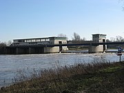
Schlüsselburg hydropower plant , in operation since 1956

Weir in Drakenburg , in the background the power plant

Weserkraftwerk u. Coal power plant on the Bremen Weser weir


Hydroelectric power stations on the Weser weirs
There is a hydropower plant at each of the eight barrages along the Weser . At the top (and by far the oldest) barrage in Hameln , in Landesbergen and at the bottom in Bremen , the weir and power station are in the immediate vicinity of the lock. In the remaining five barrages, only the weir with the power station is in the actual course of the river, while the lock is installed several kilometers away in an artificially created lock canal.
| place | operator | River km | power | in operation |
|---|---|---|---|---|
| Hameln, Pfortmühle and Alte Schleuse | GWS Stadtwerke GmbH | 135 | 1.95 MW | since 1933 |
| Petershagen hydropower plant | Statkraft | 213,985 | 3.3 MW | since 1954 |
| Schluesselburg hydropower plant | Statkraft | 236,600 | 5.0 MW | since 1956 |
| Landesbergen hydropower plant | Statkraft | 251,962 | 7.2 MW | since 1960 |
| Drakenburg hydroelectric power station | Statkraft | 277.735 | 5.0 MW | since 1956 |
| Dörverden hydropower plant | Statkraft | 308.832 | 4.2 MW | since 1913 |
| Langwedel hydropower plant | Statkraft | 329,396 | 7.2 MW | since 1958 |
| Weserkraftwerk Bremen | Weserkraftwerk Bremen GmbH & Co. KG | 362.153 | 10.0 MW | since 2012 (predecessor 1911–1987) |
Hydroelectric power station at an inlet
The hydropower plant in Minden is only operated when the Mittelland Canal has a surplus of water, because it is located at the outlet from the canal into the Weser.
| place | operator | Energy source | power | in operation |
|---|---|---|---|---|
| Minden pumping station | WSA Minden | water | 0.5 MW | since 1922, only when there is excess water in the Mittelland Canal |
Thermal power plants
Seven of the thermal power plants on the Weser burn fossil fuels, and one also burns biomass .
Of the three former nuclear power plants , one is still in operation in Grohnde today . According to the new Atomic Energy Act of 2011, the final shutdown of this nuclear power plant is to take place at the end of 2021.

Ice drift above the Grohnde nuclear power plant , in the background steam from its cooling towers

Weser weir and coal-fired power station Bremen-Hastedt before the construction of the new hydropower station, which went into operation in March 2012
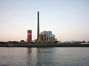
Hard coal power plant in Bremen-Farge , 2007 still with E.ON, since 2009 with the GDF-SUEZ group


| place | operator | Energy source | power | in operation |
|---|---|---|---|---|
| Würgassen nuclear power plant | E.ON | Boiling water reactor | 670 MW | 1971-1995 |
| Grohnde nuclear power plant | E.ON | Pressurized water reactor | 1430 MW | since 1985 |
| Community power plant Veltheim | E.ON, Stadtwerke Bielefeld | Hard coal , natural gas | 892 MW | 1960-2015 |
| Heyden power plant in Petershagen-Lahde on the lock canal | Uniper power plants | Hard coal | 865 MW | since 1987 |
| Landesbergen | Statkraft | Natural gas, biomass | 511 MW | since 1973/2003 |
| Bremen-Hastedt power plant | swb Generation AG & Co. KG | Natural gas, hard coal | 267 MW | since 1972/1989 (predecessor since 1907) |
| Bremen-Hafen power plant | swb Generation AG & Co. KG | Hard coal, substitute fuel | 360 MW | since 1968 |
| Bremen-Mittelbüren power plant | swb Generation AG & Co. KG | Blast furnace gas , natural gas, light oil | 238 MW | since 1964 |
| Joint power plant Bremen (GKB) | Community power plant Bremen GmbH & Co. KG | natural gas | 444.5 MW | since 2016 |
| Bremen-Farge power plant | GDF SUEZ | Hard coal | 345 MW | since 1969 |
| Unterweser nuclear power plant ( Kleinensiel ) | E.ON | Pressurized water reactor | 1410 MW | 1978-2011 |
Bridges, ferries and tunnels
All Weser crossings are listed in the order from the source to the mouth. The ferries on the Upper and Middle Weser are mostly yaw-rope ferries . In the tidal area of the Lower Weser, yaw ferries would be impractical due to the periodic flow reversal. There are only motor ferries there. Many ferry connections have a long tradition. Some have been reactivated after a long break for tourist reasons. Some ferries on the Upper and Middle Weser have quite limited operating times.
Upper Weser


- In Hann. Münden, the B 3 / B 80 cross the Weser on the Weser Bridge, which was completed in 1960 .
- The Gierseilfähre Veckerhagen - Hemeln transports up to six cars and is in operation all year round. The current ferry was launched in 2000, the ferry station itself has been traceable since 1342.
- The Gierseilfähre Oedelsheim holds two cars and is only in operation in the summer months. The current ferry was built in 1997.
- In Gieselwerder , the L 763 crosses a road bridge that was built in 1950 to replace its predecessor from 1900 that was destroyed in World War II. The southernmost fixed crossing of the Weser was here for 60 years.
- The Gierseilfähre "Märchenfähre" Lippoldsberg was built in 1981. It only runs in the summer months and can transport three cars. A ferry is mentioned here for the first time around 1300.
- The Gierseilfähre Wahmbeck - Gewissenruh was put into service in 1957; it holds two cars and only runs in the summer months.
- In Bodenfelde -Wahmbeck, a vehicle and passenger ferry crosses the Weser, which has existed since 1900.
- In Bad Karlshafen there is a road bridge inaugurated on October 22, 1894.
- In the Beverung district of Herstelle-Würgassen, a Gierseil passenger ferry, first mentioned in 1432, crosses the Weser.
- The road bridge of the k 61 between Herstelle and Würgassen was inaugurated on October 21, 1982.
- The road bridge on the B 241 between Beverungen and Lauenförde was opened in 1902, blown up in 1945 and rebuilt in 1950.
- In the Beverung district of Wehrden , a Gierseil passenger ferry, first mentioned in 1875, crosses the Weser.
- The former double-track bridge of the Solling Railway (KBS 356) Altenbeken-Ottbergen-Northeim in Wehrden has only been single-track since the Second World War.
- The railway bridge in Boffzen has not been used since the Holzminden – Scherfede railway was closed.
- The road bridge in Höxter was the first fixed Weser crossing ever since it was first built in 1115. After it was destroyed by French troops in 1673, a bridge was not built again until the 19th century. The L 755 runs over them.
- At Corvey on the eastern edge of Höxter, a railway bridge connecting Altenbeken-Ottbergen-Kreiensen spans the river.
- The road bridge for the K 46, built in Lüchtringen in 1977 , was built on the bank parallel to the Weser as a prestressed concrete structure and then swiveled in by 90 degrees .

- In Holzminden there are two road bridges, the old town bridge and the new bridge of the B 64 (bypass).
- Directly east of Grave , a district of Brevörde , there has long been a yaw ferry. The solar powered passenger ferry Grave has been in operation here since 2005 .
- There is a ferry connection in Heinsen.
- The Gierseilfähre Polle - Heidbrink was built in 1988 and transports up to four cars. It is in operation all year round. A ferry connection has existed here since 1905.
- In Bodenwerder, an old girder bridge with the L 580, a new prestressed concrete bridge with the federal highway 240 and a steel truss bridge for the Emmerthalbahn (full-track, now museum railway) cross the Weser.
- The K 8 crosses a road bridge between Daspe and Hehlen .
- The Hajen yaw ferry can transport a maximum of two cars. It only runs in the winter months. There has been a ferry here since 1389
- The Grohnde Gierseilfähre was built around 1930. It only drives with up to three cars on board in the summer months. There has been a ferry here at the Grohnder Fährhaus since 1633.
- Between Kirchohsen and Hagenohsen there is a road bridge for the L 424 and a railway bridge over the Weser.
- In Hameln, a stone bridge spanned the Weser from around 1300. A chain bridge was built there in the 19th century. In 1897 a railway bridge was added with the construction of the railway lines. Around 1933 the chain bridge was replaced by a riveted steel truss bridge. Both bridges were blown up on April 5, 1945 by German engineer units. Just four days later, the advancing Americans built a makeshift pontoon bridge, which was named the Harrison Bridge after the commanding general , but was destroyed by the floods in 1946. The current old bridge was restored in February 1946 as an emergency bridge, from 1948 to 1950 the missing parts of the old bridge were replaced by a girder bridge. The railway bridge had also been rebuilt by 1947. Since these bridges meant a big detour for the population that was hardly mobile at the time, a passenger ferry service was started on August 12, 1950 between Fischbecker Straße and Breite Weg, saving pedestrians at least 30 minutes' walk for 15 pfennigs ferry fee. Initially, it was planned to replace the ferry, which was initially operated as a barge operation, with a motor ferry. As the motorization and mobility of the citizens increased and soon shifted to the restored bridge, the ferry service was stopped on February 15, 1971 for reasons of profitability. As early as the 1960s, planning began for a further bridge, which was built in 1975 to relieve the old town and since then has led the Bundesstraße 1 and the B 83 over the Weser. From 1988 the railway bridge was initially used as a pedestrian bridge after the railway traffic was shut down, but closed in 1998 due to dilapidation. In 2003 the old bridge (also called Münsterbrücke) was completely renovated. In 2011 the western part of the bridge and in 2012/2013 the rest of the bridge was completely renewed.
- On the road bridge of Hessisch Oldendorf is L out 434 on the Weser.
- The Gierseilferry Grossenwieden - Rumbeck was built in 1960 and holds up to 4 cars. It runs all year round. There has been a ferry connection here since 1617.


- There are two road bridges in Rinteln: for the B 238 and the L 435.
- The road bridge at Eisbergen was built in 1927.
- The Weser ferry Veltheim / Varenholz is verifiably first mentioned in 1661. During a military maneuver on March 31, 1925, a serious accident occurred near the ferry. 81 soldiers were killed.
- Between Vlotho and Uffeln (Vlotho) a road bridge has spanned the Weser since 1928 (in the course of today's L 778) and since 1875 a railway bridge. Ferry services had existed here from 1423 to 1937 at the latest and from 1945 to 1951, when the road bridge was blown up by German pioneers.
- The Weser crossing of the A 2 / E 30 at Bad Oeynhausen- Rehme consists of one bridge structure for each direction of travel.
- The Hamm – Minden railway crosses the river half a kilometer downstream . The first bridge here was built in 1847 by the Cöln-Mindener Eisenbahn-Gesellschaft , and later a second was placed next to it when it was expanded to four tracks . After the destruction in 1945, the restoration was initially carried out on two tracks; the bridge has only had four tracks again since 1984.
- The Amanda passenger ferry , which has been in existence since 1988, also drives over the Weser in Rehme . A former ferry location here was a few hundred meters further upstream (cable ferry).
- The first structure to cross the Porta Westfalica was a chain suspension bridge from 1865. Before that, the Porta ferry had been in service for a long time . This also took over the service when the bridge was blown up in 1945 as a result of the effects of the war and stopped its service when the bridge was rebuilt. On May 29, 1954, a steel bridge followed as a road overpass (L 780) - the largest fully welded steel superstructure in Germany at the time. In 1995 this bridge was replaced by a steel composite bridge built a little further south as part of an expressway construction.
- About one kilometer north of this is a former railway bridge, the so-called Green Bridge Neesen . Built in 1938 to transport ore, it was closed for traffic in 1976. Today it is in ruins and cannot be walked or driven on.
- In Minden seven bridges cross the Weser, including three road bridges, such as the Theodor-Heuss-Brücke with the federal highway 65 , the Minden city bridge with the L 534 and the north bridge with the L 764, a railway bridge for the Mindener Kreisbahnen , the Glacisbrücke Minden as Pedestrian bridge and two canal bridges of the Mittelland Canal ( Minden waterway intersection ). The oldest wooden Weser bridge in Minden was mentioned as early as 1232 and was replaced by a stone bridge between 1594 and 1597. This stone bridge was blown up by French troops in 1813, later poorly repaired and replaced by an iron bridge in 1871–1874. On May 11, 1915, a new bridge over the Weser was opened without piers, which was blown up in 1945 and repaired by 1947. From 1969 two new road bridges were built north and south of the city center.
Mittelweser
- At the Petershagen weir , the crossing is possible on foot and, to a limited extent (stairs), by bike, except in winter.
- The road bridge (L 770) near Petershagen was built in 1970.
- The Petra Solara solar ferry for pedestrians and cyclists has been operating between Hävern and Windheim since 2002, replacing a ferry that was abandoned in connection with the construction of the Petershagener Weser Bridge. The ferry service is usually limited to weekends and holidays and is maintained by an association.
- In Schlüsselburg the K 1 on a 1956 opened road bridge crosses the Weser of a weir with the power plant.
- The federal road 441 and the B 215 are led together at Stolzenau by a road bridge over the Weser.
- There are two road bridges in Landesbergen.


- In Nienburg four bridges cross the Weser, two of which are road bridges, a railway bridge ( Rahden – Nienburg railway line ) and a pedestrian bridge. The oldest road bridge still built of wood was replaced by a stone bridge in 1715–1723. This stone bridge was demolished in 1903 because the narrow arches of the bridge were an obstacle to the ever increasing ship traffic. A pedestrian bridge was built at this point in 1905, which was destroyed in 1945 and only replaced by a new construction in 1999. The new road bridge was built 500 meters further down the Weser. Until the construction of the bypass road in 1982, federal road 6 ran over it .
- At Drakenburg , the K 2 crosses the Weser on a road bridge at the weir with a power station and boat lock.
- The Schweringen high- wire ferry was built in 1999, replacing the outdated yaw ferry. Up to four cars can be transported. It is out of order from the beginning of November to the end of February.
- Between Bücken ( Stendern ) and Eystrup (Düvleistungsraße) there is a pier with Panzerstraße for a pontoon bridge .
- The road bridge (L 330) in Hoya was built in 1883 at the same time as the full- gauge small railway line to Eystrup .
- The road bridge (L 203) in Groß-Hutbergen near Verden was built in 1884 and for a long time was the only bridge over the Weser in the Verden district.
- The road bridge (K 9) over the Weser weir Langwedel was opened in 1958 and approved for light vehicles up to a maximum of six tons.
- The road bridge (L 156) between Achim-Uesen and Werder was opened on August 28, 1928. Scenes from Richard Lester's anti-war film " How I won the war " were filmed on this bridge in 1966 . In the film, which gained popularity mainly through the participation of John Lennon , the Ueser Bridge embodies a Rhine bridge.
- There are several Weser crossings in Bremen:
- The railway bridge on the Bremen – Osnabrück line, without footpaths and cycle paths at Weser km 357,200
- The A 1 Hansalinie / E 22 motorway bridge near Arsten (Weser-Km 358,500) from 1962 with the widening from 1978 to six lanes. In 2008 the hard shoulder was given up in both directions in favor of eight lanes. This bridge, with its somewhat shorter south-west section, is located in Lower Saxony and can only be approached from both sides by motor vehicle via the Bremen area; the state border runs below the bridge in the middle of the Weser.
- A pedestrian and bicycle crossing over the Weserwehr in Hastedt at Weser Km 362.100


Lower Weser
-
- The Karl-Carstens-Brücke (officially Werderbrücke until 1999, also known as Erdbeerbrücke) , connects the districts of Hemelingen and Obervieland as a road bridge (Weser km 362,950).
- The motor-driven Sielwall ferry connects the eastern suburb with Stadtwerder between Weser and Werdersee. It transports pedestrians and bicycles (Weser km 365,400).
- The Great Weser Bridge (Wilhelm Kaisen Bridge) was opened in 1960 (Weser km 366,670). The B 75 , which has meanwhile been downgraded in this area, leads over them . Only 50 m downstream there had been Bremen's only bridge over the Weser since the Middle Ages (first mentioned in 1244). By the end of the 19th century, the small Weser, south of the Teerhof, had to be crossed 200 meters downstream on the Brautbrücke .
- The Teerhof Bridge, opened in 1993 as a pedestrian and cycle path bridge, and the adjoining Bridal Bridge (foot and bike, a little west of the historic bridge) connect Bremen's old town and new town (Unterweser km 0.400).
- The Bürgermeister-Smidt-Brücke was built in 1872/1875 as Bremen's second road bridge over the Weser, at that time it was called Kaiser-Wilhelm-Brücke . From 1950 to 1952 the steel arch bridge, which was badly damaged in the war, was replaced by the current steel girder bridge (Unterweser km 0.625).
- The 196 m long Stephanibrücke from 1965 (superstructure upstream) and 1967 (superstructure downstream) represents the connection Bremen – Delmenhorst as a motor road ( B 6 , then B 75 ) Bombs destroyed. Pedestrians and cyclists are guided here on both sides at the height of the steel girders, one floor lower than motor traffic (Unterweser km 1.250). This section of the B 6 is (road traffic census 2005) after the B 2R in Munich the busiest federal highway in Germany (almost 100,000 vehicles per day).
- The railway bridge on the Bremen – Oldenburg railway line , the last bridge over the Weser and the last permanent crossing of the Weser until the Dedesdorf tunnel was built, was built in 1867, destroyed in March 1945, and makeshift repairs until December 1946. In May 1962, a new truss bridge replaced the single-track temporary structure from the immediate post-war period (Unterweser km 1.3759).
- There is a seasonal triangular ferry connection between the Lankenauer Höft in Bremen- Rablinghausen , the Waterfront shopping center in Bremen- Gröpelingen and the Molenturm in Überseestadt .
- Between Bremen- Seehausen and the other side of the Weser, a tunnel is being planned as part of the A 281 , which will close the motorway ring around Bremen.
- The ferry between Lemwerder and Bremen-Vegesack has existed since the 13th century. It runs every ten minutes during the day. Today's motor ferry, the Vegesack ferry , was built in 1992 and carries up to 32 cars. During rush hour, a second ferry, the Lemwerder ferry , is used (Unterweser km 20,500).
- The connection from Bremen-Blumenthal to Motzen is operated all year round with the Rönnebeck ferry, which went into service in 1975 . In 2004, their capacity was increased from 22 to 25 cars (Unterweser km 22,000).
- The B 74 crosses the Weser with the ferry from Berne to Bremen-Farge . The Juliusplate ferry , built in 1995, can carry up to 26 cars and is also designed for transporting dangerous goods and heavy loads. During rush hour, a second ferry is also used here, the Berne-Farge , built in 1983, with space for around 18 cars (Unterweser km 25,300).
- The ferries in Vegesack , Blumenthal and Farge have been merged to form Ferry Bremen – Stedingen GmbH (FBS) since 1993 .
- The motor ship Guntsiet transports people and bicycles from Brake to the Weser island Harriersand and back (Unterweser km 39)
- The Kleinensiel motor ferry, built in 1964, transports up to 22 cars between Brake-Golzwarden and Sandstedt . It is also approved for heavy goods traffic and dangerous goods. Its operation was endangered in 2004/2005 by competition from the Weser Tunnel. Not only the city of Brake was interested in maintaining it. When SBS ( Schnellfähre Brake – Sandstedt ) was privatized, it is now operating at a higher capacity (20-minute intervals) than before the tunnel was opened (Unterweser km 43).
- The Weser Tunnel Dedesdorf - Kleinensiel was completed in 2004 in anticipation of a possible extension of the A 22 . The Dedesdorf – Kleinensiel ferry was stopped when the tunnel opened (Unterweser km 52).
- Weser ferry Bremerhaven – Nordenham : Today the ferries Nordenham and Bremerhaven operate between Bremerhaven and Nordenham-Blexen , each of which can carry 300 people and also vehicles up to heavy transporters. Upon prior notification, dangerous goods may also be transported on the new Bremerhaven Weser ferry . The Weser ferries can also be chartered for special trips ( party ship ) (Unterweser km 64–66).
Railway lines on the Weser
In contrast to the (Middle and Upper) Rhine, whose course of the river is accompanied by railroad lines for long stretches , there is no continuous railway line along the Weser. The valley of the Upper Weser was economically less interesting and because of its border location for the Royal Hanover State Railways no alternative to the Hanover Southern Railway through the Leine valley. Nevertheless, there was only one kilometer missing from the Kassel – Holzminden rail link through the lower Diemel and Weser valleys between the then two Karlshafen train stations (the Carls- and Sollingbahn ). There is also a Weser Valley Railway (towards Rinteln) in the westward section of the valley below Hameln. There is a continuous rail line on the Mittelweser, consisting of parts of the Hanover – Bremen and Minden – Rotenburg (–Hamburg) lines. Parallel to the Lower Weser, there are railway lines on both sides, sometimes more than 10 km away from the river, as the soft marshland did not allow a suitable underground for railway lines. Local railways near the Weser no longer have any passenger traffic or have been completely dismantled.
The following sections of mostly crossing railway lines run in the area of the river:
- Route: Northeim - Ottbergen , section Bodenfelde - Wehrden with stops in Bodenfelde, Bad Karlshafen and Lauenförde - Beverungen (" Sollingbahn ")
- Route: Paderborn - Altenbeken - Kreiensen , section Godelheim - Holzminden with stops in Godelheim, Höxter, Lüchtringen and Holzminden (" Egge-Bahn ")
- Line: Paderborn – Altenbeken– Bad Pyrmont - Hanover ( Hannoversche S-Bahn , " Altenbeken – Hanover ")
- Route: “ Vorwohle – Emmerthal ”, museum traffic
- Route: Hildesheim – Löhne, section Hameln – Bad Oeynhausen with stops in Hameln, Hessisch Oldendorf, Rinteln, Vlotho and Bad Oeynhausen Süd (" Weserbahn " *)
- Route: Osnabrück / Dortmund- Hanover, section Bad Oeynhausen-Minden with stops in Bad Oeynhausen, Porta Westfalica and Minden (" Hamm-Minden railway ")
- Route: Minden – Nienburg – Rotenburg (Wümme), section Minden – Nienburg – Verden with stops in Minden, Petershagen-Lahde , Leese - Stolzenau , Nienburg, Eystrup , Dörverden and Verden (" Railway lines Minden – Nienburg " and " Verden – Rotenburg ") )
- Route: “ Hanover – Bremen ”, section Nienburg – Bremen with stops in Nienburg, Eystrup, Dörverden, Verden, Langwedel, Etelsen, Baden, Achim and Bremen
- Route: “ Bremen – Nordenham ” section Hude – Nordenham with stops in Berne, Elsfleth, Brake, Rodenkirchen, Kleinensiel and Nordenham
(*) not to be confused with “Weserbahn” as the historical name of the Bremen – Oldenburg railway line
Weser Islands and tributaries
Upper and Middle Weser
- At the confluence of the Werra and Fulda to the Weser are in Hann. The river islands of Tanzwerder (with the Weserstein ) and Doktorwerder flow out .
- The two Weser islands Schleusenwerder and Werder in Hameln are together 800 m long. On the islands there are buildings that are used for catering and a lock system. Until the end of the Second World War, two grain mills (factories) worked there.
- The Stadtblänke Minden will be created in Minden in 2019 to protect biotopes and flood protection.
- At Landesbergen there is a Weser island at the level of the barrage.
Lower Weser and Outer Weser

- The Peterswerder in Bremen consisted of two small islands in the right dyke where today Weserstadion stands and then the summer dike of the Pauline Fathers march to the Eisenrads dike came, the upriver further inland this point than today Osterdeich ran and on the border with Hastedt to the Bremer dune connected.
- Opposite Pauliner Marsch and Peterswerder is the 4.3 km long Stadtwerder . It is not a real island, because for centuries there was only one flood channel left in the upper part of the southern branch of the Kleine Weser . The Werdersee with the inaccessible bird island was rebuilt as a flood channel after the storm surge in 1962. The excavated earth was used to fill the Huckelriede cemetery . After the practical test with the discharge of the melt flood through the upper part of the flood channel failed due to incorrect design during the January floods in 1981, it was enlarged and the Werdersee was extended and the Stadtwerder on the south side was also protected by a new summer dike. The natural Werdersee feeder for the fresh water supply from the Mittelweser leads through the Stadtwerder. The University of Nautical Sciences , several allotment garden areas and bathing beaches on the Weser and Werdersee are located on the Stadtwerder .
- In Bremen , the narrow downstream part of the Stadtwerder was separated by defensive ditches between the Weser and Kleiner Weser in the course of the Middle Ages . This is how the islands of Brautwerder and the "Braut" bastion came into being, followed by the Teerhof , which was a shipyard in the Middle Ages. Nowadays this area is again connected to the Stadtwerder. The Neue Museum Weserburg , one of the largest museums for contemporary art in Germany, stands on the Teerhof, only separated from the top by the Bürgermeister-Smidt-Bridge .
- Between the Stephanibrücke and the confluence of the Hohentorshafen in Bremen there is an almost 1 km long and up to 7 m wide artificially raised wall in about the middle of the river, which is now covered with vegetation. On this wall there is one pillar each for the Stephanibrücke and a railway bridge on the Bremen – Oldenburg line . At the time of the tide peak, this wall is sometimes slightly flooded and only the vegetation protrudes from the Weser.
- A small and undeveloped Weser island is located in Bremen between the Cape Horn harbor and the turning basin Neustadt. To reduce the vegetation, the island is grazed by goats in summer, which is why it is now referred to as "goat island" by the local press. Initially, this was just a peninsula, but this led to significant deposits of sediment in the port entrance. This problem has been resolved since the puncture. However, the island is still connected to the landscape at Lankenauer Höft with a sheet pile wall .
- Opposite is the passed with poplars Shipyard Island (Shipyard Iceland) , an island a few years before the closure of the shipyard AG Weser to puncture from the jetty of the port shipyard was built.
- Until the construction of the Huntes Barrage from 1967 to 1969, the Westergate was an important left branch of the Weser, into which the Hunte flowed. Of the islands between the main stream and Westergate, the one called Weserdeicher Sands is still a real island. The Elsflether sand before Elsfleth has since been a peninsula that is crossed by Weserdeich and a 3.1 km long cycle track. It is accessible via the Weser dike and the Huntes barrier.

- Harriersand across from Brake -Harrien is about 11 km long, making it the longest island on the Weser. It lies east of the main stream and is separatedfrom Hammelwarder Sand by the right tributary , a former further Weser island, nowadays only between the winter dike and the summer dike foreland of the Osterstade marshland on the right bank of the Weser. Harriersand has been inhabited since 1830. Before the second Weser correction in 1924–1932, it consisted of seven small, separate islands. Harriersand can be reached from Brake with the Guntsiet passenger ferry and from Rade via a road bridge. This island only has a summer dike on the north side and one of the few natural sandy beaches on the Weser on the south side. The houses lie like the halligh houses on a small house throws . With every strong storm surge these become mini-islands.
- Before Rodenkirchen (municipality of Stadland ) lies the Strohauser Plate west of the main stream . It is separated from the Stadland on the left bank of the Weser by the Schweiburg arm of the Weser . The Weser Island, protected as a Natura 2000 area, extends over 6 km in north-south direction and 1.3 km at its widest point in east-west direction and may only be entered as part of guided excursions.
- The former river island "Tegeler Plate" in the dike foreland near Dedesdorf serves as an ecological compensation area for Container Terminal III in Bremerhaven. For this purpose, the summer dike from the 1920s was partially removed again. The Alexandrian geographer Claudius Ptolemaeus mentioned in his writing Γερμανίας Μεγάλης θέσις ( Germanias Megalis Thesis , "Map of Greater Germany") the place Τεκελία ( Tekelía ) at the mouth of the Weser .
- The former river island " Luneplate " near Bremerhaven was diked and is now part of the mainland. Until then it was the largest island in the Weser. The dike, built in 1924/25, was strengthened in the 1970s and the Luneplate was to become an industrial park. In 2003/04, large parts of the area were rewetted as an ecological compensation measure for the expansion of Container Terminal IV in the north of Bremerhaven. Normal tides now flow through gates to the old dike. The new dike only serves to protect against severe floods.
- Weser estuary: The small islands of Langlütjen I and Langlütjen II across from Bremerhaven-Weddewarden were built as imperial forts between 1876 and 1880 . During both world wars , the bulwarks were equipped with powerful anti-aircraft guns. From September 1933 to January 1934 there was a concentration camp on Langlütjen II .
- Brinkamahöft in front of Weddewarden, also with a small fort, was leveled in the course of the expansion of the container terminal IVa and incorporated into the port area.
- Tegeler Plate (with the same name as the former Unterweserinsel near Dedesdorf) and Robbenplate are sandbanks, i.e. tidal flats, between the two arms of the Outer Weser. Small areas are consistently dry in summer and serve the seals as a resting area and nursery for the howlers .

See also
literature
geology
- Karsten Meinke: The development of the Weser in the northwest German lowlands during the younger Pleistocene. Diss., Göttingen 1992. With soil profiles of the Weser cities.
- Gerd Lüttig : To the structure of the floodplain in the river area of the Weser . In: Eiszeitalter und Gegenwart , Volume 11, Öhringen 1960, pp. 39–50
- Ludger Feldmann and Klaus-Dieter Meyer (eds.): Quaternary in Lower Saxony. Excursion guide to the anniversary general meeting of the German Quaternary Association in Hanover. DEUQUA excursion guide, Hanover 1998, p. 89 ff.
- Hans Heinrich Seedorf and Hans-Heinrich Meyer: Regional studies of Lower Saxony. Nature and cultural history of a federal state. Volume 1: Historical basics and natural features. Wachtholz, Neumünster 1992, page 105 ff.
- Ludger Feldmann: The Quaternary between Harz and Allertal with a contribution to the history of the landscape in the Tertiary. Papierflieger, Clausthal-Zellerfeld 2002, page 133ff and passim .
- Ludger Feldmann: When Springe was on the Weser - the geological history of the Deisterpforte . In: Springer Yearbook 2011 for the city and the old district of Springe, Friends of Springe e. V., Springe 2011. Pages 10–22, 209–211.
- Helmut Seger: Bremen-Bremerhaven beacon . OCEANUM. The maritime magazine special. ISBN 978-3-86927-606-9
archeology
- Bremer Archäologische Blätter, supplement 2/2000 for the exhibition of the same name in the Focke Museum: Settlers, mercenaries and pirates, Chauken and Saxons in the Bremen area , © Der Landesarchäologe Bremen, ISSN 0068-0907 .
- Bremer Archäologische Blätter, Supplement 3/2004 to the exhibition of the same name in the Focke Museum: Found Past , Archeology of the Middle Ages in Bremen, © Der Landesarchäologe Bremen, ISBN 3-7749-3233-6 . (due to the history of the Balge arm of the Weser)
Art history
- Ernst Wolfgang Mick : The Weser ( German Land - German Art ). Munich / Berlin 1962
River history
- Georg Bessell : History of Bremerhaven. Morisse, Bremerhaven 1927, 1989.
- Heinz Conradis: The battle for deepening the Weser in ancient times . In: Bremisches Jahrbuch , Volume 41, Bremen 1944.
- JWA Hunichs: Practical instructions for dyke, sewer and Schlengen construction. First part, of the piles. Bremen 1770.
- The canalization of the Mittelweser . Published by Mittelweser AG, Carl Schünemann Verlag, Bremen 1960.
- Board of Trustees for Research in Coastal Engineering: The Coast . In: Archives for research and technology on the North and Baltic Seas. Boyens, Heide 51, 1991. ISSN 0452-7739
- M. Eckholdt (Ed.), Rivers and Canals, The History of German Waterways, DSV-Verlag 1998
- Annette Siegmüller: Structure and function of landing sites and riverside markets in the 1st millennium AD on the lower Weser and the lower Ems. In: Norbert Fischer , Ortwin Pelc (Hrsg.): Rivers in Northern Germany. About their history from the Middle Ages to the present. Wachholtz, Neumünster 2013, pp. 441–459.
Flow description
- Karl Löbe : The Weserbuch. Niemeyer, Hameln 1968.
- Nils Aschenbeck , Wolf Dietmar Stock: A river trip from the Aller to the North Sea. Atelier in the farmhouse, Fischerhude 1998. ISBN 3-88132-350-3 .
- Manfred Below: The Weser. From the Thuringian Forest to the North Sea , 2nd edition, Edition Temmen, Bremen 2011, ISBN 978-3-86108-965-0 .
Web links
- Environment Lower Saxony - Area directory Weser (water body indicators and catchment areas)
- Verden Waterways and Shipping Office
- Water levels of the last 30 days - Porta Westfalica
- The implementation of the EU Water Framework Directive in the Weser processing area in North Rhine-Westphalia
- Minden Waterways and Shipping Office: Remote control of the Weser locks in the WSV control center
- Information for pleasure craft on the Weser with "Description of the Weser from river km 0.0 to river km 213.49"
- ( Page no longer available , search in web archives: information from WSA Bremen )
- The Weser and its catchment area in Westphalia (LWL) (article)
Individual evidence
- ↑ a b c d e Water map service of the Hessian Ministry for the Environment, Climate Protection, Agriculture and Consumer Protection ( notes ) (The water stationing in the Hessian service begins at km 451.4 at the confluence of the source rivers.)
- ^ German Hydrological Yearbook Weser-Ems 2014. Lower Saxony State Agency for Water Management, Coastal Protection and Nature Conservation, p. 90, accessed on October 4, 2017 (PDF, German, 8805 kB). (Instead of the location above the mouth, the yearbook states below the origin.)
- ^ Deutsches Gewässerkundliches Jahrbuch Weser-Ems 2014. Lower Saxony State Agency for Water Management, Coastal Protection and Nature Conservation, p. 99, accessed on October 4, 2017 (PDF, German, 8805 kB). (Instead of the location above the mouth, the yearbook states below the origin.)
- ↑ a b The mean upstream water supply through the Lower Weser tributaries below Intschede including Geeste is estimated at 60 m³ / s (GKSS-Forschungszentrum Geesthacht GmbH: Water analysis investigations of the Lower Weser in autumn 1979. External report GKSS 80 / E / 27 , Geesthacht 1980 ). Adding to the mean discharge at Intschede results in a discharge of 383 m³ / s below the mouth of the Geeste.
- ↑ Lengths (in km) of the main shipping routes (main routes and certain secondary routes) of the federal inland waterways ( memento of January 21, 2016 in the Internet Archive ), Federal Waterways and Shipping Administration
- ^ Meyers Konversations-Lexikon . A reference book of general knowledge. 6th edition. tape 20 . Bibliographical Institute, Leipzig 1909.
- ↑ D. Hoffmann, Snuh 'son'. - Shifting of accents and reduction of stem syllables in Wurster Frisian, in Zeitschrift für deutsches Altertum und deutsche Literatur 90, 1961, 303-322, especially p. 322. According to records from around 1700, now extinct.
- ↑ Directory E, serial no. 64 der Chronik ( Memento from July 22, 2016 in the Internet Archive ), Federal Waterways and Shipping Administration
- ↑ Julius Pokorny : Indo-European Etymological Dictionary , Bern 1959, p. 1134.
- ^ Hans Krahe : Sprache und Vorzeit , Heidelberg 1954, p. 51.
- ↑ See Hans Krahe : Our oldest river names , Wiesbaden 1964, p. 101 and 24.
- ↑ See also Manfred Below: The Weser. From the Thuringian Forest to the North Sea , 2nd edition, Bremen 2011, pp. 8 and 91.
- ↑ Level name: Hann.-Münden. Federal waterways and shipping administration, accessed on June 7, 2020 .
- ↑ see Ludwig Franzius : Die Korrektion der Unterweser . Page 4f., Bremen 1888, online as a digitized version.
- ↑ current tides for Bremen-Oslebshausen , accessed on December 19, 2019
- ↑ See Appendix 1 serial no. 64: “Connection line between the church tower of Langwarden and the mouth of the Arenschen Baches”.
- ^ Baken-net: History of the lightship Bremen
- ↑ Catchment area to the Bremerhaven lighthouse: GKZ 491 to GKZ 4992 (Geeste) plus 1.66km² Blexer Groden
- ^ Environment Lower Saxony - Area Directory Weser
- ↑ a b c Topographical Information Management, Cologne District Government, Department GEObasis NRW ( information )
- ↑ a b Environment map service of the Lower Saxony Ministry for the Environment, Energy and Climate Protection ( information )
- ↑ List of areas of the Weser water network - Lower Saxony Ministry for the Environment, Energy and Climate Protection (PDF; 0.6 MB)
- ^ Deutsches Gewässerkundliches Jahrbuch Weser-Ems 2008 Lower Saxony State Agency for Water Management, Coastal Protection and Nature Conservation, accessed on January 22, 2016 (PDF, German, 6184 kB).
- ↑ Map services of the Federal Agency for Nature Conservation ( information )
- ↑ The Weser km from 40 to 251.7 are displayed directly in TIM online. The Hessian Service shows the Weser kilometers above the mouth of the Diemel if the difference to the Weser length of 451.2 km is calculated. On the Lower Weser, protected areas are displayed in the BfN service if the scale 1: 25,000 is selected every 2 km markings for the Lower Weser km, to which you have to add 366.7 (2) km.
- ↑ Water profile and program of measures 44.1 ( Memento from January 1, 2013 in the web archive archive.today ) ( Notes ) → Overview of all Hessian river systems (PDF, 1.7 MB) lower Diemel
- ↑ The discharge of the Werre at the Löhne gauge (1,335.11 km²) was 18.3 m³ / s in 1983/2008 (Mq = 13.7 m³ / (s • km²)); the remaining 150.29 km² were extrapolated with an Mq of 10 l / (s • km²).
- ↑ The discharge of the Gehle at the Bierde gauge (121 km²) was 0.933 m³ / s in 1974/2008 (Mq = 7.71 m³ / (s • km²)); the remaining 107.6 km² were extrapolated with an Mq of 5 l / (s • km²).
- ↑ The outflow of Great Aue at the level Heide OP (1,014 square kilometers) was 1965/2008 7.27 m³ / s (Mq = 7.17 m³ / (s • square kilometers)) corresponding to the boiling at the level of boiling was (163 square kilometers) 1979/2008 1.19 m³ / s (Mq = 7.30 m³ / (s • km²)); the remaining 345.4 km² were extrapolated with an Mq of 5 l / (s • km²).
- ↑ The discharge of the Hunte at the Colnrade OP gauge (1,318 km²) was 10.3 m³ / s (Mq = 7.81 m³ / (s • km²)) in 1958/2008, while the Lethe at the Oberlethe gauge (160 km²) was in 1973 / 2008 1.36 m³ / s (Mq = 8.50 m³ / (s • km²)); the remaining 1,157.3 km² were extrapolated with an Mq of 5 l / (s • km²).
- ↑ Outcrops can be found at the gravel and sand pit (PDF; 219 kB) northeast of Brelingen .
- ↑ Source: Ludger Feldmann: When Springe was on the Weser - the geological history of the Deisterpforte . In: Springer Yearbook 2011 for the city and the old district of Springe, Friends of Springe e. V., Springe 2011. Pages 10–22, 209–211.
- ^ Dietrich Hagen: Der Naturraum , in: Oldenburg - Land between the North Sea and Dammer Mountains | hrsg = Lower Saxony State Center for Political Education pp. 11, 27–30, ISBN 3-89598-604-6 .
- ↑ Loss of land and dyke construction in today's Wesermarsch ( Memento from January 1, 2005 in the Internet Archive )
- ^ HRS Hohenkirchen: Great floods. In: Dit un dat - stories from the Wangerland. geschichtsatlas.de, accessed on October 7, 2010 .
- ↑ Gesa Hansen: The rubbish ended up in the ditch. Drainage history of the Sieltiefs - Schrabberdeich deepest point Brakes
- ↑ The Schlachte - Bremen's shore port. Schlachte Marketing und Service Verband e. V., accessed on August 14, 2012 .
- ↑ Grabemann / Müller: The mouth of the Weser - a literature study on the changes in the last 100 years in hydraulic engineering, hydrographic and ecological terms. GKSS Institute for Physics, 1989.
- ↑ Gelderblom: The Reichserntedankfeste on the Bückeberg - Why Bückeberg? f ( Memento from December 3, 2013 in the Internet Archive )
- ↑ a b Source: Verden Waterways and Shipping Office, 2011
- ↑ nw-news.de: Bad Oeynhausen - Hallig Dehme , accessed on January 26, 2011
- ↑ Level aisle link of the WSA accessed on January 11, 2012
- ↑ gwexter.org
- ↑ Background: Potash brine - where from and where to? Frankfurter Rundschau online, April 17, 2009, accessed October 7, 2010 .
- ↑ Dörverdener supplies connoisseurs and gourmets | Dörverden
- ↑ Two veterans of inland fishing. Farewell to "Willi" Dobberschütz. Landesfischereiverband Niedersachsen e. V., accessed October 7, 2010 .
- ^ Document from 1270 in full. Regesta Imperii Online, accessed March 4, 2019 .
- ↑ Johann Heinrich Gelbke, Duke Ernst the First called the Pious of Gotha as a man and regent (1810, facsimile print), pp. 206–210 ( Google Book Search )
- ↑ Ulrich Weidinger: Bremer Schiffahrt auf Weser and Aller in the early modern period. In: A foray through the history of Bremen. Günter Garbrecht, University of Bremen, archived from the original on August 17, 2010 ; Retrieved October 6, 2010 .
- ↑ a b Weser. Wasser- und Schifffahrtsamt Minden, March 19, 2007, accessed on October 6, 2010 .
- ^ Directory of the locks in Weser, Werra and Fulda. Wasser- und Schifffahrtsdirektion Mitte, March 12, 2009, archived from the original on May 29, 2009 ; Retrieved October 6, 2010 .
- ↑ Construction work ( Memento from October 28, 2011 in the Internet Archive )
- ↑ Federal waterways and shipping administration: network categorization taking into account the traffic forecast for 2030 . pdf, 1.29 MB
- ↑ Trotting sports
- ↑ [bundesrecht.juris.de/bundesrecht/strfing/haben.pdf Road Construction Act]
- ↑ Central Weser adaptation. Verden Waterways and Shipping Authority, accessed on October 6, 2010 .
- ↑ http://baeder-bhv.de/weser-strandbad/
- ↑ The Weser Cycle Path - the most beautiful journey from the Weser Uplands to the North Sea. weser.org, accessed on October 4, 2010 .
- ↑ wsa-verden.wsv.de
- ↑ Weserkraftwerk Bremen , Weserkraftwerk Bremen GmbH & Co. KG
- ↑ The passenger ferry at the youth hostel. hamelner-geschichte.de, accessed on October 4, 2010 .
- ↑ bueckeburg.dlrg.de
- ^ "Contributions to local history - O04 The way across the river - To the history of the Weser ferry in Vlotho", 2015, Exter history workshop, ISSN 1619-7828
- ^ FBS ferries Bremen-Stedingen. faehren-bremen.de, accessed on October 4, 2010 .
- ↑ Timetables. brake.de, accessed on October 4, 2010 .
- ↑ Brake-Sandstedt fast ferry. weser-faehre.de, accessed on October 4, 2010 .
- ↑ Eckhard-Herbert Arndt: Weser ferry scores with truckers. In: Daily port report of November 2, 2018, p. 16
- ^ Weser ferry GmbH Bremerhaven. weserfaehre.de, archived from the original on September 27, 2010 ; Retrieved October 4, 2010 .
- ↑ Goat Island Project. Deutsche Umwelthilfe e. V., archived from the original on November 23, 2010 ; Retrieved October 4, 2010 .
- ↑ bremenports: ecological compensation for the construction of the container terminal III. A paradise for flora and fauna. senatspressestelle.bremen.de, June 19, 203, accessed on October 4, 2010 .
- ↑ Claudius Ptolemy: Εὐρώπης πίναξ δ´ ( 4th map of Europe ) , ancient Greek text tabulated with Latin and English translation
- ↑ Relationship network for coastal protection. In: Climate Change and the Lower Weser Region (KLIMU). University of Bremen, archived from the original on November 14, 2012 ; Retrieved October 4, 2010 .