Butjadingen (landscape)
Butjadingen is a landscape in the north of a peninsula in northwestern Lower Saxony , on which Butjadingen and the Stadland are located. It is surrounded on three sides by water over a length of approx. 22 km. The word "Butjadingen" was first used in a document in 1420. Shortly before, this northern part of the peninsula between Jade and Weser had temporarily become an island due to the Heete .
location

The landscape of Butjadingen lies on the German North Sea coast and borders in the southwest on the Jade Bay , in the west and northwest on the Inner Jade and in the east and northeast on the Weser and its mouth. The southern border of Butjadingen was initially considered to be the ancestor, and since 1334 Heete, which was added as a broader new breakthrough . The line between Stollhamm on the northeast corner of the Jadebusen and Nordenham - Atens is to be assumed as the border to the neighboring Stadland to the south .
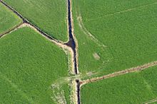
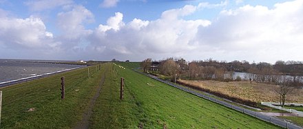
Butjadingen consists of marshland and is quite sparsely populated. In front of the peninsula, the mudflats of the Hohen Weg between the mouths of the Jade and Weser extend about 23 km to the northwest to beyond the island of Mellum . It is part of the Lower Saxony Wadden Sea National Park . The National Park has an information center in Fedderwardersiel .
Today's municipality of Butjadingen occupies the western part and the city of Nordenham the eastern part of the peninsula. The area of both municipalities together roughly corresponds to the former island of Butjadingen.
history
Part of the Gaus Rüstringen, separation from the mainland (14th century)

→ Card sizes for reading: • 33% or 216 dpi , • 50% or 144 dpi
In the Middle Ages Butjadingen was the northeast of the Gaus Rüstringen . In this rural community, the Asegabuch formed the legal basis, it was part of the Frisian Zealand . The term Butjadingen (“outer jade”) originated in the 14th century when large storm surges created new arms and separated this area from the mainland. In the further course of the century Butjadingen itself appeared as a rural community, as a conflict opponent and contract partner of the imperial city of Bremen . The neighbors of the Lower Weser extorted protection money from the ships of the Hanseatic city, and the city sought to bring the new islands of Butjadingen and Stadland under their control.
Stadland was the Rüstringer area on the left bank of the Weser south of the Heete. The border between Stadland and Bovenjadingen ("Ober-Jade") was initially the Schweier Moor, which was barely populated at the time, and later the Lockfleth .
Rule of Bremen (until 1424)
In battles with many losses (“Lewer dod as sklav”) the Butjadingers fought for their independence, both against attempts at conquest from outside and against claims to rule by the Frisian families. Sibet von Rüstringen and Christian von Oldenburg tried several times to conquer Butjadingen. In 1419 the parish communities turned to Bremen and on June 1, 1419 submitted to Bremen's protection and jurisdiction. The congregations also committed themselves to an annual Bede . A few days later, about a thousand Bremen residents from Stadland and Würden moved into Butjadingen and conquered the (fortified) churches in Blexen , Langwarden , Waddens , Eiswürde and Burhave by July 12th of that year . The combined Butjadinger and Stadlander were able to shake off control of Bremen in 1424, although they had received royal confirmation on June 5, 1420. To this end, Sibet von Rüstringen, who had announced the feud to Bremen, and Ocko II. Tom Brok joined forces on October 23.
Storm surges, rule of Oldenburg (from 1514/32), peninsula
After the Jade Bay caused three storm surges in rapid succession, the Second Cosmas and Damian Flood on September 26, 1509, an unnamed storm surge on September 9, 1510 and the Antoni Flood on September 16/17. January 1511, when it reached its greatest extent, the Rüstringer Frisians were so weakened that the Counts of Oldenburg subjugated the Stadland in 1514 and Butjadingen in 1532.
After all, the Oldenburgers had the means to build new and stronger dikes, so that since then the land gains have been greater than the land losses. Within less than five years, Stadland and Butjadingen formed a peninsula on the mainland again. On the north coast of Butjadingen alone, land was lost and with it several villages, Alt-Fedderwarden, Alt-Bordyck, Alt-Waddens, Bült and Hüsen. The cause was the main channel of the Outer Weser, which from around 1600 to around 1800 did not run northwards off the coast of the Landes Wursten as before (and again today) , but north-west along the coast of Butjadden. During the last devastating storm surge at Christmas 1717 , almost all the marshes on the German North Sea coast were inundated, in many parishes a third of the population drowned, and the region suffered for a hundred years as a result of the material losses. But land losses were much less than in the disasters of the 15th and 16th centuries. On the west and north coast of Butjadingen, however, many dykes had to be relocated again by about half a kilometer, and the village of Neu-Bordick was lost.
After this flood, the dyke lines on the east coast of the Jadebusen and the west bank of the Weser were made storm surge-proof under the direction of the Oldenburg Oberlanddrosten Christian Thomesen Sehested .
Office Butjadingen within the Grand Duchy of Oldenburg (from 1879)
With its territorial reform of 1879, the Grand Duchy of Oldenburg established the Butjadingen office , which existed until 1933, when the state's administrative structure was aligned with that of Prussia . In 1900 the Butjadingen district consisted of the communities Abbehausen , Atens (renamed Nordenham in 1908 ), Blexen , Burhave , Eckwarden , Esenshamm , Langwarden , Seefeld , Stollhamm , Tossens and Waddens .
literature
- Klaus Dede : Butjadingen. Landscape, cultural history, information. Atelier in the farmhouse, Fischerhude 1998, ISBN 3-88132-101-2 .
- Hans H. Francksen: Butjadingen . Wintermann Verlag, Oldenburg 1985.
- Jens Schmeyers: The last free Frisians between Weser and Ems: The history of Butjadingen and Stadland up to the battle at Hartwarder Schanze . Stedinger Verlag, Lemwerder 2006
Individual evidence
- ^ Christian Friedrich Strackerjan : Contributions to the history of the Grand Duchy of Oldenburg in informal notebooks . Wilhelm Kaiser, Bremen 1837, p. 107
- ^ Karl-Ernst Behre : Landschaftsgeschichte Norddeutschlands , Wachholtz Verlag , Neumünster 2008, p. 99 and maps on p. 100.
- ^ Christian Friedrich Strackerjan: Contributions to the history of the Grand Duchy of Oldenburg in informal notebooks . Wilhelm Kaiser, Bremen 1837, p. 108
- ↑ Thomas Hill: The city and its market. Bremen's regional and foreign relations in the Middle Ages (12th-15th centuries) , Franz Steiner, Wiesbaden 2004, pp. 304–306.
- ^ Martin Teller: Historical administrative structures of the state of Oldenburg
- ^ Uli Schubert: Municipal directory Germany 1900 - Grand Duchy of Oldenburg - Duchy of Oldenburg. Office Butjadingen


