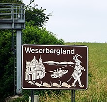
Weserbergland
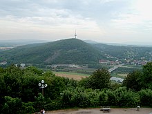
The Weserbergland is up to 527.8 m above sea level. NHN high low mountain range on both sides of the Weser between Hann. Münden and Porta Westfalica within the Lower Saxony mountains in Lower Saxony , Hesse and North Rhine-Westphalia in Germany .
geography


In addition to the entire Upper Weser Valley between Hann. Münden and Porta Westfalica include several geologically connected but clearly distinguishable low mountain ranges and mountain ranges and individual mountains . In a narrower sense, this includes - from north to south and with a maximum height in meters (m) above sea level:
| Landscape name | Max height |
|---|---|
| Weser Mountains | 336 m |
| Süntel | 440 m |
| Ottenstein plateau | 376 m |
| Vogler | 460.4 m |
| Castle Hill | 357.5 m |
| Solling | 527.8 m |
| Reinhardswald | 472.2 m |
| Bramwald | 408.1 m |
The largest contiguous forest area in the Weser Uplands is on the Solling in the Solling-Vogler Nature Park . Its forest, interrupted only by the island-like Uslar basin and the narrow Weser valley, continues south to Reinhardswald (left of the Weser) and Bramwald (right). Even beyond Fulda and Werra - and thus outside the Weser Uplands - the dense forest continues further south without any significant interruption into that of the Kaufunger Forest .
In addition to the core mountain ranges listed above, other low mountain ranges and mountain ranges are occasionally assigned to the Weser Uplands. These include in particular the following (sorted alphabetically with the respective maximum altitude above sea level):
|
|
The Deister ( 405 m ), which lies west of the Hanoverian Börde and is entirely in the catchment area of the Leine, is also occasionally included in the Weserbergland . The Ahlsburg ( 411.4 m ) and the Weper ( 379 m ) are just as completely in the catchment area of the Leine and also much closer to its banks , which are therefore entirely part of the Leinebergland , although they are sometimes also part of the Weserbergland.
Most recently, the landscape was significantly shaped in the course of the Ice Ages by glacier advances of the Scandinavian inland ice sheet (see: Geology, landscape, soils and their formation in the article North German lowlands ).
cities and communes
The towns and municipalities in the Weser Uplands include:
Culture
A separate architecture was developed in the Weserbergland. Between 1520 and 1640, the so-called Weser Renaissance, a large accumulation of Renaissance architecture, was created here .
The Pied Piper of Hameln , the "Baron of Lies" Karl Friedrich Hieronymus von Münchhausen from Bodenwerder and the one in Hann. Münden deceased German craft surgeon , surgeon and star engraver Doctor Eisenbarth .
The region is also home to some of the Grimm Brothers' fairy tales , such as Snow White , which is said to be set in Alfeld , Rapunzel , who is said to have let her prince's long hair down from a tower in Trendelburg , or Sleeping Beauty , whose castle is the Sababurg ruins near Hofgeismar applies.
reception
The picturesque landscape of the Weserbergland has inspired numerous painters and visual artists: Robert Batty , Christian Andreas Besemann , Carl Büttger , Carl Ferdinand Fabritius , Robert Geißler , Wolfgang Heinrich , Karl Arthur Held , Alfred Hesse , Rudolf Jahns , Herbert Mager , Jacob Pins , Anton Wilhelm Strack , Pascha Johann Friedrich Weitsch , August Wenderoth .
tourism
In addition to the above-mentioned historic towns and the Weserbergland Schaumburg-Hameln Nature Park and Solling-Vogler Nature Park , the 500-kilometer long Weser Cycle Path along the Weser is of major tourist importance . The rare beeches are a botanical specialty . Rühler Schweiz is a delightful landscape . The westwork of the abbey church in Corvey (Höxter) is a UNESCO World Heritage Site.
Motorcycle tourism is of increasing importance. In addition to the Harz Mountains, the Weserbergland is a popular motorcycle area in northern Germany. The Köterberg , in particular , as the highest point from this point to the North Sea, is a popular motorcycle meeting point with all-round views of up to 80 kilometers.
Also to be mentioned are the Schillat Cave , the Tonenburg in Höxter-Albaxen, the Neuhaus Wildlife Park and the Weserstein in Hann. Münden as well as several museums such as the Agricultural Technical Museum in Börry , the Blankschmiede in Dassel, the German Huguenot Museum in Bad Karlshafen and the Motorcycle Museum in Wickensen . The amusement parks include the Rasti-Land on the B1 between Hameln and Hildesheim and the Potts Park in Minden .
economy
The Weserbergland is mainly known for its tourism. In addition, there is also a strong, mostly medium-sized economy that includes well-known companies and brands, particularly in the mechanical engineering, electrical engineering, food technology, chemistry and pharmaceuticals, and glass and furniture industries. These include companies such as Aerzener Maschinenfabrik (one of the world's leading suppliers of twin-shaft rotary piston machines ), which Dr. Paul Lohmann GmbH KG (global market leader in the production of special salts), the health insurance company BKK24 , the manufacturer of soft drinks Riha Richard Hartinger Getränke , Symrise AG (one of the world's four largest suppliers of fragrances, flavorings and active ingredients for cosmetics and food) and ELF Hall and mechanical engineering GmbH.
literature
- Felicitas Hoppe: The Weserbergland. In: Thomas Steinfeld (Ed.): German landscapes. S. Fischer, Frankfurt am Main 2003, ISBN 3-10-070404-5 .
- Bernhard Pollmann: Weser Uplands. Romantic mountain region between Münden and Porta Westfalica. ISBN 3-7634-1124-0
Web links
- Geological development of the Weserbergland , on lwl.org (PDF; 959.5 kB)
- Vegetation and landscape development in the Lower Weserbergland , on lwl.org (PDF; 3.55 MB)
Individual evidence
Coordinates: 51 ° 58 ′ N , 9 ° 30 ′ E


