
Salzhemmendorf
| coat of arms | Germany map | |
|---|---|---|

|
Coordinates: 52 ° 4 ′ N , 9 ° 35 ′ E |
|
| Basic data | ||
| State : | Lower Saxony | |
| County : | Hameln-Pyrmont | |
| Height : | 130 m above sea level NHN | |
| Area : | 94.31 km 2 | |
| Residents: | 9136 (Dec. 31, 2019) | |
| Population density : | 97 inhabitants per km 2 | |
| Postal code : | 31020 | |
| Primaries : | 05186, 05153 | |
| License plate : | HM | |
| Community key : | 03 2 52 008 | |
| LOCODE : | DE SH5 | |
| Address of the stain management: |
Main street 2 31020 Salzhemmendorf |
|
| Website : | ||
| Mayor : | Clemens Pommerening (independent) | |
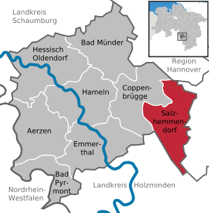
| Location of the Salzhemmendorf area in the Hameln-Pyrmont district | ||
  |
||

Salzhemmendorf is a town in the Hameln-Pyrmont district in Lower Saxony . Until the end of 2010, Salzhemmendorf was a state-recognized health resort with a brine spa.
geography
Geographical location
The Salzhemmendorf area lies within the Leinebergland in the eastern part of the Weserbergland Schaumburg-Hameln Nature Park and is mainly characterized by the Ith mountain range in the west, the Osterwald in the north and the Thüster Berg in the east (the so-called three-mountain corner ). The districts of Salzhemmendorf are at heights of 86-441 above sea level. The south-western Leine tributary Saale flows through the village .
landscape
The Ith as part of a layered landscape , the highest layer of which is the Ith ridge , with its relief formations and its geological diversity provides a habitat for a large number of plant species. The Thüster Berg, with the Kanstein as the highest elevation, is strongly characterized by steep slopes and a large amount of limestone. This has created an extensive habitat for a wide variety of plant species. Between these formations the Saale and its tributary Aue flow in a winding manner. Both bodies of water are characteristic of the landscape due to their bank edge vegetation and have a high ecological value, which should be preserved through extensive agricultural use in the municipality.
Spot breakdown

In addition to the village of the same name, Salzhemmendorf also consists of the districts of Ahrenfeld , Benstorf , Hemmendorf , Lauenstein , Levedagsen , Ockensen , Oldendorf , Osterwald , Thüste and Wallensen . These eleven formerly independent communities and spots were merged with the territorial reform of 1973 Flecken Salzhemmendorf.
Neighboring communities
The patch borders clockwise on the municipalities or joint municipalities of Coppenbrügge (Hameln-Pyrmont district), Springe ( Hanover region ), Elze , Leinebergland (both Hildesheim district ), Eschershausen-Stadtoldendorf and Bodenwerder-Polle (both Holzminden district ).
history
The localities were created at different times. The district of Oldendorf already existed before the 8th century. The original (pre-Christian) name is unknown. The local archive has been lost since the turmoil of the Thirty Years' War . After the introduction of Christianity at the end of the 8th century, an archdeaconate was established in Oldendorf by the then diocese of Hildesheim . The oldest parts of the Archdeaconate Church “St. Nicolaus ”in Oldendorf dates from the year 1100. In 1701 Conrad Werner Wedemeyer built the first coal-fired fine glass works east of the Rhine. The coal was mined very close by in the Osterwald mountain. A settlement in the Oldendorf district called "Glashütte" still reminds of this time. Among other things, the famous " Lauensteiner Glass" was produced here. The name "Lauensteiner Glas" comes from the fact that the area belonged to the Lauenstein office in the 18th century.

The village of Salzhemmendorf was first mentioned in a document in 1022. In this document, Emperor Heinrich II took the Hildesheim Michaeliskloster under his protection. The monastery had a mill in Salzhemmendorf.
The salt springs of Salzhemmendorf were discovered after the legend of goats. Salt production flourished for centuries, and the wealthy residents certainly had every reason to protect their place from envious enemies by hedges and ditches with four gates.
In 1169, Bishop Hermann von Hildesheim confirmed rights to the Hemmendorf saltworks to the Cistercian monastery in Amelungsborn from a donation.
Between 1199 and 1206 it is documented that Count Bernhard von Poppenburg and Spiegelberg from Wennigsen renounced the administration of the salt works in Swalenhusen near Hemmendorf, which had been transferred to his father by the Amelungsborn monastery. This message about Wennigsen, which is only available in a copy of the 13th century in the copial book of the Amelungsborn monastery, is in a document from Hartbert (Bishop of Hildesheim 1199–1216).
After the sinking of Spiegelberg Castle around 1226, Lauenstein Castle was built above today's Lauenstein district . This castle, owned by the nobles of Homburg, was first mentioned in 1247. The forecourt of the castle was called the "Knabenburg". The Church of St. Margaretha was originally built in 1427.
The districts of Benstorf, Hemmendorf and Oldendorf are on Bundesstraße 1 . It corresponds to the course of the former Hellweg and the Heerstraße from Aachen to Königsberg . Court was held in Hemmendorf. A court linden tree ("Tilly-Linde") can still be seen on a hill in front of Hemmendorf . Hemmendorf was first mentioned in documents in the years 854 and 997. The Church of St. Vitus was built in 1166. Hemmendorf, which stands out due to its dead straight main street, the "Alte Heerstraße" (Bundesstraße 1) with almost exclusively gabled houses, was granted the privileges of a town in 1629 as well as market rights .
On December 20, 1824, a major fire destroyed Salzhemmendorf. 103 of 108 houses were destroyed. As a result, nationwide donations were called for “for the burned down in Salzhemmendorf”. For the 1000th anniversary of the place in 1997, a memorial stone was erected on the market square.
The village of Thüste has the oldest settlement name in the area. It is probable that Thüsten was a Cheruscan settlement with the name Tiusti.
In Benstorf , flint tools from the Paleolithic have been proven.
The village of Wallensen had already been given city rights in 1351 . It was first mentioned in a deed of gift in 1068.
On the night of 27 to 28. August 2015, there was a xenophobic arson attack on a refugee center . Fortunately, no one was harmed. The three perpetrators were sentenced to several years in prison by the Hanover Regional Court for attempted murder.
Incorporations
On January 1, 1973, the previously independent communities and spots Ahrenfeld, Hemmendorf (Flecken), Lauenstein (Flecken), Levedagsen, Ockensen, Oldendorf, Osterwald, Thüste and Wallensen (Flecken) were incorporated.
Population development
| year | 1961 | 1970 | 1990 | 1995 | 2000 | 2005 | 2010 | 2015 |
| Residents | 12,510 | 12,107 | 10,943 | 11,181 | 10,932 | 10,500 | 9,881 | 9,297 |
(Population: 1961: June 6th, 1970: May 27th, the current territorial status, from 1990: December 31st)
politics
advice
The council of the Fleckens Salzhemmendorf consists of 24 council women and councilors. This is the specified number for a municipality with a population between 9,001 and 10,000. The 24 council members are elected by local elections for five years each. The current term of office began on November 1, 2016 and ends on October 31, 2021.
The full-time mayor Clemens Pommerening (independent) is also entitled to vote in the council.
The local elections on September 11, 2016 led to the following result with a turnout of 60.62%:
| Party / list | Share of votes | Seats |
|---|---|---|
| SPD | 35.56% | 8th |
| CDU | 25.73% | 6th |
| GREEN | 16.22% | 4th |
| Active | 15.19% | 4th |
| BWG | 3.15% | 1 |
| FDP | 2.55% | 1 |
| FWS | 1.58% | 0 |
mayor
The full-time mayor of Salzhemmendorf is Clemens Pommerening (non-party). In the last mayoral election on May 25, 2014, he was elected with 68.9% of the vote. The turnout was 58.1%. Pommerening took up his term in office on November 1, 2014, replacing the previous incumbent Martin Kempe, who was no longer a candidate.
coat of arms
The coat of arms of the patch shows on a blue background in the left half (heraldic right) a silver lion with a red crown as a symbol of the Count of Everstein . On the other side there is a golden lion on a red background. This is the sign of the nobles of Homburg . This half is surrounded by a blue-silver border.
Town twinning
The partner municipality of the Fleckens was from 1991 to 2011 the former municipality of Arcen and Velden in the Netherlands . After a regional reform, this is now part of the city of Venlo , so that the partnership has been transformed into a friendly relationship. A partnership with the town of Benneckenstein was dissolved in 2010 after restructuring into the town of Oberharz am Brocken .
Culture and sights


Museums
- Hüttenstollen Osterwald a visitor mine with an attached mine museum. Opens on Sundays in the summer months.
theatre
- Osterwaldbühne , an open-air stage with 613 seats in the forest on the edge of the village of Osterwald . The performers are local amateur actors. From late May to early September there are performances on the outdoor stage. In winter, the leisure ensemble plays in its own “studio theater” with 77 seats.
Natural monuments
- Tilly-Linde in Hemmendorf, a freestanding old court linden tree north of the village on a dirt road.
- Sole spring in Salzhemmendorf, a natural brine spring gushing out of a massive dolomite stone . Today it is embedded in the so-called "fountain house".
- Caves on the Ith ; six natural caves in the dolomite cliffs of the mountain ridge: red stone cave, children's cave, soldiers cave, pottery cave, nose stone cave and bear cave.
Excursion destinations
- Ith crest near Lauenstein
- Lauenstein natural adventure pool
- Lönsturm on the Kanstein
- Sennhütte in the Osterwald
- Water tree in Ockensen
- the amusement park Rasti-Land
- Ith-Sole-Therme Salzhemmendorf
Regular events
- Market every Wednesday in front of the town hall
- OrgelPUNKT concert series in the Saale Valley church district
- Concert series Saaletal organ tour
Economy and Infrastructure
traffic
In the district of Oldendorf there is a stop ("Osterwald") on the Elze – Löhne railway line . For freight traffic, there is a connection to the Voldagsen – Delligsen railway line in Salzhemmendorf .
education
Cooperative comprehensive school with the secondary school and secondary school branches (grades 5–10) and grammar school (up to grade 12). In 2003, KGS Salzhemmendorf was expanded to include two new buildings with a total of 3,200 m² of usable space.
Personalities
- Conrad Werner Wedemeyer (1662–1732), born in Lauenstein, Oberamtmann zu Lauenstein, Erb- and Burgsasse zu Eldagsen, Herr auf Gleina (near Müelte), Herrengosserstedt and Billroda
- Georg Lodemann (1827–1893), administrative lawyer, temporarily active in the Lauenstein office at the time
- Ernst Rudorff (1840–1916), born in Berlin, composer, music teacher and nature conservationist, lived partly in Lauenstein and coined the term "Heimatschutz" based on the experience gained here
- Albert Frank (1841–1909), born in Lauenstein, engineer for mechanical engineering and as professor from 1895 to 1898 rector of the Royal Technical University of Hanover
- Georg Spiegelberg (1848–1913), born in Lauenstein, banker and art collector
- Leo Catzenstein (1863–1936), born in Hemmendorf, general practitioner in Hanover
- Heinrich Krüger (1878–1964), died in Lauenstein, German literary historian and writer
- B. Traven (1882–1969), writer, anarchist and actor, lived as Otto Feige around 1900 in Wallensen
- Paula Blank (1887–1967), born in Wallensen, librarian and emigrant
- Otto Kreibaum (1902–1985), entrepreneur, lived in Lauenstein and founded OKAL, a manufacturer of prefabricated houses since 1959
- Gerda Marie Scheidl (1913–2005), died in Salzhemmendorf, German children's book author
- Wilhelm Gödecke (1928–2018), born in Hemmendorf, politician (CDU) and from 1959 to 1967 member of the Lower Saxony state parliament
- Fritz Schaumann (1946–2017), born in Wallensen, politician (FDP) and member of the state parliament
literature
- Rudolf Herrmann: Explanations for the geological map of Lower Saxony 1: 25000 sheet 3923 Salzhemmendorf . Lower Saxony State Office for Soil Research 1968
- Salzhemmendorf. State-approved health resort with brine operation . Salzhemmendorf 1992
- Christian Wiegand: Salzhemmendorf. Historical cultural landscapes in the Hameln-Pyrmont district . Hanover 2005
Web links
Individual evidence
- ↑ State Office for Statistics Lower Saxony, LSN-Online regional database, Table 12411: Update of the population, as of December 31, 2019 ( help ).
- ↑ Lower Saxony State Parliament, 16th electoral period, printed matter 16/3359: Small question "What is the significance of predicates such as" state-approved climatic health resort "especially for heather tourism and the tourism industry in Lower Saxony?" (PDF; 102 kB) . Retrieved March 23, 2011.
- ↑ On the regional reform in Lower Saxony cf. Blazek, Matthias: From the Landdrostey to the district government - the history of the district government of Hanover as reflected in the administrative reforms, ibidem-Verlag: Stuttgart 2004, ISBN 3-89821-357-9 .
- ↑ Flecken Salzhemmendorf - history of the salt works Salzhemmendorf. In: salzhemmendorf.de. January 13, 2012, accessed April 17, 2016 .
- ↑ 750 years of Wennigsen 1200–1950 , ed. by the preparatory committee for the 750th anniversary of the community of Wennigsen, printed in 1950 by the book printing workshops in Hanover, p. 8.
- ↑ Flecken Salzhemmendorf - meaning of the place names. In: salzhemmendorf.de. January 13, 2012, accessed April 17, 2016 .
- ↑ List of the Bishops of Hildesheim and external link Archived copy ( memento of the original from September 27, 2007 in the Internet Archive ) Info: The archive link was inserted automatically and has not yet been checked. Please check the original and archive link according to the instructions and then remove this notice. : Episcopal Press Office Hildesheim on November 20, 2005, p. 31.
- ^ Zimmermann, Margret; Kensche, Hans; u. a .: Castles and palaces in Hildesheimer Land, Lax, Hildesheim 1998, p. 95 f. ISBN 3-8269-6280-X .
- ↑ In detail: Blazek, Matthias: Das Löschwesen in the area of the former Principality of Lüneburg from the beginnings to 1900, Adelheidsdorf 2006, pp. 191 f., ISBN 978-3-00-019837-3 .
- ↑ “Asylum seekers' homes are attacked almost every day in Germany.” Tachles , March 21, 2016
- ↑ a b Federal Statistical Office (ed.): Historical municipality register for the Federal Republic of Germany. Name, border and key number changes in municipalities, counties and administrative districts from May 27, 1970 to December 31, 1982 . W. Kohlhammer GmbH, Stuttgart and Mainz 1983, ISBN 3-17-003263-1 , p. 195 .
- ↑ Regional statistics database , State Office for Statistics and Communication Technology Lower Saxony LSKN-Online
- ^ Lower Saxony Municipal Constitutional Law (NKomVG) in the version of December 17, 2010; Section 46 - Number of MPs , accessed on November 12, 2014
- ^ Website of the municipality - municipal council election 2016 overall result
- ↑ Individual results of the direct elections on May 25, 2014 in Lower Saxony , accessed on November 8, 2014
- ↑ Friendship yes - but off for town twinning, Dewezet.de February 11, 2011, archived on Webcite ( Memento from February 11, 2011 on WebCite ).
- ↑ Official website
- ^ Tilly-Linde on the community website of Salzhemmendorf
- ^ Brunnenhaus on the Salzhemmendorf municipal website
- ↑ Lauenstein nature adventure pool - Flecken Salzhemmendorf. Retrieved September 25, 2019 .
Ahrenfeld | Benstorf | Hemmendorf | Lauenstein | Levedagsen | Ockensen | Oldendorf | Osterwald | Salzhemmendorf | Thüst | Wallensen