
Kalletal
| coat of arms | Germany map | |
|---|---|---|

|
Coordinates: 52 ° 7 ' N , 8 ° 57' E |
|
| Basic data | ||
| State : | North Rhine-Westphalia | |
| Administrative region : | Detmold | |
| Circle : | lip | |
| Height : | 214 m above sea level NHN | |
| Area : | 112.42 km 2 | |
| Residents: | 13,471 (Dec 31, 2019) | |
| Population density : | 120 inhabitants per km 2 | |
| Postal code : | 32689 | |
| Area code : | 05264 | |
| License plate : | LIP | |
| Community key : | 05 7 66 036 | |
| LOCODE : | DE KTL | |
| Community structure: | 16 parts of the community | |
| Address of the municipal administration: |
Rintelner Str. 3 32689 Kalletal |
|
| Website : | ||
| Mayor : | Mario Hecker (independent) | |
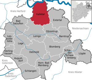
| Location of the municipality of Kalletal in the Lippe district | ||
  |
||

Kalletal [ ˈkʰalətʰaːl ] is a municipality in northeast North Rhine-Westphalia . The community belongs to the district of Lippe in the administrative district of Detmold ( Ostwestfalen-Lippe ) and has around 13,000 inhabitants. The largest district of Hohenhausen is located on the Kalle valley in the Lipper Bergland . In the north, the area drops into the river valley of the Weser , which borders the municipality . Kalletal is located in the Teutoburg Forest / Eggegebirge nature park and has joined the Nordlippe funding region .
The area of the municipality is opened up by two federal highways, the nearest long-distance train stations are in Herford and Bad Oeynhausen . The first settlement of today's municipality is dated to the end of the Bronze Age around 700 BC. The rural area only experienced a significant increase in population due to the influx of refugees and displaced persons after the Second World War. In addition to agriculture, the economy is characterized by small and medium-sized companies. The municipality of Kalletal was formed on January 1, 1969 in the course of the North Rhine-Westphalian regional reform from 16 formerly independent municipalities and therefore also referred to as a large municipality .
geography
Geographical location
Kalletal is located in the northeast of North Rhine-Westphalia , in the east of East Westphalia-Lippe and in the north of the Lippe district, about 10 km northeast of the former district town of Lemgo and 25 km north of the district town of Detmold . In the north of the municipality, the Weser coming from the east , which forms the Great Weserbogen there, forms the municipal boundary to Vlotho and Porta Westfalica . The river that gives it its name is the Kalle tributary of the Weser .
In terms of natural surroundings, the municipality is predominantly part of the Lipper Bergland . The Lipper Bergland is strongly structured, in the municipal area alternate between 350 meter high peaks and ridges, flat lowlands and hilly areas cut by rivers. Smaller parts in the north belong to the Rinteln-Hamelin Wesertalung . At Stemmen in the northeast of the municipality, there are some larger oxbow lakes and gravel lakes in the largely forest-free Weser Valley . The largest is the Stemmer See . Like all municipalities in Lippe, the municipality is located in the Teutoburg Forest / Eggegebirge Nature Park . However, both mountains do not extend into the municipality. In the northeast, the municipality borders on the Weserbergland Schaumburg-Hameln nature park in Lower Saxony .
The main town Hohenhausen is at an altitude of 160 m above sea level. NN . The highest mountain is the Kleeberg at 360 m above sea level. NN in the southern district of Henstorf. Its summit is right on the municipality boundary in Dörentrup area, so that the highest point of Kalletal is 355.5 m above sea level. NN . is located. The mouth of the Kalle in the northeast near the districts of Erder and Kalldorf is the lowest point in the community at 48 m above sea level. NN .
The closest major cities are Bielefeld (35 km southwest), Paderborn (53 km southwest), Hanover (73 km northeast) and Hildesheim (92 km east).
geology

In the area of the municipality, the Lipper Bergland mainly consists of Tertiary rocks , and shell limestone is also found like an island . In the Weser floodplains there are mainly rocks from the Holocene , and in the peripheral areas also from the Pleistocene .
The valleys of the Lipper Bergland, but not the Weser Valley, consist of extensive fertile arable land. These sandy-loamy to loamy-clayey parabroun earths often occur in connection with fertile but shallow loess , but also rather nutrient-poor, acidic podsols in the municipality . Both types of soil are used intensively for agriculture. In the Wesertal Valley, gleye or floodplain soils , partly also pseudogleye and parabroun earths, which are mainly used as grassland, have arisen. In the Lipper Bergland there are island-like brown earths in connection with Rendzina in the area of the shell limestone . The gravel mining in the Weser valley left behind some quarry ponds in the north of the community. An old limestone quarry in Bavenhausen is evidence of the former mining of shell limestone.
The iron cross , the twin pyrite crystal , was also found in this region .
With the exception of a small area west of Asendorf, Kalletal is well to very well suited for the use of geothermal heat sources by means of geothermal probes and for heat recovery through heat pump heating (see the adjacent map).
Expansion and use of the municipal area


The community, classified as a "large rural community", extends over an area of 112.42 km². The municipal area has a maximum extension in east-west direction of about 11.5 km and in north-south direction of about 15 km. The municipal area is characterized by heavy agricultural use in the valleys and plains. The proportion of the agriculturally used area is above the district and state average. Essentially only the mountains are forested. Nevertheless, for the otherwise relatively poorly wooded Ostwestfalen-Lippe, the community is rather wooded. What is striking is the small proportion of settlement and traffic areas, which is well below the national average. The following table summarizes the exact land use of the municipal area:
| Area according to type of use |
Agricultural schafts- area |
Forest area |
Building, open and operational space |
Traffic area |
Surface of water |
Sports and green space |
other use |
|---|---|---|---|---|---|---|---|
| Area in km² | 65.31 | 31.80 | 6.55 | 4.99 | 1.71 | 1.24 | 0.83 |
| Share of total area | 58.09% | 28.29% | 5.83% | 4.44% | 1.52% | 1.10% | 0.74% |
| Average in the Lippe district |
50.8% | 22.2% | 9.7% | 5.1% | 0.9% | 1.8% | 9.5% |
| Average in the state of North Rhine-Westphalia |
49.2% | 25.5% | 13.2% | 7.0% | 1.9% | 2.0% | 1.2% |
Neighboring communities
In a clockwise direction, Kalletal borders on Rinteln ( district of Schaumburg , Lower Saxony ), Extertal , Dörentrup , Lemgo (all district of Lippe), Vlotho ( district of Herford ) and Porta Westfalica ( district of Minden-Lübbecke ).
Community structure
According to § 3 of the main statute of the municipality of Kalletal, the municipality is divided into 16 districts. These districts correspond to the formerly independent municipalities from which the large municipality of Kalletal was formed by the Lemgo Act as part of the regional reform :
| Locality | surface | Residents | map |
|---|---|---|---|
| Asendorf | 6.16 km² | 250 |
 |
| Bavenhausen | 7.08 km² | 861 | |
| Bentorf | 6.13 km² | 1.104 | |
| Brosen | 7.53 km² | 419 | |
| Earth electrode | 5.91 km² | 751 | |
| Heidelbeck | 8.98 km² | 618 | |
| Henstorf | 6.01 km² | 191 | |
| Hohenhausen (main town, seat of administration) | 10.45 km² | 3,709 | |
| Kalldorf | 9.69 km² | 1,347 | |
| Langenholzhausen | 12.15 km² | 1,453 | |
| Lüdenhausen | 7.30 km² | 1,025 | |
| Osterhagen | 3.14 km² | 31 | |
| To stem | 4.66 km² | 1,084 | |
| Talle | 6.04 km² | 1,170 | |
| Varenholz | 6.10 km² | 751 | |
| Westorf | 5.09 km² | 969 | |
| total | 112.42 km² | 15,733 |
The following localities are located in these districts and do not have the status of a district:
- Dalbke
- Echternhagen
- Elfenborn
- Faulensiek
- Rake pillows
- Herbrechtsdorf
- Niedermeien
- Rentorf
- Tevenhausen
- Waterloo
- Hellinghausen
- Selsen
- Rafeld
climate

Kalletal is located in the temperate, fully humid climate of northwest Germany with relatively evenly distributed rainfall and moderately warm summers and moderately cold winters. The relative altitude in the Lipper Bergland leads to slightly higher amounts of precipitation than the North Rhine-Westphalian average, but with an annual mean of 896 mm per year in Hohenhausen, they are still significantly lower than west and south-west in the heights of the Egge Mountains , where mean annual rainfall of up to to be registered to 1400 mm. Due to the relief, rainfall within the municipality varies between 900 mm in the south and below 700 mm in the Weser Valley. The following tables and the graph show the precipitation distribution in the year:
|
Monthly mean values Kalletal-Hohenhausen 1961–90
Source: DWD Climate Data Germany
|
|||||||||||||||||||||||||||||||||||||||||||||
|
Monthly mean values in Kalletal-Langenholzhausen
Source: Lippe Atlas
|
|||||||||||||||||||||||||||||||||||||||||||||
The long-term annual mean temperature is around 8 ° C. The influence of the altitude on the temperature is clearly evident. It is up to about 1 ° C lower at the higher altitudes of the municipality than in the Wesertal valley to the north . When compared to North Rhine-Westphalia, it is cooler overall in Kalletal (except for the Wesertalung).
history


Prehistoric burial mounds north of Kalldorf and urn graves from the early Iron Age near Varenholz indicate that the area of the municipality of Kalletal was settled in prehistoric times. Further burial mounds were found near Hohenhausen, Heidelbeck and Rentorf. Most of these mounds have a depression at the top. These are the visible traces of grave robbers from the 18th and 19th centuries who wanted to get hold of the bronze grave goods . For this reason, the Princely Lippe Government issued an ordinance in 1821 that was supposed to prevent the digging for dead urns and other antiquities .
According to the name research, the place names Talle , Harkemissen and Tevenhausen suggest that these are prehistoric settlements. These places are located on both sides of a high path that, coming from Blomberg , led via Lemgo and Hohenhausen to Erder and Vlotho , as has been proven by archaeological finds.
The official seat of Varenholz was of particular importance for the county and the later principality of Lippe . With a few exceptions, the area of the Varenholz office corresponds to the current borders of the municipality of Kalletal.
In the 19th century, the places in the Kalletal were predominantly farming villages whose main occupation was agriculture. Many residents had to move into the distance as migrant workers , especially the landless farm workers. The rulers of Lippe were not prepared to actively and farsightedly promote the economic and structural development of their country, so that migrant work in Lippe was a unique phenomenon that had no parallel in the rest of the German Empire.
The structural change in the late 20th century from agriculture to industrialization is evident in the settlement of small and medium-sized industrial companies. Examples are the metal industry in Kalldorf and the plastics and wood industry in Langenholzhausen and Lüdenhausen. The district of Hohenhausen developed into the largest and central place in the municipality of Kalletal with the seat of the municipal administration. It has a developed economic structure due to the settlement of wood, plastic and metal processing companies in the Echternhagen industrial area. Overall, the number of jobs in industry, trade and services in Kalletal is very low, so that numerous commuters work in Lemgo, Vlotho and Rinteln.
History of the districts
Archaeological finds in Bavenhausen and Huxol indicate that the area was settled in the Stone Age. Bavenhausen was first mentioned in a document in 1343. The landmark of the district is the well-preserved windmill built in 1854, which has since been discontinued.
A Callendorper fiefdom from 1359 mentions the Bentorf district for the first time . There is also a windmill there that is still in operation. Müller Karl Ohsiek built it in 1892 on the road to Kalldorf.
The medieval name of Brosen was Brochusen or Brokhusen and meant village or houses in the Bruche , i.e. in the swamp . Brosen was probably settled in the Old Saxon period in the 4th to 6th centuries. The first mention of the village took place in 1362, when the Lippe sovereign Simon III. free people's donations bonded .
In 1733, Princess Pauline zur Lippe planned to expand the town of Erder on the Weser into a large inland port in Lippe. The plan was not implemented, however, because Prussia did not want to allow competition for its ports in Minden and Vlotho. Nevertheless, the Weser harbor in Lippe was of some importance for the Principality of Lippe. A road was built between Erder and Lemgo through which goods from Bremen , such as sugar, coffee, rice and herrings, were transported to Lippe. For many migrant workers, mainly Ziegler , the first two Weser steamers Hermann and Wittekind were a comfortable way to travel from Erder to Bremen. From there the journey continued to East Frisia and Holland . That only changed when the railroad through Lippe was completed in 1895/96 and the bricklayers set off from the placement center in Lage to their workplaces. Erder was also the starting point for many American emigrants in the 19th century.
.jpg)
The district of Heidelbeck owes its existence to the Möllenbeck monastery , which established the Helbeck office there. The Knights of Helbecke were the first officials until the Knights of Westphal took over the office in 1411 and owned the Castle and Gut Heidelbeck until 1839. Then they sold their property to the prince of Lippe. Today the Dorfkrug is located in the rooms of the renaissance castle Heidelbeck, built in 1596. There is a richly decorated half-timbered building on Kurstrasse, the castle mill built in 1537. It served as a forester's house for many years and is now home to the forest and forest museum.
The earliest reference to the church village Hohenhausen can be found in the Vita Meinwerki from 1015. Originally the place was called Hodanhusen , a name from the old Saxon times. The oldest parts of the church are built in the Romanesque style and date from the time between 1100 and 1240. The nave was built around 1410. Stephan Ludwig Jacobi was born in Hohenhausen in 1711. He is considered to be the founder of artificial fish farming and is known to experts around the world. Today Hohenhausen has developed into the capital of the municipality of Kalletal.
In the area of Kalldorf, barrows in the Haiberg testify from the Iron Age around 700 BC. The early settlement of today's municipal area. The name comes from the Knights of Callendorp , who owned extensive property in Kalldorf in the 13th century. After the knight dynasty died out, the fiefdom passed to the de Wend family , the most powerful knight dynasty in the north of the Lippe region. In 1359 there was a glassworks in Kalldorf , which had apparently been founded by the landlords. 1453, the first lippische glass production has been set, but in the course of clashes between the family de Wend and Lippe rulers Bernhard VII. And Simon V. was destroyed. Later Kalldorf put two Zugkolonnen for Treidelschifffahrt between Vlotho and Rinteln. In 1884 a guesthouse with a bathing facility was opened, the Kalldorfer Brunnen. The water came from a nearby brine source and was bottled as healthy drinking water until 1970.
Langenholzhausen was first mentioned in a document around 1245. In the Middle Ages the place was called Holthusen and came into the possession of Simon I in 1323 through the purchase of the Gogericht Holthusen . In the church, stone grave slabs commemorate the last three members of the de Wend knight family, who died between 1534 and 1561. A document gives the news of a mighty fire around 1633; the entire settlement was destroyed. In 1819 Princess Pauline zur Lippe had a double arch bridge built over the Kalle River, near which the Princely Leasehold Mill, built in 1568, with Simons VI's coat of arms . stands.
Lüdenhausen was formerly known as Ludenhausen and during the Saxon period was called Luidinghusen. A wooden church with a stone tower in the Romanesque style, which also served as a defense tower and is provided with thick walls and loopholes, was probably built around 1200 . In times of war it served as a refuge for the farmers, who brought their seeds and property to safety there. On a boulder in the center of the village, September 20, 1339 can be read as the date of the first documented mention of the Ludenhausen district. It was erected on the occasion of the 650th anniversary in 1989.
The first document with the name of the village of Stemmen is dated May 14, 1331. The village is in the eastern vicinity of Varenholz and both places are historically and spatially closely connected. Stemmen was called Stamf or Stamfried in the Middle Ages, possibly after the name of the first settler.
The landmark of the mountain village Talle is the Petruskirche, whose early Romanesque west tower dates from the 11th century. The double-nave late Gothic hall church was built between 1482 and 1492. The name Talle is believed to be derived from the Celtic-Germanic word Tala , which means water . The nearby Gut Röntgenorf belongs to the village . Princess Gundula zur Lippe spent a large part of her life there.

Varenholz was probably settled in prehistoric times, as some grave mounds in the area testify. The name means in front of the wood and indicates the settlement between the Weser and the wooded mountainous region of Lippe. Together with Stemmen, Varenholz is the northernmost village in Lippe. Its history is largely determined by the castle and the later Varenholz castle . The castle was first mentioned in 1188 and was owned by Messrs Vornholte . In 1323 Simon I acquired the castle and extended the Lippe dominion area in the north to the Weser. The building history of the palace complex dates back to 1540. Between 1591 and 1600 Count Simon VI. zu Lippe expand the castle into one of the most important buildings of the Weser Renaissance . On March 31, 1925, during a maneuver by the Reichswehr on the Weser between Varenholz and Veltheim, a serious accident occurred in which 81 soldiers drowned while crossing the river. This incident is still considered to be the greatest disaster of the German army in times of peace. Since then, all recruits had to learn to swim with the Reichswehr and later with the Wehrmacht .
The place Westorf was called Westerndorp or Wessentrup in the Middle Ages and referred to a village west of Hohenhausen. The village is mentioned as early as the 12th century in the Herford Abbey register of properties . The predominantly poor soil did not allow sufficient agricultural yields, the residents had to look for other sources of income. Many worked as migrant workers, mainly bricklayers. In the 1840s in particular, the number of migrant workers rose sharply. Home work was also widespread, for example for the cigar industry .
In its districts of Brosen-Selsen , Erder , Henstorf , Kalldorf , Langenholzhausen , Lüdenhausen and Talle, Kalletal was persecuted by witches from 1588 to 1667 . 17 people got into witch trials : 14 women and three men. Five people were executed and two were expelled from the country. The outcome of other processes is unknown.
The Kalletal animal park existed from 1969 to 2009.
Religions

Like the majority of the population in the former Principality of Lippe, the population of the municipality of Kalletal is predominantly Protestant. The Reformation found its way into the principality as early as 1533. When the prince converted to the Reformed Confession in 1603, most of the Lippers finally adopted the Evangelical Reformed denomination , broke away from the Catholic dioceses of Paderborn and Minden and from this point on were part of today's Lippe regional church . Therefore, most of the residents of the Kalletal community are still members of an Evangelical Reformed church today. The five parishes in the area of today's municipality are summarized in the Brake class of the Lippische Landeskirche:
- Hohenhausen I (Parish I: Brosen, Dalbke and Hohenhausen. Parish II: Bentorf, Echternhagen, Eichholz and Westorf)
- Langenholzhausen (Faulensiek, Kalldorf, Heidelbeck, Langholzhausen and Tevenhausen)
- Lüdenhausen (Asendorf, Henstorf, Herbrechtsdorf, Lüdenhausen and Niedermeien)
- Talle (Bavenhausen, Osterhagen, Rentorf, Talle and Waterloo)
- Varenholz (Elfenborn, Erder, Stemmen and Varenholz).
Only after the Second World War did the immigration of refugees lead to a more diverse religious landscape. A Catholic community can be found in Hohenhausen (St. Marien). The Catholic community is part of the Lemgo -Nordlippe pastoral network of the Bielefeld-Lippe deanery in the Archdiocese of Paderborn . In addition, the Independent Evangelical Lutheran Church Community of St. Michaelis in Talle has existed since 1927 . There is a Mennonite brotherhood in Hohenhausen. Only a few structural remains indicate the Jewish inhabitants (the last Jewish woman from the Kalle valley died in Varenholz in 1902) of today's municipal area: a mikvah in Lüdenhausen and the listed Jewish cemeteries in Hohenhausen , Lüdenhausen and Varenholz .
An indication of the current distribution of religions can be the denomination of the students in Kalletal. According to this, 67.7% of the students in the 2006/2007 school year stated Protestant, 8.2% Catholic and 1.6% Islamic as their religious affiliation. 9.4% said they belonged to another religion and 13.1% no religion.
Incorporations


The municipality Kalletal with effect from 1 January 1969 in accordance with § 7 of the Lemgo-law from the previously independent communities and today's towns Asendorf, Bavenhausen, Bentorf, Brosen, grounding, Heidelbeck, Henstorf, Hohenhausen, Kalldorf, Langenholzhausen, Lüdenhausen, Osterhagen, Stemmen, Talle, Varenholz and Westorf were formed. These former Lippe communities were not as many in the former Prussian was common parts of the country North Rhine-Westphalia, at an office connected to each other, but formed in 1932 immediately the administrative level under the district administration in Lemgo , 1973 along with the District Office of Detmold in the district Lip opened. Between 1879 and 1932, however, today's municipal area belonged to the area of responsibility of the offices of Varenholz (larger part) and Hohenhausen (smaller parts), both of which were administrative sub-units of the Lippe administration, later the district office of Brake . The name of the largest town, Hohenhausen, was not chosen as the place name of the new large municipality of Kalletal, but rather reference was made to the geographical location on the Kalle River .
Population development
The following overview shows the population of the municipality of Kalletal according to the respective territorial status. As of 1975, the figures are official updates from the State Office for Information and Technology in North Rhine-Westphalia . The figures from 1975 to 1985 are estimated values, the figures from 1990 onwards based on the results of the 1987 census. The data relate to the resident population and from 1985 to the population at the place of the main residence .

|
|
politics
Kalletal belongs to the Lippe II state electoral district , in which Jürgen Berghahn (SPD) was elected as a direct candidate in the 2017 state elections . At the federal level, Kalletal is part of the Lippe I constituency , in which Kerstin Vieregge (CDU) was elected as a direct candidate in 2017 .
Municipal council


The municipality of Kalletals has been made up of 32 council members from three parties and the electoral association of Independent Kalletaler Citizens (UKB) , who have come together in 4 parliamentary groups. According to the local constitution, the mayor has limited voting rights in the council. The last local election took place in May 2014. The municipal council is elected for 5 years. The following table shows the local election results from 1975:
| CDU | SPD | Green | FDP | UKB | Individual competitions |
total | electoral participation |
||||||||
|---|---|---|---|---|---|---|---|---|---|---|---|---|---|---|---|
| Electoral term | % |
|
% |
|
% |
|
% |
|
% |
|
% |
|
% |
|
% |
| 1975-1979 | 40.53 | 14th | 51.96 | 17th | 7.50 | 2 | 100 | 33 | 90.02 | ||||||
| 1979-1984 | 43.40 | 15th | 52.72 | 18th | 3.88 | 0 | 100 | 33 | 80.21 | ||||||
| 1984-1989 | 40.93 | 14th | 53.96 | 18th | 5.11 | 1 | 100 | 33 | 76.48 | ||||||
| 1989-1994 | 42.75 | 15th | 46.71 | 16 | 6.60 | 2 | 3.95 | 0 | 100 | 33 | 78.99 | ||||
| 1994-1999 | 38.69 | 13 | 44.21 | 15th | 5.67 | 1 | 11.43 | 4th | 100 | 33 | 85.09 | ||||
| 1999-2004 | 42.11 | 14th | 43.62 | 14th | 3.32 | 1 | 0.46 | 0 | 10.50 | 3 | 100 | 32 | 67.00 | ||
| 2004-2009 | 44.37 | 14th | 43.79 | 14th | 4.87 | 2 | 6.98 | 2 | 100 | 32 | 63.15 | ||||
| 2009-2014 | 41.16 | 14th | 41.14 | 13 | 6.25 | 2 | 10.15 | 3 | 1.30 | 0 | 100 | 32 | 64.27 | ||
| Percentages rounded. Sources: State database NRW; State Office for Information and Technology in North Rhine-Westphalia | |||||||||||||||
mayor
Mayor of the community was Andreas Karger ( CDU ) from October 21, 2009 until his death on February 21, 2015 . From 1999 to 2009 Klaus Fritzemeier ( SPD ) was the municipality's first full-time mayor. From 1989 to 1999 he was the municipal director. According to the North German Council Constitution , the municipal director was supported by a part-time mayor. After the change in the municipal constitution in North Rhine-Westphalia, the citizens of Kalletal were able to determine the mayor in a direct election for the first time in the 1999 municipal elections. Fritzmeier received 52.0 percent of the valid votes in the first ballot on September 12, 1999. In 2004 he was re-confirmed in office with 65.6 percent of the valid votes in the first ballot. Fritzemeier did not run for another term in the 2009 local elections . Andreas Karger ( CDU ) was elected as his successor . After abolishing the runoff election, on August 30, 2009, 32.65 percent of the valid votes were enough for him to win. He took office on October 21, 2009. As a result of a violation of the election regulations in the Lüdenhausen voting district, the election in the municipality was canceled by the Ministry of the Interior of the State of North Rhine-Westphalia in January 2011 at the request of the opposition. New elections were scheduled for March 2011. The Federal Administrative Court in Leipzig suspended the re-election set by the Ministry of the Interior, since the matter has not yet been decided before the Federal Administrative Court. In July 2011, the Federal Administrative Court in Leipzig allowed the appeal brought by the CDU Kalletal. Andreas Karger remained the mayor of the municipality of Kalletal.
coat of arms
|
|
Blazon : In the golden (yellow) head of the shield a red St. Andrew's cross, underneath it, divided into blue by a wavy cut, a silver (white) swimming fish.
In a document dated July 21, 1972, the district president in Detmold granted the municipality of Kalletal the right to use coats of arms, seals, flags and banners. The St. Andrew's Cross comes from the coat of arms of the Lords of Vornholte, who resided at Varenholz Castle until they sold it to the Lords of Lippe in 1323 . The fish is reminiscent of the inventor of artificial fish farming, Stephan Ludwig Jacobi , from the village of Hohenhausen. The seal of the community contains the name and coat of arms of the community. The flag is striped blue-white-blue in a ratio of 1: 3: 1 and shows the municipal coat of arms pushed forward slightly over the middle. The banner is striped lengthways in a ratio of 1: 3: 1 blue-white-blue and shows the municipal coat of arms above the center. |
Culture and sights

Museums
Location Heidelbeck - Forest and Forest Museum : The construction of the main building of the group of houses that makes up the Heidelberg Forest and Forest Museum is dated to 1537. Remnants of this medieval mill from Heidelbeck Castle can still be seen in the neighboring “Schlosskrug” restaurant. When the Lippe regional association dissolved the existing forestry department at the beginning of the 1970s, the specialist museum for forest, forest and hunting was established. The visitor is familiarized with several topics: exhibits of currently encountered, but also extinct animal species; Documentation of the development of hunting weapons and methods since the high Middle Ages as well as information on forestry in historical times up to modern forest management. The presentations are supported by themed exhibitions that change every year.
music
There are three men's choirs and four mixed singing groups in the localities of the municipality. There is also the Fanfarenzug Blau-Weiss Kalletal e. V. , the Hohenhausen trombone choir and the Talle trombone choir . In the association Kulturkreis Kalletal e. V. carried Deele Brosen, cabaret, readings and exhibitions are primarily held as music concerts.
Buildings

The Varenholz Castle is a castle in the style of the Weser Renaissance , dating back to its beginnings in the 12th century. There is a private school with boarding school in the castle . From 1945 to 1949 the UFA had settled in the castle. The castle chapel, today an Evangelical Reformed church, is located within the outer ring wall. The church building consists of a cross-shaped hall with a flat-roofed nave from 1500, the vaulted north wing from the 14th century and the south wing with portal from 1839.

The tower of the Evangelical Reformed Church in Langenholzhausen was built in 1150. In the 14th century the choir was enlarged by a new building in the Gothic style. Around 1522, the part of the nave , which dates back to Romanesque times, was supplemented with two cross vaults in the late Gothic style . The organ , built in 1752 by the Herford organ builder Christian Klausing , is the oldest in Lippe and is one of the most important old organs in Westphalia-Lippe . The Evangelical Reformed Church in Hohenhausen is a Romanesque hall building from the 12th century. The vaulting, choir and heightening of the west tower were completed in the 15th century. The cruciform extension of the ship was carried out by 1887. The west tower of the Petruskirche in Talle was built in the early Romanesque style around the year 1100. The late Gothic nave was added from 1482 to 1492 . The church in Lüdenhausen probably goes back to a wooden church built around 1200 with a stone tower. The Romanesque tower with its thick stone walls and loopholes was the core element of this fortified church . The church was converted into a late classicist hall church in 1867 .

The Bentorf windmill, built in 1889, is the last operational one in its original state in the Weser Uplands. After extensive renovation, it is looked after by the Brink family and the Kalletal Museum Association. On open days (e.g. the German Milling Day ), the visitor will find a program with a tour, weather-dependent grinding, gastronomic offer (including coffee and cake from the company's own bakery) and a family-friendly supplementary program The Bavenhausen windmill was built in 1853 however, no longer operational due to the lack of technical interior equipment. The listed shell is only used as an elevated tank for the water supply. The courtyard complex, which consists of six half-timbered houses, with a water mill at Klemmes Hof in Dalbke can look back on around 500 years of history. From 1986 onwards, all buildings were restored to their original state, they are under monument protection. In the farm shop, baked goods from their own bakery with a clay oven are offered. On a smaller scale, animals are kept with free access. The visitors can buy the products in the farm shop. The princely lease mill is a watermill on the Kalle . It was built in 1568. With its manifoldly decorated Renaissance half-timbered gable, it is a unique property in Westphalia-Lippe. The listed Niedernmühle Kalldorf an der Kalle was built in the first half of the 16th century.
Parks
The approximately half a hectare large Varenholz castle garden is owned by the Lippe regional association and is open to the public. It is located on a terrace that slopes steeply in the direction of the Weser valley, was built at the end of the 16th century and has been redesigned several times. It is assumed that the UFA film company, which had its headquarters in the castle between 1945 and 1951, used the garden and other facilities on the castle grounds as a film set before the Second World War. In its current state, the garden's generous path system is no longer recognizable and part of the planting has disappeared. Noteworthy is a Belvedere, which is believed to have been built in the 1930s.
Natural monuments and nature reserves
The Bentorf district borders the city of Vlotho with the 225 meter high Lichtensberg. There are sometimes extensive and deep sinkholes in which, unlike in the neighboring town, no peat bog was formed. Around six percent of the municipal area, which is completely located in the Teutoburg Forest / Eggegebirge Nature Park , is designated as nature reserve. The largest nature reserve Rotenberg, Bärenkopf, Habichtsberg and Wihupsberg has an area of around 400 hectares.
sport and freetime
The sports clubs in the municipality cover the most popular sports. Most of the clubs are organized in the community sports association Kalletal . Eight offer popular sports . In Kalletal there are two tennis and two football clubs , with SV Arminia Heidelbeck playing basketball as well as football . The disabled sports community in Kalletal makes it possible for disabled people to do sports. TuS Talle is well known because Gerhard Schröder was a striker there in his youth. The first team of TUS Talle plays together with SV Westorf as SG Talle / Westorf in the district league B1 Lemgo . Home games are played in the Waldstadion Westorf or in the Ilsefitarena Talle.
There are also offers for table tennis , chess , motor sports and water sports . The BUDO Sportverein Kalletal e. V. maintains a school for Shaolin Kempo Hadaka, Lung Chuan Fa Kempo, Judo , Taijiquan and Wing Chun . The association has been recognized by the German Judo Association for its youth work and is also a cooperation partner of the State Sports Association of North Rhine-Westphalia . For animal sports there is the Boxer Club Kalletal e. V. Landesgruppe Westfalen and the Reit- und Fahrverein Kalletal e. V.
The Weser leisure center with the Camping Park Kalletal is located on Stemmer See in the Varenholz district . The leisure options on offer include a water ski cable car and a swing golf course . The facility, which is maintained by a private operator, was temporarily closed to external day visitors in 2009 and 2010.
Regular events
At the German mill day (Whit Monday) and on European Heritage Day , the family Brink their participates every year with the opening Windmill in Bentorf.
The municipality of Kalletal is known far and wide for a festivity that is atypical for the northern Lippe region. Since 1957, the district of Kalldorf ("Kalledonia") has been busy with carnival activities during the season, with a ceremonial meeting and a carnival parade. The organizer is the sports club SG Kalldorf von 1911 e. V.
Culinary specialties
Specialties in the Kalletal and in the entire Lipperland are the typical Lippe specialties such as the Lippische Pickert , the Lipper Schütze or the kale and Pinkel , which are widespread throughout Westphalia , whereby the kale is often called the Lippische Palme in the region .
Economy and Infrastructure
traffic

The federal highways 238 ( Lemgo - Rinteln ) and 514 ( Bad Oeynhausen - Kalletal) run through the municipality of Kalletal . The next slip road on the Ruhrgebiet - Berlin motorway ( A 2 ) in Rehme can be reached via the B 514. In local public transport, Kalletal is served by go.on Gesellschaft für Bus- und Eisenbahnverkehr mbH in local traffic, a call line connects with Vlotho . The closest train stations are Lemgo on the Begatalbahn to Bielefeld , Bad Salzuflen ( Herford – Altenbeken line ) and Vlotho on the Elze – Löhne line (Weserbahn). The Extertalbahn in the neighboring municipalities of Extertal and Rinteln only operates as a museum. The Weser federal waterway can only be crossed directly in the municipality with a passenger ferry in Varenholz (km 174.1; Gierseilferry to Veltheim, only operates on weekends / holidays); There is also a bridge to icebergs nearby. The nearest commercial airports are Paderborn / Lippstadt Airport (70 km south-west) and Hanover Airport (90 km north-east).
media
The Lippische Landes-Zeitung, which is journalistically linked to the Neue Westfälische, publishes a daily local section for Nordlippe (Kalletal, Dörentrup and Extertal). The Vlothoer Zeitung , which belongs to the Herford district newspaper and reports regularly from the northern Kalletal (Hohenhausen, Bentorf etc.), has its own editorial office based in Vlotho . The Nordlippischer Anzeiger advertising paper appears around weekly with an editorial section for the Nordlippe region (Dörentrup, Kalletal, Extertal). The local radio for Kalletal and the other Lippe communities is Radio Lippe .
Public facilities
As early as 1756, a fire ordinance in the Kalletal stipulated who had to operate the fire engines in the villages. The first syringe house was built in Hohenhausen in 1808. The syringe companies of that time were converted into mandatory fire brigades in the second half of the 19th century . The fire brigade was founded in Erder in 1853, in Bavenhausen in 1860, in Hohenhausen in 1876, in Lüdenhausen in 1882 and in Varenholz in 1893. As a result of the drafts in World War I , the number of staff dropped drastically. On July 17, 1930, the Hohenhausen volunteer fire brigade was founded. Today the community has nine fire brigade locations in the Kalletal. A total of around 210 firefighters are organized in eight fire fighting groups and one fire engine . 110 young people are in training in the youth fire brigade .
In the Hohenhausen district, the community maintains the handicapped-accessible outdoor pool on Römerweg, which has a swimmer and a non-swimmer pool.
education
There are three primary schools in the municipality , one secondary school . In 2007, a total of 1618 pupils were taught at these schools with 112 teachers, 37.7% of them in elementary schools, 17.7% in Hauptschule, 37.8% in Realschulen and 6.8% in special schools. In Castle Varenholz a secondary school and a is boarding housed. The closest grammar schools are in Lemgo and Vlotho, the closest comprehensive school in Lemgo.
Established businesses

The administration and production facilities of Meyra GmbH are located in the district of Kalldorf . The Meyra Group is a manufacturer of wheelchairs and rehabilitation aids. Until the 1950s, the group manufactured the Meyra 2000 , which is considered the first small vehicle with a polyester body . In the Hohenhausen district, the Echternhagen industrial area with small, medium-sized companies has emerged over the past decades. The East Westphalia Plan was of great importance for the promotion of the Kalletal economy . Tourism also has a certain importance. The municipality's host directory lists eleven hotels and guest houses with a total of 217 available beds and 12 holiday apartments or holiday homes. The Weser leisure center is Kalletal's most popular leisure facility. Swimming, kite surfing, windsurfing, water skiing, wakeboarding, sailing, canoeing and pedal boating are possible on several lakes. The affiliated campsite has 650 parking spaces. In 2005, Kalletal counted 35,741 overnight stays. The tourism intensity (number of overnight stays per 100 inhabitants) was 231 and has thus almost doubled since 1995. The district government sees great potential in the attractive landscape, especially for quiet “rural tourism” in the otherwise structurally weak region of Nordlippe . In a comparison of all municipalities in Lippe, including numerous large spas, tourism in Kalletal, measured by the tourism intensity indicator, only plays a subordinate role. Only around 50 full-time employees work in the hospitality industry.
Personalities

Sons and daughters of the church
- Stephan Ludwig Jacobi (1711–1784), born in Hohenhausen, founder of fish farming ; therefore a fish is part of the Kalletal coat of arms
- Charlotte Diede (1769–1846), pen pal of Wilhelm von Humboldt
- Gustav Hackemack (1872–1958), born in Bentorf , private teacher, native and dialect poet
- August Meier-Böke (1901–1956), born in Langenholzhausen , teacher and local researcher
- Klaus Brandner (* 1949), politician (SPD)
- Heinrich (Hennak) Hanke (1906–1968), born in Bentorf , teacher and vice principal, native and dialect poet
- Rainer Brinkmann (* 1958), politician (SPD)
- Oliver Gröne (* 1969), abstract landscape painter
Other personalities
- Cajus Julius Caesar (* 1951), politician (CDU)
- Fritz Doht (1891–1960), SPD politician, was rector in Varenholz
- Heinrich Röhr (1888–1969), chairman of the Lippe Heimatbund, was a teacher in Hohenhausen
- Former Chancellor Gerhard Schröder lived in Osterhagen from 1957 to 1971 and attended elementary school in Talle, where he played football at TuS Talle. There he got his nickname Acker .
- The chansonnier Sebastian Krämer (born 1975 in Bad Oeynhausen ) grew up in Kalletal.
literature
- Ulrich Bosse: A company closes down…. Company closures as a central problem of trade union policy using the example of Kalletal . In: Company and unions . Two thousand, Offenbach 1978.
- Willi Bunte: Post supply for the villages of Varenholz and Stemmen . Wagener, Lemgo 1979, ISBN 3-921428-27-0 .
- Willi Bunte: The former elementary school in Flecken Varenholz. It began in 1665 - its end on July 15, 1975, a piece of local history . Self-published, Lemgo 1985.
- The structure of agriculture and forestry and their development opportunities in the area of the Kalletal landscape plan, Lippe district . In: District Office for Agricultural Structure (Hrsg.): Agricultural and forestry specialist article . No. 203. Chamber of Agriculture Westphalia-Lippe, [Münster] 1988.
- Oliver Droste: Stories from the Kalletal . Edition Nove, Neckenmarkt 2007, ISBN 978-3-85251-151-1 .
- Hansjürgen Hilker: The Lippe Weser village of Erder. A local history investigation . Ed .: Heimatverein Erder in the Lippischen Heimatbund. Heimatverein, Erder 2004, ISBN 3-926311-99-1 .
- Erich Kittel, Rolf Böger: home chronicle of the Lippe district . In: Series of home chronicles of the cities and districts of the federal territory . tape 44 . Archive for German Homeland Care, Cologne 1978.
- Christian Kuhnke: Lippe Lexicon . Boken-Verlag, 2000, ISBN 3-935454-00-7 .
- August Meier-Böke: Municipality of Kalletal . In: The Lippe Villages . Institute for Lippe Regional Studies, Lemgo 2001, ISBN 3-9807758-7-9 .
- Karl Schreck: From the struggle of the Confessing Church in Lippe: 1933–1945 . Self-published, 1969.
- Otto Walter: Hohenhausen through the ages - ANNO 1015 MARCHA HODANHUSUN . Self-published, 2007, ISBN 978-3-00-021820-0 .
Web links
- Website of the municipality of Kalletal
- Site of the village of Talle
- Website of the villages Asendorf and Herbrechtsdorf
- Site of the village of Lüdenhausen
- Local online news service Kalletaler Nachrichten
- Kalletal in the Westphalia Culture Atlas
Individual evidence
- ↑ Population of the municipalities of North Rhine-Westphalia on December 31, 2019 - update of the population based on the census of May 9, 2011. State Office for Information and Technology North Rhine-Westphalia (IT.NRW), accessed on June 17, 2020 . ( Help on this )
- ↑ Martin Bünermann: The communities of the first reorganization program in North Rhine-Westphalia . Deutscher Gemeindeverlag, Cologne 1970, p. 67 .
- ↑ Federal Agency for Nature Conservation: Landscape profiles. Lipper mountain country. ( Page no longer available , search in web archives ) Info: The link was automatically marked as defective. Please check the link according to the instructions and then remove this notice.
- ↑ Federal Agency for Nature Conservation: Landscape profiles. Rinteln-Hameln Wesertalung. ( Page no longer available , search in web archives ) Info: The link was automatically marked as defective. Please check the link according to the instructions and then remove this notice.
- ↑ Website of the municipality of Kalletal: Henstorf ( Memento of the original from March 4, 2016 in the Internet Archive ) Info: The archive link was inserted automatically and has not yet been checked. Please check the original and archive link according to the instructions and then remove this notice.
- ↑ Geological Service NRW: Geoscientific community descriptions NRW. Kalletal (Ostwestfälisches Hügelland) ( Memento from August 2, 2012 in the web archive archive.today )
- ↑ Kinder Lippe: Geologie ( Memento of the original from July 13, 2007 in the Internet Archive ) Info: The archive link has been inserted automatically and has not yet been checked. Please check the original and archive link according to the instructions and then remove this notice.
- ↑ Geological Service NRW: Using geothermal energy - geothermal study provides planning basis ( Memento of September 14, 2005 in the Internet Archive ) (PDF; 369 kB).
- ↑ a b State Office for Data Processing and Statistics North Rhine-Westphalia : Kommunalprofil Kalletal ( Memento of the original from May 5, 2008 in the Internet Archive ) Info: The archive link was automatically inserted and not yet checked. Please check the original and archive link according to the instructions and then remove this notice.
- ↑ a b Main statutes of the municipality of Kalletal (PDF; 81 kB).
- ↑ Municipality of Kalletal: Ortschaften ( Memento of the original from February 1, 2017 in the Internet Archive ) Info: The archive link was automatically inserted and not yet checked. Please check the original and archive link according to the instructions and then remove this notice.
- ↑ a b Kinder Lippe / Lippe Atlas: Precipitation distribution ( memento of the original from February 15, 2013 in the Internet Archive ) Info: The archive link has been inserted automatically and has not yet been checked. Please check the original and archive link according to the instructions and then remove this notice.
- ↑ DWD: Download of the mean precipitation values for the period 1961–1990 ( Memento of the original from 23 September 2015 in the Internet Archive ) Info: The archive link was inserted automatically and has not yet been checked. Please check the original and archive link according to the instructions and then remove this notice. ( ZIP ; 349 kB)
- ↑ City of Detmold: Climate Maps ( Memento of the original from January 14, 2016 in the Internet Archive ) Info: The archive link was inserted automatically and has not yet been checked. Please check the original and archive link according to the instructions and then remove this notice.
- ^ Scientific Association for the Land of Lippe, History Department (ed.): Messages from the Lippe history and regional studies . tape 10-13 . Meyersche Hofbuchhandlung Verlag, 1914.
- ^ A b Wilhelm Rinne: Landeskunde Nordrhein-Westfalen Volume: Lippe. Verlag Ferdinand Schöningh, Paderborn 1993. ISBN 3-506-76111-0 , p. 279 ff.
- ↑ Erich Kittel: home chronicle of the Lippe district. Archive for German Heimatpflege GmbH, Cologne 1978, p. 419 ff.
- ↑ a b c d e f g h History of the Kalletal , accessed on August 19, 2009.
- ↑ a b c d Christian Kuhnke: Lippe Lexikon. Boken Verlag, Detmold 2000, ISBN 3-935454-00-7 .
- ↑ a b c Website of the village of Kalldorf: The development towards our villages . (No longer available online.) Archived from the original on October 6, 2013 ; Retrieved April 26, 2014 . Info: The archive link was inserted automatically and has not yet been checked. Please check the original and archive link according to the instructions and then remove this notice.
- ^ Rainer Walz: Faith in witches and magical communication in the village of the early modern age: The persecution in the county of Lippe. Westphalian Institute for Regional History, Landschaftsverband Westfalen-Lippe Münster, Research on Regional History, Volume 9, Ferdinand Schöningh, Paderborn 1993.
- ↑ Jürgen Hartmann: The memorandum of the Detmold teacher and preacher Moritz Rülf on the synagogues and cemeteries in Lippe 1936/37. Retrieved May 20, 2019 . (PDF; 1.1 MB), in the e-publication Rosenland Lippe 9/2009, p. 34.
- ↑ A Jewish ritual immersion bath in Kalletal-Lüdenhausen, Lippe district. (PDF) Retrieved April 26, 2014 .
- ↑ State Office for Data Processing and Statistics: Students at general education schools in North Rhine-Westphalia according to religious affiliation.
- ↑ Ministry of the Interior of North Rhine-Westphalia: Law on the reorganization of the Lemgo district.
- ↑ Martin Bünermann, Heinz Köstering: The communities and districts after the municipal territorial reform in North Rhine-Westphalia . Deutscher Gemeindeverlag, Cologne 1975, ISBN 3-555-30092-X .
- ^ Community directory.de: Community directory Germany 1900 - Principality of Lippe - Administrative Office Brake.
- ^ State Office for Information and Technology North Rhine-Westphalia (IT.NRW) - Statistics division: State database NRW.
- ↑ Kalletal municipal code (PDF). Retrieved April 26, 2014 .
- ↑ State database NRW; Election results for the municipality code 05766036
- ^ State Office for Information and Technology in North Rhine-Westphalia: Local elections
- ↑ Doris Christoph: Klaus II Fritzemeier rules the Calledonian fools. (No longer available online.) In: Vlothoer Anzeiger. November 17, 2012, archived from the original on April 26, 2014 ; Retrieved April 26, 2014 . Info: The archive link was inserted automatically and has not yet been checked. Please check the original and archive link according to the instructions and then remove this notice.
- ↑ State Office for Data Processing and Statistics North Rhine-Westphalia: The State Returning Officer informs: Final result for Kalletal
- ^ Municipal data center Minden-Ravensberg / Lippe: Mayoral election 2004 - Kalletal
- ↑ WDR.de: NRW-KOMMUNALWAHLEN 2009. Kalletal.
- ↑ lz-online.de
- ↑ Decision of the BVerwG ( page no longer available , search in web archives ) Info: The link was automatically marked as defective. Please check the link according to the instructions and then remove this notice. dated March 10, 2011.
- ↑ Section 2, Paragraph 2 of the main statute of the municipality of Kalletal (PDF; 81 kB)
- ↑ Gasthof Tannenhof: Kalletal - our home ( memento from December 10, 2013 in the Internet Archive )
- ↑ Kreis Lippe: What the Lipper are up to. ( Memento of the original from May 20, 2007 in the Internet Archive ) Info: The archive link was inserted automatically and has not yet been checked. Please check the original and archive link according to the instructions and then remove this notice.
- ↑ a b c d Website Museumsverein Kalletal e. V.
- ↑ Website of the municipality of Kalletal: Forest and Forest Museum Heidelbeck ( Memento of the original from May 28, 2016 in the Internet Archive ) Info: The archive link was inserted automatically and has not yet been checked. Please check the original and archive link according to the instructions and then remove this notice.
- ↑ Municipality of Kalletal: Varenholz ( Memento of the original dated February 6, 2015 in the Internet Archive ) Info: The archive link has been inserted automatically and has not yet been checked. Please check the original and archive link according to the instructions and then remove this notice.
- ↑ a b Municipality of Kalletal: Langenholzhausen ( Memento of the original from December 4, 2015 in the Internet Archive ) Info: The archive link was automatically inserted and not yet checked. Please check the original and archive link according to the instructions and then remove this notice.
- ↑ Municipality of Kalletal: Hohenhausen ( Memento of the original dated February 3, 2014 in the Internet Archive ) Info: The archive link was inserted automatically and has not yet been checked. Please check the original and archive link according to the instructions and then remove this notice.
- ↑ Municipality of Kalletal: Talle ( Memento of the original dated February 3, 2014 in the Internet Archive ) Info: The archive link was inserted automatically and has not yet been checked. Please check the original and archive link according to the instructions and then remove this notice.
- ↑ Municipality of Kalletal: Lüdenhausen ( Memento of the original dated February 3, 2014 in the Internet Archive ) Info: The archive link was inserted automatically and has not yet been checked. Please check the original and archive link according to the instructions and then remove this notice.
- ↑ German Society for Milling Knowledge and Maintenance of Mills (DGM) e. V .: Brink windmill
- ↑ Municipality of Kalletal: Bentorf ( Memento of the original from January 25, 2016 in the Internet Archive ) Info: The archive link was inserted automatically and has not yet been checked. Please check the original and archive link according to the instructions and then remove this notice.
- ↑ Municipality of Kalletal: Bavenhausen ( Memento of the original from March 1, 2016 in the Internet Archive ) Info: The archive link was inserted automatically and has not yet been checked. Please check the original and archive link according to the instructions and then remove this notice.
- ↑ German Society for Milling Knowledge and Maintenance of Mills (DGM) e. V .: Small watermill
- ↑ German Society for Milling Knowledge and Maintenance of Mills (DGM) e. V .: Watermill Langenholzhausen
- ^ Regional Association Westphalia-Lippe: Varenholz Castle Park in LWL GeodatenKultur
- ↑ HP Märgner: And it still moves - devil's holes and moors in the Valdorfer Mulde. In: Historical yearbook for the Herford district. No. 14, 2007, pp. 163-169.
- ↑ Hans Weimann: Stemmer See tabu for Vlothoer. ( Memento of the original from July 16, 2010 in the Internet Archive ) Info: The archive link was inserted automatically and has not yet been checked. Please check the original and archive link according to the instructions and then remove this notice. In: Vlothoer Anzeiger. July 8, 2009.
- ↑ Wolf Scherzer: The swimming lake is open to everyone. In: Lippische Landeszeitung. July 20, 2010.
- ↑ Municipality of Kalletal: Accommodation Directory 2009
- ↑ Campingpark Kalletal: Our facility ( memento of the original from April 26, 2014 in the Internet Archive ) Info: The archive link was automatically inserted and not yet checked. Please check the original and archive link according to the instructions and then remove this notice.
- ↑ Detmold district government: GIEK Nordlippe (PDF; 2.9 MB).
- ↑ Christoph Becker, Anja Brittner, Petra Becker, University of Trier (eds.): Economic importance of the tourism industry in East Westphalia-Lippe. Trier 2002.
- ↑ Information and Technology North Rhine-Westphalia (IT.NRW): Kommunalprofil Kalletal ( Memento of the original from April 26, 2014 in the Internet Archive ) Info: The archive link was automatically inserted and not yet checked. Please check the original and archive link according to the instructions and then remove this notice. (PDF; 220 kB).
- ^ Gerhard Schröder: The biography. Retrieved October 9, 2018 .
- ↑ When Gerhard Schröder was still plowing the lawn. Retrieved April 23, 2014 .

Augustdorf | Bad Salzuflen | Barntrup | Blomberg | Detmold | Dörentrup | Extertal | Horn-Bad Meinberg | Kalletal | Location | Lemgo | Leopoldshöhe | Lie | Oerlinghausen | Schieder-Schwalenberg | snakes