
Horn-Bad Meinberg
| coat of arms | Germany map | |
|---|---|---|

|
Coordinates: 51 ° 53 ' N , 8 ° 58' E |
|
| Basic data | ||
| State : | North Rhine-Westphalia | |
| Administrative region : | Detmold | |
| Circle : | lip | |
| Height : | 207 m above sea level NHN | |
| Area : | 90.15 km 2 | |
| Residents: | 17,263 (Dec. 31, 2019) | |
| Population density : | 192 inhabitants per km 2 | |
| Postal code : | 32805 | |
| Area code : | 05234 | |
| License plate : | LIP | |
| Community key : | 05 7 66 032 | |
| City structure: | 16 districts | |
City administration address : |
Marktplatz 4 32805 Horn-Bad Meinberg |
|
| Website : | ||
| Mayor : | Stefan Rother (independent) | |
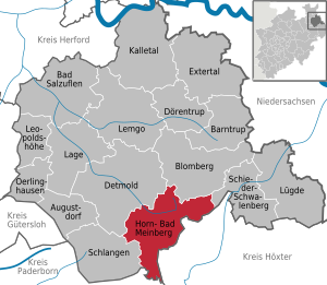
| Location of the town of Horn-Bad Meinberg in the Lippe district | ||
  |
||

Horn-Bad Meinberg ( Low German : Häoern-Möomag ) is a German city in Lippe in the north-east of North Rhine-Westphalia on the edge of the Teutoburg Forest , which is particularly known for the natural attraction Externsteine . The Bad Meinberg district is the Lippe state bath .
geography
Geographical location
The Egge Mountains , which run from south to north, meet at Horn with its northern end on the eastern end of the Teutoburg Forest, which runs from west to east . In the municipality are the two highest mountains of the Egge Mountains, the (also the) Lippische Velmerstot with 441.4 m and the (also) the Prussian Velmerstot with about 464 m above sea level and the highest elevation of the Teutoburg Forest, the Barnacken with 446.4 m high. The two low mountain ranges are separated by the rocky valley of the Silberbach . The lowest point in the urban area is 125 m above sea level.
This is where the 156 km long Hermannsweg , which crosses the Teutoburg Forest, and the Eggeweg , a 70 km long section of the European long-distance hiking trail 1 , meet.
Between the districts of Horn and Holzhausen-Externsteine there is probably the most famous natural monument of the Teutoburg Forest, the Externsteine , near which the Wiembecke rises.
The Werre rises in the district of Wehren and crosses the Lippe district in a north-westerly direction.
Parts of the municipality are located in the Teutoburg Forest / Eggegebirge nature park .
geology

In the municipality, the Lipper Bergland consists predominantly of clay marl , limestone and sandstones from the Middle Ages . These sedimentary rocks are between one and two kilometers thick. In the course of the earth's history, they have been raised and broken down into a multitude of saddles , hollows , clumps and ditches as part of mountain-building processes . The rock layers that were originally one above the other are therefore often arranged next to one another or in the area of clods that have been pushed over as repeating rock sequences. Under these layers are the rocks of the ancient world , especially from Devonian , Carboniferous and Permian . Loose rocks from the Ice Age ( gravel , sand and loess ) are found particularly in the northeastern foreland of the low mountain range, in slopes and in the valleys.
According to the complicated geological structure, the groundwater resources differ greatly in quality. Important aquifers are the largely karstified limestones of the Upper Cretaceous and shell limestone , fissured clay marl stones in sections of the Keuper and the sandstones of the Lower Cretaceous. Occasionally, groundwater is salinized and mineralized by dissolving rock salt and gypsum in the deeper subsoil. In Bad Meinberg, about 260 m below the surface, there is a carbon dioxide gas deposit in layers of the middle red sandstone .
Horn-Bad Meinberg is moderately suitable in individual valley locations (including the settlement area of Horn), otherwise good to very good for the use of geothermal heat sources by means of geothermal probes and heat recovery through heat pump heating (see the adjacent map).
Expansion and use of the urban area
The city, classified as a "small medium-sized town", covers an area of 90.16 km². The municipal area has a maximum extension in east-west direction of about 14.9 km and in north-south direction of about 15.5 km.
| Area according to type of use |
Agricultural area | Forest area | Building, open and operational space | traffic area | Water surface | Sports and green space | other use |
|---|---|---|---|---|---|---|---|
| Area in km² | 43.26 | 33.20 | 7.07 | 4.40 | 0.72 | 1.15 | 0.36 |
| Share of total area | 47.98% | 36.82% | 7.84% | 4.88% | 0.80% | 1.28% | 0.40% |
Neighboring communities
Beginning in the west, the community borders on Schlangen , Detmold , Blomberg and Schieder-Schwalenberg in the Lippe district . It follows in the south of the district of Höxter with the municipality of Steinheim . To the southwest, the Paderborn district with the municipalities of Altenbeken and Bad Lippspringe meets the border with the municipality of Horn-Bad Meinberg.
City structure
According to its main statute, the city is not explicitly subdivided into parts of the city or district, which, for example, would be headed by a local mayor. Nevertheless, the municipalities and parts of the municipality from which the town of Horn-Bad Meinberg was formed in the course of the municipal reform in 1970 are explicitly named in the main statute. In § 1 of the main statute it says: "The city is through the law for the reorganization of the Detmold district of December 2, 1969 (GV NW S. 799) with effect from January 1, 1970 through the amalgamation of the city of Horn and the municipalities of Bad Meinberg, Belle, Bellenberg, Billerbeck, Fromhausen, Heesten, Holzhausen-Externsteine, Leopoldstal, Schmedissen, Vahlhausen bei Horn, Veldrom and Wehren as well as Kempenfeldrom and incorporation of parts of the communities Oberschönhagen (Fissenknick) and Schönemark (Wilberg) newly formed […] “On the The city's website is therefore explicitly broken down into 16 districts several times. It is obvious that the 14 fully integrated old communities plus the places Fisseknick and Wilberg are meant in detail. However, there are still uncertainties due to the lack of an official definition regarding the old communities Kempenfeldrom and Veldrom, which are named on the city's website as the common district Feldrom / Veldrom / Kempen , which contradicts the number 16 on the other hand, reflects that Feldrom (formerly district of Kempenfeldrom) and Veldrom Build a place in terms of urban planning (and etymology ). The conceptual separation of Feldrom and Veldrom is primarily due historically to the demarcation between Prussia / Paderborn and Lippe , which goes back to the Lippspring original comparison . In terms of urban planning, it would be closer to showing Kempen on the one hand and Feldrom / Veldrom on the other hand as two separate districts. Regardless of these differences, the division of the city into districts or districts hardly plays a political or administrative role anyway. If one takes the 16 areas named in the main statute as a yardstick, Horn-Bad Meinberg can be broken down as follows:
| District | Residents | Settlement priorities and structure |
|---|---|---|
| Bad Meinberg | 4636 |
 
|
| Belle | 1196 | |
| Bellenberg | 337 | |
| Billerbeck | 447 | |
| Kink of the foot | 524 | |
| Fromhausen | 175 | |
| Heesten | 145 | |
| Holzhausen-Externsteine | 1191 | |
| horn | 7018 | |
| Kempenfeldrom ( Kempen + Feldrom ) | 492 | |
| Leopoldstal | 1991 | |
| Schmedissen | 90 | |
| Vahlhausen | 156 | |
| Veldrom | 346 | |
| Fight back | 337 | |
| Wilberg | 192 |
climate

Horn-Bad Meinberg belongs to the moderate climate zone of Central Europe and lies in the area of the subatlantic maritime climate . The winters are mostly mild under the influence of the Atlantic and the summers are moderately warm. The annual mean temperature is around 8–9 ° C.
Due to the location in the sub-Atlantic maritime climate, a humid climate prevails all year round with relatively evenly distributed rainfall. Altogether, at the high-altitude measuring station Feldrom, a long-term average of 1258.8 mm of precipitation falls annually and thus significantly more than the German average.
|
Precipitation Feldrom (360 m) and duration of sunshine Bad Meinberg (216 m) (1961–1990)
Source: German Weather Service
|
|||||||||||||||||||||||||||||||||||||||||||||||||||||||||||||||||||||||||||
For the climate in the Ostwestfalen-Lippe region , to which the city belongs, see also the article Climate in Ostwestfalen-Lippe .
history
The town of Horn-Bad Meinberg has existed since the territorial reform that came into force on January 1, 1970. The previously independent town of Horn became with the communities Bad Meinberg, Belle, Bellenberg, Billerbeck, Fromhausen, Heesten, Holzhausen-Externsteine, Leopoldstal, Schmedissen, Vahlhausen, Veldrom, Wehren, Kempenfeldrom, parts of the community Oberschönhagen - as the district Fissenknick - and parts of the Municipality of Schönemark - as a district of Wilberg - combined. According to the law on the reorganization of the Detmold district of December 2, 1969, the newly emerging town was named Bad Meinberg-Horn . On the other hand, there was massive resistance from the inhabitants of the former town of Horn, which then led to the renaming of the town to Horn-Bad Meinberg on September 10, 1970.
Incorporations
On December 2, 1969, the Detmold Act was passed, which on January 1, 1970 the town of Horn with the municipalities of Bad Meinberg, Belle, Bellenberg, Billerbeck, Fromhausen, Heesten, Holzhausen-Externsteine, Leopoldstal, Schmedissen (all from the Detmold country of birth ) and Vahlhausen near Horn Veldrom, weirs and Kempenfeldrom ( Office Steinheim in Höxter ) to the new office-level city Bad Meinberg Horn in county Detmold merged. This was renamed Horn-Bad Meinberg on September 10, 1970 . On January 1, 1973, the Detmold district was dissolved and merged with the Lemgo district in what is now the Lippe district .
Population development
The following overview shows the population of Horn-Bad Meinberg. The 1987 number is a census result. The figures for 1975, 1980 and 1985 are estimated values (official updates from the State Statistical Office ) and the figures from 1990 onwards are based on the results of the 1987 census.
| year | Residents |
|---|---|
| 1975 | 16,920 |
| 1980 | 16,843 |
| 1985 | 16,499 |
| 1987 | 16,234 |
| 1990 | 17,409 |
| 1995 | 18,664 |
| 2000 | 18,754 |
| 2005 | 18,507 |
| 2007 | 18,184 |
| 2011 | 17,689 |
| 2012 | 17.182 |
source
politics
Horn-Bad Meinberg belongs to the Lippe III (99) state electoral district , in which Dennis Maelzer (SPD) was elected as a direct candidate in the 2017 state elections . At the federal level, Horn-Bad Meinberg is part of the Höxter - Lippe II (137) constituency, in which Christian Haase (CDU) was elected as a direct candidate in 2017 .
Municipal council
The council of the city of Horn-Bad Meinberg currently consists of 32 city councilors. In addition, the mayor is the council chairman.
| 2014 | 2009 | 2004 | 1999 | 1994 | 1989 | 1984 | 1979 | 1975 | ||||||||||||||||||
|---|---|---|---|---|---|---|---|---|---|---|---|---|---|---|---|---|---|---|---|---|---|---|---|---|---|---|
| Political party | Seats | % | Seats | % | Seats | % | Seats | % | Seats | % | Seats | % | Seats | % | Seats | % | Seats | % | ||||||||
| SPD | 14th | 42.7 | 13 | 39.63 | 12 | 36.17 | 14th | 39.22 | 13 | 35.76 | 18th | 44.99 | 20th | 50.21 | 17th | 42.40 | 17th | 43.63 | ||||||||
| CDU | 10 | 32.5 | 11 | 35.39 | 13 | 42.26 | 15th | 42.08 | 13 | 35.82 | 15th | 37.89 | 17th | 42.33 | 19th | 46.16 | 18th | 46.33 | ||||||||
| GREEN 1 | 3 | 8.7 | 2 | 6.95 | 2 | 6.26 | 2 | 5.26 | 3 | 7.75 | 2 | 7.12 | - | - | - | - | - | - | ||||||||
| Citizens' Alliance | 2 | 7.6 | 3 | 9.20 | 3 | 10.09 | 2 | 6.37 | - | - | - | - | - | - | - | - | - | - | ||||||||
| FDP | 1 | 3.0 | 2 | 5.20 | - | - | - | - | - | 3.85 | 4th | 9.99 | 2 | 7.45 | 3 | 7.92 | 4th | 10.03 | ||||||||
| LEFT | 2 | 5.5 | 1 | 3.61 | - | - | - | - | - | - | - | - | - | - | - | - | - | - | ||||||||
| UWG 2 | - | - | - | - | 2 | 5.22 | 3 | 7.07 | 6th | 16.83 | - | - | - | - | - | - | - | - | ||||||||
| GAZ | - | - | - | - | - | - | - | - | - | - | - | - | - | - | - | 3.52 | - | - | ||||||||
| Total 3 | 32 | 100 | 32 | 100 | 32 | 100 | 36 | 100 | 35 | 100 | 39 | 100 | 39 | 100 | 39 | 100 | 39 | 100 | ||||||||
| voter turnout | 52.9% | 57.36% | 60.89% | 61.34% | 83.66% | 73.51% | 75.30% | 78.5% 6 | 89.04% | |||||||||||||||||
mayor
Mayor of Horn-Bad Meinberg was Eberhard Block (SPD) from 1999 to 2015. In the runoff election for the 2015 municipal election, the non-party candidate Stephan Rother prevailed against Matthias Engel (SPD) with 56.3% of the valid votes.
coat of arms
The coat of arms description reads:
- A golden (yellow) horn hung in blue on a five-petalled red rose with golden (yellow) lugs, below a silver (white) fountain temple with a round arched door.
The five-petalled rose is the Lippe rose , which belongs to the district or country Lippe . The horn attached to it indicates etymologically the district of the same name. The fountain temple is in the baroque spa gardens of Bad Meinberg.
Town twinning
Horn-Bad Meinberg maintains city partnerships with the following cities :
- Villedieu-les-Poêles , a small town of around 4,000 inhabitants in Normandy, France
- Kudowa-Zdrój , a spa in the Lower Silesian Voivodeship, Poland
Religions


The majority of the population in Horn-Bad Meinberg is Protestant. This goes back to the Reformation introduced in 1538 by Bernhard VIII Graf zur Lippe . The Reformed Confession, which was introduced in the 17th century , is predominant .
The denomination of the students in Horn-Bad Meinberg can be an indication of the current distribution of religions. Accordingly, in the school year 2006/2007 54% of the students stated Protestant, 16.4% Catholic and 9.3% Islamic as religious affiliation. 14.0% said they belonged to another religion and 6.4% had no denomination.
The parishes are:
-
Evangelical Reformed Congregations :
- Ev.-ref. Parish of Horn with the associated churches in Horn and Holzhausen
- Ev.-ref. Parish Bad Meinberg with the associated church
- Ev.-ref. Parish of Leopoldstal with the associated churches in Leopoldstal and Veldrom
These three parishes are the sponsors of the "Evangelical Youth Horn-Bad Meinberg" (House of Youth "Alte Post")
-
Evangelical Free Church Congregation :
- Ev.-Free Church. Congregation Horn (Baptists) dissolved since March 31, 2015.
-
Catholic community :
- Catholic community Heilig Kreuz Horn-Bad Meinberg with the associated churches
- Christ the King Bad Meinberg
- Holy Cross Horn
- St. Josef Feldrom
- Catholic community Heilig Kreuz Horn-Bad Meinberg with the associated churches
-
New Apostolic Church :
- New Apostolic Congregation Horn-Bad Meinberg in Horn
-
Islamic community:
- It has existed since 1982 with the Diyanet Turkish-Islamic Community of Horn e. V. ( DITIB Horn Selimiye Camii) an independent Islamic community.
Culture and sights

theatre

In the Kurtheater Bad Meinberg musical and theater artists from the region and all over Germany perform.
The Bellenberg open-air stage is located in the Bellenberg district , where two adult and one children's play are usually performed on weekends during the summer months.

movie theater
The Bad Meinberg Film Palace in Bad Meinberg was closed in July 2012.
Museums
The Horn Castle Museum is open from Easter to All Saints Day and offers the history of the town of Horn from the Middle Ages to the present day. Horn Castle is one of the oldest residences of the noble lords of the Lippe.
In the Kempenfeldrom district is the privately operated Kempen Tractor Museum , which shows agricultural implements from the Middle Ages to the 1960s.
music
In Horn-Bad Meinberg there are two women's and one men's choir.
Structures in the Horn district


- Evangelical Reformed Parish Church , formerly St. John the Baptist. The two-bay, three-nave hall church with west tower and polygonal choir was built in the last quarter of the 15th century. The tower is likely to date from the 12th century, making it the oldest known structure in Horn. In 1819 the roof of the church and the tower were destroyed after a lightning strike. It was not until 1826 that the current Welsh tower dome could be completed. The spacious interior, spanned by ribbed vaults , looks very compact. The vaults rest on two mighty round pillars . The furnishings include a font from 1589 and an organ prospect from the 17th century . In the choir there is a choir stalls with Gothic carvings from the late 15th century, which were reworked in the 19th century. The epitaph of Cordt von Mengerssen († 1561) has been attached to the southeast wall of the aisle since 1859 . It was originally set up in the choir area. In the nave there are five chandeliers that were commissioned by the town of Horn and the brewers' guild from a Nuremberg goldsmith in 1708.

- The former Horn Castle (local history museum) stands directly on the city wall . The existing facility is likely to have been built during the founding of the city and was evidently expanded in 1348. It is an angular two-storey building above a high basement that protrudes slightly into the former city moat. It was heavily rebuilt between 1656 and 1659. During this time, the east wing was apparently added and the stairwell was installed. A new portal was installed on the front. The upper part of the tower, which was originally crowned by a curved hood, was later demolished due to its dilapidation. In the course of the restoration work carried out between 1983 and 1989, the tower was given its upper floors and a new roof. The former castle barn, a plastered building with a crooked hip roof , was built in 1744.

- The stately neo-Gothic building of the town hall was built in 1865–1866 by the contractor and architect Wilhelm Lakemeier from Steinheim (Westphalia) , after the previous building had been destroyed by fire two years earlier. Originally two-winged, it was expanded in 1956 with rear extensions. The front of the market, designed as a front, shows two risalites , which are crowned by triangular gables decorated with pinnacles . At the northeast corner facing Mittelstrasse there is a four-storey polygonal corner tower, which is closed off by a low balustrade .
- Kotzenbergscher Hof (Hotel Vialon). The two-storey solid structure consisting of two wings was built around 1616. Heinrich Baumhauer could beconsidered as a master builderdue to the similar individual shapes at the Paderborn town hall. On the market side there is a pretty portal, which is marked 1680.

Residential buildings : Once upon a time, the cityscape was largely shaped by gable-side half-timbered, hallway houses . Some fine examples have survived to this day on Nordstrasse and Mittelstrasse. The Nordstrasse 21–33 assembly group is particularly attractive. The solid construction remained an exception well into the 19th century. The following should be mentioned for individual buildings:
- Burgstrasse 27. Inscribed 1663.
- Heerstraße 47. A hall house built in the 18th century with a rear building with a basement.
- Kirchstraße 2. Although the well-preserved hall house on the gate beam is labeled "1860", it is likely to date from the 17th century.
- Mittelstraße 48. The gabled house with a younger Utlucht, the ground floor of which is impaired by shopfitting, was built in 1671 for the pastor Wilhelm Fabricius and his wife from Bremen. There are tendril ornaments on the filling boards .
- Mittelstrasse 65. The massive gabled house on the ground floor, built around 1570/80 for Henrich Teerbeck, was once one of the most magnificent residential buildings in the city. It had a side vault, a richly carved timber-framed storage floor and a rear building with a basement. In 1627 it came into the possession of the Detert merchant family and was finally integrated into a neighboring Art Nouveau building in 1910. Nothing is left of the magnificent facade; the Utlucht was mutilated into a bay window. On the right side of the eaves facing the Ratswete, remains of the carvings with half rosettes have been preserved.
- Mittelstraße 67. The baroque half-timbered house with massive gable facades is marked in 1756. On the street front, the three central window axes are accentuated by pilaster strips. A double flight of stairs is in front of the portal .
- Mittelstrasse 71. The building, which was partly built in half-timbered construction, was probably built in 1563 for the count's secretary Johann von Rintelen. A chimney inside is designated in 1564. The Utlucht , crowned by shell attachments , may also date from this time . In 1579 the house got a new stepped gable decorated with shell-filled volutes . This was largely removed in the 18th century and partially reconstructed around 1920. At that time, the segmental arch was also added. The main gable used to be seen as a work by Heinrich Overkotte . The art historian Otto Gaul later ascribed it to Hermann Wulff together with the very similar house at Mittelstrasse 64 in Lemgo .
- Nordstraße 5. The gabled house from 1613 with a side panel is decorated with elaborate carvings.
- Nordstrasse 9. (“Alt Horn” restaurant). The house, decorated with rich carvings (fan rosettes), was built in 1579 for councilor Peter Steffen , according to an inscription that was apparently added at a later date . The extension on the left, serving as a farm building, was added in 1775. A comprehensive restoration of the building was carried out in 1953.
- Nordstrasse 17. Inscribed 1655.
- Nordstraße 21. As the inscription on the gate beam shows, the building was destroyed in a fire together with other houses on this street section (No. 23,29,31) in 1730 and rebuilt the following year.
- Nordstraße 23. The hall house, designated in 1731 and built for Johann Cord Lahmann, has lavish carvings in the form of tendril ornaments on the gate posts and on the panels .
- Nordstrasse 25 . Marked on the gate in 1710, the house with a gorge apparently survived the fire of 1730.
- Nordstrasse 29. Half-timbered building with carvings, probably built in 1731.
- Nordstrasse 31. In terms of design, the house from 1731 and richly carved is similar to Nordstrasse 23.
- Nordstrasse 33. Erected in 1695.
- Pfuhlstraße 11. Four-column construction with Utlucht, which was probably built in 1725 (or 1735?). Its gate beam is carved with flat ornaments.

- Larger parts of the wall have survived from the medieval city fortifications , especially in the south (on the road behind the wall ) and in the area of the castle. Of the four formerly documented towers, only the so-called Malzdarre (later also called Owl Tower) remained. The round tower with a conical roof and keyhole loopholes may have been built around 1500. It has a diameter of 8.50 m and a height of 17.50 m.
- At the end of the village in the direction of Steinheim / Vinsebeck there is a classicist milestone and a medieval stone cross .
Buildings in the Bad Meinberg district
- At the Ev.-ref. Parish church is a small vaulted building from the 12th century.
- The oldest half-timbered house in the village is Brunnenstraße 34 from 1588 with richly decorated cleats. It was rebuilt in 1696 and has served as a guesthouse since 1961.
Parks
The historic spa park in Bad Meinberg was laid out around 1770 as a baroque complex. Its size is 6.25 hectares.

The original layout of the park goes back to a plan sketch drawn up in 1767 by the chief forester Feige. It owes its creation to the support of the founder of the spa in Meinberg, Johann Erhard Trampel, and the sovereign Count Simon August (Lippe) . The park was laid out around a Mofette (gas source) that was initially mistaken for a source of water. The Werre flows through the park. The north-south axis of the park is turned a few degrees to the west and points approximately to NNW. The buildings surrounding the park include the bathing and lodging house Stern (built 1770–1773) at the northern end of the axis and the Kurhaus Rose, completed in 1775, at its southern end. The east-west axis turns today on the west side into the avenue, the central shopping street of Bad Meinberg. The originally strictly geometrical park has undergone numerous redesigns over the years. An octagonal fountain house was built in 1768 as the center of the park. From here, avenues planted with linden and horse chestnut trees and diagonal paths surrounded by hornbeam hedges formed the basic structure of the park. As early as 1785, the first major redesign based on the English model took place. Following suggestions from Christian Cay Laurenz Hirschfeld, the diagonal paths were removed and the areas between the cross avenues landscaped. The straightened Werre received several barrages to reduce its flow rate. In the southwest of the park, a snail mountain was created as a lookout point. Another redesign took place in 1820, this time according to plans by court gardener Nolda from Kassel. Building on Hirschfeld's ideas, he had meandering paths, lawns and a “pleasure garden” laid out. The course of the Werre was changed again, so that the river now crossed the park slightly meandering. The fountain temple in the spa gardens was built in 1842 instead of the fountain house. It is the landmark of Bad Meinberg and has also found its way into the city arms of Horn-Bad Meinberg.
As an extension of the spa park, the establishment of the mountain garden began in 1928 . The design plan for the 3 hectare site was made by the Bielefeld garden architect Pieper, and the execution was carried out by the gardener Hermann Niemeyer. The facility, which is located on the northern outskirts of Bad Meinberg, comprises a southern, lower-lying geometric part and a northern, higher-lying, scenic part. The lower part of the park is dominated by a central staircase that divides the southern slope into several terraces. The central axis of the park was originally aligned with the villa of Count Leopold from Lippe, known as "Schlösschen" or "Schloss". This building was demolished in 1962. Originally there was a direct connection between the mountain garden and the historic spa park to the south. This was interrupted in 1986 by a newly built outbuilding of the spa hotel Zum Stern , and an underground car park was installed in the lower part of the garden. Instead of the tennis courts located there, a garden of the senses was created in 2000 . The scenic part is made accessible by a circular route. The northern end of the park is an open weather shelter from which the entire complex can be viewed.

The Seepark is a 3-hectare facility with an approx. 1-hectare lake that was laid out between 1953 and 1955 and adjoins the historic spa gardens in an easterly direction. The lake results from a damming of the Werre. Towards the end of the Second World War, French forced laborers began work on the dam for a flood retention basin. From 1953 the lake was dammed, the completion of the lake park, based on plans by the gardener Hermann Niemeyer, took place in 1955. The twelve meter high fountain in the lake can be seen from afar. The Neptune monument is located near the tributary of the Werre. The main access to the park is via its west side, which continues the east-west axis of the historic spa park with generously designed flower beds and leads directly to the lake. The lake is surrounded by a circular path, which in turn is separated from the surrounding buildings - mostly spa pensions and guest houses with a view of the park - by groups of trees and bushes.
With about 40 hectares, the Silvatikum (you can also find the spelling Sylvatikum ) is the largest of the parks in Horn-Bad Meinberg. The park is located on the eastern outskirts of Bad Meinberg. It connects to the historic spa park and the lake park and flows smoothly into the open landscape. In the period from 1962 to 1965, 36,000 trees and bushes were planted in this facility, which was designed by Forest Director Splettstößer as a "regional forest park", which form forest landscapes from 14 different regions of the world. There are groups of trees with over 50 genera, which represent the following regions as characteristic plant communities: Japan (Hondo Island), China (Himalaya), Caucasus, East Prussia, Pomerania, Spreewald, Central European floodplain forest, high Alps, Northern Italy and the Mediterranean, Yugoslavia and Bosnia, North America (Mississippi, California / Sierra Nevada, Northeast America, Northwest America).
The park is owned by Staatsbad Meinberg GmbH. In 2019 Yoga Vidya bought part of the Silvatikum. All facilities are open to the public.
Natural monuments

In the Holzhausen district there are the Externsteine , a group of thirteen, partly free-standing, up to 38 meters high sandstone rocks that were washed out by the Wiembecke over millions of years. They are among the most important natural sights in Germany. An area of approx. 140 hectares is designated as a nature reserve in its vicinity. In the early 12th century there was a Christian pilgrimage site here. A relief 3.6 meters wide and 5 meters high was carved into the wall of the main rock, depicting the Descent from the Cross. At the foot of the rocks, the Wiembecke is dammed into a small lake.
The Werre , a tributary of the Weser, rises in the district of Wehren .
The Norderteich in the Billerbeck district was artificially created by damming and is the oldest nature reserve in the Lippe district. It was mentioned in a document as early as 1115 and is owned by the Lippe regional association .

The Silberbachtal near Leopoldstal is a scenic stream valley with a former silver mill and the Kattenmühle . The name Silberbach comes from small silver finds in the years 1711 to 1712. The nearby Lippische Velmerstot at the transition from the Teutoburg Forest to the Egge Mountains is a popular hiking destination. At 441 meters, it is the second highest mountain in the Egge Mountains, next to the Prussian Velmerstot (468 meters), which is about 1000 meters away. The mountain top consists of a bizarre sandstone formation and offers an impressive view.
Sports
The clubs TuS Horn-Bad Meinberg, Türkischer SV Horn, TSV Belle, TuS Holzhausen / Externsteine and TSV Leopoldstal are organized in the Football and Athletics Association of Westphalia. The TTV Horn-Bad Meinberg offers table tennis in the city area. There is also an air sports club, three tennis clubs, a tennis and bowling center, a fitness center, a riding club, two shooting clubs and a billiards cafe.
Regular events
The regular events in the course of the year begin with the spring festival in Horn, a fair in April at the town hall. It continues on the 4th weekend in April with the flower and garden market in Bad Meinberger Allee. At Easter, Easter fires are burned in the districts . At the end of April, the volunteer fire brigade in Bad Meinberg organizes the dance in May .
At the end of May there is a wine festival in Bad Meinberg and on the 3rd weekend in June there is a moor and music festival in Bad Meinberg. The large spa park lighting attracts many visitors. After the summer break, there is a fair on the 3rd weekend in September in the Meinberg district. The last weekend in September is the Hörnchenfest in the old town of Horner.
Beller Schnirz is the name of the folk festival in the Belle district on the 3rd weekend in October. At the same time there is a farmers market in Bad Meinberg. On the 3rd weekend before the first Advent there is Kläschen in Horn, the traditional fair around the town hall. The end of the year is the Christmas market in Bad Meinberg in the Kurpark on the third Advent.
During the course of the year, the shooting festivals of the shooting societies and brotherhoods in seven districts.
Culinary specialties
Horn-Bad Meinberg you know the typical Lippische specialties like turnip cream soup , Pickert and pear pudding .
The spring-fresh mineral water from the city has been known for 300 years. It has been marketed under the name Bad Meinberger since 1971 .
Economy and Infrastructure
Horn-Bad Meinberg is part of the Integrated Rural Development Concept Südlippe , a network of the municipalities of Blomberg , Horn-Bad Meinberg, Lügde , Schieder-Schwalenberg and Schlangen .
traffic
Road traffic
In Horn-Bad Meinberg the federal highways 1 and 239 cross . While the B 1 has been running through the municipality as a bypass road since 1990, the B 239 bypasses for the Bad Meinberg and Belle districts are only in the planning phase. The so-called "Südring" is also being planned in Horn as a continuation of the inner-city bypass road "Hessenring" to close the gap from "Steinheimer Straße" to "Leopoldstaler Straße".
Rail and bus transport

The Horn-Bad Meinberg Station is located on the railway line Herford-Altenbeken . It is served every hour by the RB 72 "Ostwestfalen-Bahn" Herford - Detmold - Altenbeken - Paderborn as well as by individual services of the RE 82 "Der Leineweber" (Altenbeken–) Detmold– Bielefeld . Another stop on the RB 72 is in Leopoldstal .
Local rail passenger transport is carried out by the Eurobahn , which replaced the Westfalenbahn at the 2017 timetable change , with Flirt electric railcars and Talent diesel railcars (RB 82). The Horn-Bad Meinberg urban area is part of the Westphalian tariff .
The two districts of Horn and Bad Meinberg are connected by a city bus line, which also offers connections to the train service. The surrounding towns (including Schlangen , Bad Lippspringe , Blomberg ) can be reached by regional buses .
Bicycle traffic
The Radfernwege Romans-Lippe route , wellness cycling route , BahnRadRoute Weser-Lippe and Senne bike path leading through the municipality. In addition, the European cycle route R1 runs directly past the Externsteine on its way from Calais (France) to Tallinn (Estonia).
Established businesses
The largest employer (with approx. 480 employees) in Horn-Bad Meinberg is the wood-based material manufacturer GHP GmbH , which belongs to the Portuguese Sonae Indústria Group (see also Glunz AG ) . This company emerged from the Hornitex Group, which went bankrupt in 2001, which was founded in 1926 by the brothers Friedrich and Otto Künnemeyer as the plywood factory Gebr. Künnemeyer, was renamed in 1958 to Hornitex Werke Gebr - and plastic sheet industry (4 locations, approx. 3000 employees).
media
The only local newspaper that is available in the Lippe district is the Lippische Landes-Zeitung (LZ) from Lippische Zeitungsverlag Giesdorf GmbH & Co.KG. in Detmold. The LZ appears Monday to Saturday and belongs to the newspaper group " Neue Westfälische ".
At the end of 2003, the second local daily newspaper Lippische Rundschau was discontinued.
Three free advertising papers are distributed in the city:
- On Wednesdays and Saturdays Lippe currently publishes Oppermann Druck u. Verlag GmbH & Co. KG in Detmold
- Saturday will be the latest news from Lippische Zeitungsverlag Giesdorf GmbH & Co.KG.
- The Horn-Bad Meinberg city gazette from Kurier-Verlag GmbH & Co. KG in Horn appears 13 times a year (as of 2009)
The private local radio station Radio Lippe , based in Detmold, broadcasts local news from the Lippe district. The Bielefeld studio of Westdeutscher Rundfunk (WDR) with a regional office in Detmold is responsible for Horn-Bad Meinberg for public broadcasting .
Public facilities
The Stadtwerke Horn-Bad Meinberg maintain a wastewater treatment plant that cleans the city's sewage 246 kilometers of canals. With the waterworks, almost all parts of the city are supplied with fresh water over 175 kilometers of water pipes. The municipal utilities pump the water from 19 deep wells and can store up to 6,560 m³ of drinking water. Only about 2% of the water requirement has to be procured by the Detmold municipal utility and the Veldrom water procurement association.
In the city there are outdoor pools in the districts of Bad Meinberg, Belle and Horn. There is also the Horn swimming pool and the thermal mineral bath in Bad Meinberg.

The Horn-Bad Meinberg volunteer fire brigade is divided into six fire engines that are spread across the city. In Horn, a turntable ladder , a rescue vehicle and several crew and fire fighting vehicles are available for rescue, extinguishing and recovery . Bad Meinberg, there is a hose reels , one pumper an assistance Löschgruppenfahrzeug and a crew transport vehicle . The remaining fire engines usually have a fire fighting vehicle or a portable fire pump . A youth fire brigade is maintained to recruit new firefighters .
The Julie Hirschfeld public library - named after a Jewish citizen in Horn - has a media inventory of 18,000 media. These include 7,000 books for children and young people, 4,500 crime fiction and novels, 6,000 non-fiction books and various magazines. In the area of new media , the library offers around 500 audio cassettes, 100 CD-Roms with educational software and audio books.
education

There are three primary schools in the municipality: the largest is the Horn primary school with almost 500 children, then there is the Bad Meinberg primary school with around 200 children and the Belle primary school with around 90 children. The secondary schools are located in the school center in Horn: the Horn-Bad Meinberg secondary school with around 350 students, the Horn-Bad Meinberg secondary school and the Horn-Bad Meinberg grammar school . In Horn there is also a school for children with special learning needs, the tower school (special needs school for the learning disabled) and the school at the Teutoburg Forest as a school for the mentally handicapped. While the city is responsible for the other schools, the school in the Teutoburg Forest is a school in the Lippe district.
In 2007, the city's schools with 198 teachers taught a total of 2,560 pupils, 29.7% of them at elementary schools, 10.3% at Hauptschule and 18% at Realschule, 32.6% at Gymnasium, and 9, 5% at the special schools.
Personalities
Honorary citizen
- Gotthilf August Benjamin Schierenberg (born March 18, 1808 in Horn, † October 12, 1894 in Lucerne), businessman, local researcher and amateur archaeologist, honorary citizen of the city of Horn, brother of Heinrich Schierenberg
- August Schierenberg (born May 13, 1849 in Horn, † February 4, 1920 in Freudenstadt (?)), Merchant, donated a "public library with reading hall" (city library) to the city of Horn
- Friedrich Künnemeyer (born April 25, 1883 in Ledde near Tecklenburg, † February 6, 1964 in Horn), manufacturer, city councilor (CDU) and benefactor of the city of Horn
sons and daughters of the town
- Johann Conrad Barchusen , actually Barkhausen , (born March 16, 1666 in Horn, † October 2, 1723 in Utrecht , Netherlands ) was the first professor of chemistry at a university at Utrecht University .
- Bernhard Meyer (born August 20, 1812 in Bad Meinberg; † October 26, 1886 in Detmold), lawyer, civil servant, politician and writer
- Franz Hausmann (born February 26, 1818 in Horn, † December 30, 1877 in Horn), lawyer and liberal politician, Vice-President of the Landtag of Lippe 1847-1851, from 1867 member of the North German and German Reichstag
- Friedrich Ernst Husemann (born September 19, 1873 in Leopoldstal (Lippe), † April 15, 1935 in Sögel ), trade unionist, chairman of the Association of Mining Industry Workers in Germany from 1919 to 1933, member of the Prussian state parliament from 1919 to 1924 and member of the Reichstag from 1924 to 1933.
- Hermann Weber (1888–1937), KPD functionary and politician
- August Winkel (1902–1968), chemist
- Karl Heinrich Krüger (born April 4, 1907 in Horn, † February 25, 1997), high school teacher, textbook author and history didactic
- Daniel Brinkmann (* 1986), former professional footballer in the 1st Bundesliga
Other people connected to the city
- Karl Friedrich Titho , born on May 14, 1911, died in Horn 2001, SS officer and war criminal
Individual evidence
- ↑ Population of the municipalities of North Rhine-Westphalia on December 31, 2019 - update of the population based on the census of May 9, 2011. State Office for Information and Technology North Rhine-Westphalia (IT.NRW), accessed on June 17, 2020 . ( Help on this )
- ↑ [1]
- ↑ Geological Service North Rhine-Westphalia, Geoscientific community description Horn-Bad Meinberg ( Memento from July 8, 2014 in the Internet Archive )
- ↑ Geological Service NRW: Using geothermal energy - Geothermal study provides planning basis ( Memento from September 14, 2005 in the Internet Archive ) (PDF; 369 kB)
- ↑ a b State Office for Data Processing and Statistics North Rhine-Westphalia : Municipal profile Horn-Bad Meinberg ( Memento of the original from May 5, 2008 in the Internet Archive ) Info: The archive link was automatically inserted and not yet checked. Please check the original and archive link according to the instructions and then remove this notice.
- ↑ 449.100.1 Main Statute of the City of Horn-Bad Meinberg.
- ^ Website of the town of Horn-Bad-Meinberg: 16 districts
- ↑ Feldrom / Veldrom / Kempen
- ↑ [2]
- ↑ Martin Bünermann: The communities of the first reorganization program in North Rhine-Westphalia . Deutscher Gemeindeverlag, Cologne 1970, p. 106 .
- ↑ a b Federal Statistical Office (ed.): Historical municipality register for the Federal Republic of Germany. Name, border and key number changes in municipalities, counties and administrative districts from May 27, 1970 to December 31, 1982 . W. Kohlhammer, Stuttgart / Mainz 1983, ISBN 3-17-003263-1 , p. 321 .
- ^ Ministry of the Interior and Local Affairs of the State of North Rhine-Westphalia, Citizens Service: Law for the reorganization of the Detmold district
- ^ Ministry of the Interior and Local Affairs of the State of North Rhine-Westphalia, Citizens Service: Bielefeld Law
- ↑ Martin Bünermann, Heinz Köstering: The communities and districts after the municipal territorial reform in North Rhine-Westphalia . Deutscher Gemeindeverlag, Cologne 1975, ISBN 3-555-30092-X .
- ↑ [3]
- ↑ State database NRW; Election results for the municipality code 05766032
- ↑ State Office for Data Processing and Statistics: Local elections
- ↑ State Office for Data Processing and Statistics: Students at general education schools in North Rhine-Westphalia according to religious affiliation
- ↑ Evangelical Free Church Community Horn ( Memento from July 15, 2015 in the Internet Archive )
- ^ New Apostolic Congregation
- ^ Regional Association Westphalia-Lippe: Historical spa park in LWL geodata culture
- ^ Regional Association Westphalia-Lippe: Kurpark Bad Meinberg - Extension of Berggarten in LWL GeodatenKultur
- ^ Regional Association Westphalia-Lippe: Kurpark Bad Meinberg - Extension Seepark in LWL-GeodatenKultur
- ↑ Regional Association of Westphalia-Lippe: Kurpark Bad Meinberg - Enlargement Countries Forest silvaticum in fiber optic spatial data culture
- ^ Christian Kuhnke: Lippe Lexikon. Boken Verlag, Detmold 2000, ISBN 3-935454-00-7 .
- ↑ LSV - Egge e. V. Accessed June 22, 2017 .
- ↑ Entry about Gotthilf Schierenberg in the Lippischen authors lexicon (PDF; 13 kB)
- ^ Kurt August Schierenberg: August Schierenberg 1849–1920. In: Freudenstädter Heimatblätter. 1938/39, pp. 74-77.
- ^ Karlheinz Spielmann: Honorary Citizen and Honors. 3rd edition, Dortmund 1967, Volume I, p. 401.
literature
- Jens Buchner (Ed.): Stadtgeschichte Horn 1248–1998 . Hütte-Verlag, Horn-Bad Meinberg 1997, ISBN 3-922417-13-2 .
- G. Ulrich Großmann: Detmold. Guide through town, castle and surroundings. Marburg 1981, ISBN 3-87822-088-X , p. 113-126 .
- August Meier-Böke : The Lippe villages: town of Horn-Bad Meinberg, community of Schlangen, Augustdorf . In: Kurt Dröge (ed.): Zig-zag trip through Lippe (1954–1958) . tape 6 . Landesverband Lippe, 2002, ISBN 978-3-936225-08-2 .
Web links
- City website
- private portal about the spa
- Staatsbad Meinberg on the website of the Landesverband Lippe
- Website of the Staatsbad Meinberg GmbH with a detailed chronicle on the occasion of the 100th anniversary in 2003
- Horn-Bad Meinberg in the Westphalia Cultural Atlas

Augustdorf | Bad Salzuflen | Barntrup | Blomberg | Detmold | Dörentrup | Extertal | Horn-Bad Meinberg | Kalletal | Location | Lemgo | Leopoldshöhe | Lie | Oerlinghausen | Schieder-Schwalenberg | snakes