
Extertal
| coat of arms | Germany map | |
|---|---|---|

|
Coordinates: 52 ° 5 ' N , 9 ° 5' E |
|
| Basic data | ||
| State : | North Rhine-Westphalia | |
| Administrative region : | Detmold | |
| Circle : | lip | |
| Height : | 240 m above sea level NHN | |
| Area : | 92.49 km 2 | |
| Residents: | 11,069 (Dec. 31, 2019) | |
| Population density : | 120 inhabitants per km 2 | |
| Postal code : | 32699 | |
| Primaries : | 05262, 05751, 05754 | |
| License plate : | LIP | |
| Community key : | 05 7 66 028 | |
| LOCODE : | DE EXT | |
| Community structure: | 12 districts | |
| Address of the municipal administration: |
Mittelstrasse 36 32699 Extertal |
|
| Website : | ||
| Mayoress : | Monika Rehmert ( SPD ) | |
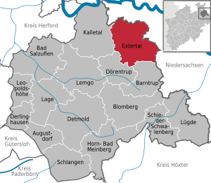
| Location of the municipality Extertal in the Lippe district | ||
  |
||


Extertal is a municipality with about 11,000 inhabitants in the northeast of the county Lippe in Detmold in North Rhine-Westphalia . The municipality was formed as part of the local government reform in 1969 from twelve independent municipalities in the catchment area of the River Exter , from which the name of the municipality was derived. Together with the town of Barntrup and the neighboring communities Dörentrup and Kalletal , the community Extertal forms the Nordlippe region .
geography
Geographical location

Extertal is located in the northeast of North Rhine-Westphalia , in the east of East Westphalia-Lippe and in the north of the Lippe district. Extertal borders Lower Saxony in the east and north . The Weser and Weser Valley are about ten kilometers to the northeast. The eponymous Weser tributary Exter runs through the center of the municipality . The Hummebach rises in the Extertal .
In terms of nature, the municipality is counted as part of the Lipper Bergland . The Lipper Bergland is strongly structured, in the municipal area up to almost 400 meter high peaks and ridges, lowlands and hilly areas cut with valleys alternate. The main town of Bösingfeld is surrounded by several mountain ranges in the Bösingfeld basin, a widened valley in the Exter valley. To the north, the Exter valley opens up to the Rinteln basin . Like all municipalities in Lippe, the municipality is located in the Teutoburg Forest / Eggegebirge Nature Park . In the east and north, the municipality borders on the Weserbergland Schaumburg-Hameln Nature Park, which is entirely in Lower Saxony .
The lowest points of the municipality are at about 90 m above sea level. NN in the north, where Exter and Wemke leave the municipality in the direction of Rinteln. The highest peak is Dörenberg with 387 m in the southwest of the community at 52 ° 3 ' N , 9 ° 4' O . The Schanzenberg , located just a few 100 meters north-west, with the Polackenschanze a little west of Sternberg Castle , reaches a height of 379 m , the Hohe Asch still 371 m on the border with Lower Saxony.
The closest large cities are Bielefeld (40 km west), Paderborn (45 km south-west), Hanover (54 km north-east) and Hildesheim (57 km east).
geology

The municipality lies on the northern flank of the Pyrmont-Piesberger axis. Layers of the Middle and Upper Keuper, dipping slightly to the north, are extensive. From the Middle Keuper (km) mostly marl rocks have survived. This rock was formed from shallow water sediments deposited around 200 million years ago during the Upper Triassic. An intermediate sandstone layer, the reed sandstone, is the deposit of a huge river system. The Keuper marl were mined in numerous marl pits and were used for liming the poor fields. Quarry stones were extracted from the sandstones. The Obere Keuper (ko) is characterized by clay and sandstones. The sandstones are mainly quartz sandstone and therefore very weather-resistant. These layers cover large areas and protect them from erosion. The sediments of the Upper Keuper were created in the course of a sea transgression. The clay stones of the Upper Keuper are used as raw material for brick production. Only in the protection of hollows and ditches in the center of the Extertal are mudstones of the Lower Jura (Lias) preserved in some places (Bösingfeld-Asmissen and Silixen). The last ice age left clear traces in the Extertal. During the cold time of the Saale, the Weser Glacier advanced to close to the southern edge of the municipality. In the hollows and creek valleys in Extertal, several meters thick loose rock from the Ice Age cover the bedrock as described above. The loose rocks include the loess (brought in by Aeolian processes), the ground moraine (remains of Ice Age glaciers ) and the gravel and sand in the Exter valley. The clay is mined at Silixen for a brickworks - earlier the clay was mined in other pits. Gravel and sand were extracted in the community's quarry ponds. The sandstone was formerly extracted in small quarries.
The soils occurring in the municipality of Extertal can be classified as follows: Only shallow brown earths formed above the weather-resistant Keuper layers , especially where the subsoil has to be assigned to the quartz-rich sandstone layers. The Keup layers also weathered to often silty-loamy to clayey-loamy, shallow soils, especially where the subsoil is assigned to the marl and clay stones of the Keup layers. With only slightly sloping slopes, the latter soils also “suffered” from waterlogging, so that pseudogleye developed. Often only extensive agriculture is possible on this - arable farming only through drainage measures. The loess soils and parabroun earths in the valleys, on the other hand, can be used for arable farming and are very fertile.
The area is well to very well suited for the use of geothermal heat sources by means of a geothermal probe and heat recovery through heat pump heating (see the adjacent map).
Expansion and use of the municipal area

The community, classified as a "large rural community", extends over an area of 92.51 km². The municipal area has a maximum extension in east-west direction of around 12.2 km and in north-south direction of around 12.5 km.
The land use shares do not differ significantly from comparable municipalities in North Rhine-Westphalia and are roughly in line with the district, administrative district and state averages. Essentially only the numerous high altitudes are forested. Between these forested mountains, the area is mainly used for agriculture. The following table shows the land use:
| Area according to type of use |
Agricultural schafts- area |
Forest area |
Building, open and operational space |
Traffic area |
Surface of water |
Sports and green space |
other use |
|---|---|---|---|---|---|---|---|
| Area in km² | 59.44 | 22.29 | 5.90 | 3.47 | 0.63 | 0.60 | 0.18 |
| Share of total area | 64.25% | 24.09% | 6.38% | 3.75% | 0.68% | 0.65% | 0.19% |
Neighboring communities
The municipality borders in a clockwise direction on the Lower Saxony Rinteln (in the north and east, district of Schaumburg ), the Lower Saxony Aerzen (in the south-east, district of Hameln-Pyrmont ), and the Lippe communities of Barntrup (in the south), Dörentrup (in the southwest) and Kalletal ( in the West).
Together with the city of Barntrup and the municipalities of Dörentrup and Kalletal, the municipality of Extertal merged in 2004 to form the Nordlippe region .
Community structure
Extertal is divided into twelve districts. The administrative seat is in Bösingfeld. The following table gives an overview of the districts and their population figures:
| District | Residents 1 | Districts of the municipality of Extertal
|
|---|---|---|
| Almena | 1310 | |
| Asmiss | 2246 | |
| Bösingfeld | 4243 | |
| Bremke | 322 | |
| Goestrup | 188 | |
| Broken chick | 258 | |
| Break | 575 | |
| Meierberg | 436 | |
| Nalhof | 357 | |
| Red | 337 | |
| Schönhagen | 203 | |
| Silixes | 1422 | |
1 inhabitant as of December 31, 2016. Source: Municipality of Extertal
climate

Extertal is located in the temperate, fully humid climate of northwest Germany with relatively evenly distributed rainfall and moderately warm summers and moderately cold winters. The relative altitude in the Lipper Bergland leads to rainfall that is slightly higher than the North Rhine-Westphalian average, but with an annual mean of 846 mm per year, it is still significantly lower than west and south-west in the heights of the Egge Mountains , where annual rainfall averages from partially to to be registered to 1400 mm. The following table and the graphic below shows the precipitation distribution in the year:
|
Monthly mean values Extertal 1961–90
Source: DWD Climate Data Germany
|
|||||||||||||||||||||||||||||||||||||||||||||
The long-term mean annual temperature is around eight to nine degrees Celsius. This clearly shows the influence of the altitude on the temperature. At the higher altitudes of the municipality, it is up to about one degree Celsius cooler than in the western Bega / Werretal and in the western and northern Wesertal valleys . But even within the municipality with its pronounced relief, annual mean temperatures up to 0.5 ° C warmer than in the higher altitudes of the municipality are registered in the Extertalung. In a North Rhine-Westphalian comparison, Extertal shows a slightly cooler temperature curve overall.
history
From the Stone Age to the Middle Ages

After the end of the last ice age around 6000 BC A coherent primeval forest developed throughout Central Europe in which people lived in small tribal groups in the Mesolithic as hunters and gatherers. The finds from the Stone Age discovered near Rott, Almena and Bremke indicate that there were people in the Extertal in prehistoric times. It was evidently a loose settlement, as the sites of discovery are further apart compared to other Lippe areas.
A larger number of people could only exist in the Extertal when further food sources were developed in the Neolithic with arable farming and cattle breeding. However, people with the primitive wooden tools of that time could not work the hard soils of the Rhaetian peaks and were dependent on the areas of the alluvial land of the streams and rivers. The primeval forests of the mountains remained untouched except for about 10 clearing islands. The exact location of these prehistoric farms can no longer be reconstructed today. However , there are indications of the locations from the location of barrows above the areas inhabited at the time. About 25 graves are known in the Extertal area. Around 500 AD the Saxons conquered the Extertal, whose language formed the roots of Low German, which was generally spoken here until the middle of the 20th century.
In the early Middle Ages, the Uffoburg was built, a hilltop castle on the Hagenberg near Bremke, which served to secure the traffic route through the Extertal. Today only a few remains of the ramparts and rectangular depressions that indicate former buildings can be seen. During scientific excavations ceramic shards were found, which suggest a settlement of about 850 to 920.
At that time the farmers were working with primitive agricultural methods that did not allow for productive cultivation of the soil. Only with the introduction of the iron wheel plow, the three-field economy and the water mill in the High Middle Ages did this situation change. The Rhaetian peaks of the mountains were cleared so that only a few forest remnants remained. The cultural landscape, which is still visible today, dates from this time; most of the old farms and hamlets with a few farms were built, while real villages were founded with Silixen , Almena and Laßbruch .
Around 1150 the Alt-Sternberg Castle was built on the Mühlingsberg in the area of today's Dörentrup municipality . It was the seat of a noble family unknown by name and was abandoned at the beginning of the 13th century. Her successors were the Counts of Sternberg , members of a side line of the Counts of Schwalenberg. They resided here since the middle of the 13th century and ruled over an area that was roughly the size of the present-day communities of Barntrup and Extertal without Silixen. Around 1240 they built Sternberg Castle west of Linderhofe.
In order to protect their territory, the Counts von Sternberg built permanent settlements with small neighboring castles, which were marked by a three-street pattern . In the town centers of Barntrup, Alverdissen and Bösingfeld , the old road system can still be seen today. In Bösingfeld these three streets are the north, south and middle streets. These settlements were not protected by a wall, but received a thorn thicket, the so-called Hagen , as protection against enemies. Alverdissen has the only surviving castle complex with a castle that was only built at the beginning of modern times.
Bösingfeld was founded as a town by the Counts of Sternberg shortly before 1252. Between 1437 and 1442, however, Bösingfeld lost its town charter and was downgraded to a town . So Bösingfeld remained a relatively insignificant market town even after the change of rule from the Sternberg counts to the noble lords of the Lippe , which could hardly develop due to the unfavorable location in the northeast of the county. Other economic and cultural obstacles were caused by territorial disputes, pledging to Schaumburg-Lippe and their subsequent return to the Lippe rulers. Another clue for this is the transfer of the bell from the church of Bösingfeld to Hillentrup in today's Dörentrup, which was permitted by Minden Bishop Albert in 1442 .
From the Reformation to the Weimar Republic

From 1522, the Lutheran order was preached in Lemgo and from 1533 the Reformation found its way into the entire county of Lippe. In 1605, the sovereign Simon VI. officially to the Evangelical Reformed creed, so that in Lippe the change from the Lutheran to the Reformed creed was carried out according to the principle cuius regio, eius religio . Only the old Hanseatic city of Lemgo remained Lutheran.
The rulers of the 15th century developed their territories into centrally administered states and Sternberg Castle became the seat of a sovereign bailiff . The office administered the area of today's municipality Extertal without Silixen and Almena, as well as the municipality Dörentrup. State power was exercised in the individual villages by local peasant judges. All violations of the law had to be reported to the office.
Extertal was affected by the persecution of witches in its districts of Bösingfeld , Göstrup , Meierberg and Schönhagen from 1587 to 1662 . Five women and one eight to nine year old girl got into witch trials . At least two women were executed; the outcome of the other trials is unknown.
His chronic financial need compelled the Lippe sovereign, Count Simon Henrich Adolph von Lippe, to pledge Sternberg Castle in 1733 to the House of Hanover , which was then owned by King George II of Great Britain . For a payment of 410,000 silver thalers , which were delivered in an ox cart, the English king secured all rights to the Sternberg office. It was not until Count Simon August , who ruled from 1734 to 1782, to end the English rule over Sternberg by repurchasing it in 1781.
The files of the Sternberg office show that there was a remarkable continuity in the population, because in 1940 almost all local people were descendants of the population of the Extertal from the beginning of the 17th century. Between 1600 and 1800 there was a continuous increase in population. The reason for this was the improvement in living conditions through the emerging linen industry, in which many residents were involved in flax cultivation, spinning and weaving. The population grew from 2347 people in 1590 to 4238 people in 1807, who lived in 537 colonies . As early as 1700, the number of Exterthals employed in the home industry and handicrafts exceeded those in agriculture, in Silixen the ratio was even 4: 1. As a result, the residents of the Extertal were particularly affected by the decline in home weaving around 1850. Many saw their only chance in emigration to America. In the second half of the 19th century, more than 1,000 exterthals were looking for a new home in the USA.
Another source of income was the work as a migrant brick , known as the Lippische Ziegler . Lively construction activity developed in the big cities, which led to a growing demand for bricks. From around 1840 to 1940, many Extertaler Zieglers moved to the big cities as migrant workers in the warm season and were thus able to support their families. Some of them were even able to build their own home in Extertal. Between 1840 and 1933, 66 new colonies were built, with the traditional half-timbered construction being replaced by solid construction. In the villages, brick houses in the typical construction from the first half of the 20th century soon dominated, for example the old rectory built in Bösingfeld in 1896 .
In the course of the global economic crisis after the First World War , the migrant brick industry also lost its importance, which led to high unemployment, also due to the poor transport links in the Extertal. The construction of the Extertalbahn in 1927 improved the situation here. The standard-gauge railway from Barntrup to Rinteln with the white and red railcars connected the villages in Extertal with the Löhne-Hameln and Bielefeld-Lemgo-Hameln railway lines.
National Socialism and World War II
Since the Great Depression in 1929, the National Socialists have enjoyed steadily increasing election results. That only changed in 1932, when the measures taken by the Brüning government to combat the crisis had an effect. In the Reichstag election in November 1932, the NSDAP had to accept a decline in its share of the vote from 41.13% to 34.72%. That is why the National Socialists tried to win the state elections in Lippe on January 15, 1933 under all circumstances. The entire leadership of the NSDAP was included in the election campaign and in the final phase of the election campaign Hitler alone spoke 16 times in ten days in Lippe. With 39.5%, the NSDAP was the strongest party in the Lippe state parliament, but it was by no means able to achieve the absolute majority that had previously been hoped for.
The National Socialist seizure of power had similar effects in Extertal as in the rest of Germany. In the context of the so-called " Gleichschaltung" , the other parties were banned and most of the leading positions in politics, administration and public life were filled by the NSDAP. Anyone who did not fit into the so-called "Volksgemeinschaft" was persecuted and imprisoned. Citizens in the Extertal also opposed the demands of the National Socialist state. House searches were repeatedly carried out and fellow citizens were suspected of belonging to the illegal organizations SPD and KPD. The few Jews in the Extertal also fell victim to the National Socialist paranoia. Most of them perished in the concentration camp , with the exception of those who had previously managed to escape abroad. The Alberg-Rosenthal family sold their house in Almena in 1927 and left Germany. She moved to Argentina and so avoided physical annihilation.
During the Second World War , the Extertal was largely spared from air raids. However, fire platelets filled with phosphorus were thrown off to set the grain on fire in the fields. These had to be collected by the students, as well as the leaflets dropped, which were supposed to undermine the morale of the population. From 1943 onwards, a steadily increasing number of American and British associations moved across the Extertal. The few bombs that fell on the ground were all emergency drops. Some Allied planes also crashed over the area, for example at the Siekbach in Almena. In 1944 the residents of the Extertal also felt the consequences of the air war. Air alarms were often raised when the Allied units laid the neighboring cities of Bielefeld, Paderborn, Hanover and Kassel to rubble. The cellars were converted into air raid bunkers and air raid drills were held in the schools.
The 2nd US Panzer Division reached the Teutoburg Forest near Detmold on April 1, 1945 and advanced to the northeast in the following days. The German General Staff had not planned any special defense measures for the area of the Kalle and Extertals. On April 4, the American spearheads reached the town of Barntrup , which was taken without a fight. The places in the Extertal were also occupied without a fight on the afternoon of April 4. Some mayors and other well-known National Socialists had previously fled the area to the east and the population had hoisted sheets as white flags.
Post-war and present
After the unconditional surrender on May 8, 1945, Lippe belonged to the British zone of occupation. British officers were assigned to the newly appointed German heads of authorities. As Commander in Chief, the Commander in Chief of the British Armed Forces in Germany also became the highest political authority in the British zone. He resided at Gut Rickbruch in the immediate vicinity of Almena. The aim of the British occupying power was the democratization of Germany and the return to free political conditions.
The East Westphalia plan of the state government in North Rhine-Westphalia and the construction of the Extertalstrasse in 1968 and 1969, which created an efficient connection to the B1 federal highway near Barntrup and the A2 motorway near Rinteln , were particularly positive for the economic development of the region from 1956 .
The US Army set up the Linderhofe Communication Station, an ACE high station for an over-the-horizon radio link to West Berlin.
Tourism also became increasingly important after the Second World War. There were already beginnings at the beginning of the 20th century, but the world wars and the global economic crisis in 1929 interrupted this development.
The economic and political structure of the districts in the municipality of Extertal has changed considerably in the last few decades, as can be seen most clearly in the example of Bösingfeld. An administrative center for the entire Extertal has developed from the former market town , which was dominated by rural and handicrafts . In addition, Bösingfeld now has a secondary and secondary school as well as considerable industrial settlements in the Bösingfeld / Asmissen industrial area.
Since 2007 the municipality with the municipalities Dörentrup and Kalletal Nordlippe funding region has been part of the EU LEADER program .
Religions
Like most of the population in the former Principality of Lippe, the population of the municipality of Extertal is predominantly Protestant. The Reformation found its way into the principality as early as 1533. By converting Simon VI. At the time of the Reformed Confession in 1603, most of the Lippers finally accepted the Evangelical Reformed denomination , broke away from the Catholic dioceses of Paderborn and Minden and from that point on were part of today's Lippe regional church . Therefore, most of the residents of Extertal are still members of one of the three Protestant Reformed parishes of Bösingfeld, Almena and Silixen. They are all in the territory of the municipality. The three communities are grouped together with other communities outside Extertal in the Bösingfeld class , which in turn belong to the Lippe regional church . The Lower Saxon village of Goldbeck , which borders the municipality, is also part of the reformed parish of Bösingfeld in Extertal.
The first Catholic community was not formed until after the Second World War, through migration of refugees. In 1952 the foundation stone for today's Holy Spirit Church was laid. The free church settled in Bösingfeld as early as 1933. In addition to the parishes of the Lippe regional church, the following parishes exist in Extertal: The Catholic parish of the Holy Spirit, the free evangelical parish, the Jehovah's Witnesses and the New Apostolic Church (all in Bösingfeld).
The Catholic community is part of the Lemgo -Nordlippe pastoral network of the Bielefeld-Lippe deanery in the Archdiocese of Paderborn .
An indication of the distribution of religions can be the membership of the Extertaler students in religious communities. According to this, around 71% of the students in the 2006/07 school year were Protestant, 9% Catholic and 3% Islamic. 5% belonged to another religious community, 12% did not belong to any religious community.
The listed Jewish cemeteries in Bösingfeld and Silixen are a reminder of the former Jewish communities in the Extertal .
Incorporations
Extertal was founded on January 1, 1969 due to the Lemgo Act as part of the regional reform from the formerly independent twelve municipalities and spots Almena, Asmissen, Bösingfeld, Bremke, Göstrup, Kükenbruch, Laßbruch, Meierberg, Nalhof, Rott, Schönhagen and Silixen, the today are localities of the municipality. Some of the parcels of the communities Asmissen and Schönhagen were not integrated into the new community, but given to Dörentrup and Barntrup respectively. From the communities of Heidelbeck and Lüdenhausen , both of which were incorporated into Kalletal, and Schwelentrup, which was incorporated into Dörentrup, some parcels were integrated into Extertal. The name of the largest town, Bösingfeld, was not chosen as the place name of the new large community, but rather the geographical location on the Exter river was used .
On October 1, 1971, parts of the Lower Saxony municipalities of Krankenhagen with about 100 inhabitants and Wennenkamp with only about five inhabitants were added.
Population development
The following overview shows the population of the municipality Extertal according to the respective territorial status or for 1939, 1950 and 1961 the population of today's municipality according to the territorial status of 1987. The figures are census results up to 1970 and 1987 and official from 1975 Updates by the State Office for Data Processing and Statistics . The figures from 1975 to 1985 are estimated values, the figures from 1990 onwards based on the results of the 1987 census. The data relate to the resident population and from 1985 to the population at the place of the main residence .

|
|
politics
The municipal administration is based in the district of Bösingfeld .
Municipal council
The municipal council in Extertal consists of 30 councilors and the mayor Monika Rehmert (SPD). As a result of the local elections on May 25, 2014, the SPD , the CDU , the UWE (Independent Voting Association Extertal) and the FDP are currently represented.
The following table shows the local election results since 1975:
| 2014 | 2009 | 2004 | 1999 | 1994 | 1989 | 1984 | 1979 | 1975 | ||||||||||
|---|---|---|---|---|---|---|---|---|---|---|---|---|---|---|---|---|---|---|
| Political party | Seats | % | Seats | % | Seats | % | Seats | % | Seats | % | Seats | % | Seats | % | Seats | % | Seats | % |
| CDU | 9 | 29.62 | 12 | 36.99 | 11 | 35.89 | 14th | 43.32 | 15th | 43.37 | 12 | 36.07 | 12 | 35.50 | 13 | 38.36 | 13 | 38.27 |
| SPD | 9 | 32.27 | 12 | 35.67 | 13 | 39.56 | 13 | 41.56 | 15th | 43.47 | 18th | 51.52 | 17th | 51.14 | 18th | 54.47 | 16 | 48.68 |
| UWE 1 | 7th | 22.69 | 6th | 19.96 | 8th | 24.55 | 3 | 10.66 | 0 | 1.31 | - | - | - | - | - | - | - | - |
| FDP | 5 | 15.42 | 2 | 7.38 | - | - | - | - | 0 | 3.66 | 1 | 5.40 | 2 | 5.90 | 2 | 7.17 | 4th | 13.05 |
| Green | - | - | - | - | - | - | 2 | 4.46 | 3 | 8.18 | 2 | 7.01 | 2 | 7.46 | - | - | - | - |
| Total 2 | 30th | 100 | 32 | 100 | 32 | 100 | 32 | 100 | 33 | 100 | 33 | 100 | 33 | 100 | 33 | 100 | 33 | 100 |
| voter turnout | 50.71 | 55.18 | 56.23 | 61.20 | 81.95 | 71.62 | 73.12 | 79.68 | 85.88 | |||||||||
1 Independent Voting Association Extertal, until 2004 UWG (Independent Voting Association)
2 without taking into account rounding differences
mayor
Acting mayor is the business administration graduate Monika Rehmert ( SPD ). She was elected Mayor of Extertals on September 13, 2015 with 50.7 percent of the vote. It received only 66 votes more than its opponent Ulrich Hilker ( CDU ).
Previously, the non-party Hans Hoppenberg held the office for 16 years. He did not run again in 2015.
In the election periods from 1979 to 1994, Karl Hermann Haack ( SPD ) was mayor of the municipality of Extertal.
Further election results
The results of the last Landtag, Bundestag and European elections in Extertal are shown in the table below. For the state elections Extertal is part of the constituency 98 - Lip II and for the general election for constituency 136 - lip I . The municipality is divided into 22 regular electoral districts. Jürgen Berghahn (SPD) was elected as a direct candidate in the 2017 state election and Kerstin Vieregge (CDU) as a direct candidate in the 2017 federal election.
| Parties and constituencies | 2004 European elections | State election 2010 | Bundestag election 2005 ¹ | |
|---|---|---|---|---|
| CDU | Christian Democratic Union | 43.09% | 35.87% | 32.35% |
| SPD | Social Democratic Party of Germany | 34.35% | 44.19% | 44.24% |
| Green | Alliance 90 / The Greens | 7.28% | 7.04% | 5.40% |
| FDP | Free Democratic Party | 5.60% | 4.02% | 9.17% |
| left | PDS or Linkspartei.PDS | 1.27% | 6.15% | 5.35% |
| NPD | National Democratic Party of Germany | - | - | 1.40% |
| REP | The Republicans | 1.60% | - | - |
| WASG | Work & Social Justice - The Alternative Choice | - | - | - |
| Otherwise. | Other parties | 6.82% | 2.56% | 2.09% |
| total | 100% | 100% | 100% | |
| voter turnout | 37.32% | 56.36% | 77.40% | |
¹ second votes
coat of arms
Blazon :
- Divided diagonally to the right by silver (white) and green, above with a red eight-pointed star, below with a golden (yellow) wavy bar.
The coat of arms of the Extertal formed in 1969 was approved by the district president on October 8, 1970 and is a new creation. The star is the heraldic figure of the Counts of Sternberg , whose Sternberg Castle is in Extertal. The star for the Sternberg is common in many municipal coats of arms in the region. It can also be found, for example, in the arms of Barntrup and Bad Salzuflen as well as the old district of Lemgos . The Schwalenberg star, which can be found, for example, in the coats of arms of Lübbecke , Preußisch Oldendorf and Schieder-Schwalenberg as well as the old district of Detmold , is related to the Sternberg star via the ancestral holder of the Counts of Sternberg (cf. Heinrich I. von Schwalenberg ). Hence he is heraldically regarded as the same figure. The wave bar is intended to symbolize the exter that gives the new municipality its name .
Town twinning
Tangerhütte from the Stendal district in the Altmark region is the municipality's twin town.
Culture and sights
Museums
The "Music Sternberg Castle" houses since 2004 in addition to the Academy of Ancient Music, the "Sounding Museum". Around 400 historical musical instruments from the collection of the instrument maker Peter Harlan , who lived in the castle from 1944 to 1966, are exhibited here. They have been owned by the Lippe Regional Association since 1999 .
Museum railway

The Extertalbahn railway line, which was closed for regular rail traffic , has been a listed building in the Extertal area since 2008. There is a regular museum railroad between Bösingfeld and Barntrup on the route . The museum railway is operated by Landeseisenbahn Lippe e. V. and is one of the few museum railways in Germany to operate with three types of traction (steam, diesel and electric traction). The Rinteln - Alverdissen section of the route can also be used as a tourist attraction by trolleybuses .
music
The city of Extertal maintains a music school. In addition, the Landesverband Lippe maintains Sternberg Castle, where the “Sounding Museum” and an instrument making workshop are open to visitors. Here the “Academy for Early Music” is dedicated to music, dance and instrument making from the Middle Ages, the Renaissance and the Baroque. In addition, the "Musikburg Sternberg" serves as a venue for musical events. The largest choir in the community is the “Extertaler Musikanten e. V. ". In 2001 he received an entry in the Guinness Book of Records at a particularly long concert together with other choirs .
Buildings

Bösingfeld was founded shortly before 1252 by Count zu Sternberg as a planned town according to the urban three-street system . The place was not surrounded by a city wall, but by a hedge of thorns. The model for this was the Lemgo plant . The village structures in the community, which is made up of several localities, have been preserved to this day, with a church and an (old) school building in each of the villages.
There is an Evangelical Reformed parish church in Bösingfeld. The first church at this location was probably built as early as the town elevation around 1252. The current building probably dates mostly from the 15th century. Badly damaged by fire in 1632, the ship was renewed in 1708 and expanded by Ferdinand Ludwig August Merckel between 1853 and 1857 . In 1934 a new tower replaced the medieval, dilapidated previous building. The most important piece of equipment is the baroque pulpit with the figures of the four evangelists.
In Almena, the original construction of the parish church probably dates from the 13th century. It was replaced from 1865 to 1866 by a neo-Gothic stepped hall designed by Ferdinand Ludwig August Merckel; the church tower, the organ, the stalls and the chandelier were preserved.
There are also the following castles, aristocratic residences and mansions in the municipality.
The castle Sternberg is a hilltop castle in the southwest of the community and was built around 1240 by the first Counts of Sternberg and the headquarters of the county Sternberg. The castle was expanded in the 15th and 16th centuries, pledged several times and finally came into the possession of the House of Lippe together with the County of Sternberg . Since the end of the Second World War, the largely preserved castle has served as a youth center and music school and is therefore sometimes called "Sternberg Music Castle" today. The castle should not be confused with the "Alt-Sternberg" castle ruins , which are located east of Sternberg Castle in the neighboring municipality of Dörentrup.
The Neutrotzdenburg or Alte Trotzenburg (name not exactly known): This castle in Bösingfeld has completely disappeared. Their location is believed to be on the Pulverberg or on the Nordhagen. Their beginnings lie in the dark. It was first mentioned in 1346. The builders and first owners were probably the Counts of Sternberg, later Lords of Bösingfeld . The castle was abandoned in 1442.
The Good Schönhagen is a 1845 to 1855 by the merger of nine farms of America emigrants by captain created Benno Kaufmann Good. In 1890 the estate came into the possession of the fertilizer manufacturer Thomasmehl, Gerhard Hoyermann. In the course of time , the estate, which covered an area of 400 hectares , was mainly used as a test site for newly developed fertilizers. After Hoyermann's death in 1911, the estate changed hands several times and in 1956 came to the German farmers' settlement . The mansion, now vacant, was used as a retirement home until the 1990s. This mansion was only built in 1937 in place of an older mansion in half-timbered construction in the German-national style. It is a two-storey plastered building on a rustic base.
Only the remains of ramparts and moats have survived from the Uffoburg . You are on the Hagenberg near Bremke. It consisted of a main and outer bailey. The resident was probably a noble family in the period from the middle of the 9th century to around 920; the family name is unknown. The name "Uffo" comes from the 15th century and is probably not the historical name of the castle or the residents.

The Good Ullenhausen is a former manor and next to the castle Sternberg is the oldest and most important building municipality of Extertal. Founded around 1240 as a very important Benedictine monastery , the convent became smaller and smaller and in 1407 only consisted of five members. Around 1420 the monastery buildings fell into disrepair. Then the property was the Augustinian - hermits in Herford transmitted. Around 1500 there was no longer a church in Ullenhausen. It was not until 1557 that the former Ullenhausen monastery became a manor when Simon V transferred the property to the Werpup family from Alverdissen as a fief until 1700. 1704 to 1798 the estate was owned by the family of the royal Great Britain captain von Alten. In 1798 she sold the estate to the Cordemann family. Heinrich Braband bought the estate in 1937, and his family has managed the 800-year-old estate and former monastery to this day.
The Rickbruch estate in the Almena district has a two-storey, plastered mansion in the form of the reduced reform style with a neo-baroque style from 1929. In 1945 the estate was confiscated by the British occupation army and served as a residence for the Commander-in-Chief of the British Occupation Zone with headquarters in Bad Oeynhausen . Among other things, the British Field Marshal Sir Bernard Law Montgomery resided here .
The Rohbraken estate near Almena was once owned by the Hameln Abbey , which passed it on to its inheritance authorities , the Lords of Zerssen, with other possessions in icebergs and in Rinteln , as fiefdoms . After the von Zerssen family died out, Rohbraken came to the Adickes and Hugenberg families in the 19th century. One of the owners was Alfred Hugenberg , who was also buried at Gut Rohbracken , who from 1916 built up a large, nationalist-minded media group and was a minister in Hitler's first cabinet .
The watermill on the Laßbach, so-called "Kükenbrucher Mühle" is a watermill from 1880 with overshot water wheel in the state of preservation from 1960.
There are other well-known or special buildings in the community such as the observation tower on the Hohe Asch and the transmission tower on the Dörenberg near Linderhofe, today used as a VHF transmitter for broadcasting Radio Lippe . On the Buntenberg , between Laßbruch and Göstrup, there are remains of stone and earth walls, the origin of which, however, has not yet been examined in more detail archaeologically. They are protected as a ground monument.
Parks
The manors in the area mostly included gardens, some of which are still preserved today.
A small landscape park was created around Gut Schönhagen, which is no longer completely preserved. What remains is an impressive population of trees.
A landscape park along a side stream of the Exter am Gut has been proven at Gut Rickbruch as early as the 19th century. At the east end of the park there is a quarry and a hereditary burial. A lake is dammed up at the manor house. Most of the park is surrounded by a quarry stone wall that has been largely preserved. The park was cut up by Extertalstrasse , but otherwise very well preserved.
Natural monuments and nature reserves

The entire municipality has been part of the Teutoburg Forest / Eggegebirge Nature Park since 2008 . Extertal also borders directly on the Weserbergland Schaumburg-Hameln Nature Park to the north and east . The following nature reserves are designated in Extertal:
| Key no. | place | Territory name | Area in ha | Area number |
|---|---|---|---|---|
| LIP-050 | Extertal | Hummerbachtal | 67.8778 | 1 |
| LIP-073 | Extertal | Valley of the Exter | 175.1484 | 3 |
| LIP-074 | Extertal | Rinnenberg | 53.1440 | 1 |
| LIP-075 | Extertal | Bremker Bachtal | 67.6061 | 2 |
| LIP-076 | Extertal | Almetal | 92.4911 | 2 |
| LIP-077 | Extertal | Juergensberg | 12.1705 | 1 |
| LIP-078 | Extertal | Siekbachtal | 97.3564 | 2 |
| LIP-079 | Extertal | Black Bach / Sellenbach | 192.9853 | 1 |
| LIP-080 | Extertal | Wettsteinsiek | 44.6527 | 1 |
| LIP-081 | Extertal | Heimbachtal | 102.2194 | 3 |
According to the current landscape plan, several individual trees and groups of trees, four quarries, a geotope complex , a marl cave and a small moor area are designated as natural monuments .
Sports
There are more than 20 sports clubs in the municipality, as well as two outdoor and two indoor pools. One focus is on nature-based sport, in winter with cross-country skiing and a ski lift and in summer with riding and driving clubs.
Regular events
In the villages of the Extertal community, the community festivals of all parishes take place at the beginning of June. The autumn market is celebrated every year in the Almena district. There are two festive events in Bösingfeld: The maypole festival on April 30th and the fountain festival with trade show on October 3rd.
Culinary specialties
A dairy in Extertal-Fütig ( Nalhof district ) produced Fütiger cheese until it closed in 2000 .
Economy and Infrastructure
traffic
Extertal can be reached with regional buses from Rinteln, Lemgo and Barntrup. On Sundays and public holidays, dial-a-bus and shared taxis are used to Rinteln. Extertal is part of the Westfalentarif tariff association ("TeutoOWL" network).
The nearest train stations are today Rinteln on the Weserbahn (Hameln-Löhne), Lemgo on the Begatalbahn (Lemgo - Bielefeld) and Bad Pyrmont on the S-Bahn line Paderborn - Hanover Airport . Furthermore, the Extertalbahn , which is under monument protection, is located in the area of the municipality of Extertal, passenger traffic was given up here in 1969, today only museum traffic takes place.
The A 2 motorway can be reached in around ten kilometers via the Bad Eilsen junction in Rinteln . In Barntrup , about seven kilometers away , you can reach the B 66 to Bielefeld and the B 1 to Hameln . From Rinteln to Barntrup, the Extertalstraße leads directly through the district of Bösingfeld and along the Exter.
The nearest international airports are those of Hanover and Paderborn / Lippstadt .
Established businesses
The community is located in Nordlippe , a region that has long lived from agriculture. The structural change was promoted in the 1950s by the Ostwestfalenplan , which is being continued today in the Nordlippe funding region in the EU LEADER program .
In the community there are companies in the metal construction, drive technology, control electronics, plastics and wood processing sectors, as well as Brandt Kühlfahrzeugbau , a refrigerated vehicle manufacturer. Tourism is also economically important. The best known tourism company is the Tourismuspark Extertal holiday complex .
The private specialist acute hospital Oberberg-Klinik Weserbergland for psychiatry, psychosomatics and psychotherapy is located in Extertal-Laßbruch, which focuses in particular on inpatient acute and crisis care and further scientifically-based specialist therapeutic treatment of addictive diseases, depressive disorders and fears, mainly in the case of work-related stress Groups of patients (doctors, self-employed, managers, teachers), which is why the treatment of burnout syndrome is another focus of the clinic.
Bösingfeld is the seat of the vbe Verkehrsbetriebe Extertal-Extertalbahn GmbH , which consists of the operating parts vbe, Karl Köhne Omnibusbetriebe GmbH and vbe Spedition GmbH .
media
The Lippische Landes-Zeitung, which is journalistically linked to the Neue Westfälische, publishes a daily local section for Nordlippe (Kalletal, Dörentrup and Extertal). The Nordlippischer Anzeiger advertising paper appears around weekly with an editorial section for the Nordlippe region (Dörentrup, Kalletal, Extertal). The local radio for Extertal and the other Lippe communities is Radio Lippe .
Public facilities
The town hall of the community is located in the district of Bösingfeld. In Bösingfeld and Laßbruch the community maintains an outdoor pool, and an indoor pool in Bösingfeld and Silixen, although the indoor pool in Silixen is reserved for school and club sports. In addition to an archive with a large collection of photos, there are three small public libraries in the municipality of Extertal in the districts of Bösingfeld (5000 books), Almena (2000 books) and Silixen (3000 books).
With the municipal reorganization of Extertal on January 1st, 1969, the Extertal volunteer fire brigade was created from the formerly independent fire brigades Bösingfeld, Linderhofe, Lassbruch, Almena, Silixen and Bremke. It is divided into a fire fighting train and five fire fighting groups . Each of the groups has a fire fighting vehicle . There is also an ELW1 command vehicle in Silixen and a team transport vehicle in Almena . A turntable ladder , a rescue vehicle , a tank tender , a command vehicle , a personnel transport vehicle and an equipment vehicle are stationed in the Bösingfeld fire fighting train . Young firefighters are supported in the three youth fire brigades Bösingfeld / Linderhofe, Lassbruch / Almena and Silixen / Bremke.
education
The community has two primary schools, a secondary school, a secondary school and a special school. In 2007, a total of 1552 pupils were taught at the Extertaler schools (excluding adult education center) with 100 teachers, of which 36.3% at elementary schools, 20.6% at secondary schools, 35.3% at secondary schools and 7.8% at the special school. The Lippe-Ost adult education center responsible for the community was founded in 1977 together with the neighboring towns of Barntrup, Blomberg, Lügde and Schieder-Schwalenberg. Its headquarters are in Schieder-Schwalenberg, and there is a branch in Blomberg.
In the area of early childhood education there are six kindergartens in Extertal. The sponsors are the CJD , the DRK , the AWO and the political and church communities. All facilities offer care for three to six year old children. The DRK kindergarten looks after children from the age of four months, the community kindergarten from one year.
Personalities
Sons and daughters of the church
Simon von Sternberg was born in Extertal before 1389 . He was Prince-Bishop of Paderborn and Count von Sternberg. His place of birth is probably at today's Sternberg Castle, but possibly also on Alt-Sternberg, Dörentrup.
Simon Albert, born in Bistrup on October 18, 1889, was a bricklayer and local writer. In 1986 he died in Extertal.
Friedrich Winter was born in 1896 . He was a politician of the SPD, mayor of the district of Silixen, district administrator in the Lippe district and a member of the state parliaments of Lippe and North Rhine-Westphalia.
Karl-Heinz Hansen was born in 1927 , also a politician and former member of the German Bundestag ( SPD ).
Former member of the German Bundestag and party politician of the SPD Karl Hermann Haack was born in Extertal in 1940.
The politicians Kerstin Vieregge (CDU) and Christian Sauter (FDP), both members of the 19th German Bundestag , grew up in Extertal and still live today.
Other personalities with a connection to Extertal

The following other personalities were not born in the municipality of Extertal, but are closely connected to the municipality and its districts through life and work. Before 1243, Heinrich I von Schwalenberg should be mentioned, first Count of Sternberg and builder of the castle of the same name. Around 1340, Simon III. , Landesheer von Lippe, first owner of the castle and the county of Sternberg. Hermann Wulff , master builder, built the Sternberg Castle. Gottfried Heinrich zu Pappenheim , General, resided at Sternberg Castle for the winter of 1631/1632. Simon Heinrich Adolf , sovereign of the County of Lippe, pledged Sternberg Castle to Hanover due to financial difficulties. The builder Ferdinand Ludwig August Merckel , born in 1808 , built the church in Almena. Bernard Montgomery , British Field Marshal , resided at Rickbruch Estate after the Second World War. Peter Harlan , as an officer of the castle commandant at Sternberg Castle, became an instrument maker there after 1945.
In 1951, the mining and media entrepreneur Alfred Hugenberg , who was born in Hanover in 1869, died in Extertal-Kükenbruch . From 1933 he belonged to Hitler's first cabinet as Minister of Economics , was considered the leader of the German Nationalists, opponent of Weimar democracy and was a bourgeois pioneer of National Socialism .
Erich Valentin , musicologist, worked as a music teacher at Sternberg Castle. In addition to the Counts of Sternberg, later the rulers of the Lippe region , members of the Everstein family were also tenants and thus lords of Sternberg Castle.
The rapper Casper grew up in Extertal.
literature
- Heimat- und Kulturverein Almena e. V. (Ed.): Almena - history of a village . Almena 1991, ISBN 3-87085-150-3 .
- Community Extertal (Hrsg.): Extertal: The history of a community; edited as a chronicle on behalf of the municipality of Extertal . 1988.
- Werner u. Ingrid Schütte: 75 years of the Extertal public transport operator, 1924–1999. Uhle & Kleimann, Lübbecke 1999, ISBN 3-928959-25-5 .
- Niemeyer: Our Sunday excursion 2. From the Extertal to the Seven Mountains. 52 new hikes to the right and left of the Weser . Hamelin 2006.
- August Meier-Böke : The Lippe Villages: Extertal municipality, Barntrup town . In: Kurt Dröge (ed.): Zig-zag trip through Lippe (1954–1958) . tape 8 . Landesverband Lippe, 2006, ISBN 978-3-936225-10-5 .
Web links
- Website of the municipality of Extertal
- Extertal in the Westphalia culture atlas
- Pictures of Extertal in the picture archive of the LWL media center for Westphalia
- Website of the Heimat- und Kulturverein Almena e. V.
- School project on the history of the Jews in Extertal
Individual evidence
- ↑ Population of the municipalities of North Rhine-Westphalia on December 31, 2019 - update of the population based on the census of May 9, 2011. State Office for Information and Technology North Rhine-Westphalia (IT.NRW), accessed on June 17, 2020 . ( Help on this )
- ↑ Geological Service NRW: Geoscientific community descriptions NRW. Extertal. ( Memento from August 1, 2012 in the web archive archive.today )
- ↑ Kinder Lippe: Geologie ( Memento from July 13, 2007 in the Internet Archive )
- ↑ Kinder Lippe: Extertal ( Memento from February 16, 2013 in the Internet Archive )
- ↑ Geological Service NRW: Using geothermal energy - Geothermal study provides planning basis ( Memento from September 14, 2005 in the Internet Archive ) (PDF; 369 kB)
- ↑ a b ( page no longer available , search in web archives: State Office for Data Processing and Statistics North Rhine-Westphalia: municipal profile Extertal )
- ↑ a b c Welcome to the LEADER region Nordlippe! nordlippe.net, accessed on May 28, 2017 .
- ^ Extertal municipality: Extertal - twelve places, one municipality
- ↑ a b ( page no longer available , search in web archives: main statute of the municipality of Extertal from November 4, 2008. § 1 name, designation and area )
- ↑ DWD: Download of the mean values of precipitation for the period 1961–1990 ( Memento from 23 September 2015 in the Internet Archive ) ( ZIP ; 349 kB)
- ^ City of Detmold: Climate Maps ( Memento from October 16, 2014 in the Internet Archive )
- ^ Kinder Lippe: Precipitation distribution ( Memento from February 15, 2013 in the Internet Archive )
- ^ A b c d e f g h Wilhelm Rinne: Landeskunde Nordrhein-Westfalen Volume: Lippe, page 270. Verlag Ferdinand Schöningh, Paderborn 1993. ISBN 3-506-76111-0
- ↑ a b c d e f g h i j Municipality of Extertal: History of the Extertal
- ↑ History of the churches, parishes, spiritual foundations and clergy in the Lippisches Land 1881, p. 182, at wiki-de.genealogy.net ( online ; accessed on March 15, 2010).
- ^ Wilhelm Rinne: Landeskunde Nordrhein-Westfalen Volume: Lippe. Verlag Ferdinand Schöningh, Paderborn 1993, page: 289 ff. ISBN 3-506-76111-0
- ^ Rainer Walz: Faith in witches and magical communication in the village of the early modern age: The persecution in the county of Lippe . Westphalian Institute for Regional History, Landschaftsverband Westfalen-Lippe Münster, Research on Regional History, Volume 9, Ferdinand Schöningh, Paderborn 1993
- ↑ Stefan Backe: The British flag once waved at the castle. In: Lippische Landeszeitung, p. 19, from April 2, 2010
- ↑ a b c d Almena - history of a village . Heimat- und Kulturverein Almena e. V., ISBN 3-87085-150-3 .
- ↑ 447th Signal Battalion ( English ) usarmygermany.com. Retrieved April 3, 2019.
- ↑ State Office for Data Processing and Statistics North Rhine-Westphalia: Students at general education schools in North Rhine-Westphalia according to religious affiliation (publication 2008)
- ↑ Martin Bünermann: The communities of the first reorganization program in North Rhine-Westphalia . Deutscher Gemeindeverlag, Cologne 1970, p. 67 .
- ^ Federal Statistical Office (ed.): Historical municipality directory for the Federal Republic of Germany. Name, border and key number changes in municipalities, counties and administrative districts from May 27, 1970 to December 31, 1982 . W. Kohlhammer GmbH, Stuttgart and Mainz 1983, ISBN 3-17-003263-1 , p. 192 .
- ↑ State Statistical Office of North Rhine-Westphalia: The resident population in the municipalities of North Rhine-Westphalia 1970: Results of the census on May 27, 1970 . Düsseldorf 1972, p. 41.
- ^ State Office for Data Processing and Statistics North Rhine-Westphalia: Special series on the 1987 population census in North Rhine-Westphalia, Volume 1.1: Population, private households and employed persons. Düsseldorf 1989, p. 110.
- ^ State Office for Data Processing and Statistics North Rhine-Westphalia: State database North Rhine-Westphalia
- ↑ State database NRW; Election results for the municipality code 05766028
- ↑ State Office for Data Processing and Statistics: Local elections
- ↑ Results of the municipality of Extertal 2014
- ↑ Local elections 2015 - election of the mayors of the municipalities belonging to the district - final result for: Extertal (766028). The regional returning officer of North Rhine-Westphalia, accessed on August 9, 2019 .
- ↑ The regional returning officer informs: Final result for Extertal. The regional returning officer of North Rhine-Westphalia, accessed on August 9, 2019 .
- ^ Estate at the Friedrich Ebert Foundation , accessed in March 2009
- ^ European elections 2004 - Extertal. Retrieved August 27, 2013 .
- ^ State elections 2010. Accessed on August 27, 2013 .
- ↑ Bundestag election 2005 - Extertal community - first votes. Retrieved August 27, 2013 .
- ↑ ( page no longer available , search in web archives: main statute of the municipality of Extertal from November 4, 2008 )
- ^ District of Lippe: What the Lipper are up to ( Memento from May 20, 2007 in the Internet Archive )
- ↑ Information page about the music school ( Memento from July 20, 2006 in the Internet Archive )
- ↑ Cultural Atlas of Westphalia. Extertal.
- ↑ a b Regional Association Westphalia-Lippe: Gutspark Schönhagen in LWL GeodatenKultur
- ^ A b Landschaftsverband Westfalen-Lippe: Gutspark Rickbruch in LWL-GeodatenKultur
- ^ Relict.com: Focke-Wulf
- ↑ Webwecker Extertal: Circular hiking trail A3 "Nördliches Almena" ( Memento from May 29, 2014 in the Internet Archive )
- ↑ Mills in Westphalia-Lippe (PDF; 101 kB)
- ↑ Senderfotos-OWL
- ^ Friedrich Hohenschwert: "Prehistoric and early historical fortifications in Lippe". Lippe Studies, Vol. 4, Landesverband Lippe (Ed.), Münster 1978
- ↑ Landscape plan No. 5 of the Lippe district: Extertal, Chapter 2.1.7
- ^ Page of the municipality of Extertal accessed in March 2009
- ↑ Kulturatlas Westfalen, events, festivals, markets in Extertal Homepage accessed in February 2009
- ^ Homepage of the municipality of Extertal Wirtschaft, accessed in February 2009
- ↑ Homepage of the adult education center accessed in February 2009
- ^ Simon Albert in the Lexicon of Westphalian Authors , accessed in April 2009

Augustdorf | Bad Salzuflen | Barntrup | Blomberg | Detmold | Dörentrup | Extertal | Horn-Bad Meinberg | Kalletal | Location | Lemgo | Leopoldshöhe | Lie | Oerlinghausen | Schieder-Schwalenberg | snakes