Wiembecke (Werre)
| Wiembecke | ||
|
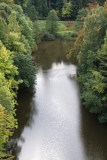
Confluence of the Berlebecke (right) with the Wiembecke |
||
| Data | ||
| Water code | EN : 4612 | |
| location | North Rhine-Westphalia , Germany | |
| River system | Weser | |
| Drain over | Werre → Weser → North Sea | |
| Headwaters | South of Holzhausen-Externsteine 51 ° 51 ′ 53 ″ N , 8 ° 54 ′ 11 ″ E |
|
| Source height | approx. 305 m above sea level NN | |
| muzzle | In the Berlebecke in Heiligenkirchen Coordinates: 51 ° 56 '47 " N , 8 ° 51' 12" E 51 ° 56 '47 " N , 8 ° 51' 12" E |
|
| Mouth height | approx. 120 m above sea level NN | |
| Height difference | approx. 185 m | |
| Bottom slope | approx. 10 ‰ | |
| length | 18.2 km | |
| Catchment area | 47.12 km² | |
The Wiembecke or Wiembeke is an 18.2 km long orographically left tributary of the Werre , or according to the traditional use of names, a right tributary of the Berlebecke in the Teutoburg Forest . The stream rises west of the Externsteine and joins the Berlebecke in Detmold - Heiligenkirchen . From here, the water is traditionally referred to as the Berlebecke, in the center of Detmold as the Bonebach, but hydrographically (GKZ and stationing) assigned to the Wiembecke, which according to this definition flows into the Werre in Detmold and is 700 m longer than this at the confluence.
geography

course
The Wiembecke rises north of the Barnackens on the northern flank of the Teutoburg Forest, which is part of the Rhine-Weser watershed . The Wiembecke flows over the Werre to the Weser, while waters that arise a few hundred meters further south-west ultimately flow into the Rhine . The Wiembecke is dammed up to a pond at the Externsteine .
A large part of the largely natural upper stream course is under nature protection within the framework of the NSG Wiembeck Valley over a length of 3.5 km from the source to the Horn-Bad Meinberg / Detmold city limits .
After the Externsteinen, the Wiembecke passes the small town of Horn-Bad Meinberg . Here it turns its course from the originally northeastern direction of flow to the northwest. Your further path leads you to the villages of Fromhausen and Hornoldendorf to Heiligenkirchen, where you at 158 m above sea level. NN takes up the Berlebecke coming from the south.
The Wiembecke overcomes an altitude difference of 185 m. It drains a 47.12 km² catchment area .
Tributaries
Looking downstream:
- Zangenbach - 4.7 km long, right tributary at 225 m above sea level. NN , catchment area: 4.267 km²
- Stadtgraben - 4.02 km long, right tributary at 200 m above sea level. NN
- Holzhauser Bach - 2.78 km long left tributary at 180 m above sea level. NN
- Hudebach - 0.67 km long, right tributary at 173 m above sea level. NN
- Amselbach - 0.37 km long, right tributary at 160 m above sea level. NN
(All length information according to the Land Survey Office North Rhine-Westphalia)
environment
Water quality
The entire course of the Wiembecke is classified as critically loaded to heavily polluted in quality classes II-III to III. Apart from its tributaries and diffuse pollutant inputs, the water is affected by the sewage from the Horn sewage treatment plant. In order to protect Hornoldendorf , Heiligenkirchen and Detmold from flooding , a flood retention basin is planned between Horn and Hornoldendorf.
Fish death
In 2004 there was a fish death in the Wiembecke. It was caused by runoff of fire fighting water when fighting a smoldering fire of wood waste on the premises of a wood processing company in Horn .
See also
Web links
- Nature reserve "Wiembecke (Werre)" (LIP-027) in the specialist information system of the State Office for Nature, Environment and Consumer Protection in North Rhine-Westphalia
Individual evidence
- ↑ a b NRW water portal Elwas with TK5
- ↑ a b NRW water portal Elwas with factual data query
- ^ Wolfgang Kramer: The river basin of the Oberweser. (= Hydronymia Germaniae, Volume 10). Wiesbaden 1976, p. 72.
- ↑ TIM online
- ↑ Topographic map 1: 25,000

