List of nature reserves in the Lippe district
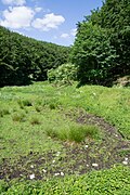
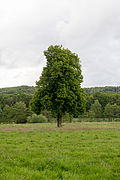
The list of nature reserves in the Lippe district contains the nature reserves of the Lippe district in North Rhine-Westphalia .
list
| Key no. | local community | Territory name | Area in ha | image |
|---|---|---|---|---|
| LIP-002 | Augustdorf | Ölbachtal with Augustdorfer dune field | 168.4737 |

|
| LIP-018 | Augustdorf | Gorges and moors on the upper Furlbach | 92.9690 |

|
| LIP-066 | Augustdorf | Eastern Teutoburg Forest | 2323.4736 |

|
| LIP-039 | Bad Salzuflen | Salt Valley | 60.9524 |

|
| LIP-040 | Bad Salzuflen | Glimketal | 72.1915 |

|
| LIP-041 | Bad Salzuflen | City forest | 142.6045 |

|
| LIP-042 | Bad Salzuflen | In the Masch | 23.3655 |

|
| LIP-043 | Bad Salzuflen | Bachtal near Grünau | 36.0067 |

|
| LIP-044 | Bad Salzuflen | Bexter forest | 49.4427 |

|
| LIP-045 | Bad Salzuflen | Holzhauser Bruch | 39.6981 |

|
| LIP-005 | Barntrup | Hedge and grassland complex on the Sonnenborn plateau and the Knappberg | 51.4681 |

|
| LIP-036 | Barntrup | Begatal | 502.2795 |

|
| LIP-054 | Barntrup | Forests near Blomberg | 561.9130 |

|
| LIP-071 | Barntrup | Valley of the Exter | 15.0357 |

|
| LIP-072 | Barntrup | Biotope complex at the mill tower | 9.3726 |

|
| LIP-051 | Blomberg | Headwaters of the Dorla | 10.6463 |

|
| LIP-052 | Blomberg | Marpetal with Passade and tributaries | 89.0834 |

|
| LIP-053 | Blomberg | Hurn | 226.6632 |

|
| LIP-054 | Blomberg | Forests near Blomberg | 561.9130 |

|
| LIP-055 | Blomberg | Valley system of the Königsbach | 208.8934 |

|
| LIP-056 | Blomberg | Beller wood | 103.9765 |

|
| LIP-015 | Detmold | Donoperteich-Hiddeser Bent | 118.8671 |

|
| LIP-023 | Detmold | Dörenschlucht | 26.0780 |

|
| LIP-024 | Detmold | Beech forest on the southeast slope of the Grotenburg | 2.4340 |

|
| LIP-066 | Detmold | Eastern Teutoburg Forest | 2323.4736 |

|
| LIP-087 | Detmold | Oetterbach | 108.5083 |

|
| LIP-088 | Detmold | Passade / Dorlatal | 150.5344 |

|
| LIP-089 | Detmold | Excavation of Retlager Bach | 11.6153 |

|
| LIP-090 | Detmold | Hasselbach / Schwarzenbrink / Heidemoor on the Kupferberg | 59.4980 |

|
| LIP-091 | Detmold | Berlebecke | 111.1652 |

|
| LIP-092 | Detmold | Valley of the Little Werre | 11.5847 |

|
| LIP-093 | Detmold | Wiembeck Valley | 24.9698 |

|
| LIP-036 | Dörentrup | Begatal | 502.2795 |

|
| LIP-070 | Dörentrup | Alt-Sternberg and Steinberg | 63.1136 |

|
| LIP-050 | Extertal | Hummerbachtal | 67.8778 |

|
| LIP-073 | Extertal | Valley of the Exter | 175.1484 |

|
| LIP-074 | Extertal | Rinnenberg | 53.1440 |

|
| LIP-075 | Extertal | Bremker Bachtal | 67.6061 |

|
| LIP-076 | Extertal | Almetal | 92.4911 |

|
| LIP-077 | Extertal | Juergensberg | 12.1705 |

|
| LIP-078 | Extertal | Siekbachtal | 97.3564 |

|
| LIP-079 | Extertal | Black Bach / Sellenbach | 192.9853 |

|
| LIP-080 | Extertal | Wettsteinsiek | 44.6527 |

|
| LIP-081 | Extertal | Heimbachtal | 102.2194 |

|
| LIP-004 | Horn-Bad Meinberg | Norderteich with Napte valley | 229.7166 |

|
| LIP-006K2 | Horn-Bad Meinberg | Egge-Nord (LIP) | 288.3124 |

|
| LIP-007 | Horn-Bad Meinberg | Externsteine | 126.5755 |

|
| LIP-020 | Horn-Bad Meinberg | Bielstein cave with hatch hole | 18.9343 |

|
| LIP-022 | Horn-Bad Meinberg | Sannenbruch | 6.1268 |

|
| LIP-027 | Horn-Bad Meinberg | Wiembeck Valley | 77.5556 |

|
| LIP-028 | Horn-Bad Meinberg | Silberbachtal with Ziegenberg | 139.0844 |

|
| LIP-029 | Horn-Bad Meinberg | Eggeosthang with Lippischer Velmerstot | 143.1713 |
|
| LIP-059 | Horn-Bad Meinberg | Beller wood | 358.5241 |

|
| LIP-060 | Horn-Bad Meinberg | Beech forest near Bellenberg | 87.6348 |

|
| LIP-011 | Kalletal | Bucket | 70.9680 |

|
| LIP-013 | Kalletal | Aberg-Herrengraben | 108.0159 |

|
| LIP-031 | Kalletal | Vineyard | 13.0574 |

|
| LIP-032 | Kalletal | Chisel excavation | 19.5511 |

|
| LIP-033 | Kalletal | Rotenberg, Bärenkopf, Habichtsberg and Wihupsberg | 381.7461 |

|
| LIP-034 | Kalletal | Rafelder mountain | 43.8584 |
|
| LIP-035 | Kalletal | Source area of the Osterkalle | 22.1223 |

|
| LIP-009 | location | Hardisser Moor | 29.9125 |

|
| LIP-023 | location | Dörenschlucht | 26.0780 |

|
| LIP-066 | location | Eastern Teutoburg Forest | 2323.4736 |

|
| LIP-069 | location | Spring areas and brooks on the Lohweg | 13.1265 |

|
| LIP-082 | location | Werreniederung and Haferbach | 51.9921 |

|
| LIP-083 | location | Oetterbach | 103.6831 |

|
| LIP-084 | location | Gruttbach and Sunderbach | 20.1626 |

|
| LIP-085 | location | Stadenhauser Mergelkuhlen | 18.2292 |

|
| LIP-086 | location | Excavation of Retlager Bach | 145.5012 |

|
| LIP-019 | Leopoldshöhe | Heipker See | 24.6415 |

|
| LIP-037 | Leopoldshöhe | Windwehetal | 56.3900 |

|
| LIP-038 | Leopoldshöhe | Goodness | 28.5631 |

|
| LIP-009 | Lemgo | Hardisser Moor | 29.9125 |

|
| LIP-036 | Lemgo | Begatal | 502.2795 |

|
| LIP-094 | Lemgo | Ilse | 141.67 |

|
| LIP-095 | Lemgo | Breda break | 88.79 |

|
| LIP-096 | Lemgo | Middle reaches of the Bega | 112.49 |

|
| LIP-097 | Lemgo | Biesterberg | 74.44 |

|
| LIP-098 | Lemgo | Passade Valley | 56.43 |

|
| LIP-099 | Lemgo | Oetterbach | 5.50 |

|
| LIP-021 | Lie | Emmertal | 390.5358 |

|
| LIP-030 | Lie | Emmertal (LIP) | 79.9565 |

|
| LIP-046 | Lie | Winzenberg | 19.4037 |

|
| LIP-047 | Lie | Schildberg | 122.7936 |

|
| LIP-048 | Lie | Bierberg | 31.6365 |

|
| LIP-049 | Lie | Ilsenbach | 43.1712 |

|
| LIP-063 | Lie | Schwalenberg Forest | 2924.6288 |

|
| LIP-064 | Lie | Forests near Blomberg | 605.4911 |

|
| LIP-002 | Oerlinghausen | Ölbachtal with Augustdorfer dune field | 168.4737 |

|
| LIP-016 | Oerlinghausen | Menkhauser Bachtal with Schopketal (LIP) | 16.0501 |

|
| LIP-017 | Oerlinghausen | Dry valleys, box valleys and dunes of the upper Westerholter Bach | 19.3712 |

|
| LIP-038 | Oerlinghausen | Goodness | 28.5631 |

|
| LIP-065 | Oerlinghausen | Menkhauser Bachtal with Schopketal | 7.8986 |

|
| LIP-066 | Oerlinghausen | Eastern Teutoburg Forest | 2323.4736 |

|
| LIP-067 | Oerlinghausen | Quarry on Barkhauser Berg | 6.2909 |

|
| LIP-068 | Oerlinghausen | Tönsberg | 45.1013 |

|
| LIP-010 | Schieder-Schwalenberg | Pond near Wöbbel | 2.7739 |

|
| LIP-025 | Schieder-Schwalenberg | Niese lowland with mouth area | 254.1735 |

|
| LIP-030 | Schieder-Schwalenberg | Emmertal (LP) | 79.9565 |

|
| LIP-063 | Schieder-Schwalenberg | Schwalenberg Forest | 2924.6288 |

|
| LIP-064 | Schieder-Schwalenberg | Forests near Blomberg | 605.4911 |

|
| LIP-001 | snakes | Strothe lowland | 95.8178 |

|
| LIP-003 | snakes | Snake Moor | 8.3717 |

|
| LIP-008 | snakes | Emkental | 20.7172 |

|
| LIP-057 | snakes | Senne north of Oesterholz | 17.9577 |

|
| LIP-058 | snakes | Oesterholzer Bruch with Schwedenschanze | 38.8250 |

|
| LIP-061 | snakes | Hollow stone cave | 0.1862 |

|
| LIP-062 | snakes | Schwedenschanze | 0.8073 |

|
| LIP-066 | snakes | Eastern Teutoburg Forest | 2323.4736 |

|
See also
- List of protected landscape areas in the Lippe district
- List of nature reserves in North Rhine-Westphalia
Web links
Commons : Nature reserves in the Lippe district - collection of images