
Brakel
| coat of arms | Germany map | |
|---|---|---|

|
Coordinates: 51 ° 43 ' N , 9 ° 11' E |
|
| Basic data | ||
| State : | North Rhine-Westphalia | |
| Administrative region : | Detmold | |
| Circle : | Höxter | |
| Height : | 135 m above sea level NHN | |
| Area : | 173.92 km 2 | |
| Residents: | 16,137 (Dec. 31, 2019) | |
| Population density : | 93 inhabitants per km 2 | |
| Postal code : | 33034 | |
| Primaries : | 05272, 05648 , 05276 , 05645 | |
| License plate : | HX, WAR | |
| Community key : | 05 7 62 016 | |
| LOCODE : | DE BKK | |
| City structure: | 13 boroughs | |
City administration address : |
Am Markt 12 33034 Brakel |
|
| Website : | ||
| Mayor : | Hermann Temme ( CDU ) | |
| Location of the city of Brakel in the Höxter district | ||
  |
||


Brakel is a town in the Höxter district in the east of North Rhine-Westphalia . It covers an area of around 174 km² and has around 16,500 inhabitants . The historical names Brakele, Bracle and Brabecke are used for the current place name.
geography
Geographical location
Brakel is located in the center of the Höxter district between Eggegebirge and Weser in the Oberwälder Land ( Nethegau ), 30 km east of Paderborn and 15 km southwest of Höxter . The city is located in the Teutoburg Forest / Eggegebirge nature park .
The urban area has great differences in altitude; the lowest point is at a height of 110 m, the highest point at 361 m.
geology

The bedrock in the urban area is largely determined by clay , marl , limestone and sandstones from the Middle Ages , which mainly originate from the Triassic . These sedimentary rocks are up to a kilometer thick here. During the course of the earth's history, they were lifted out and broken down into numerous saddles , hollows , ditches , clumps and clods .
Deeper is a solid rock plinth made of rocks from the ancient world ( Devonian , Carboniferous and Permian ). In the valley level of the Nethe, its tributaries and in the Brakeler Mulde, the bedrock is covered by loose rock from the Ice Age ( gravel , sand and loess ).
The largely karstified limestones of the lower and upper shell limestone, as well as the sands and gravels in the Nethetal and the Brakeler Mulde, are good aquifers. In the karstified limestones, the calcium sulphate content can be increased by inflows from gypsum-bearing layers, so that use as drinking water is not always possible.
In the Brakel urban area, mostly nutrient-rich, stony, shallow, loamy-clayey rendzines and rendzina brown soils predominate on knolls and mountain ridges . Very deep, silty - loamy parabroot soils developed on loess, which originated from the Ice Age and are mainly found on slopes and in hollows , which are preferably used for agricultural purposes. In the stream valleys ( gleye and gley brown soils) have developed through stream sedimentation, and grassland use predominates there.
Brakel is well suited for the use of geothermal heat sources by means of a geothermal probe and heat recovery through heat pump heating (see the adjacent map).
Expansion and use of the urban area
The city of Brakel, classified as a "small town", extends over an area of 173.74 km². The urban area has a maximum extension in east-west direction of around 14.7 km and in north-south direction of 18.9 km.
| Area according to type of use |
Agricultural schafts- area |
Forest area |
Building, open and operational space |
Traffic area |
Surface of water |
Sports and green space |
other use |
|---|---|---|---|---|---|---|---|
| Area in km² | 97.96 | 60.24 | 6.67 | 7.09 | 1.00 | 0.62 | 0.16 |
| Share of total area | 56.38% | 34.67% | 3.84% | 4.08% | 0.58% | 0.36% | 0.09% |
Neighboring communities
Brakel borders on the cities of Bad Driburg in the west, Nieheim in the north-west, Marienmünster in the north, Höxter in the north-east, Beverungen in the east, Borgentreich in the south-east and Willebadessen in the south, all of which belong to the Höxter district.
City structure

- Auenhausen (118 inhabitants), Frohnhausen (329 inhabitants) and Hampenhausen (42 inhabitants) are the highest villages in Brakel. These three villages are also known as Heggedörfer. The villages were first mentioned between 1142 and 1147. In the 12th and 13th centuries, the Gehrden monastery owned these villages.
- Beller : 205 inhabitants
- Bellersen (665 inhabitants) lies on the edge of extensive forests in the Rivendell. Bellersen is known as the "'model tourist village' of the state of North Rhine-Westphalia". Has Bellersen as "village as" in the Judenbuche of Annette von Droste-Hulshoff gained international notoriety.
- Bökendorf (769 inhabitants) celebrated its 1000th anniversary in 1965. The Bökerhof Castle was the center of the "romantics circle" with Annette von Droste-Hulshoff, the brothers Grimm , Clemens Brentano and Joseph Gorres and now houses a museum of literature. The Bökendorf open-air stage is one of the most popular stages in Germany.
- The forerunner of the village of Erkeln (554 inhabitants), a farm group, was first mentioned in the 9th century.
- The titular town of Gehrden (939 inhabitants) was first mentioned in 868. It is located in the Oesetal on the eastern slope of the Egge Mountains and is a tourist destination. The Benedictine Abbey, founded in 1141, had a great influence and several possessions in the Warburg region. The Romanesque monastery church has the largest historical bell ringing in Westphalia.
- Hembsen (959 inhabitants) was mentioned for the first time in the year 800 and is located in the middle of the wooded ridges of the Nethegau.
- Istrup (647 inhabitants) is located west of Brakel in the valley of the small river Aa .
- Rheder (282 inhabitants) is known for the castle (1750), the castle brewery Rheder (since 1686) and the church, which was built in 1716 by Johann Conrad Schlaun .
- Riesel : 577 inhabitants.
- Schmechten : 215 inhabitants
- Siddessen : 444 inhabitants
- Brakel: 16,713 inhabitants, of which in the city center: 9,874 inhabitants
(Population figures as of December 31, 2015)
climate
See: Climate in Ostwestfalen-Lippe
history
| Capitals and cities of the Principality of Paderborn until 1802/03 (as of 1789): |
|---|
| Paderborn , Warburg , Brakel , Borgentreich | Beverungen , Borgholz , Bredenborn , Büren , Driburg , Dringenberg , Gehrden , Calenberg , Kleinenberg , Lichtenau , Lippspringe , Lügde , Nieheim , Peckelsheim , Salzkotten , Steinheim , Vörden , Willebadessen , Wünnenberg |
Brakel was first mentioned around 836 by Benedictines as "Villa brechal". It is in the Nethegau . According to a document from 1213, Hermann von Brakel transferred his tithe income "ad ecclesiam Bracle". Brakel developed into a not insignificant trading town. In the 14th century was the Hanseatic city at the center of its height and was Bishopric of Paderborn passu with so-called capital of Paderborn , Borgentreich and Warburg , recognizable by its own judicial and market law.
Brakel's Hanseatic relationships go back to its early history up to the Middle Ages. The first documented settlement "villa brechal" (first written mention in 836 in connection with the transfer of the remains of St. Vitus from St. Denis near Paris to Corvey), later the seat of the Lords of Brakel in the 12th century , is due to two Old trade routes crossing there on the one hand in a central traffic situation, on the other hand the topography offered the possibility of expansion in the early Middle Ages. The long-distance traders played a decisive role in the development of Brakel from the very beginning, as can be demonstrated as the leadership class in many planned systems in Westphalian cities. The Hellweg line running through Brakel was thus the traditional economic basis for long-distance trade.
As the principal city of the Hanseatic city of Paderborn, Brakel became a member of the Hanseatic League and was involved in the Hanseatic trade at an early stage. In the 13th and 14th centuries in particular, it had developed into the Hanseatic cities of the Baltic Sea region. At the time (15th century), Brakel coins in the Baltic Sea area refer to this relationship. (Excerpts from the contribution Brakel as Hanseatic City by Ulrich Ernst as part of the Hanseatic city histories of the Westphalian Hanseatic League).
The general situation deteriorated in the 15th century. The Brede Monastery was founded in the outskirts .
The Thirty Years' War also left its mark on Brakel. In 1803 Prussia took over the city and made Brakel a district town. After temporary French administration, the district seat had to be finally ceded to Höxter from 1832 .
At the end of the Second World War , Brakel was taken without a fight on April 5, 1945 by US soldiers of the 16th US Infantry Regiment of the 1st US Infantry Division .
Religions


Due to its affiliation to the former bishopric of Paderborn, the majority of the population of Brakel is traditionally Catholic . The denomination of the Brakel students can be used as an indication of the distribution of religions. In the 2006/2007 school year, when asked about their denomination, 18.3% of the students said they were Protestant, 63.6% Catholic and 5.5% Islamic; 7.9% indicated another and 4.6% none at all.
There are 13 Catholic parishes in the urban area , which belong to the pastoral association of Brakeler Bergland and “Nethegau”, which are supposed to grow together to form a “pastoral area of Brakeler Land”. You belong to the deanery Höxter of the Archdiocese of Paderborn .
The parishes are St. Michael in Brakel, St. Meinolf in Bellersen, St. Johannes Nepomuk in Bökendorf, St. Katharina in Rheder and St. Marien in Riesel, St. Bartholomäus in Istrup, St. Bartholomäus in Frohnhausen (with the places Auenhausen and Hampenhausen), St. Peter and Paul in Gehrden, St. Agatha in Siddessen, St. Philippus and Jakobus in Schmechten, St. Petri in Erkeln and St. Johannes in Hembsen, St. Josef in Beller.

The Reformation entered Brakel around 1560 . In 1580 all believers had the Protestant creed. From 1602 to 1604 the agenda dispute raged against Bishop Dietrich von Paderborn with the result that Brakel submitted in 1611 and was completely re-Catholicized under Pastor Deppe. From 1831 the Capuchin Church was shared by the evangelical believers. The Protestant congregation was founded in 1844, and in 1912 it received its own church. The Resurrection Church belongs to the Paderborn parish of the Evangelical Church of Westphalia .
Incorporations
On January 1, 1970, the previously independent communities of Beller, Bellersen, Bökendorf, Erkeln, Hembsen , Hinnenburg , Istrup, Rheder, Riesel, Schmechten and the city of Brakel became a city due to the stipulation in the law on the reorganization of the Höxter district of December 2, 1969 Brakel joined together. The previous office of Brakel was dissolved.
On the basis of the law on the reorganization of the municipalities and districts of the Sauerland / Paderborn area (Sauerland / Paderborn law) of November 5, 1974, the Höxter district and the old district of Warburg were merged with effect from January 1, 1975. The until then independent communities Auenhausen, Frohnhausen, Hampenhausen, Siddessen and the city of Gehrden from the Dringenberg-Gehrden office were incorporated into the city of Brakel.
In the course of the reorganization, it was also under discussion to appoint Brakel as the district town of the new district. The geographical location in the middle of the new district was seen as a plus point for Brakel. The seat of the newly formed circle eventually became Höxter.
Population development
The following overview shows the population development of Brakel since 1975 in each area. The figures are official updates from 1975 onwards by the State Office for Information and Technology in North Rhine-Westphalia, statistics division . The figure for 1987 is a census result and the figures from 1990 onwards are updates based on the results of the 1987 census 1985 on the resident population and from this point on the population at the place of the main residence .

|
|
politics

City council
The following table shows the composition of the city council and the local election results since 1975 (only results with at least 1% of the vote).
| 2014 | 2009 | 2004 | 1999 | 1994 | 1989 | 1984 | 1979 | 1975 | ||||||||||
|---|---|---|---|---|---|---|---|---|---|---|---|---|---|---|---|---|---|---|
| Political party | Seats | % | Seats | % | Seats | % | Seats | % | Seats | % | Seats | % | Seats | % | Seats | % | Seats | % |
| CDU | 17th | 50.8 | 15th | 45.5 | 17th | 53.89 | 18th | 56.51 | 21st | 51.22 | 19th | 46.40 | 24 | 60.93 | 26th | 66.77 | n / a | 65.27 |
| SPD | 7th | 22.2 | 6th | 20.3 | 7th | 21.89 | 7th | 23.16 | 11 | 27.35 | 11 | 28.43 | 12 | 31.07 | 13 | 33.23 | n / a | 25.21 |
| UWG / CWG 1 | 4th | 14.1 | 4th | 12.1 | 5 | 14.61 | 5 | 14.56 | 4th | 11.75 | 6th | 14.56 | - | - | - | - | - | - |
| Future 2 | 1 | 2.0 | 3 | 10.8 | - | - | - | - | - | - | - | - | - | - | - | - | - | - |
| GREEN | 2 | 7.9 | 2 | 6.6 | 2 | 6.44 | 2 | 5.77 | 3 | 9.68 | 3 | 7.39 | 3 | 7.99 | - | - | - | - |
| FDP | 1 | 2.9 | 2 | 4.7 | 1 | 3.17 | - | - | - | - | 0 | 3.21 | - | - | - | - | - | - |
| Others 3 | - | - | - | - | - | - | - | - | - | - | - | - | - | - | - | - | n / a | 9.52 |
| Total 4 | 32 | 100 | 32 | 100 | 32 | 100 | 32 | 100 | 39 | 100 | 39 | 100 | 39 | 100 | 39 | 100 | n / a | 100 |
| voter turnout | 57.2% | 62.7% | 63.0% | 67.9% | 84.3% | 75.1% | 74.2% | 75.3% | n / a | |||||||||
|
1 Independent constituency / Christian constituency |
3 Voter group (s) currently unknown |
mayor
Hermann Temme (CDU, 64.3% of the valid votes) has been mayor since August 30, 2009. He was confirmed in office in the 2014 local elections with 71.7% of the valid votes.
Coat of arms, banner, flag and official seal
The city of Brakel was given a certificate from the District President Detmold dated December 19, 1974 to display the coat of arms, banners, flags and official seals.
Description of the coat of arms : In red between two silver (white) pointed towers connected by an ornamental gable, a green shield with three silver (white) posts, covered in the shield head by a red bar, which is covered with three golden (yellow) balls.
Meaning: The small shield with the gate gate, which appears on Brakel coins as early as 1227, is the coat of arms of the Lords of Brakel, who were the city lords until they died out in male line in 1268. On the south side of the town hall there is a coat of arms stone, probably from the 16th century, which only shows this shield of the Lords of Brakel. The Paderborn coat of arms manuscript of the 18th century also only contains this shield as the coat of arms of Brakel. Since the end of the 13th century, the town of Brakel has had a seal that contains the image given under “Description”. A seal that has been in use since 1316 is still kept in the city archive today. When the coat of arms was re-established in 1907, the city chose the seal stamp from 1316 as a model. The colors of the coat of arms of the Lords of Brakel correspond to the city colors, as the coat of arms colors of the extinct city rulers are not known. In this form, the coat of arms received royal approval on March 18, 1908.
Banner: Striped lengthways in green and white with the city's coat of arms in the middle of the upper half.
Flag: Green and white striped lengthways with the city's coat of arms shifted from the center to the pole.
Official seal: The seal is labeled STADT at the top and BRAKEL at the bottom. The seal picture shows the coat of arms in which the content of the city coat of arms is reproduced in outline.
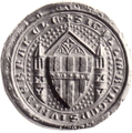
Historic seal from 1316
Today's official seal of the city

City arms

banner

Hoist flag


Town twinning
The city of Brakel has been twinned with the municipality of Wetteren in Belgium since 1971 . This is based on the 43rd Belgian artillery battalion stationed in the city until 1995. The partnership has been expanded and consolidated over the years through regular mutual visits.
The community of Zirkow on the island of Rügen Brakel has been linked in a partnership since 1991 . After initial working visits at administrative level to help with the introduction of local self-government, meetings between friendly associations are now taking place.
In addition, Brakel is a member of the New Hanseatic League of Cities .
military

On March 9, 1955, the British armed forces set up a radar station with a radome in the Auenhausen district near Borgentreich . The Bundeswehr Air Force took over this early warning location on April 1, 1959 and, from 1960 onwards, incorporated it into Flight Information Department 331, later to III. Abt / Fernmelderegiment 33 and I. Abt / Fernmelderegiment 34. In the 1980s the location belonged to Radar Guidance Department 15 in Borgentreich (until 1993). Today there is still a detached Technical Train 242 of the Air Force with 40 service posts , which, as a geographically remote location, is subordinate to today's Operations Area 2 of the Air Force and operates a phased array radar system of the type GM 406F for air defense.
From June 1966 to May 30, 1995 the artillery battalion 43A of the Belgian army with mobile anti-aircraft missiles of the type MIM-23 HAWK was stationed in the Maenhout barracks . This included the radar position in Rheder and anti-aircraft missile positions in Bosseborn , Bad Driburg , Tietelsen and Willebadessen .
Culture
theatre
From 1958 to 1963, and again since 1977, an adult and a children's play is performed on the Bökendorf open-air stage every year. The season is from late May to early September.
Museums
The local history and museum association maintains a city museum on the upper floor of the Haus des Gastes in Brakel. The development of the city from the Neolithic settlement to the present day is shown on around 100 m². The exhibits include Stone Age tools, ceramics, glass and metal finds and hymn books from the Jewish community.
The company FSB Franz Schneider , which manufactures fittings , operates a museum on its premises with objects from its own company history (e.g. models and motifs from advertising campaigns). A library for the history of design is attached to the museum.
The Rheder Hussar Museum has existed since 2003 and is located in the outer bailey of Rheder Castle. The uniforms and equipment of the blue hussars from Paderborn and Neuhaus Castle from the 19th and 20th centuries are shown here. There are also exhibits from the imperial era and from the 18th century.
The Urdorf Museum in Bellersen shows an exhibition about the Teutons 2000 years ago. The village museum is also housed in the half-timbered house.
The model federal railway, which opened on May 26, 2018 , shows as an H0 model railway layout (1:87) the operation of the German Federal Railroad in and around Ottbergen in the summer of 1975 , the locomotive exchange station for the heavy steam locomotives class 44 in the Weser Uplands . In addition to the Ottbergen and Bad Driburg train stations, there are some Brakel motifs such as the Nethe bridge at the boathouse and the Schäferhof. In the next ten years, the model federal railway is to be expanded in three construction phases to a layout area of up to 300 m².
music
In Brakel there are two fanfares, three choir communities, four marching bands and five other bands and clubs.
The Summer City Beats music festival has been taking place annually in Brakel since 2011 .
Buildings

The Alte Waage am Markt was built around 1350 as the seat of the Knights of Modexen. The gable is built in Gothic forms. In 1479 the building was pledged to the city and in 1553 it became their property. The city scales were housed here until 1840 . In 1868 the building was restored and the upper floors, which previously served as a granary, were converted into apartments. The first floor was initially used as a fire station. The council meeting room, city archive and exhibition rooms have been housed in the building since 1980.
The octagonal Annenkapelle was built in 1719. Hermann Ludwig von Asseburg, Drost and Edelherr zu Hindenburg, vowed to build this chapel together with his wife Odilie Elisabeth von Haxthausen from Welda. After his death, his wife Maria Elisabeth zu Schell had the chapel built from Rechen. It serves as a station for the annual Anne procession, which has been celebrated since July 21, 1700.

The Mariae Opferungstal monastery in Brede was founded in 1483. The brothers Bernhard and Dietrich von Asseburg provided land and financial means for this purpose. In 1490 Bishop Simon von Paderborn confirmed the foundation of the Augustinies . Later on, the poor School Sisters of Notre Dame ran various schools. The monastery has meanwhile been dissolved; The building houses the Brede schools , a private grammar school, a vocational college and a secondary school under the sponsorship of the Brede Schools Foundation of the Archdiocese of Paderborn .

The parish church of St. Peter and Paul is the former collegiate church of the Benedictine convent of Gehrden, which was founded in 1142. The church was built between 1150 and 1190 as a Romanesque pillar basilica. Their furnishings are baroque. The ringing of bells is considered to be the largest in Westphalia. In the second half of the 17th century the baroque monastery buildings were restored. In 1810 the monastery was closed, sold to Count Bocholtz and converted into a castle. The castle was used as a family rest home until 2011 and is now a 4-star hotel.
The Hinnenburg is located on a hilltop north of Brakel and was first mentioned in a document in 1237. It was initially the seat of the knight Berthold von Brakel and later fell into the possession of Burchard von der Asseburg. The buildings were renovated in the 17th and 18th centuries. The main Renaissance building is three-story with a corner tower in the south.

The Capuchin Church was built between 1715 and 1718 as the first work by Johann Conrad Schlaun . In 1645 the Capuchins came to Brakel and initially used the hospital church for church services. Prince-Bishop Franz Arnold von Wolff-Metternich zur Gracht commissioned Schlaun to rebuild the church. The Provincial of the Capuchins rejected a first draft by Schlaun, so that the baroque facade of the church is kept rather simple. The coat of arms of the bishop can be seen above the portal of the church.
The Catholic parish church of St. Michael is a hall church with a retracted rectangular choir. During the restoration in 1998 it was found that the first church already existed in the ninth to twelfth centuries. The current Romanesque church was built by Werner von Brakel as a pillar basilica with a single-nave transept and three apses . In the 14th century the apse was demolished and replaced by a Gothic high choir. The roof of the tower was also Gothicized. In 1517 the church burned down and the south aisle was rebuilt. In the 19th century the tower was demolished and a new one was built. There is evidence of an organ in the church as early as 1349. Today's organ is decorated with four oil paintings by the Brakel painter Johann Georg Rudolphi . A pulpit from 1622, the stone high altar from 1748 and a tombstone belonging to the von Asseburg and Haxthausen families are also part of the furnishings.

The Modexer waiting , even Modexer tower called a first time in 1383 mentioned earlier is Wartturm northeast of Brakel. It served as a guard between the Landwehr and the city of Brakel. The name is based on the Modexen court group, which fell in the middle of the 14th century. After several renovations, the 12.6 m high tower now serves as a lookout tower .

The town hall dates from the 13th century. The stepped gable is pierced by four- passes; the southern portal is built in the Renaissance style and bears the year 1573. It is provided with a basket arch and ornate cuboid border.
The Gothic Roland column on the market square was built in the 14th century and measures 5.45 meters in height. It showed the market rights of the city of Brakel and was later used as a pillory .

The Rheder castle was in 1750 as Wasserburg built. In the simple mansion, the rococo rooms are decorated with stucco. In the central hall there are mythological representations on the ceiling and family portraits on the walls. A Chinese wallpaper from 1770 has been preserved in a cabinet. During this time, Burchard von Mengersen also had the farm buildings renewed by Johann Conrad Schlaun. At the beginning of the 1970s, the roof was re-covered with Weser sandstone slabs and the buildings re-plastered. Today there is a small hussar museum in the outer bailey and a brewery since the 18th century.
Parks and natural monuments
The Abbenburg estate park is a private, not publicly accessible, historical landscape park of around 1 hectare in size. Annette von Droste-Hülshoff described the state of the garden in the first half of the 19th century as follows: “About 200 paces from the house (on the quiet side) a very high and wide arcade, broken off in the middle, where there is a wonderful stone linden tree Tables and benches around them. ”To the east of the manor house, this area is adjoined by a meadow surrounded by deciduous trees and conifers and a pond. Another area south of a quarry stone wall, which could have been a castle wall, was probably cultivated as a kitchen garden. The area of the estate described by Annette von Droste-Hülshoff is still clearly recognizable as a hill next to a linden tree. Some hornbeams, which probably belonged to the remainder of the arcade, are still present. The eastern garden area, like the areas near the house, is well maintained. However, the area around the pond is overgrown.

The Gutspark Bökerhof is a private historical Gutspark of about 3 ha size and publicly available. There are first indications of a garden in the second half of the 18th century. A few old beeches , chestnuts , spruce trees , elms and a stately plane tree on the castle meadow are preserved evidence of the time of origin. The historic arcade that delimits the park over a length of several hundred meters on the northern and western edges should be emphasized. It is mostly planted with hornbeams , which have been pruned to form a dense canopy of leaves. This arcade originally also delimited the southern area of the park. In a square in front of the manor house, a round lawn was laid out with an enclosure made of boxwood and spherically cut boxwood .
The Gutspark Hainhausen is a private, not publicly accessible, historic landscape park of about 3 ha size. Baroque garden sculptures depicting dwarfs and plant bowls on pedestals from the former baroque garden at Hinnenburg Palace were placed along the access road to the estate . The garden is characterized by wide lawns with deciduous shrubs and conifers as well as an oak willow with old solitary trees.
The Hinnenburg Palace Park is a private landscape park originally 15 hectares in size. The outside area of the castle complex is accessible to the public via hiking trails. The complex is now mainly forested and therefore only archaeologically verifiable. In the upper area, which is kept free and is now used as pasture, the former baroque garden terraces are still visible as steps.
The Kaiserbrunnen spa park is around 18 hectares and is open to the public. The park includes a sulphurous mineral spring that has been known since the 18th century and was created after a failed economic exploitation of the spring and extensively expanded in 1913. The fountain house was built in the early 1960s. There are circular paths around two larger ponds, a forest restaurant with an outdoor terrace and a children's playground. The western part of the park beyond Brunenallee is called Kaiser-Wilhelm-Hain . The memorial stone was erected in 1908 by the community in honor of Kaiser Wilhelm II. He had pitched his tent here during the imperial maneuver in 1907.

The Rheder Landscape Park, which is 8 hectares today, belongs to the privately owned castle of the same name . Areas near the castle are not open to the public. The main feature of the park is a wide line of sight on the garden side of the castle. The park is essentially determined by the alternation of wide areas with two ponds and dense trees. There are numerous paths and stairs. The park has been a designated Sieseberg nature reserve since 1949 .
The processional complex, which is several hundred meters long, is open to the public. The path to the Katharinenberg is flanked by an avenue with chestnuts and linden trees.
The Gehrden Castle Park is around 2 hectares and is open to the public. It was built at the beginning of the 19th century in the north of the palace on the basis of a previously existing monastery kitchen garden and essentially consists of a small pond with a grotto as design elements. A sycamore elm and other solitary trees have been preserved, especially a hanging beech , a copper beech and a sycamore maple . Particularly noteworthy is the so-called "twelve apostle linden", the third oldest linden tree in Germany today, which has been preserved from the early days of the monastery. According to tradition, in the 13th century, symbolically for the 12 apostles, nuns planted the same number of young linden trees so close together that a single tree was formed from them. Today the linden tree has a trunk circumference of about 8 m and a crown diameter of more than 30 m. Only one of the original twelve individual strains has not been preserved. The park was extensively redesigned in the 1960s.
Sports
The local soccer club SpVg Brakel played several seasons in the Oberliga Westfalen in the 1990s . In the 2017/18 season, the first team plays in the national league . The soccer players of SV Bökendorf were promoted to the third-class Regionalliga West in 2018 .
In addition, the DJK-Brakel offers many sports for children and young people, but also adults, from ball sports to athletics and rehabilitation . The first team of the women in the table tennis department of the DJK plays in the Oberliga NRW in the 2019/2020 season. The inline skater hockey club Brakel Blitz plays with its first team in the Landesliga Westfalen of ISHD and also offers championship teams for women and all youth age groups.
Two triple sports halls and several smaller halls as well as sports fields are available for mass sports. Other sports facilities in the city include an archery range, canoeing on the Nethe, two mini golf courses, four riding arenas, a cross-country ski run and several tennis courts. Indoor and outdoor pools complete the offer.
Regular events
The Annentag in Brakel is the largest city fair in Weserbergland , which takes place every year on the weekend of the first Sunday August.
Culinary specialties

Beer has been brewed in Schloss Rheder since July 2, 1686. For the Schloßbräu Rheder , water is obtained from the Sieseberg nature reserve. In addition to the Pils, tasty bock beers and the hussar drink , an anniversary beer whose name alludes to the Prussian hussar regiment no. 8 , are brewed.
Infrastructure and economy
Due to its central location in the district, Brakel has been able to develop strongly economically in recent years and is now one of the most successful cities in the region. Income growth and the reduction in unemployment are above average compared to cities of comparable size.
traffic
Brakel lies at the intersection of federal highways 64 ( Münster - Paderborn -Brakel Holzminden - Seesen ) and 252 ( Ostwestfalenstraße ) ( Blomberg -Brakel- Korbach - Marburg ).

The Brakel train station (Kr. Höxter) is on the Altenbeken – Kreiensen railway line . The route is served every hour by the RB 84 "Egge-Bahn" Paderborn - Ottbergen - Holzminden - Kreiensen . As a rule, a part of the train from Ottbergen continues on the Sollingbahn and branches off in Bodenfelde onto the Oberweserbahn to Göttingen .
The local rail passenger transport is carried out by the NordWestBahn , which uses Bombardier Talent multiple units corresponding to the DB class 643 for speeds of up to 120 km / h. The "Hochstift tariff" ( local transport association Paderborn-Höxter ) applies to all local public transport and the NRW tariff applies to all tariff areas .
media
At daily newspapers appearing Neue Westfälische and Westfalen-Blatt , they report, six days a week on local events. The cover edition of both newspapers is obtained from the respective main editorial offices from Bielefeld . In addition, the magazine Die Warte for the districts of Paderborn and Höxter appears quarterly in the Hochstift Paderborn and Corveyer Land with articles on regional history, literature and art.
Brakel belongs to the reporting area of the regional studio Bielefeld of the WDR . In the area of the former Hochstift Paderborn , to which Brakel also belonged, there has been the radio station Radio Hochstift since 1991, which deals in particular with regional topics and has a higher share of listeners compared to the national broadcasters (e.g. WDR).
Public facilities

The jurisdiction in the city of Brakel is represented by the Brakel District Court .
The city of Brakel has an indoor pool and a summer pool. A youth leisure center is housed in the former Catholic parish hall.
The volunteer fire brigade in Brakel is divided into the fire brigade in the city center and 13 fire fighting groups in the districts. In the core city are command vehicle , a Löschgruppenfahrzeug , a pumper , a rescue truck , a ladder , a hose trolley , a trolley Logistics, a portable pump vehicle and a crew transport vehicle available.
education
The city offers all types of schools. There is a primary school with two locations in the urban area. A comprehensive school, a secondary school ( Realschule Brede ). Two grammar schools (the municipal Petrus-Legge grammar school (expiring) and the grammar school Brede , a private Catholic school), two vocational colleges (Kreisberufskolleg Brakel with vocational schools, technical schools, technical colleges and a vocational grammar school as well as the vocational college of Brede , which is a vocational school for Economy and administration). And three special schools, the Adolph Kolping School, a private special school of the Kolping Schulwerk with a special focus on learning, in the area of secondary level I , the Brothers Grimm School with the special focus language of the Höxter district, and the von Galen School in Frohnhausen district, a private special needs school, sponsored by Lebenshilfe for people with intellectual disabilities, schools and homes gGmbH Brakel.
In 2007, a total of 3429 students were taught at the city's schools with 228 teachers, of which 23.9% at elementary schools, 15.3% at Hauptschule and 14.5% at Realschule, 41.0% at grammar schools as well 5.2% in special schools. In addition, is located in Brakel, the Kolping - Berufsbildungswerk with integrated vocational school, a training center for disadvantaged youth.
The former Benedictine convent Schloss Gehrden is used today by the Catholic Family Association in the Archdiocese of Paderborn and the Archdiocese and Diocesan Caritas Association of Paderborn as an adult education center.
Established businesses
Mainly medium-sized handicraft companies and companies in metal, glass, wood and plastics processing are located in Brakel.
The Schaumstofftechnik Schulze presents since 1967 Microphone windshield for well-known manufacturers such as Sennheiser ago. The product portfolio also includes wind protection with a logo for the public broadcasters. The product range also includes insulation material for the automotive industry.
Franz Schneider Brakel (FSB) and his 600 employees manufacture handles and handles, for example for the Turning Torso in Malmö and the James-Simon-Galerie in Berlin.
The Catholic Hospital Association Weser-Egge (KHWE) has its administrative headquarters in Brakel. In addition, the KHWE operates the St. Vincenz Hospital in Brakel. The orthopedic-rheumatological specialist hospital is part of the Weser-Egge Clinic.
Personalities
Honorary citizen
The following citizens have been granted honorary citizenship (the leading number indicates the year of the award):
- 1930: Beda Kleinschmidt (1867–1932), Franciscan, "Eggepater"
- 1932: Petrus Legge (1882–1951), Bishop of Meissen
- 1926: Johannes Meyer (1843–1931), businessman and city councilor
Honorary citizen of the formerly independent municipality of Rheder
- 1924: Adolf Freiherr Spiegel von und zu Peckelsheim (1875-?), Economist and brewery owner, captain in World War I
sons and daughters of the town


In Brakel were born:
- 1593: Hermann Goehausen , Professor of Law
- 1633: Johann Georg Rudolphi , painter
- 1780: Werner von Haxthausen , civil servant and philologist
- 1792: August Franz von Haxthausen , agricultural scientist, national economist, lawyer, farmer, writer and folk song collector
- 1914: Moses Flechtheim , grain wholesaler in Brakel and Münster
- 1867: Julius Theodor Kleinschmidt , Franciscan
- 1882: Petrus Legge , Bishop of Meissen, Nazi victim, brother of Theodor Legge
- 1889: Theodor Legge , general secretary of the Bonifatiusverein and the German Katholikentage, Nazi victim, brother of Petrus Legge
- 1926: Hubert Löneke , sculptor
- 1943: Paul Kersten , writer and radio editor
- 1947: Johannes Weinrich , terrorist, member of the Revolutionary Cells
- 1948: Thilo Graf Rothkirch , film producer, screenwriter and director *
- 1949: Horst-Dieter Krus , author, local history researcher and archivist
- 1950: Joachim von Braun , agricultural scientist, president of the Pontifical Academy of Sciences
- 1961: Michael Wollitz , soccer player
- 1962: Jürgen Herrmann , politician (CDU) and member of the Bundestag
- 1965: Claus-Dieter Wollitz , soccer player and coach
Connected to the city
- Albert Florath (1888–1957), German actor, lived in Brakel and went to school here
- Herbert Engemann (1923–2016), German educator, historian and author. He published many articles on history and is a co-initiator of the city museum.
- Konrad Beikircher , born 1945, cabaret artist, musician and author. As part of his training as a prison psychologist, he attended a course in the former Brakel legal training facility, which existed from 1973 to 2003. On the occasion of a cabaret evening in the Paderhalle Paderborn , he began by talking about the character of the Westphalians and the drinking habits in an inn in Brakel.
- Joachim von Braun , born in Brakel in 1950, related to the house of Graf Asseburg (noble family) , German agricultural scientist, various director positions in research institutions and president of the Pontifical Academy of Sciences . He spoke in 2006 at the Brakel Business Day.
Literary mention by the Brothers Grimm
The fairy tale of the Bremen Town Musicians is said to have been given to the Brothers Grimm in Brakel, who spent a summer there at the Bökerhof at the invitation of the Baron von Haxthausen . It is well known that the musicians never arrived in Bremen because they had chased away the robbers and then settled in their house. The robber house is said to have stood between Brakel and Bosseborn. There is a photo of this Kotten in the city archives and a stone monument of the Bremen Town Musicians stands nearby today.
The Low German fairy tale Dat Mäken by Brakel is also related to Brakel.
literature
- Urban history working group: Brakeler street names - history and meaning. In: Brakeler Schriftenreihe, issue 20/2006, publisher. Brakel Heimat- und Museumsverein
- Bernhard Junker: The Paderborn Monastery: Portrait of a region . Ed .: Josef Drewes. Paderborn 1997, ISBN 3-506-95293-5 , p. 309-319: Brakel .
- Heinz Stoob: Brakel city folder . In: Heinz Stoob , Wilfried Ehbrecht (ed.): Westphalian city atlas . Volume I, 4th part. Dortmund / Altenbeken 1975, ISBN 3-89115-331-7 (on behalf of the Historical Commission for Westphalia and with the support of the Westphalia-Lippe Regional Association).
- Franz Schneider (Ed.): Annentag in Brakel. A German folk festival . König, Cologne 1992, ISBN 3-88375-157-X .
- Herbert Engemann, Ulrich Ernst: National Socialism and Persecution in Brakel: Documentation and Commentary . City of Brakel, Brakel 1988, ISBN 3-926971-00-2 .
- Vivat Clemens August! Paderborn glass art of the 18th century. The Emde glassworks near Brakel . Paderborn 2000, ISBN 3-88789-136-8 .
- Advanced course in the history of the municipal grammar school: Brakel - small historical city guide . Home u. Tourist office Brakel, Brakel 1983, ISBN 3-9809107-9-2 .
- Arnold Beuke, Theodor P. Nolte (preface): 1748 - One year in the city of Brakel . Ed .: Dirk Brassel, Jürgen W. Braun, Ralph Becker. City of Brakel, Brakel 1999, ISBN 3-926971-02-9 .
- Anna Bálint: Brakel. A city portrait . City of Brakel, Brakel 2002, ISBN 3-926971-02-9 .
Web links
- Website of the city of Brakel
- Document registers from the Brakel city archive / digital Westphalian document database (DWUD)
- Brakel in the Westphalia Culture Atlas
Sources and Notes
- ↑ Population of the municipalities of North Rhine-Westphalia on December 31, 2019 - update of the population based on the census of May 9, 2011. State Office for Information and Technology North Rhine-Westphalia (IT.NRW), accessed on June 17, 2020 . ( Help on this )
- ↑ Geological Service of North Rhine-Westphalia, Geoscientific community description Brakel ( Memento from February 14, 2015 in the Internet Archive )
- ↑ Geological Service NRW: Using geothermal energy - Geothermal study provides planning basis ( Memento from September 14, 2005 in the Internet Archive ) (PDF; 369 kB)
- ^ A b State Office for Data Processing and Statistics North Rhine-Westphalia : Brakel municipal profile
- ^ Culture model village Bökendorf
- ↑ localities
- ↑ Data, figures, facts
- ↑ Heinrich Gottfried Gengler: Regesten and documents on the constitutional and legal history of German cities in the Middle Ages. Erlangen 1863, pp. 266-270. (books.google.de)
- ↑ State Office for Data Processing and Statistics: Students at general education schools in North Rhine-Westphalia according to religious affiliation
- ^ Ministry of the Interior of the State of North Rhine-Westphalia, Citizens Service: Law on the reorganization of the Höxter district
- ↑ Martin Bünermann: The communities of the first reorganization program in North Rhine-Westphalia . Deutscher Gemeindeverlag, Cologne 1970, p. 107 f .
- ^ Ministry of the Interior of the State of North Rhine-Westphalia, Citizens Service: Sauerland / Paderborn Law
- ^ State Office for Information and Technology North Rhine-Westphalia, Statistics division: State database North Rhine-Westphalia
- ^ Landesbetrieb Information und Technik NRW: Special series on the 1987 population census in North Rhine-Westphalia, Volume 1.1: Population, private households and employed persons . Düsseldorf 1989, p. 110.
- ↑ State database NRW; Election results for the municipality code 05762016
- ↑ State Office for Data Processing and Statistics: Local elections
- ↑ Brakel Council Information System
- ^ Certificate of approval from the District President Detmold dated October 6, 1977 (PDF; 89 kB)
- ^ City of Brakel: twin cities
- ↑ Overview of locations in NRW (PDF). (PDF) October 2011, accessed May 7, 2014 .
- ↑ The old radar antenna set up again
- ↑ husaremusem.de
- ↑ brakel.de
- ↑ exhibition
- ↑ NW New domicile Modellbundesbahn
- ↑ / City of Brakel new building
- ↑ BILD Modellbundesbahn
- ↑ Modexer Warte on warttürme.de
- ↑ The architectural and art monuments of Westphalia . Volume 37: Höxter district. 1914, pp. 37-53.
- ^ Regional Association Westphalia-Lippe: Gutspark Abbenburg in LWL GeodatenKultur
- ^ Regional Association Westphalia-Lippe: Gutspark Bökerhof in LWL GeodatenKultur
- ^ Regional Association Westphalia-Lippe: Gutspark Hainhausen in LWL-GeodatenKultur
- ^ Regional Association Westphalia-Lippe: Hinnenburg Castle Park in LWL Geodata Culture
- ^ Regional Association Westphalia-Lippe: Kurpark Kaiserbrunnen in LWL-GeodatenKultur
- ↑ Landschaftsverband Westfalen-Lippe: Landschaftspark Rheder in LWL-GeodatenKultur
- ↑ Landschaftsverband Westfalen-Lippe: Procession facility Katharinenkapelle in LWL-GeodatenKultur
- ^ Regional Association Westphalia-Lippe: Gehrden Castle Park in LWL Geodata Culture
- ↑ Westfalen Blatt :, accessed on October 21, 2019.
- ↑ brakel.de
- ↑ kolping-schulwerk.de
- ↑ brothers-grimm-school-brakel.de
- ↑ vgs-brakel.de
- ↑ kbbw-brakel.de
- ↑ kolping-schulwerk.de
- ↑ FSB from Brakel opens doors worldwide. Neue Westfälische, accessed on September 4, 2013 .
- ↑ kunstwerk-brakel.de
- ↑ brakel.de
- ↑ Urban history working group: Brakeler street names - history and meaning. Brakeler Schriftenreihe, issue 20, 2006, p. 82
- ↑ wz.de: Konrad Beikircher: "Westphalia and Rhinelander - that's simply a genetic difference" , August 5, 2016.
- ↑ Brake Agrar: Keynote speakers and topics at the Brakel Business Day , accessed on April 5, 2020
- ↑ brakel.de
Bad Driburg | Beverungen | Borgentreich | Brakel | Höxter | Marienmünster | Nieheim | Steinheim | Warburg | Will bath food
Auenhausen - Frohnhausen - Hampenhausen | Beller | Bellersen | Bökendorf | Brakel | Erkeln | Gehrden | Hembsen | Istrup | Rheder | Trickle | Schmechten | Siddessen