Achim (Verden district)
| coat of arms | Germany map | |
|---|---|---|

|
Coordinates: 53 ° 1 ' N , 9 ° 2' E |
|
| Basic data | ||
| State : | Lower Saxony | |
| County : | Verden | |
| Height : | 15 m above sea level NHN | |
| Area : | 68.01 km 2 | |
| Residents: | 31,923 (Dec. 31, 2019) | |
| Population density : | 469 inhabitants per km 2 | |
| Postal code : | 28832 | |
| Area code : | 04202 | |
| License plate : | VER | |
| Community key : | 03 3 61 001 | |
| LOCODE : | DE ACM | |
| NUTS : | DE93B | |
City administration address : |
Obernstrasse 38 28832 Achim |
|
| Website : | ||
| Mayor : | Rainer Ditzfeld (independent) | |
| Location of the city of Achim in the Verden district | ||
Achim ( ) is the largest city and an independent municipality in the district of Verden in Lower Saxony ( Germany ). Located southeast of Bremen , it is often referred to as Achim near Bremen .
geography
Achim is located in the Central Weser lowlands on the edge of the Achim-Verden Geest . In the vicinity of the city there are natural moors.
City structure
The city is divided into two localities and seven districts (population on January 1, 2012 in brackets):
|
Locations : |
Districts : |
Baden mountains
The Baden mountains are located in the village of Baden , a district of Achim. The landscape is characterized by marshland on the Weser west of the city, up to 40 m high dune elevations and the Badenermoor in the west. Up until the 19th century the area was only sparsely populated and the inhabitants lived from growing potatoes , raising sheep and from workshops that were moved here from the city of Bremen. Hans Höppner was able to identify around 200 of the 250 known bee species in Germany in the years 1898 and 1900 in the mountains of Baden . Around a hundred years later, according to Riemann, there were only 130 species of bees left.
Former military installations
The Baden oil store was part of a bunker system dating from the First World War . It was built in 1917 and served as a transshipment point for crude oil , heating oil and fuel . Fourteen underground containers were created, but the last two containers were scrapped. During the Weimar Republic , the oil warehouse was rented to oil companies. As part of the remilitarization of Germany before the Second World War , the oil storage facility was expanded and expanded (approx. 36 tanks). Because the camp was undamaged after the end of the war, it was blown up by British occupation troops in 1946.
The area became a military training area for the Bundeswehr . The combat exercises and tank rides had a serious impact on the vegetation . Similar to other military training areas, a typical sand-heather landscape was created. As a result of the extensive settlement by the neighboring community of Baden in the 1970s and 1980s, more and more rubbish such as garden waste and animal faeces came into the forest-heather area. New garden plants displaced parts of the flora . In 2003/04 151 different plant species could still be detected in the oil store. The Steuben barracks and the associated oil store training area were closed in 2003. The area will now become an urban forest and settlement area for living, sport and business.
history
Prehistory and early history
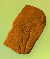
Prehistoric finds and large stone graves from the Stone Age that were destroyed in the 19th century indicate an early settlement. During excavations as part of the laying of the Northern European natural gas pipeline through Lower Saxony in 2011/12, a storage area for Stone Age groups of hunters and gatherers was discovered near Bierden under a Bronze Age settlement . An early Mesolithic stone device was found there , which was named Venus von Bierden because of its engraving . The find is exhibited in the Lower Saxony State Museum in Hanover .
In the Neolithic Age , members of the funnel cup culture erected five large stone graves near Achim and Bierden , but they were removed in the 19th century.
After the end of the Great Migration , the Saxons settled in the area . The dominant height of the Lindenberg south of Bremen, on which the old Arahem leaned, was a pagan place of worship and court. Achim was the meeting place of a Saxon Hundreds Court (later Gogerichts ) in the Gow Wigmodien .
middle Ages
After the Christianization by Charlemagne , Achim became part of the Archdiocese of Bremen . In 1013 today's district of Baden was mentioned in a document, in 1059 Bierden and Achim in 1091 for the first time as Acheim or Arahem . Here the Archbishop of Bremen and his entourage held court over the Hoya nobleman Gerhard von Stumpenhusen. In Achim, the Christian mission built a baptistery in the 12th century. Today's St. Laurentius Church, begun in the Romanesque style and later extended in Gothic style, was first mentioned in a document in 1257.
Since 1226, the Vogt of Langwedel Castle was the administrator of the region. Around 1450 the free farmers of Achim and the surrounding area elected their own court lord, the Gohgrefen. This office was exercised by members of the Clüver family until the end of the Thirty Years' War . The place of justice was on a linden tree-lined wurt near the church. In the course of the War of the Lüneburg Succession , Achim was set on fire in 1381 by fighting between Duke Albrecht of Saxony-Wittenberg and Prince Archbishop of Bremen, Albert II .
1600 to 1712
In the Thirty Years' War the place Achim suffered great damage. In 1626 the army of the Danish king Christian IV camped on the edge of the village . A powder truck caught fire and exploded, and the flying sparks set the place on fire. In the end there were only two houses and the stone church.
Since 1648 Achim was part of the Swedish-ruled Duchy of Bremen . The freely elected Gohgrefe was deposed and replaced by a Swedish official. The former Archdiocese of Bremen and the Diocese of Verden continued to be administered as "the Duchies of Bremen and Verden".
1719 to 1866 Hanoverian period
In 1712 the Danes occupied the Duchy of Bremen. The Elector of Hanover bought the duchies from them and the Swedish crown in 1715 and 1719 respectively. During the Seven Years' War and the Napoleonic Wars, the duchies were subject to changing occupations until they were incorporated into the Kingdom of Hanover at the Congress of Vienna in 1814 .
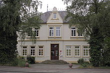
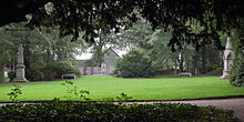
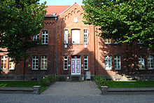
During the Hanover period, a house was purchased in 1782, which was subsequently used as an office building, as well as the construction of the prison in 1789 and an increase in the size of the prison in 1835, known as the gate house. While the gate house and the remise of the office building were preserved, the office building, later called the district councilor, was demolished in 1976. The “new town hall” built in 1993 is located here today. From 1989 to January 2015, the city library was located in the remise of the office building. The old town hall, a villa bought in 1929, is now the seat of the local court. The park by the old town hall has been used as a generation park since 2008 and offers visitors space for sports and games.
One of the reforms in the Kingdom of Hanover in 1852 was the separation of administration and justice; the Gohgericht became the district court, and the Achim office was headed by a governor.
The Achimers experienced the beginning of industrialization in 1847 with the construction of the Bremen - Wunstorf (Hanover) railway line. Due to its favorable location, Achim initially got a breakpoint, which was followed by the construction of the station building in 1852/53. In 1865 the first stationary steam engine found its way into the newly built steam mill. Up until this point in time, Achim was still a purely farming village in which the population mainly lived from agriculture.
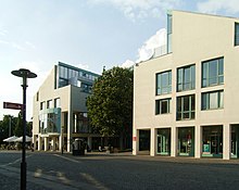
In 1854 the Kingdom of Hanover, in contrast to the nearby Hanseatic city of Bremen, joined the German Customs Union in 1833. Now there was better economic development. Due to the imposed duty, the tobacco products manufactured in Bremen became more expensive for export to the states of the Zollverein. The Bremen cigar manufacturers reacted to this disadvantage by relocating their factories to other Hanoverian countries. Achim became a stronghold of cigar production and remained so until the beginning of the 20th century. After a corresponding renovation, one of the first factory buildings is now the Paulsberg elementary school. Today we think twice about the heyday of tobacco processing in Achim. The cigar maker monument is in the pedestrian zone in front of the town hall and the sculpture "The Reader" is in the reading garden of the city library.
From 1866: Achim in Prussia
After the German War of 1866, the Kingdom of Hanover was annexed by Prussia and became the Province of Hanover . Prussia divided the area into offices and districts; Achim became a district town in 1885 with a district administrator at its head. In 1932, during an administrative reform, Prussia united the district of Achim and the district of Verden to form the district of Verden , with Verden as the district town. The old district of Achim lost with Hemelingen and its current districts Mahndorf, Arbergen and Sebaldsbrück economically strong communities to Bremen.
With the construction of the railway lines between Bremen and Hanover and the so-called American line from Bremen via Uelzen to Berlin and Magdeburg , Achim received a train station in 1847. The railway also brought the first tourists to Achim, Baden and Uphusen. There were bigger restaurants in all places. Baden, with its abruptly sloping Weser slope and the wide view over the Weser lowlands, became a point of attraction that was also approached by excursion steamers. The Achim Citizens' Park was created in 1889.
With the settlement of a bread factory (1902) and a machine factory with a well drilling facility (1904), the first industrial area arose in the area of the station. Also in 1904 in Uesen and in 1926 in Uphusen, two hard stone factories began production, thus continuing a brick production that had begun around 1827 but which later came to a standstill.
The telephone network was created around 1890. Street lighting using petroleum lamps was replaced by gas lanterns from 1900. The acetylene gas facility required for this was replaced in 1909/10 by a hard coal gas works from Gaswerke Achim AG , which also supplied the energy needs of households. In 1965 the company switched to natural gas. In 1924 it was connected to the electricity supply network. Today (2012) the city's energy supply is in the hands of Stadtwerke Achim AG .
In 1916 an oil depot for the navy was built in the Uesen dune area, once a military area of the cavalry. After 1945 the tanks were blown up. When the Bundeswehr was founded, a barracks was built on the oil storage site, into which the first soldiers moved in at the end of 1957. With the Bundeswehr reform, the Achim Steuben barracks was closed at the end of 2003; residential buildings are being built here. The former practice area became the city forest.
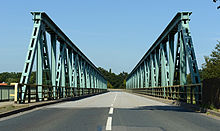
In the time of National Socialism, Achim formed a regional center of this movement. The synagogue and the Jewish cemetery were destroyed, Jewish citizens were expelled and murdered, and there were forced labor camps in Uphusen and Uesen. In 1945, at the end of the Second World War, the Weser Bridge in Uesen, inaugurated in 1928, was blown up.
Achim after 1945
This important traffic connection between Achim and Thedinghausen was restored in 1951 with the construction of the bridge. From 1948 onwards, the expansion of the sewage system begun in 1927 and the central water supply across the entire city area could be continued. The resulting wastewater was first trickled into the marsh and, since 1964, purified in a sewage treatment plant. Wells were built in the urban area to provide drinking water. The Wittkoppenberg waterworks have been supplying drinking water since 1966.
Since 1945 the population of Achim, which was granted town charter in 1949, has increased steadily, due to East German expellees and after 1965 by guest workers and others. a. from Turkey. Likewise, many Bremen residents found a new home in Achim in the 1960s. The largest residential construction project, north of the railroad, began in 1964 in the Achimer Vahr district , which is supplied with district heating and is now known as the Magdeburg district. From 2000 onwards, some buildings were demolished.
The highest dune, the Kosakenberg , used to serve as a viewpoint over the Weser valley. After 1945 the tree population fell victim to the fuel shortage and shortly afterwards the sand from the dune was processed into bricks in the nearby Uesen sand-lime brick works. The Bürgerpark settlement was built here from 1949 .
After 1945, companies such as DESMA , the Heller tool factory, a light metal factory owned by the automobile manufacturer Borgward, the animal feed manufacturer Vitakraft and the Runken clothing factory offered many jobs; Many more companies have been added over the years.
In 1962 the A 27 motorway was built with two interchanges for Achim. In 1990 a bypass road came for the city center. Obernstraße in the inner city area has been a pedestrian zone since 1991.
In 1598 Gohgrefe Lüder Clüver founded a school that can be seen as the forerunner of today's secondary school. In 1927, today's secondary school opened its doors as a middle school. Today the city has six primary schools, two special schools and two grammar schools (founded in 1971 and 2006). In 1949 a community college was founded. The Verden district music school has existed in Achim since 1974.
In addition to the indoor and lawn sports facilities, an outdoor pool has been available to swimming since 1962, a teaching pool since 1971 and an indoor pool since 1978.
Today Achim is the center in the northern part of the Verden district.
Incorporations
On July 1, 1972, the municipalities of Baden, Bierden, Bollen, Embsen, Uesen and Uphusen were incorporated.
politics
City council
The council consists of 38 councilors and the mayor. After the municipal elections in 2011 and 2016, the following allocation of seats resulted:
| Party / list | Seats 2011 | Seats 2016 | |
|---|---|---|---|
| SPD | 14th | 13 | |
| CDU | 13 | 12 | |
| GREEN | 7th | 5 | |
| FDP | 1 | 3 | |
| left | 1 | 1 | |
| WGA * | 2 | 3 | |
| Single applicant * | - | 1 | |
mayor
- 1968–2006: Christoph Rippich , SPD
- 2006–2014: Uwe Kellner , non-party
- Since 2014: Rainer Ditzfeld , non-party
Honorary Mayor
- Christoph Rippich
coat of arms
After approval by the district government in Stade, the municipality of Achim has had a coat of arms since 1948.
Blazon : Split shield, on the right on a red background a silver cruciform key turned to the left, on the left a black bear's claw extending from the left edge of the shield on a silver background.
The Achimer coat of arms is a combination of the coat of arms of the Archbishopric of Bremen with the bear paw from the coat of arms of the noble family of Clüver, which provided ten gohgrefen of the Achim court in the 15th to 17th centuries. The Bremen key is a reminder of belonging to the Duchy of Bremen-Verden, the black bear claw indicates the connection to the Clüver family.
Partnerships
- City partnerships exist with
- Achim is represented in the Lower Saxony / Bremen municipal association.
- The secondary school maintains contacts and student exchanges with the French city of Nantes .
Cultural sights
St. Lawrence Church
Achim's oldest building, consecrated to St. Lawrence of Rome , is also the oldest and largest country church between the former bishops of Bremen and Verden. The first written mention of a church in Achim is found in 1257. The original Romanesque field stone building was expanded and rebuilt. The old masonry can still be seen on the tower and in the south wall. The choir and transept were built in the first half of the 14th century . Originally the church had a flat ceiling made of wood. From 1350 to 1500, in the late Gothic period , this was replaced by a rib vault . The baroque altar was created in 1750 by the Verden sculptor Arend Meyer. The church was given its current appearance during a major renovation in the 1960s.
Achim Jewish cemetery
At the Achim Jewish cemetery , which is on the “An der Bahn” road, there are 56 tombstones for Jews from Achim and the surrounding area who died between 1867 and 1935. The cemetery is a cultural monument .
Public facilities
General facilities
- The Achim town hall in Obernstraße 38 with the town archive, the citizen's office and the Achim community foundation
- The city library with over 30,000 media. The library is divided into the headquarters in the town hall and the district libraries in Baden, Bierden, Uesen and Uphusen.
- The police station Achim
- Hospitals: In addition to Verden, Achim is the location of the Aller-Weser-Klinik , a hospital in the ProDiako network under municipal ownership.
- The Federal Employment Agency at Lindhooper Straße 9 in Verden
- The district road maintenance authority in Verden-Nord
education
There are the following educational institutions in Achim:
- The six primary schools
- The Achim secondary school (Liesel-Anspacher-Schule)
- The junior high school Achim
- The grammar school on the market ("GamMa")
- The Cato Bontjes van Beek high school
- The Erich Kästner School for Learning Assistance
- The primary level of the Janusz Korczak School in Verden
- The city forest school
- The district music school with the office in Verden
- The adult education center Achim in the Cato-Gymnasium
- The district adult education center in Verden
Social
- The Verden educational counseling center and Achim branch
- The ALV - youth workshop in Achim, Burgfeld and Verden
- The Achimer alliance for families
- The Seniors and Disabled Advisory Council of the City of Achim
- The senior meetings and homes such as the municipal senior meeting, the DRK homes in Achim, Baden and Uphusen, the AWO meeting Uphusen, the senior center Achim, the retirement and nursing home Badener Berg etc.
Religion and churches
- The majority of the denominational residents belong to the Evangelical Lutheran Church. This includes:
- The Ev.-luth. St. Laurentius parish of Achim
- The Ev.-luth. Parish of Baden
- St. Matthias in Meislahnstrasse belongs to the Roman Catholic Church .
- There are also members of Islam . The construction of a new mosque is currently being planned.
societies
Achim's cultural and sports landscape is animated by numerous clubs. Mention should be made of the traditional rifle and sports clubs, the Achim art club, the volunteer fire brigades , the Achim branch of the technical relief organization, the scout tribe of the Association of Girl Scouts and Boy Scouts BdP Wikinger Achim and the former handball second division club SG Achim / Baden . The volleyball men of TV Baden have been playing in the 2nd Bundesliga since 2018 .
Successful competition riders were and are represented in equestrian sports.
Furthermore, Achim is represented in golf by the Achimer Golf Club (AGC), which was able to successfully take part in the DMM (German Team Championships). The youth team in the youth league north holds a place in the highest league, the regional youth league.
Economy and Transport
economy
Several international companies are based in Achim, including Coca-Cola and Vitakraft . Companies are located in the Achim-Ost, Bierdener Mehren, Baden, Uesen, Uphuser Mehren, An der Eisenbahn, Bremer Kreuz, Bremer Strasse and Desma Technology Park industrial areas.
traffic
train
Achim's location directly on the Bremen – Hanover railway line enables hourly train connections to Bremen (alternating every two hours to Norddeich Mole or Bremerhaven-Lehe ) and Hanover, with connections to long-distance traffic. Achim has been connected to the Bremen – Uelzen route again since the end of 2009, after the route was shortened to the Uelzen – Langwedel route at the end of 2008. There is a two-hour service here. In mid-December 2011, Achim was integrated into the Bremen / Lower Saxony regional suburban railway network, the first stage of which went into operation in mid-December 2010. During commuter traffic, the S-Bahn runs every half hour, otherwise every hour. You and the RE enable direct connections to the Bremen / Hanover local transport.
Public bus and citizen bus
Several bus lines connect Achim's districts with each other and with the surrounding towns.
| line | operator | Line course |
|---|---|---|
| 702 | VBN | Achim - Thedinghausen - Emtinghausen |
| 703 | VBN | Achim - Borstel / Badenermoor - Bassen |
| 733 | VBN | Achim - Badenermoor |
| 739 | VBN | Achim - Posthausen |
| 740 | VBN | Achim - Bremen / Verden |
| 745 | VBN | Achim - Oyten - Ottersberg - Nathauen |
| 748 | VBN | Achim - Embsen |
| 791 | CitizenBus | Achim - Bierden - Uphusen |
| 792 | CitizenBus | Achim - Uesen - Baden |
| 793 | CitizenBus | Achim - Borstel - Embsen |
| 794 | CitizenBus | Achim - Uesen - Baden - Badenermoor |
Street
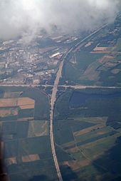
Achim is connected to the A 1 and A 27 federal motorways via three junctions . This convenient location in particular has made it a popular residential area for many families from Bremen over the past 30 to 40 years. A fourth junction of the A 1 federal motorway is outside Achim in Oyten , which offers commuters a good alternative to Hamburg. One of the most important motorway junctions in northern Germany, the Bremer Kreuz (junction A1 and A27) is located in the Achimer area.
channel
In 1919 plans were drawn up for a “ Bramsche - Stade Canal” which would branch off the Mittelland Canal in the town of Bramsche , cross the Weser at Achim and flow into the Elbe at Stade . The planned canal was later given the name " Hansakanal ". The plans for the section of the canal west of the Weser were officially discontinued in 1950, those for the eastern section in 1955.
Personalities
mayor
after the Second World War
- 1945: Johann Gröffel
- 1945–1946: Fritz Rübeck
- 1946–1959: Friedrich Grothen
- 1959–1968: Georg Osmers
- 1968–2006: Christoph Rippich
- 2006–2014: Uwe Kellner
- since 2014: Rainer Ditzfeld
Daughters and sons of the city of Achim
in chronological order
- CJD von Ahsen (* 1760 in Baden ), legal scholar and lawyer
- H. August von Tewes (1831–1913), professor of Roman law at the University of Graz
- Friedrich Wilhelm Kleukens (1878–1956), graphic artist and typographer
- Christian Heinrich Kleukens (1880–1954), type artist and poet
- Heinrich Fahrenholz (1882–1945), local politician and author
- Karl Ravens (1927–2017), politician (SPD), Federal Minister
- Fritz-Heiner Hepke (* 1947), politician (SPD), member of the state parliament
- Heinz Emigholz (* 1948), freelance filmmaker, author, artist and producer
- Hartmut Cyriacks (* 1955), dramaturge, translator and journalist
- Martin Schmidt (* 1969), handball player
- Fero Andersen (* 1982), television presenter
- Annika Kahrs (* 1984), visual artist
- Steffen Riekers (1984–2016), theater actor
- Matthias Weidenhöfer (* 1985), actor
- Christina Siemoneit (* 1988), actress and dancer
- Ole Rahmel (* 1989), handball player
- Michel Brandt (* 1990), politician (Die Linke), member of the Bundestag
- Lucas Höler (* 1994), soccer player
- Marcel Costly (* 1995), football player
- Deniz Undav (* 1996), soccer player
Other personalities
- Hans Puvogel (1911–1999), lawyer and notary since 1947, politician ( CDU ), 1959 member of the city council
- Christoph Rippich (* 1938), honorary mayor, from 1968 to 2006 mayor, district administrator of the district of Verden and member of the state parliament (SPD)
- Jürgen Rimann (1945–2006), vexillologist and heraldist
literature
- Horst Korte: City of Achim. Past and present in words and pictures. Lüers, Jever et al. Thedinghausen 1984.
Web links
Individual evidence
- ↑ State Office for Statistics Lower Saxony, LSN-Online regional database, Table 12411: Update of the population, as of December 31, 2019 ( help ).
- ^ Reinhard Dietrich: Population development . In: Geschichtswerkstatt Achim - Association for Regional History eV (Hrsg.): 1000 years of Baden . House of Advertising Verden, Verden 2013, ISBN 978-3-00-039036-4 , p. 221-224 .
- ↑ Hans-Cord Sarnighausen: Hannoversche Amtsjuristen from 1715 to 1866 in Achim, in: Heimatkalender für den Landkreis Verden 2013, pp. 134–147
- ^ Federal Statistical Office (ed.): Historical municipality directory for the Federal Republic of Germany. Name, border and key number changes in municipalities, counties and administrative districts from May 27, 1970 to December 31, 1982 . W. Kohlhammer GmbH, Stuttgart and Mainz 1983, ISBN 3-17-003263-1 , p. 247 .
- ↑ Final result of the 2016 municipal elections in Achim
- ↑ Coca-Cola now comes from Achim ( Memento from February 27, 2017 in the Internet Archive )
- ↑ Timetable change 2011 with the new RS 1 - Verden connected to the regional S-Bahn ( Memento from December 16, 2012 in the web archive archive.today )
- ^ History workshop Achim: The planning of the Hansakanal , in: Landkreis Verden (Hrsg.): 900 years Achim , special print from the home calendar for the Landkreis Verden 1991.
- ↑ Achimer Kreisblatt dated May 9, 2008: ... Honorary Mayor Christoph Rippich celebrates his 70th birthday today ...


