
Hunte


The Hunte is a 189 km long left and western tributary of the Weser in Lower Saxony ( Germany ). It is its second longest tributary after the Aller and crosses or touches the districts of Osnabrück , Diepholz , Vechta , Oldenburg , Wesermarsch and the city of Oldenburg .
course
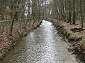
The river rises south of the Wiehengebirge on the northern slope of the Holzhauser Berg in the Osnabrück hill country north of Melle, west of the hamlet of Hustädte. The headwaters lie between the Oldendorf and Buer districts of Melle and belong to the TERRA.vita nature park .
In a short breakthrough valley, the Hunte crosses the ridge of the Wiehengebirge between the Linner Berg (181 m) in the west and the Kleiner Kellenberg (161 m) and reaches the North German Plain about 10 km from the source . At Wittlage Castle on the eastern edge of Bad Essen , it is passed under the Mittelland Canal . Some of the water is also fed into the canal.

Sign to the Huntequelle
The Hunte leaves the urban area of Melle
Hunte near Ippenburg Castle


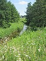
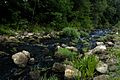
In the moor belt, the Hunte flows through Bohmte and its Hunteburg district, which is named after it, and then into the Dümmer . It leaves this with two main branches, which reunite in Diepholz . The western main arm is called Hunte , the eastern one is called Lohne . The next places on the Hunte are Drebber and Barnstorf . Then it enters the Wildeshauser Geest , where it flows through Goldenstedt and Wildeshausen and takes up the floodplain south of Dötlingen . In a north-westerly direction it cuts through the scenic lowlands west of the Osenberge - this section of the river is one of the most beautiful and ecologically most important of the Hunte.
Renatured section of the Huntelauf in Hunteburg
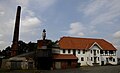
Former hydro-powered oil mill on the Hunte in Hunteburg

Western Dümmerniederung (front) and Ochsenmoor (rear); in between the hunt
Lattice cube south of Diepholz
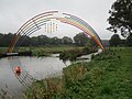
Steel sculpture “Goldregen” over the Hunte between Goldenstedt and Twistringen

Wildeshausen hydropower plant during flooding

Strongly meandering Hunte near Dötlingen

Hunte at Hundsmühlen


She leaves the Wildeshauser Geest Nature Park near Wardenburg . As a special feature, the Lethe crosses the Hunte at Hundsmühlen : its water is led through culverts under the Hunte. So it happens that the Lethe , although its catchment area is to the left of the Hunte, flows into the Hunte orographically from the right (south) in the Oldenburg district of Osternburg via the Osternburg Canal .
In the southern urban area of Oldenburg , south of the coastal canal , the Hunte divides: The Alte Hunte is directed from south to north through a culvert at KüK-km 2.4, above the Oldenburg lock , and then runs north of the coastal canal. Extensive hydraulic engineering measures were carried out below the city motorway, which were completed in 2006. As part of a redesign of the OLANTIS river pool, the Alte Hunte (also called “Mühlenhunte” here) received a new, natural-looking bed in this area as part of the Mühlenhunte landscape park . The Alte Hunte then flows along the Schlossgarten and Huntestrasse and feeds the Old Harbor below the reservoir. At the traffic gate, coming from the left (west), the hair flows into the Hunte.
The Neue Hunte flows southeast of the coastal canal parallel to it and joins the canal route below the Easterburg secondary school, at the lower end of the outer harbor of the Oldenburg lock. From here up to km 0.00 the Neue Hunte belongs to the coastal canal. At its beginning, the Neue Hunte joins the Alte Hunte below the turning port. The arm of the river bears the name “Neue Hunte” because its bed was only created in connection with the canal construction work.

Mühlenhunte above the A 28 in Oldenburg
Renatured Mühlenhunte below the A 28 in Oldenburg near the leisure pool
Boat landing stage on the Alte Hunte near the Oldenburg castle gardens; in the background the Augusteum

View over the Mühlenhunte and the castle gardens to Oldenburg Castle

Classicist row of houses on Huntestrasse on the edge of Oldenburg city center


In Oldenburg, the Hunte bends northeast and reaches the marshland. First, the border between the counties of Oldenburg and Weser march , slightly downstream then the boundary between the southeast, Stedingen and up to the Jade Bay reaching Stadland . South of Elsfleth it flows into the Weser coming from the southeast . Until the end of the 19th century, the Hunte flowed south of Elsfleth into the Westergate arm of the Weser . At its beginning, this was disconnected from the Weser. The northern part of the Westergate has since been assigned to the Hunte, so that Elsfleth is no longer on the Weser, but on the Hunte.

Open bascule bridge over the Hunte in Oldenburg

Port of Oldenburg Nordkaje
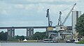
Osthafen and bridge of the A 29 over the Hunte near Oldenburg

Lift bridge over the Hunte at Huntebrück 53 ° 12 ′ 0 ″ N , 8 ° 26 ′ 49 ″ E

The Huntes Barrage at the confluence of the Hunte (front) into the Weser (rear) 53 ° 14 ′ 55 ″ N , 8 ° 28 ′ 29 ″ E


Catchment area
The catchment area of the Hunte is relatively narrow (maximum width around 40 km) and extends from south to north over the federal states of Lower Saxony and, to a lesser extent, North Rhine-Westphalia (Minden-Lübbecke and Herford districts) over a length of around 110 km. The highest point of the catchment area is the Nonnenstein in the Wiehengebirge ( 275 m above sea level ), the lowest areas of the catchment area are in the marshes on the lower Hunte (partly below zero). By far the largest part of the catchment area lies in the North German Plain , so that the Hunte mainly flows through moors , geest and marshes . A small part is in the low mountain range .
Use of the hunte
There are hydropower plants in Wildeshausen and Oldenburg . The Wildeshausen power plant was commissioned in 1913, the Oldenburg power plant (700 kW, 2 GWh / a) in 1927. Both power plants use the flowing hunt water to generate electrical energy. In addition, the Oldenburg power plant also regulates the water levels of the Hunte or the coastal canal during floods.
According to the Lower Saxony Fisheries Act of 1978, the Hunte is divided into four fishing districts
- Fishing district Hunte I (from the municipality boundary Hustädte - Selingsdorf to the confluence with the Dümmer)
- Dümmer fishing district
- Fishing district Hunte II (from the outflow from the Dümmer to the road bridge of the federal highway 1 near Wildeshausen)
- Fishing district Hunte III (from the A 1 road bridge to Huntebrück).
The Hunte below the line connecting the dykes at Huntebrück is considered to be coastal waters within the meaning of Section 16, Paragraph 3 of the Lower Saxony Fisheries Act.

The middle Hunte as a water sports and fishing area
The section between the Dümmer and Wildeshausen is used by canoeists and rowers as a territory. The steel sculpture “Goldregen” by the Friesoyth-based blacksmith artist Alfred Bullermann was erected in 2013 at a canoe dock next to a weir immediately south of the “Golden Bridge” spanning the Hunte and connecting the districts of Vechta and Diepholz .
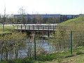
The 41 km long section between Wildeshausen and Oldenburg is suitable as a paddling area for beginners and occasional paddlers. The river here is between 12 and 20 meters wide, the flow speed is low at around two kilometers per hour . There are no weirs or other obstacles, and no motorized shipping. The section above Wildeshausen has 14 weirs that require the boats to be carried around. From April 1st to June 15th there is a traffic ban for nature conservation reasons, during the rest of the time there is a boat size restriction of 6 m in length and 1 m in width.
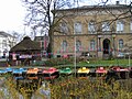
The approximately 2 hectare large, on average 10 to 15 meters wide and 2.0 to 2.5 meters deep Mühlenhunte is a popular leisure and fishing area. In the city center of Oldenburg, it forms the southeastern border of the Oldenburg Palace Gardens.
The middle Hunte as an inland waterway

Above the Oldenburg lock , the Hunte, after it has split into the Neue Hunte and the Mühlenhunte, runs parallel to the coastal canal , separated from it only by the Achterdiek road. Only below the lock does it unite with the canal. From the lower outer port of the lock (km 1.22) to the beginning of the coastal canal 140 m below the Amalienbrücke in Oldenburg (km 0.00) at the entrance to the old port, the middle Hunte is part of the federal waterway coastal canal.
The lower Hunte as a shipping route
As early as the 14th and 15th centuries, shipping traffic on the lower Hunte from and to Oldenburg was considerable. However, navigation was made very difficult by numerous sharp bends. From 1833 until after 1952 a total of 20 punctures were made and regular dredging was carried out. This shortened the length of the route to Westergate by a good 12 km from the original 34 km. At the same time, the mean tidal range in Oldenburg grew to 2.6 m today. Deep dredging and curve flattening were performed in the 1990s.
The km 0.00, 140 m below the Amalienbrücke, is the starting point of the coastal canal to the west, and to the east the starting point of the federal waterway Hunte (lower Hunte) as a shipping route (scope of the shipping route regulations ) with the end km 24.63 at Unterweser -km 32.09. The Bremen Waterways and Shipping Office is responsible .
The coastal channel and the lower Hunte form the shipping route between the Ems and the Lower Weser. The coastal channel belongs to class IV of the inland waterways, the Hunte to class Va with restrictions. While the canal is only permitted for ships with a draft of up to 2.5 m , the dredging of the Hunte also enables smaller seagoing vessels and coasters with a draft of up to 4 m to access the Oldenburg port. Ships with high superstructures can also use the Hunte, since bridges from the Oldenburg port are either very high or movable (bascule or lifting bridges).
Nature reserves

In its course the Hunte touches or crosses the following nature reserves :
- Upper Hunte
- Ox moor
- Western stupid lowlands
- dumber
- High seven
- Huntebruch and Huntebruchwiesen
- Pestruper Moor
- Poggenpohlsmoor
- Medium hunte
- Barnführer wood and Schreensmoor
- Bornhorster Huntewiesen
- Moorhauser Polder
Buildings
Road bridges in Oldenburg

The Hunte is crossed by a total of five road bridges in the urban area of Oldenburg (not including the Alte Hunte).
Seen downstream, these are
- Niedersachsendamm
- Motorway bridge of the BAB 28
- Cecilia Bridge
- The Cäcilienbrücke has crossed the Hunte since 1832. The bridge was replaced by a lift bridge with the construction of the coastal canal . The bridge, completed in 1927, has been crossing the Hunte at this point ever since.
- Amalienbrücke
- The Amalienbrücke has crossed the Hunte since 1893. At first there was a drawbridge here , but this was replaced by a lift bridge when the coastal canal was built. From 1978 to 1981 the lift bridge was replaced by a fixed bridge a little below the old lift bridge.
- A 29 high bridge
Railway bridge in Oldenburg

In Oldenburg, the bridge of the Oldenburg – Bremen and Oldenburg – Osnabrück railway spans the Hunte. The bridge is designed as a roller bascule bridge according to the Scherzer system, which has two passages for ships . Both flaps can be opened independently of each other. The opening is done hydraulically by means of a lifting cylinder, after the original mechanical control via drive wheels and crank mechanism had been replaced by a hydraulic control in 2003.
The bascule bridge at this point was built from 1946 to 1954. The hatch over the southern passage was already operational in 1952, the hatch over the northern passage in 1954. The bridge replaces a fixed crossing over the Hunte after a swing bridge that had been in place since July 1866 was destroyed in April 1945. The destroyed swing bridge was initially replaced by a fixed crossing, which, however, hindered shipping traffic on the Hunte too much.
The overhead line installed in the course of the electrification of the line in 1982 has a special construction at this point. There are permanently tensioned line segments on the two flaps, which are suspended from two cross members at the outer ends of the flaps. In the middle of the bridge there are separating pieces which are bent to the side and which interlock precisely when the bridge is closed. On the bank side, the overhead lines coming from the land are led to the outside a few meters in front of the bridge on a massive cross beam at a right angle and braced to the side . The resulting gap, which creates space for the lowering counterweights when the bridge flaps are opened , is bridged by two metal brackets protruding lengthways on the crossbeam, which swing out to the side when the bridge opens.
In addition to rail traffic, which can cross the bridge via two tracks, the bridge can also be used by pedestrians and cyclists . The bridge, which belongs to Deutsche Bahn , is controlled by a signal box on the north side directly on the bridge.
Huntebrück lift bridge
The Lower Saxony Monument Hubbrücke Hunte bridge was from 1951 to 1953 for B212 (about Hunte bridge of Berne built) and was until 2015 one of the oldest in operation lift bridges in Germany. The roadway of the road runs in a steel lattice trough, which is moved by an electric motor in the middle of the bridge with an output of 42 kW (57 HP ). The counterweights in the lifting towers each weigh 155 t. At medium high tide , the headroom in the two lifting stages is 8.23 m and 24.53 m respectively. The lifting process takes 2 minutes, or 30 seconds when using the speed setting.
In the course of the construction of the federal highway 212 (B 212n), the lift bridge was replaced by a bascule bridge in 2015. The dismantling of the lift bridge began at the end of August 2018.
Huntebrück bascule bridge
The replacement of a bascule bridge over the Hunte was put out to tender in November 2009. The completion date was set for mid-2012. The poor building ground in particular delayed the work considerably. The bridge was inaugurated on December 10, 2015. It replaces the lift bridge, which for years could only be operated with great effort.
The bascule bridge, which costs around 20 million euros, is 1.90 meters higher than the previous lift bridge, which means that it does not have to be lifted as often. It takes around 3 minutes to fully raise the 84 meter long flap. It is the largest single-wing bascule bridge in Germany.
Swing bridge of the Hude – Nordenham railway

About one kilometer down the bascule bridge at Elsfleth -Orth there is a steel lattice swing bridge on the Hude-Nordenham railway line .
Huntes barrier
At the confluence of the Hunte into the Weser near Elsfleth there is the Huntes barrage, built from 1976 to 1979, to block off storm tides. Two powerful, convexly curved barrier gates (segment gates) in the 20 m wide flow openings and two two-part stemmed gates in the 26 m wide shipping openings can be closed in the event of a storm surge and thus protect the hinterland from flooding. The barrage is built over with a bascule bridge , which is closed every full hour during the day and allows pedestrians and cyclists to cross the Hunte for five minutes, provided that shipping traffic permits. In order to hinder shipping on the Hunte as little as possible, the Huntes barrier is normally open.
Overflow polder
Below the city of Oldenburg, there are overflow polders into which the Hunte floods when the Hunt barrier closes. In the middle of the 19th century, around 15 km² of lowland areas could absorb water during both floods and storm surges. Due to dikes and the expansion of the city of Oldenburg, the area was reduced to around 8 km². In 1927 the Oldenburg Ministry of the Interior set a maximum height for the summer dyke in order to reduce the risk of flooding for the city. When the hunt barrier was built, another polder was built so that, with a lock time of 33 hours, an inflow of the hunt of 227 cubic meters per second can be stored. In total, the polders can hold 26.1 million cubic meters of water. The nature reserves Moorhauser Polder and Bornhorster Huntewiesen are part of the overflow polders . The Moorhauser Polder is flatly flooded in the winter months in order to offer resting birds favorable conditions.
Project "River Landscape Hunte"

On April 6, 2008, the “River Landscape Hunte” project was launched by the Diepholz , Vechta and Oldenburg districts . Its aim is to develop the river in its entire length across the district back into a lifeline for people and nature. In the years 2008 to 2010, various measures in the areas of water management , nature conservation and tourism were implemented. To finance the project, the three districts and all Hunte communities have made a total of 600,000 euros available. The project management, which is part of the district of Diepholz (specialist service district development), is funded with 40,000 euros by the Northwest Metropolitan Region .
Before the Cornau district of the Drebber municipality , the left of the three fields of the Cornau weir system in the direction of flow was converted in 2017 . Since then, the Hunte has also made a rough channel with a basin structure in this area for the fauna living in the river. Before that, the step of the weir, built in 1962, was about one meter high.
literature
- Georg Ruseler : Die Hunte , in: Lower Saxony VIII (1902/1903), pp. 344–345
- Remmer Akkermann: The Hunte - portrait of a north-west German river . BSH, Wardenburg 1994, ISBN 3-89442-178-9 (part 1) / ISBN 3-923788-28-2 (part 2 - 1995).
- Nils Aschenbeck and Bernd Oeljeschläger : The Hunte - From Wildeshausen to Oldenburg. Informative culture and nature guide. CULTURCON medien, Wildeshausen 2007, ISBN 978-3-939401-12-4 .
- Martin Eckoldt (Ed.): Rivers and canals, The history of the German waterways, DSV, Hamburg 1998, ISBN 3-88412-243-6 (part 1) / ISBN 3-88412-286-X (part 2).
Individual evidence
- ↑ Various authors: Geographische Landesaufnahme: The natural spatial units in single sheets 1: 200,000 . Federal Institute for Regional Studies, Bad Godesberg 1952–1994. → Online maps
- ^ German Hydrological Yearbook Weser-Ems 2014. Lower Saxony State Agency for Water Management, Coastal and Nature Conservation, p. 210, accessed on October 4, 2017 (PDF, German, 8805 kB).
- ↑ Weser river basin community: Weser river basin management plan 2005 - inventory of sub-area Tideweser
- ↑ Mühlenhunte Landscape Park (website of the City of Oldenburg), accessed on August 15, 2016, from oldenburg.de
- ^ Lioba Meyer and Frank Hinrichs: The new river pool at the OLantis Huntebad ( memento from June 25, 2016 in the Internet Archive ). In: AB Archiv des bathing iron 08/08, pp. 404–414, accessed on August 15, 2016, at polyplan-gmbh.de
- ↑ The hydroelectric power station on the Hunte (video), November 10, 2011, on youtube.com
- ↑ EWE operates a hydropower plant on the Hunte . Northwest Newspaper . April 1, 2010, on nwzonline.de
- ↑ Lower Saxony Fisheries Act (Nds. FischG), Annex 2 (to Section 18, Paragraph 1) , dated February 1, 1978, accessed on December 11, 2015, at voris.niedersachsen.de
- ↑ Water tourism Hunte - action program , January 2007, p. 17 f, on yumpu.com
- ↑ "Laburnum" stretches over Hunte. New steel sculpture inaugurated at the Golden Bridge ( memento from October 12, 2013 in the Internet Archive ), municipality of Goldenstedt, October 8, 2013, on goldenstedt.de
- ↑ Mittlere Hunte: Barnstorf to Wildeshausen ( memento of October 9, 2007 in the Internet Archive ), accessed on October 11, 2009, at hunte-natur.de
- ↑ Jürgen Gerlach, Heinrich Nejdly: Canoeing in Germany . BLV Verlagsgesellschaft mbH. Munich. 2002, p. 82 ff. ISBN 3405164575
- ↑ Water tip - Mühlenhunte in Oldenburg ( Memento of the original from May 24, 2015 in the Internet Archive ) Info: The archive link was inserted automatically and has not yet been checked. Please check the original and archive link according to the instructions and then remove this notice. , Fishing magazine from May 2006, accessed on October 11, 2009, at angelmagazin.com
- ↑ a b Directory E, Ser. Nos. 22 and 25 , in chronicle about the legal status of the Reich waterways / inland waterways of the federal government in the territory of the Federal Republic of Germany after October 3, 1990 , Federal Waterways and Shipping Administration, on wsv.de (PDF; 1.32 MB)
- ↑ a b Lengths (in km) of the main shipping lanes (main routes and certain secondary routes) of the federal inland waterways ( Memento of the original from January 21, 2016 in the Internet Archive ) Info: The archive link was automatically inserted and not yet checked. Please check the original and archive link according to the instructions and then remove this notice. , in the structure of federal waterways , federal water and shipping administration, on wsv.de
- ↑ Oldenburg / Hunte , on kuestenfahrer.de
- ↑ Flyer for the Open Monument Day at the rolling bascule bridge over the Hunte, September 14, 2014.
- ^ Niels Lehmkuhl: The roller bascule bridge over the Hunte in Oldenburg. September 13, 2011, accessed September 22, 2012 . , on nielslehmkuhl.de
- ^ New construction of the federal highway 212 from Huntebrück to the state border Lower Saxony / Bremen. Lower Saxony State Authority for Road Construction and Transport, from December 10, 2015, on strassenbau.niedersachsen.de
- ^ New construction of a bascule bridge over the Hunte in the course of the new construction of the B 212n , in tender: Construction of road bridges - D-Oldenburg , on icchofmann.de
- ↑ Hans-Carl Bokelmann: Old Huntebrücke in the Wesermarsch: Lift bridge is now actually history , Nordwest-Zeitung, August 27, 2018. Retrieved on August 27, 2018.
- ↑ New Huntebrücke on B 212 , NWZ-Online from December 22, 2015
- ^ Heinz Hoffer: Storm surge protection in the 20th century. In: Rosemarie Kramer, Heinz Hoffer: Between storm surge and headwater. From the history of the I. Oldenburgische Deichbandes. Isensee, Oldenburg 1991, ISBN 3-89442-106-1 , pp. 390-490, here pp. 431-434.
- ^ Lower Saxony State Office for Water Management, Coastal Protection and Nature Conservation (Ed.): Bornhorster Huntewiesen. Moorhauser Polder. Fascinating wetlands in the Hunteniederung. ( Memento of the original from January 2, 2016 in the Internet Archive ) Info: The archive link was inserted automatically and has not yet been checked. Please check the original and archive link according to the instructions and then remove this notice. , on oldenburg.de (PDF, 1.3 MB)
- ↑ Hunte River Landscape ( page no longer available , search in web archives ) Info: The link was automatically marked as defective. Please check the link according to the instructions and then remove this notice. , Districts of Diepholz, Oldenburg, Vechta, on duemmerweserland.de
- ↑ Districts of Vechta, Diepholz and Wildeshausen start the “River Landscape Hunte” project ( page no longer available , search in web archives ) Info: The link was automatically marked as defective. Please check the link according to the instructions and then remove this notice. , Oldenburgische Volkszeitung , April 7, 2008, on goldenstedt.de
- ↑ Weir system Cornau is being rebuilt - preparation begins at the end of February , press release of the Lower Saxony State Office for Water Management, Coastal and Nature Conservation , dated February 17, 2017, accessed on February 17, 2017, at nlwkn.niedersachsen.de
- ↑ Gerhard Scheland: Redesign of the Hunte weir system completed - free path for the fish in Cornau . Kreiszeitung.de. July 1, 2017, accessed June 23, 2019
Web links
- Discover the Hunte by canoe - from Hunteburg to Oldenburg , on hunte-natur.de
- Volume 3 Water quality report Hunte 2000 , in publications on the subject of water quality , at the Lower Saxony State Office for Water Management, Coastal and Nature Conservation , September 2002, accessed on December 11, 2015, at nlwkn.niedersachsen.de (PDF; 4.785 MB)
- Entertainment Association Hunte - Water and Soil Association , on uhv71.de
- WSA-Bremen , on wsv.de
- EC WFD model project Hunte / Lethe / Haaren. Subproject Hunte , final report 2009, from the Lower Saxony State Agency for Water Management, Coastal Protection and Nature Conservation (Brake - Oldenburg), on hunte-25.de (PDF; 3.42 MB)