
District of Oldenburg
| coat of arms | Germany map |
|---|---|

|

Coordinates: 52 ° 59 ' N , 8 ° 23' E |
| Basic data | |
| State : | Lower Saxony |
| Administrative headquarters : | Wildeshausen |
| Area : | 1,063.16 km 2 |
| Residents: | 130,890 (Dec. 31, 2019) |
| Population density : | 123 inhabitants per km 2 |
| License plate : | OIL |
| Circle key : | 03 4 58 |
| NUTS : | DE94D |
| Circle structure: | 15 municipalities |
| Address of the district administration: |
Delmenhorster Strasse 6 27793 Wildeshausen |
| Website : | |
| District Administrator : | Carsten Harings (independent) |
| Location of the district of Oldenburg in Lower Saxony | |
 .svg) |
|
The district of Oldenburg is located in western Lower Saxony .
geography
location
The district of Oldenburg extends south of Oldenburg and has an approximately circular shape measuring around 35 × 40 km. The largest part of the district lies in the natural spatial unit of the third order with the name Ems-Hunte - Geest . He has shares in the natural spatial units of the fourth order called Oldenburger Geest , Hunte-Leda-Moorniederung , Wesermarsch , Thedinghauser Vorgeest and the Syker , Delmenhorster and Cloppenburger Geest . It thus represents a broad cross-section of typical north-west German marshland , moorland , old moraine and floodplain landscapes in the Atlantic to sub-Atlantic climatic zones.
The Hunte runs through the district as a larger tributary of the Weser. The relief of the landscape is flat to undulating with terrain heights between 2 and 55 m above sea level. Larger areas belong to the Wildeshauser Geest Nature Park . The Ahlhorner Fischteiche nature reserve on the border with the district of Cloppenburg is noteworthy : the largest carp pond complex in western Lower Saxony was able to become a valuable biotope for amphibians , water birds and rare dwarfs in the 20th century thanks to its embedding in a natural environment and the only extensive management Develop pond bottom plants.
Neighboring areas
The district borders in a clockwise direction in the northwest on the district of Ammerland , on the district of Oldenburg , on the district of Wesermarsch , on the district of Delmenhorst and on the districts of Diepholz , Vechta and Cloppenburg .
Nature reserves
There are 18 nature reserves in the Oldenburg district . The largest nature reserve is the Hasbruch with an area of 630 hectares , the smallest is the Hatter Holz with an area of 5.3 hectares.
See also:
- List of nature reserves in the Oldenburg district
- List of landscape protection areas in the district of Oldenburg
- List of natural monuments in the Oldenburg district
- List of protected landscape components in the district of Oldenburg
history

The current district of Oldenburg was already settled 4000 years ago. At that time, megalithic stone graves were created there, around 20 of which are still preserved today. About 700 years BC Extensive burial grounds arose.
At the time of the Roman Empire, Chauken (in the north) and Angrivarians (in the central Huntetal) settled the area of the district. At the end of the migration period , the Saxons settled on both sides of the Hunte . Today's district area extended largely over the densely populated Largau in the Duchy of Engern, bordered by the Hunte and Weser , and the Westphalian Lerigau west of the Hunte .
The northern part of today's district, in which the present-day communities Ganderkesee, Dötlingen, Hatten, Wardenburg and Hude are located, belonged to the ancestral territory of the Counts of Oldenburg from the beginning and remained Oldenburg until 1946. Wildeshausen, however, was initially ruled by a branch line of the House of Oldenburg , the Oldenburg-Wildeshausen line. After they died out, Wildeshausen came to the Archdiocese of Bremen , after which the city came into the possession of the bishops of Münster . The city became Swedish through the Peace of Westphalia in 1648 .
In 1700, the Swedish King Charles XII pledged . the Wildeshausen office to the Electorate of Hanover . In 1803 the town and office of Wildeshausen became Oldenburg again.
The three Oldenburg offices of Oldenburg , Delmenhorst and Wildeshausen have existed in what is now the district since the 19th century . The city of Oldenburg had been vacant since 1855. The city of Delmenhorst left the office of Delmenhorst in 1903 and was also vacated. Between 1922 and 1933, the three communities Osternburg , Eversten and Ohmstede were incorporated from the Oldenburg office into the city of Oldenburg. In 1933, a new Oldenburg office was formed from the Wildeshausen office, most of the Delmenhorst office and the communities of Hatten and Wardenburg from the old Oldenburg office . At the same time, some of the old congregations were merged into new large congregations. The western part of the Oldenburg office with the communities of Rastede and Wiefelstede came to the new Ammerland office . In 1939 the new office of Oldenburg became the district of Oldenburg .
With the merger of the states of Hanover , Braunschweig , Schaumburg-Lippe and Oldenburg to form Lower Saxony, the district of Oldenburg became a district in Lower Saxony and a sub-area of the Lower Saxony administrative district of Oldenburg , which became part of the Weser-Ems administrative district in 1978 . This in turn, like all administrative districts in Lower Saxony, was dissolved in 2005.
The territorial reform of 1933 was partially reversed in 1948. The communities Schönemoor and Stuhr were again detached from the community Hasbergen and the community Holle again from the community Hude . Holle was renamed Wüsting in 1949 .
On July 1, 1972, the municipality of Schönemoor was incorporated into the municipality of Ganderkesee and the municipality of Wüsting into the municipality of Hude .
On March 1, 1974, the community of Stuhr moved to the county of Hoya . At the same time, the municipality of Hasbergen was incorporated into the independent city of Delmenhorst .
The district of Oldenburg received its current layout on August 1, 1977, when, as part of the Lower Saxony district reform, the combined community of Harpstedt with its eight member communities from the dissolved district of Grafschaft Hoya was incorporated into the district.
The administration of the district of Oldenburg was initially in Oldenburg. In 1988 she moved to Wildeshausen . On July 1, 1993, the name changed from the district of Oldenburg (Oldenburg) to the district of Oldenburg .
Population development
| year | Residents | source |
|---|---|---|
| 1933 | 41,805 | |
| 1939 | 44,821 | |
| 1950 | 74,149 | |
| 1960 | 72,400 | |
| 1970 | 84,700 | |
| 1980 | 96,900 | |
| 1990 | 103.509 | |
| 2000 | 121.017 | |
| 2010 | 127.282 |
politics
District council
The most recent election to the district assembly took place on September 11, 2016.
| Parties and constituencies | Percent 2016 |
Seats 2016 |
Percent 2011 |
Seats 2011 |
Percent 2006 |
Seats 2006 |
Percent 2001 |
Seats 2001 |
|
|---|---|---|---|---|---|---|---|---|---|
| CDU | Christian Democratic Union of Germany | 30.70 | 15th | 32.35 | 15th | 34.61 | 16 | 37.65 | 18th |
| SPD | Social Democratic Party of Germany | 30.52 | 15th | 33.84 | 16 | 38.09 | 18th | 37.92 | 18th |
| Green | Alliance 90 / The Greens | 12.01 | 6th | 16.43 | 7th | 7.26 | 3 | 6.39 | 3 |
| FDP | Free Democratic Party | 9.81 | 5 | 8.66 | 4th | 15.13 | 7th | 14.25 | 6th |
| AfD | Alternative for Germany | 7.84 | 4th | nk | 0 | nk | 0 | nk | 0 |
| UWG | Independent constituency of the district of Oldenburg | 3.96 | 2 | 2.59 | 1 | 1.84 | 1 | nk | 0 |
| left | The left | 2.76 | 2 | 2.18 | 1 | nk | 0 | nk | 0 |
| FW | Free voters | 1.94 | 1 | 3.91 | 1 | nk | 0 | nk | 0 |
| PIRATES | Pirate Party Germany | 0.43 | 0 | nk | 0 | nk | 0 | nk | 0 |
| UWG | Independent voter community | nk | 0 | nk | 0 | 1.87 | 1 | nk | 0 |
| UWG-Gdk | Independent voter community - Gdk | nk | 0 | nk | 1 | nk | 0 | 1.03 | 1 |
| total | 100 | 50 | 100 | 46 | 100 | 46 | 100 | 46 | |
| Turnout in percent | 56.8 | 54.9 | 56.1 | 54.3 | |||||
District Administrator
District Administrator of the district Oldenburg Carsten Haring (independent). The last district administrator was elected in the 2014 municipal elections on May 25, 2014. Only the previous First District Councilor Harings, who had been supported by all parties and groups represented in the district assembly, ran as district administrator. With a turnout of 52.9%, he received 80.61% of the yes votes. Carsten Harings took office on November 1, 2014, but had represented his predecessor Frank Eger in his previous role as First District Councilor since his retirement in the course of a corruption affair .
| Applicant Harings | be right |
|---|---|
| Yes | 43,144 votes (80.61%) |
| No | 10,373 votes (19.38%) |
As part of the local elections in 2006 , the district administrator was elected on September 10, 2006:
| Applicants | Political party | be right |
|---|---|---|
| Eger | SPD | 37,092 votes (68.22%) |
| by Daniels | CDU | 17,276 votes (31.77%) |
coat of arms
The coat of arms of the district of Oldenburg shows the "Ammer" bars at the top right and the "Delmenhorster Cross" at the top left . In the lower part you can see the roses of the Wildeshausener line of the Counts of Oldenburg .
The coat of arms was awarded to the district on April 25, 1934 and retained after the establishment of the federal state of Lower Saxony in 1946 to commemorate the historical context of the state.
Municipal partnerships
- In 1972 the district of Oldenburg sponsored the former residents of the Neumark district in West Prussia who lived in the Federal Republic of Germany . From this sponsorship a communal partnership with the Nowomiejski district in Poland developed .
- The district is represented in the Lower Saxony / Bremen municipal association.
Institutions
- Oldenburg landscape , registered corporation under public law for the maintenance and promotion of cultural interests.
Economy and Transport
economy
In the Future Atlas 2016 , the district of Oldenburg was ranked 207 out of 402 districts, municipal associations and urban districts in Germany, making it one of the regions with a “balanced risk-opportunity mix” for the future.
The company Exxon Mobil operates in the municipality Großenkneten one of the world's biggest natural gas processing plants . In addition, large quantities of natural gas are stored in underground storage facilities ( pore storage ) in the municipality of Dötlingen .
The Stöver Agarfrost group of companies in Aldrup ( Wildeshausen ) manufactures a wide variety of potato products ( French fries , potato pancakes , potato chips, etc.) and supplies them to the McDonald’s restaurant chain, among others .
The company Atlas Terex (formerly Atlas Weyhausen ) in Ganderkesee is one of the largest excavator manufacturer in Germany.
The logistics company Hüffermann has its headquarters in Wildeshausen.
traffic
- Road traffic
The district is accessed by three motorways, the A1 in the southeast (communities Harpstedt and Dötlingen, town of Wildeshausen), the A28 in the north (communities Hude, Hatten and Ganderkesee) and the A29 in the west (communities Großenkneten, Hatten and Wardenburg). All three motorways are interconnected (A1 / A29 at Ahlhorner Dreieck. A28 / A29 at Oldenburger Ostkreuz and A1 / A28 at Delmenhorster Dreieck), so that they form a complete ring around the district of Oldenburg.
Other trunk roads are the federal highways B212 , which leads from the northeast of the Oldenburg district into the Wesermarsch , and the B213 , which leads from the south of the district into the Cloppenburg district.
The federal highways B69 and B75 , which were downgraded to state highways after the construction of the motorways A28 and A29, are only of historical importance . The same happened to the B213 in its earlier further course from Wildeshausen to Delmenhorst, which has been replaced by the A1 as a trunk road, but is valued as a diversion route in the event of traffic jams on the A1, as there is only relatively little time loss on this route.
- Rail transport
In the district of Oldenburg, rail traffic began on the Bremen – Delmenhorst – Oldenburg line of the Oldenburg State Railway in 1867, which was continued in the direction of Leer two years later. A branch line has been branching off from Hude to Brake since 1873.
Also in 1867 the connection from Oldenburg to Wilhelmshaven was established by the Prussian State Railways .
The main line from Oldenburg to Cloppenburg – Osnabrück was opened again in 1875 by the Oldenburg State Railway; from her the connection to Vechta branched off in Ahlhorn in 1885. The Oldenburg – Brake branch line went into operation in 1896.
From Delmenhorst a line was led via Vechta to Osnabrück in 1898 and in 1922 a branch line to Lemwerder under the direction of the Deutsche Reichsbahn .
In 1912 the Delmenhorst – Harpstedt small railway was opened ( Delmenhorst-Harpstedter Eisenbahn GmbH / DHE).
The rail network was 148 kilometers long until 1952. Of these, public transport was suspended for 36 kilometers:
- 1952: Ahlhorn – Schneiderkrug 5 kilometers
- 1961: Oldenburg Hbf. – OL-Ohmstede – OL-Etzhorn – Brake 7 kilometers
- 1962: Delmenhorst – Deichhausen – Lemwerder 8 kilometers
- 1967: Delmenhorst DHE – Kirchseelte – Harpstedt 16 kilometers
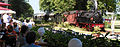
On the Delmenhorst-Harpstedter Eisenbahn GmbH route from Delmenhorst to Harpstedt, the Delmenhorst-Harpstedter Eisenbahnfreunde operate a museum railroad.
Culture and sights
Jewish cemeteries
There are three Jewish cemeteries in the city and district of Oldenburg : in Harpstedt , Oldenburg and Wildeshausen . They are cultural monuments that are worth protecting - stone witnesses to formerly existing Jewish communities and a lively Jewish community life up to the 1930s. The cemeteries are usually difficult to find, especially since they are mainly on the outskirts of the communities.
Wildeshauser Geest Nature Park
Most of the Wildeshauser Geest Nature Park is located in the Oldenburg district, a large part of which is in the Nature Park. Of particular interest are the megalithic tombs around Wildeshausen by the road of the megalithic culture are interconnected.

Sheep pens on the northern edge of the Pestrup burial ground near Wildeshausen

The large stone grave of the Visbek groom near Ahlhorn

Hude monastery ruins

Alexander Church Wildeshausen

Heinefelde watermill (Wildeshausen)
Museum railway Jan Harpstedt in Dünsen


Communities


The number of inhabitants on December 31, 2019 in brackets.
|
Joint municipality with its member municipalities: * Seat of the joint municipality administration
|
License Plate
On July 1, 1956, the district was assigned the distinctive symbol OL when the vehicle registration number that is still valid today was introduced . It is still issued today.
literature
- Johannes-Fritz Töllner (in collaboration with Wouter J. van Bekkum, Enno Meyer and Harald Schieckel ): The Jewish cemeteries in the Oldenburger Land. Inventory of the preserved tombstones. (Ed.): Oldenburg landscape in connection with the "Stichting Vrienden van het Rijksarchief" and the "Rijksarchivaris in de Provincie Groningen", Oldenburg 1983. (703 pages with numerous photos + 1 map sketch; therein pp. 25–692: approx 1300 photos of Jewish cemeteries and tombstones); Note: The photos were taken in 1979/80 by Marco Arthur Douma, Groningen
- [Author collective]: The district of Oldenburg. People - history - landscape. (Ed .: District of Oldenburg; overall editing: Walter Barton with the assistance of Wolfgang Haubold) Oldenburg 1992, 723 pages with 308 illustrations (photos, drawings, facsimiles, map sketches, plans)
- Werner Meiners : People in the Oldenburg District 1918-1945. Political development - events - fates. Oldenburg 1995, 233 pages with numerous Fig. (Photos, faks, map sketches)
- Helga Klöver: Wildeshauser Geest. An illustrated travel guide. Bremen 2000, 208 pages with numerous Photos, drawings and 2 map sketches
- Mamoun Fansa : large stone graves between Weser and Ems. With photos by Ingeburg Lindner-Olbrich. 4th edition Oldenburg 2009, ISBN 978-3-89995-626-9
- Harald Witt: The most beautiful bike tours between Hunte, Weser and Wümme. Nature - culture - history. Bremen 2003, ISBN 3-936289-44-1
Web links
Individual evidence
- ↑ State Office for Statistics Lower Saxony, LSN-Online regional database, Table 12411: Update of the population, as of December 31, 2019 ( help ).
- ↑ NLWKN : List of nature reserves in the district of Oldenburg , accessed on November 5, 2014
- ↑ Oldenburg law for the simplification and cheaper administration of April 27, 1933
- ^ Law on the formation of new communities in the Lower Saxony administrative district of Oldenburg of April 26, 1948
- ↑ Law on the integration of the municipality of Wüsting into the municipality of Hude (Oldenburg) and the municipality of Schönemoor into the municipality of Ganderkesee of December 23, 1971
- ^ Law on the reorganization of the municipalities in the area of Grafschaft Diepholz / Grafschaft Hoya / Delmenhorst of November 8, 1973
- ^ A b c d Michael Rademacher: German administrative history. (No longer available online.) Archived from the original on March 4, 2016 ; Retrieved April 12, 2015 . Info: The archive link was inserted automatically and has not yet been checked. Please check the original and archive link according to the instructions and then remove this notice.
- ↑ Statistical Yearbook for the Federal Republic of Germany 1972
- ↑ Statistical Yearbook for the Federal Republic of Germany 1981
- ↑ a b c Lower Saxony regional database
- ^ Website of the communal data processing in Oldenburg , accessed on April 22, 2017
- ^ Website of the communal data processing in Oldenburg , accessed on April 22, 2017
- ↑ District of Oldenburg - district election on May 25 , 2014, accessed on November 5, 2014
- ↑ The new title alone is still unusual , accessed on November 5, 2014
- ↑ a b LK Oldenburg - coat of arms of the district of Oldenburg , accessed on November 5, 2014
- ↑ Future Atlas 2016. (No longer available online.) Archived from the original on October 2, 2017 ; accessed on March 23, 2018 . Info: The archive link was inserted automatically and has not yet been checked. Please check the original and archive link according to the instructions and then remove this notice.
- ↑ LANDKREIS OLDENBURG. In: Jewish cemeteries according to the current administrative structure - Lower Saxony. In: Overview of all projects for the documentation of Jewish grave inscriptions in the area of the Federal Republic of Germany
- ↑ State Office for Statistics Lower Saxony, LSN-Online regional database, Table 12411: Update of the population, as of December 31, 2019 ( help ).
Counties : Ammerland | Aurich | Celle | Cloppenburg | Cuxhaven | Diepholz | Emsland | Friesland | Gifhorn | Goslar | Göttingen | County of Bentheim | Hameln-Pyrmont | Harburg | Heidekreis | Helmstedt | Hildesheim | Holzminden | Empty | Lüchow-Dannenberg | Lüneburg | Nienburg / Weser | Northeim | Oldenburg | Osnabrück | Osterholz | Peine | Rotenburg (Wümme) | Schaumburg | Stade | Uelzen | Vechta | Verden | Wesermarsch | Wittmund | Wolfenbüttel
Region : Hanover
Independent cities : Braunschweig | Delmenhorst | Emden | Oldenburg (Oldb) | Osnabrück | Salzgitter | Wilhelmshaven | Wolfsburg