
Wittmund district
| coat of arms | Germany map |
|---|---|

|

Coordinates: 53 ° 35 ' N , 7 ° 43' E |
| Basic data | |
| State : | Lower Saxony |
| Administrative headquarters : | Wittmund |
| Area : | 656.64 km 2 |
| Residents: | 56,926 (Dec. 31, 2019) |
| Population density : | 87 inhabitants per km 2 |
| License plate : | WTM |
| Circle key : | 03 4 62 |
| NUTS : | DE94H |
| Circle structure: | 19 municipalities |
| Address of the district administration: |
Am Markt 9 26409 Wittmund |
| Website : | |
| District Administrator : | Holger Heymann ( SPD ) |
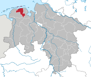
| Location of the district of Wittmund in Lower Saxony | |
  |
|
The district of Wittmund is a regional authority in the northwest of Lower Saxony and belongs to East Frisia . After the Lüchow-Dannenberg district, it is the second smallest district in Lower Saxony and Germany in terms of population. The district seat is the city of Wittmund .
geography
location
In addition to the municipalities on the mainland, the district area also includes the two offshore East Frisian islands Langeoog and Spiekeroog . Much of the mainland includes the historic Harlingerland .
Neighboring areas
The district of Wittmund borders clockwise in the north, starting with the North Sea and the districts of Friesland , Leer and Aurich .
Land use
Of the total area, according to the cadastral area (as of January 1, 2007), 50,368 hectares are agricultural areas, 3,889 hectares are buildings and open spaces and almost as many forest areas (3,880 hectares). The remaining areas are areas for other uses (3,089 hectares), traffic areas (2,512 hectares), water areas (1,525 hectares), recreational areas (228 hectares) and operational areas (175 hectares).
history
The Wittmund district was created in 1885 from the old Hanoverian offices of Wittmund and Esens and the city of Esens. Wittmund became the district seat.
On April 1, 1919, the city of Wilhelmshaven , until then an exclave of the Wittmund district separated by Oldenburg , left the district and formed its own urban district . In the course of the moor colonization in East Friesland , the two new communities Mullberg and Wiesmoor were formed in the Wittmund district on June 1, 1922 . On April 1, 1951, Mullberg and Wiesmoor became part of the enlarged Wiesmoor community, which was assigned to the Aurich district.
The regional reform in Lower Saxony led to a further reduction in the size of the Wittmund district on July 1, 1972:
- The municipality of Gödens was incorporated into the municipality of Sande in the district of Friesland.
- The communities Marcardsmoor and Wiesederfehn were integrated into the community Wiesmoor in the district of Aurich.
- The communities Roggenstede and Westeraccum were incorporated into the Dornum district in the north .
- The municipalities of Westeraccumersiel and Westerbur were incorporated into the municipality of Dornumersiel in the north district.
Overall, the regional reform reduced the number of municipalities in the district from 63 in 1967 to 19 today.
In the course of the district reform carried out in Lower Saxony in 1977, the district of Wittmund was temporarily dissolved and merged with the communities of Jever , Sande, Schortens , Wangerland , Wangerooge of the district of Friesland to form a new district of Friesland, whose district town became Wittmund. After a constitutional complaint, the Lower Saxony State Court in Bückeburg declared the district reform in the Friesland area to be unconstitutional. As a result, the Lower Saxony state parliament restored the districts of Ammerland , Friesland and Wittmund in their original form from July 31, 1977 on January 1, 1980 .
Population development
| year | Residents | source |
|---|---|---|
| 1890 | 47,275 | |
| 1900 | 55,545 | |
| 1910 | 69,678 | |
| 1925 | 38,881 | |
| 1939 | 42,756 | |
| 1950 | 60,863 | |
| 1960 | 51,000 | |
| 1970 | 56,700 | |
| 1980 | 53,500 | |
| 1990 | 52,827 | |
| 2000 | 57,334 | |
| 2010 | 57,280 |
Since the 1990s, the district of Wittmund has recorded above-average population growth in a national comparison. The number of inhabitants rose by around 2200 between 1996 and 2006. This number resulted from a migration surplus of 2278 people with a birth deficit of minus 77. The proportion of the population under 20 years of age is 22.5 percent, that is slightly more than the average for western Germany of 20.7%. The proportion of people over 65 was slightly higher: 20% compared to 19.5%.
politics
District council
The district council of the Wittmund district has 42 elected members and the district administrator . The deputies are elected by local elections for five years each. The current term of office began on November 1, 2016 and ends on October 31, 2021.
The last local election on September 11, 2016 gave the following result (with the results of the previous elections) :
| Parties and constituencies | Voices 2016 |
Seats 2016 |
Voices 2011 |
Seats 2011 |
Voices 2006 |
Seats 2006 |
Voices 2001 |
Seats 2001 |
||
|---|---|---|---|---|---|---|---|---|---|---|
| CDU | Christian Democratic Union of Germany | 36.91% | 16 | 41.83% | 17th | 44.31% | 18th | 43.2% | 19th | |
| SPD | Social Democratic Party of Germany | 39.86% | 17th | 37.94% | 16 | 42.46% | 18th | 45.7% | 20th | |
| Green | Alliance 90 / The Greens | 7.47% | 3 | 9.91% | 4th | 4.02% | 2 | 3.2% | 1 | |
| AfD | Alternative for Germany | 4.66% | 2 | - | - | - | - | - | - | |
| FDP | Free Democratic Party | 3.00% | 1 | 2.75% | 1 | 3.84% | 1 | 3.0% | 1 | |
| left | The left | 1.73% | 1 | 1.83% | 1 | 1.54% | 1 | - | - | |
| BFB | Citizens For Citizens Wittmund | 1.69% | 1 | 1.67% | 1 | 1.88% | 1 | - | - | |
| EBI | Esener citizens' initiative | 1.48% | 1 | 2.50% | 1 | - | - | - | - | |
| FWG | Wittmund Free Community of Voters | 0.97% | 0 | 1.44% | 1 | 1.92% | 1 | - | - | |
| The Frisians | 0.75% | 0 | - | - | - | - | - | - | ||
| total | 42 | 42 | 42 | 41 | ||||||
| voter turnout | 58.6% | 56.0% | 57.4% | 59.5% | ||||||

For the 2016 to 2021 electoral period, the SPD concluded an alliance with the Greens, BFB, Left and EBI. The new group, called Rot-Grün-Plus , has 23 of 42 seats in the district council and thus has a majority in the district council. The SPD thus terminated its cooperation with the CDU and FDP, which had been ongoing since 2006.
District Administrator
The district administrator of a district represents the district on a political level and is also head of the district administration. On September 11, 2016, Holger Heymann , Member of the SPD, was elected as the new District Administrator . He replaced Matthias Köring , who had switched to the private sector. Koering was previously First District Councilor and thus the first deputy of his predecessor Henning Schultz , who had given up his office for reasons of age. Schultz had been the first full-time elected district administrator since 1998. While Schultz was a member of the CDU, Köring was supported in the election campaign by a broad alliance of CDU, SPD and FDP. Between 1964 and 1977 and from 1980 Hermann Creutzenberg (CDU) was district administrator.
Former district administrators
The previous district administrators were:
- Karl Lodemann (April 1, 1885 - November 14, 1889)
- Bruno Alsen (November 20, 1889 - December 10, 1897)
- Ernst Budde (December 1, 1897 - June 15, 1911)
- Max Schramm (June 15, 1911 - December 31, 1929)
- Karl Liebenow (January 2, 1930 - July 1, 1933)
- Hans Kreutzberger (October 9, 1933 - July 21, 1937)
- Adolf von Nassau (August 2, 1937 - May 12, 1945)
- Eberhard Buisman (April 8, 1946 - October 31, 1946)
- Reinhard Onken (November 1, 1946 - October 20, 1964)
- Hermann Creutzenberg (1964–1977)
- Hermann Ehlts (August 1977 - December 31, 1979)
- Hermann Creutzenberg (1980–1991)
- Werner Schmidt (November 11, 1991 - March 31, 1998), last honorary district administrator
- Henning Schultz (April 1, 1998 - December 31, 2009), first directly elected district administrator in the Wittmund district
- Matthias Köring (January 6, 2010 - October 31, 2016)
- Holger Heymann (since November 1, 2016)
Former senior district directors
- Unke Oncken (April 1, 1946 - June 30, 1957)
- Heinrich Strauss (July 1, 1957 - May 31, 1974)
- Rudolf Hoyer (June 1, 1974 - June 30, 1977)
- Eckart Bode (August 1, 1977 - December 31, 1979)
- Dieter-Joachim Bannowsky (January 1, 1980 - September 30, 1980)
- Christian von Arnswaldt (October 1, 1980 - August 25, 1985)
- Henning Schultz (April 1, 1986 - March 31, 1998)
Members of the Landtag and Bundestag
The Bundestag constituency Friesland - Wilhelmshaven - Wittmund includes the city of Wilhelmshaven and the districts of Friesland and Wittmund. The directly elected MP is Siemtje Möller (SPD). No party candidate from the constituency entered the Bundestag via the parties' list.
The state electoral district of Wittmund / Insel includes the district of Wittmund and, in the district of Aurich, the cities of Norderney and Wiesmoor , the municipality of Dornum and the island communities of Juist and Baltrum . 15 parties ran for the state elections in Lower Saxony in 2017 . Six of these parties have put up direct candidates. The directly elected MP is Jochen Beekhuis from the SPD .
coat of arms

A golden cog with three sails is depicted on the coat of arms. On the sails there are images of a black bear, two crossed whips and a double-headed eagle. It was awarded to the district in 1951.
Economy and Infrastructure
The economy is shaped by agriculture and tourism as well as a large number of medium-sized and family businesses. The district is considered structurally weak. In the Future Atlas 2016 , the Wittmund district was ranked 284 out of 402 districts, municipal associations and urban districts in Germany, making it one of the regions with a “balanced risk-opportunity mix” for the future.
According to a survey by the regional business portal Regis-Online, there were almost 11,600 employees in the district at the end of March 2007. Trade, hospitality and the transport sector are represented above average in the coastal district: 32.1 percent of employees work here (national average: 23.6%). The construction industry (11.4% / federal government: 5.4%) and agriculture (2.2% / federal government: 0.9%) are also stronger than the national average. The service sector is slightly below average, while the manufacturing sector is well below average. This is likely to reflect the generally peripheral location, but also the remoteness from the main traffic routes in the region. The largest industrial employer in the district is a factory of the window manufacturer Rehau in the district town with around 500 employees. Otherwise the southernmost municipality in the district, Friedeburg, is still the most industrialized. In 2006 around 1350 people worked in 17 industrial companies. A large public employer is the Richthofen Squadron of the Luftwaffe in Wittmund, another is the Wittmund hospital, which is sponsored by the district . Many commuters from the Wittmund district work in Wilhelmshaven, some also in Aurich and Emden for the larger companies there. As of June 30, 2006, the district recorded a total of 6,748 inbound commuters and 10,074 outbound commuters, which results in a commuter surplus of 3,326 employees.
The unemployment rate in August 2010 was 6.2 percent. It was thus above the national average. The highest unemployment figures can be found in the March statistics when tourism has not yet started and there is often winter unemployment in the construction sector.
The trade tax revenues in the municipality of Friedeburg are by far the highest in the district, but do not come close to the Lower Saxony average.
traffic
Road traffic
There is no motorway in the district. The closest connection options to the German motorway network are on the A 29 federal motorway , namely at the Wilhelmshavener Kreuz, Sande or Varel / Obenstrohe junctions . To the west (to Leer and further in the direction of Emsland or the Netherlands), the closest motorway entrances are the Remels and Filsum junctions on the A 28 .
There are four federal highways in the district. The most important one in other parts of the world is the B 210 , which leads from Emden via Aurich and Wittmund to Jever and Wilhelmshaven. In addition, the B 436 from Leer to Sande ensures the connection of the southern district area, especially the municipality of Friedeburg, to the motorway network. The B 437 begins in the Friedeburg district of Strudden on the B 436 and leads over the A 29 near Varel and the Weser tunnel to the A 27 south of Bremerhaven .
A nationwide specialty is the B 461 : It only runs through one municipality, namely the district town of Wittmund. As a junction from the B 210, it leads north to the coastal district of Carolinensiel .
On many federal, state, district and municipal roads there are separately guided cycle paths, which were created not least as part of the promotion of cycle tourism .
Rail transport
The NordWestBahn operates the rail connections in the Wittmund district. There are three train stations in the district: in Wittmund, Esens and Burhafe. The connections lead from Esens via Burhafe and Wittmund and on via Jever to Wilhelmshaven and Oldenburg .
The first railway line in the Wittmund district was run in 1883 by the Prussian State Railway from Emden via the north to Esens - Wittmund; it connected to the Oldenburg State Railroad further east on the district border .
The Leer-Aurich-Wittmund district , in which the Wittmund district also participated, served to further develop the area - especially from the district capital Aurich . The main route was divided in Ogenbargen: one branch led to Wittmund from 1899, the other to Esens from 1909 and on to the port of Bensersiel, where the ships depart for the island of Langeoog.
On the mainland, the rail network covered 51 km, 33 km of which are now idle:
- 1950/53: Aurich - Wittmundhaven - Wittmund Klb. 11 km (meter gauge) and
Ogenbargen - Brill - Esens 9 km (meter gauge)
- 1967: Esens - Bensersiel 5 km (meter gauge)
- 1983: North - Dornum - Fulkum - Esens 8 km
Island railways that connected the port with the island village were built on the two islands belonging to the Wittmund district:
- 1885 by the bath and shipping company Spiekeroog Gen. mbH and
- 1901 by the Langeooger Pferdebahn-Gesellschaft oHG.
The Jever - Harle railway, built by the Frankfurt banking house Erlanger & Sons in 1888/90 as a feeder to the island of Wangerooge, ran entirely on Oldenburg territory, but also served the towns of Carolinensiel and Harle in the Wittmund district, whose names had two stations.
A reactivation of the rail connections to the west (to Aurich or north) to connect the JadeWeserPort with Emden is to be investigated (status: February 2008).
Shipping
The ferries to Langeoog leave from Bensersiel, the neighboring island of Spiekeroog is supplied from Neuharlingersiel.
The Ems-Jade Canal also runs through the southern district, but (on this section) it is used exclusively for recreational boating. There is a lock in the Friedeburg district of Upschört.
education
There are 14 primary schools, six secondary schools, five secondary schools, three grammar schools, three special schools and one vocational school in the Wittmund district. The grammar schools include the grammar school in the district town, the Lower Saxony boarding high school Esens (NIGE) and the Hermann Lietz school Spiekeroog (boarding high school).
Nearby universities are in Emden ( University Emden / Leer ), Wilhelmshaven ( Jade University ) and Oldenburg ( Carl von Ossietzky University Oldenburg ).
Attractions
The sun stone from Horsten is a Bronze Age stone made of granite porphyry with 17 concentric circles.
Communities


The Wittmund district consists of four unified communities and two integrated communities with a total of 15 member communities.
The number of inhabitants on December 31, 2019 in brackets:
- Friedeburg (10,154)
- Langeoog (1817)
- Spiekeroog (809)
- Wittmund , district town (20,313)
Joint municipalities with their member municipalities
* Seat of the joint municipality administration
|
|
Former parishes
The following list contains all former municipalities of the Wittmund district, all district changes and all incorporations:
| local community | incorporated after |
Date of incorporation |
annotation |
|---|---|---|---|
| Abickhafe | Reepsholt | July 1, 1972 | |
| Altharlingersiel | Neuharlingersiel | July 1, 1972 | |
| Ardorf | Wittmund | August 16, 1972 | |
| Asel | Wittmund | July 1, 1972 | |
| Bentstreek | Friedeburg | August 16, 1972 | founded on July 1, 1954 |
| Berdum | Harlesiel | July 1, 1968 | |
| Bensersiel | Esens | July 1, 1972 | was called Westbense until December 23, 1938 |
| Blersum | Wittmund | August 16, 1972 | |
| Brill | Dunum | July 1, 1972 | |
| Burhafe | Wittmund | August 16, 1972 | |
| Buttforde | Wittmund | August 16, 1972 | |
| Carolinensiel | Harlesiel | July 1, 1968 | |
| Damsum | Holtgast | July 1, 1972 | |
| Can | Reepsholt | July 1, 1972 | |
| Eggelingen | Wittmund | July 1, 1972 | |
| Etzel | Friedeburg | August 16, 1972 | |
| Fulcum | Holtgast | July 1, 1972 | |
| Funnix | Harlesiel | July 1, 1968 | |
| Godens | Sands | July 1, 1972 | |
| Harlesiel | Wittmund | August 16, 1972 | founded on July 1st, 1968 |
| Hesel | Friedeburg | August 16, 1972 | |
| Hoheesche | Reepsholt | July 1, 1972 | |
| Clumps | Friedeburg | August 16, 1972 | |
| Hovel | Wittmund | August 16, 1972 | |
| Empty harbor | Wittmund | August 16, 1972 | |
| Mamburg | Stedesdorf | July 1, 1972 | |
| Marcardsmoor | Wiesmoor | July 1, 1972 | |
| Marx | Friedeburg | August 16, 1972 | |
| Mullberg | Wiesmoor | April 1, 1951 | founded on June 1, 1922 |
| Neustadtgödens | Godens | April 1, 1951 | |
| Ostbense | Neuharlingersiel | July 1, 1972 | |
| Easter Accum | Stedesdorf | July 1, 1972 | |
| East daughter | Ochtersum | July 1, 1972 | |
| Reepsholt | Friedeburg | August 16, 1972 | |
| Roggenstede | Dornum | July 1, 1972 | |
| Seriem | Neuharlingersiel | July 1, 1968 | |
| Death | Esens | July 1, 1972 | |
| Thunum | Stedesdorf | July 1, 1972 | |
| Utgast | Holtgast | July 1, 1972 | |
| Uttel | Wittmund | August 16, 1972 | |
| Westbense | Renamed Bensersiel on December 23, 1938 | ||
| Westeraccum | Dornum | July 1, 1972 | |
| Westeraccumersiel | Dornumersiel | July 1, 1972 | |
| Westerbur | Dornumersiel | July 1, 1972 | |
| West daughter | Ochtersum | July 1, 1972 | |
| Wiesede | Friedeburg | August 16, 1972 | |
| Wiesederfehn | Wiesmoor | July 1, 1972 | |
| Wiesedermeer | Friedeburg | August 16, 1972 | |
| Wiesmoor | Founded on June 1, 1922 on April 1, 1951 in the Aurich district |
||
| Wilhelmshaven , city | since April 1, 1919 independent city | ||
| Will | Wittmund | August 16, 1972 |
Protected areas
In addition to landscape protection areas and natural monuments, there are seven designated nature reserves in the district (as of February 2017).
See also:
- List of nature reserves in the Wittmund district
- List of landscape protection areas in the district of Wittmund
- List of natural monuments in the Wittmund district
- List of protected landscape components in the district of Wittmund
License Plate
On July 1, 1956, the district was assigned the distinctive sign WTM when the vehicle registration number that is still valid today was introduced . From April 5, 1978 to June 23, 1982, the FRI indicator of the short-term district of Friesland (1977–1979) was issued in the area of the district . Since then, WTM has been issued again until today.
literature
- Wittmund district, East Friesland (data, facts, information), 2008
Web links
Individual evidence
- ↑ State Office for Statistics Lower Saxony, LSN-Online regional database, Table 12411: Update of the population, as of December 31, 2019 ( help ).
- ^ District regulation for the province of Hanover (1884)
- ↑ Law on the reorganization of the communities in the Emden - Norden - Aurich - Wittmund area of June 23, 1971
- ↑ a b c d e f g h i j Michael Rademacher: German administrative history from the unification of the empire in 1871 to the reunification in 1990. wittmund.html. (Online material for the dissertation, Osnabrück 2006).
- ↑ Statistical Yearbook for the Federal Republic of Germany 1972
- ↑ Statistical Yearbook for the Federal Republic of Germany 1981
- ↑ a b c Lower Saxony regional database
- ↑ www.regis-online.de: Data & Facts
- ↑ District election 2016 , accessed on January 1, 2017.
- ↑ classic.kreis-wtm.de: District election 2011 ( memento from January 5, 2016 in the Internet Archive ), accessed on January 5, 2016.
- ^ Results of the local elections in 2006
- ↑ The majority group in the Wittmund district assembly has been determined , accessed on January 1, 2016
- ^ "We have our own political culture" , Ostfriesen-Zeitung, October 22, 2011, accessed on the same day.
- ^ Nordwest-Zeitung: Bundestag election: These members represent our region . In: NWZonline . ( nwzonline.de [accessed September 29, 2017]).
- ↑ Future Atlas 2016. (No longer available online.) Archived from the original on October 2, 2017 ; accessed on March 23, 2018 .
- ↑ www.regis-online.de: Data & Facts
- ↑ a b Landkreis Wittmund - location profile ( memento from March 2, 2008 in the Internet Archive ), accessed on April 19, 2019.
- ↑ www.regis-online.de: Data & Facts
- ↑ State Office for Statistics Lower Saxony, LSN-Online regional database, Table 12411: Update of the population, as of December 31, 2019 ( help ).
- ↑ Register of municipalities in the district of Wittmund
- ↑ territorial.de: Wittmund district
- ^ Community encyclopedia for the Free State of Prussia: Province of Hanover Verlag des Prussian State Statistical Office, 1930
- ^ Law on the reorganization of the Bentstreek community of June 29, 1954
- ↑ Law on the amalgamation of the communities Carolinensiel, Funnix and Berdum of June 27, 1968
- ^ Law on the formation of the community Wiesmoor, district Aurich of March 28, 1951
Counties : Ammerland | Aurich | Celle | Cloppenburg | Cuxhaven | Diepholz | Emsland | Friesland | Gifhorn | Goslar | Göttingen | County of Bentheim | Hameln-Pyrmont | Harburg | Heidekreis | Helmstedt | Hildesheim | Holzminden | Empty | Lüchow-Dannenberg | Lüneburg | Nienburg / Weser | Northeim | Oldenburg | Osnabrück | Osterholz | Peine | Rotenburg (Wümme) | Schaumburg | Stade | Uelzen | Vechta | Verden | Wesermarsch | Wittmund | Wolfenbüttel
Region : Hanover
Independent cities : Braunschweig | Delmenhorst | Emden | Oldenburg (Oldb) | Osnabrück | Salzgitter | Wilhelmshaven | Wolfsburg