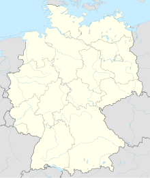
Harlesiel
Coordinates: 53 ° 42 ′ 33 " N , 7 ° 48 ′ 31" E
Harlesiel is located in the north of Carolinensiel , a district of the East Frisian city of Wittmund in Lower Saxony . Harlesiel is a seaside resort with around 800 inhabitants.
location
Harlesiel is located directly on the North Sea and belongs to the city of Wittmund . The place is one kilometer north of Carolinensiel and around ten kilometers east of Neuharlingersiel . The harle flows through the place . The federal highway 461 ends in the ferry port (ferry to the East Frisian island of Wangerooge ) .
Population and tourism
| year | Residents | Tourists 1 |
|---|---|---|
| 1959 | 63 | 117 |
| 1969 | 179 | 251 |
| 1979 | 344 | 817 |
| 1989 | 568 | 1189 |
| 1999 | 727 | 3167 |
| 2009 | 809 | 4880 |
history
The place was created between 1953 and 1956, when a new port and sewer system was built north of the Friedrichsschleuse.
The draining of the Harle Bay had already started in 1930 . The project was stopped because of the Second World War . In 1952 the Harlebucht was already drained. In 1953 the Harlesieler Hafen and in 1957 the pumping station were built. In 1959, a campsite, a mini golf course , a children's playground and an outdoor seawater pool were built to promote tourism . In the 1960s, a bathing beach was also created, which has been expanded in area to the present day. In 1973 the Harle airfield was put into operation. In the following years the "Haus des Gastes" (today "Cliner Quelle") in Carolinensiel, the lido and many other commercial clubs were founded.
On August 16, 1972, Harlesiel was incorporated into the district town of Wittmund.
From 1890 to 1989, Harlesiel was the end point of the Jever – Harle railway line for the seaside resort traffic to Wangerooge.
Attractions
Individual evidence
- ^ Federal Statistical Office (ed.): Historical municipality directory for the Federal Republic of Germany. Name, border and key number changes in municipalities, counties and administrative districts from May 27, 1970 to December 31, 1982 . W. Kohlhammer GmbH, Stuttgart / Mainz 1983, ISBN 3-17-003263-1 , p. 264 and 265 .


