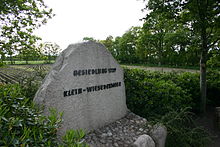
Wiesedermeer
|
Wiesedermeer
Municipality Friedeburg
Coordinates: 53 ° 28 ′ 47 " N , 7 ° 43 ′ 33" E
|
|
|---|---|
| Height : | 9 m above sea level NN |
| Area : | 11.24 km² |
| Residents : | 600 |
| Population density : | 53 inhabitants / km² |
| Incorporation : | August 16, 1972 |
| Postal code : | 26446 |
| Area code : | 04948 |
Wiesedermeer is a district of the municipality Friedeburg in the district of Wittmund ( East Friesland ). The place was created in 1739 in the course of the bog colonization . Wiesedermeer is named after the much older Geestdorf Wiesede to the south of it , which is also in the municipality of Friedeburg, and two inland lakes that have now been drained. The size of the place with a widely scattered settlement structure is 1124 hectares . Wiesedermeer has about 600 inhabitants.
geography
Wiesedermeer is located in the area of the raised bogs , which extend east and south-east of Aurich . Until Abtorfung large parts of the moor and the draining of the small Wieseneder Sea and the Great Sea Wieseneder it was an uninhabited and barren area. The seas were formed in the Ice Age. Today only parts of the raised bog are preserved, around 96 hectares. The seas no longer exist. The cultivated areas are used for agriculture, mostly as grassland.
history
The first two settlers came to the area of today's Wiesedermeer in 1739. They peated parts of the moor, sold the peat and grew buckwheat . However, wet years made this first settlement project fail again. However, the year Wiesedermeer was founded is still seen as 1739. In the second half of the 18th century, the second attempt at settlement took place, which was also successful. There was an access road from Aurich, i.e. from the west.
Around 1800 roads were also laid to the east, to Friedeburg and to Wittmund . There was now a continuous, direct connection from Aurich to Friedeburg. Trade was strengthened through the street. Other settlers came from the Oldenburg region and the craft developed.
In 1859 Wiesedermeer, which at that time belonged to the Kingdom of Hanover like all of East Friesland , was raised to the municipality. A mill was built in 1866, the grinding operation continued until 1960. The mill is now an exhibit on the subject of grinding technology in the Deutsches Museum in Munich. The Ems-Jade Canal , running south of Wiesedermeer, was built between 1880 and 1888, and many Wiesedermeer found work building canals. However, workers from other areas of East Frisia also settled permanently in Wiesedermeer in the course of the canal construction.
The cultivation of further parts of Wiesedermeer took place in the 1920s with steam plows. Thanks to the improved technology, more people settled there and were the first residents of Neu-Wiesedermeer in the west of the village. In 1930 the Wiesedermeer dairy was founded.
On July 1, 1972, the former communities Abickhafe , Dose , Hoheesche and Reepsholt merged to form the community Reepsholt. In the course of the municipal reform on August 16, 1972, the municipality Friedeburg was formed from the previous municipalities Bentstreek , Etzel , Friedeburg, Hesel , Horsten , Marx , Reepsholt, Wiesede and Wiesedermeer.
Neighboring places
| Collrunge | Müggenkrug and Ardorf | Leerhafe and Rispel |
| Brockzetel |

|
Reepsholt , Hoheesche and Abickhafe |
| Marcardsmoor | Wiesmoor | Upschört , Wiesede , Friedeburg |
Economy and Infrastructure
Road connections exist to Aurich, Wittmund, Jever , Friedeburg, Reepsholt and Wiesmoor . Wiesedermeer is the intersection of these roads. There is a small industrial area at the intersection of the Aurich-Reepsholt and Wittmund-Wiesmoor routes. The small dairy Wiesedermeer existed until 2015 and produced sour cream butter as a specialty . The Oldenburg-Ostfriesische Wasserverband has maintained an intermediate pumping station there since 1964. Many residents also work as commuters in the surrounding cities and towns.
In Wiesedermeer there is a campsite by a lake, a daycare center and a youth center in the former elementary school. The village's primary school students are educated in the neighboring Reepsholt, the closest secondary and secondary school is in Friedeburg. There is a grammar school in the district town of Wittmund and in the neighboring town of Wiesmoor .
literature
Heinrich Behrends: The history of the village Wiesedermeer and its old families . Publishing house Ostfriesische Landschaft , Aurich 1976
Web links
- Friedeburg, Wiesedermeer village
Individual evidence
- ^ Federal Statistical Office (ed.): Historical municipality directory for the Federal Republic of Germany. Name, border and key number changes in municipalities, counties and administrative districts from May 27, 1970 to December 31, 1982 . W. Kohlhammer GmbH, Stuttgart and Mainz 1983, ISBN 3-17-003263-1 , p. 264 and 265 .

