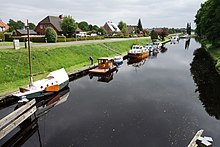
Marcardsmoor
|
Marcardsmoor
City of Wiesmoor
Coordinates: 53 ° 27 ′ 41 ″ N , 7 ° 42 ′ 49 ″ E
|
|
|---|---|
| Height : | 12 m above sea level NN |
| Incorporation : | July 1, 1972 |
| Postal code : | 26639 |
| Area code : | 04948 |

Marcardsmoor is a bog colony in East Friesland and a district of Wiesmoor .
Location and transport links
Marcardsmoor is located on the Oldenburg-East Frisian Geestrücken and there within the East Frisian central moor. Around 1900 the area still had a peat thickness of about eight meters. Since the 1950s, there has also been a road connection to Wiesmoor and on to Autobahn 28 in the form of Landesstraße 12 . Until then, the Nordgeorgsfehnkanal and a field railway were the most important modes of transport.
history
The place was the first that was created in the late 19th century according to the so-called " German high moor culture ". This stipulated that after the bog had been drained with the help of artificial fertilizers, agricultural use should be made possible. After the Ems-Jade Canal was laid out from 1880 to 1888 , the Prussian Central Moor Commission began cultivating an area of around 2,100 hectares north and south of the canal. Up until now, Marcardsmoor was only inhabited by a bridge and lock keeper on the canal. The reclamation of the moor was carried out by settlers together with prisoners. They drove drainage ditches into the moor at a right angle to the east-west canal. In 1890 five settlers were counted, followed by another 29 by 1900. In 1906 the construction of the Nordgeorgsfehn Canal began from Marcardsmoor , which enabled the settlement of today's Wiesmoor core area. In 1907 the Kreuzkirche was built . After further growth, the state manor district of Marcardsmoor was converted into an independent political municipality in 1924. It belonged to the district of Wittmund and was named after Eduard Marcard , former Undersecretary of State in the Prussian Ministry of Agriculture. He had rendered outstanding services to new methods in peatland cultivation. In 1951 the area was ceded by the Wittmund district to the Aurich district. Marcardsmoor has been part of Wiesmoor since July 1, 1972 .
A former school was closed in 2000, and children and young people have been attending schools in Wiesmoor ever since.
economy
In the first decades of existence, agriculture was predominant. The colonists moved more and more from agriculture to livestock farming. Agriculture still plays a role in land use today, but many Marcardsmoorers are also commuters and work in Wiesmoor, Aurich or other places in the area.
Web links
- City of Wiesmoor, district of Marcardsmoor
- Marcardsmoor. A small village in the moor
Individual evidence
- ↑ a b Helmut Sanders (local chronicle of the East Frisian landscape): Marcardsmoor . PDF file, p. 1, accessed June 25, 2011.
- ^ Federal Statistical Office (ed.): Historical municipality directory for the Federal Republic of Germany. Name, border and key number changes in municipalities, counties and administrative districts from May 27, 1970 to December 31, 1982 . W. Kohlhammer GmbH, Stuttgart and Mainz 1983, ISBN 3-17-003263-1 , p. 261 .

