
Langeoog
| coat of arms | Germany map | |
|---|---|---|

|
Coordinates: 53 ° 45 ' N , 7 ° 29' E |
|
| Basic data | ||
| State : | Lower Saxony | |
| County : | Wittmund | |
| Height : | 5 m above sea level NHN | |
| Area : | 19.67 km 2 | |
| Residents: | 1817 (Dec. 31, 2019) | |
| Population density : | 92 inhabitants per km 2 | |
| Postal code : | 26465 | |
| Area code : | 04972 | |
| License plate : | WTM | |
| Community key : | 03 4 62 007 | |
| LOCODE : | DE LGO | |
| Address of the municipal administration: |
Hauptstrasse 28 26465 Langeoog |
|
| Website : | ||
| Mayoress : | Heike Horn (independent) | |
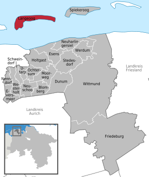
| Location of the community Langeoog in the district of Wittmund | ||
  |
||

Langeoog ( East Frisian long = long, oog = island, so long island) is one of the East Frisian islands in northwest Germany , which are off the mainland of the state of Lower Saxony between the Ems and Weser estuaries in the German Bight . Neighboring islands are Spiekeroog in the east and Baltrum in the west. Langeoog belongs to the district of Wittmund as a unified municipality .
geography
.png)


Geographical location
Langeoog is one of the East Frisian Islands off the coast of East Frisia. Parts of the island and the Wadden Sea around the island belong to the Lower Saxony Wadden Sea National Park . Neighboring islands are, separated by the sea gates Otzumer Balje , Hullbalje and Schillbalje , Spiekeroog in the east and Baltrum just under two kilometers away in the west, separated by the Accumer Ee . The distance from the southernmost tip of the island to the mainland is four kilometers. The individual areas in the mud flats south of the island in the direction of the mainland bear the names Dornumer Nacken , Accumersieler Balje , Neiderplate , Dollart , Ruteplate , Langeooger Plate and Stüversplate , Hungat Plate and the Seriemer Watt from west to east . The large Priel Rute leads south of the Ruteplate towards Hullbalje .
description
Langeoog has an area of around 20 square kilometers and a sandy beach that is around 14 kilometers long . The beach is a dune landscape includes up to 20 m high dunes at. The dune areas are arranged from west to east as follows: Flinthörndünen, Süddünen, Kaapdünen and the Heerenhusdünen. Langeoog is the only one of the East Frisian islands that has so far managed without sea-side coastal protection structures.
In the southwest of the island of Langeoog there is the so-called Flinthörn (Flint corresponds to the flint stone . And Hörn means flood hook, headland) The distinctive salt meadow and dune area developed over time from an independent, accumulating sandplate . Benefiting from the Flinthörndeich, which was built between 1937 and 1944, the dike foreland developed undisturbed from the sandplate through the various stages of dune development to the older gray dunes . The Flinthörn has been a nature reserve since 1963 and is no longer allowed to be entered. The "Flinthörn Nature Trail" is an exception . Starting from the 7.4 meter high Flinthörndeich, the path leads over 1.5 kilometers to an observation platform on the edge of the dune and on to the Flinthörnstrand. The start and end of the nature trail are marked by steles . Illustrated information boards explain the habitats that occur with their bird and plant species.
The south dunes follow north of the Flinthörndünen. To the south-east of it there is an extensive island forest, which arose there on the former military airfield after the Second World War . The forest is criss-crossed by various hiking, cycling and riding trails as well as a fitness trail. At the edge of the forest there is an allotment garden colony .
The Kaapdünen adjoin the southern dunes in a northeastern direction. They separate the residential development of the island village from the official beach sections that begin here. A paved path leads as a "high promenade" through the dunes in an easterly direction to the Heerenhus dunes , which are joined by the long Pirolatal . South of the latter two areas is the so-called Meedland in the interior of the island . It is bounded in the south by the old polder dike built in 1932/1933. The dike also bears the name Schniederdamm ( Sniederdiek ), as it was built under the supervision of a Langeoog tailor in emergency work . At the beginning of the Second World War, the Schniederdamm lost its importance with the construction of a four-meter-high sea dike running southeast towards the harbor. The new dike was raised in 1971 to 6.16 to 6.80 meters.
The Schloppsee ( Sloppersee ) is located in the dune landscape east of the Pirolatal, near the Großer Schlopp ( Grote Sloop ). The lake was only created in 1971 by removing sand for coastal protection. This is followed by the Melkhorn dunes with the approximately 20 m high Melkhorn dunes . It is the highest point on the island and, once 21.3 meters high, was for a long time the highest natural point in East Frisia. The Melkhörn (= Melkecke) owes its name to the fact that the cows were milked here at the former 1st dairy until 1952. Today the Langeoog Youth Hostel is housed in the building. To the east of the Melkhörndünen , after the Kleiner Schlopp ( Lütje Sloop ), there is an area called Dreebargen . Up to the end of the island at Osterhook , the vegetation and the development of the dunes are now continuously decreasing .
In the southern section of the Großer and Kleiner Schlopp, a 218 hectare salt marsh area was separated from the Wadden Sea in 1934 and 1935 by the construction of a 5.5-kilometer-long summer dike , creating a summer polder . This was renatured in the years from 2002 to 2005, when a compensation area was needed for this encroachment on nature in the course of the laying of the Europipe I and II gas pipes in Accumer Ee . By removing the summer dike, the original character of the area was restored.
Although Langeoog is surrounded by the salt water of the North Sea, there is a freshwater deposit in the sediment below the island core, which varies in size depending on the height of the dune. The occurrence in the form of a mighty freshwater lens has been endangered for several years, as the storm surges in winter cause the protective dunes north of the Oriola Valley to break off more and more.
Land use
The division of space on the island of Langeoog is detailed in the following table:
| Land use (as of 2005) | Area in ha | Share in % |
|---|---|---|
| Construction areas | 102 | 5.2 |
| Areas for common use | 9 | 0.4 |
| Traffic areas | 24 | 1.2 |
| Supply and disposal areas | 5 | 0.3 |
| Green spaces | 49 | 2.4 |
| Agricultural land | 555 | 28.2 |
| Forestry areas | 104 | 5.3 |
| Bodies of water | 59 | 3.0 |
| Areas for embankments and excavations | 8th | 0.4 |
| Other areas | 1054 | 53.6 |
| total area | 1967 | 100.0 |
Climate and weather extremes
The island of Langeoog has a maritime climate with milder winters and cooler summers. The average annual temperature is 8.8 ° C. The monthly temperature mean in February is 1.1 ° C, in August 16.4 ° C. An average of seven days per year with temperatures above 25 ° C are recorded. The annual rainfall is 680 millimeters, with August being the wettest month. The lowest rainfall, however, is recorded in March.
Hard ice winters are reported in the following years:
- 1929 - This year the frozen Wadden Sea made it impossible to pass the ship between January and March of that year. However, the closed ice cover could be crossed by means of cars, sometimes also cars.
- 1955/56 - Ferry traffic was paralyzed for weeks. The island supply was guaranteed by the rescue boats Borkum , Lübeck and Langeoog .
- 1962/63 - Following weeks of isolation with up to three meters high towering ice floes on the beach, the supply was carried out with army - helicopters .
Island protection
On the lake side, Langeoog is only protected from the forces of the North Sea by natural dunes, which are known as protective dunes. The dunes are over 20 kilometers long, they start in the southwest at Flinthörn and end in the east of the island at Osterhook. There are no massive protective systems such as stone or sheet piling walls. In 2018, the state of Lower Saxony will use the Lower Saxony State Agency for Water Management, Coastal Protection and Nature Conservation (NLWKN) with financial expenditures of 2 million euros from the funds of the federal-state joint task for coastal protection, following the sand flushing carried out in 2017, another 200,000 cubic meters of sand over a length 1.5 kilometers in length on the upper beach area to compensate for any missing heights. This serves to secure the dunes in front of the Pirolatal and thus to protect the Pirolatal from the ingress of water during storm surges. The protection of the Oriola Valley is necessary to secure the settlement. Under this valley lies the freshwater lens, from which the drinking water for Langeoog is obtained. If the valley was flooded, it would be mixed with salt water and thus inedible.
Flora and fauna
Heather family
The name of the Pirolatals goes to the scientific name Pyrola rotundifolia (or on the French common name Orioles / Pyrole - due to the membership of France in the Napoleonic period ) of the under nature conservation standing round-leaved wintergreen back, which formerly marked the terrain. Since its drainage, the population has declined and a crowberry heather has developed , for which the black crowberry ( Empetrum nigrum ) is characteristic on the North Sea islands . Both types of plants belong to the heather family (Ericaceae).
Birds

Langeoog temporarily housed the largest herring gull colony in Germany with up to 30,000 breeding pairs. To protect this bird species and its breeding areas, the Dreebargen area has been the oldest nature reserve on the island with the seagull colony since 1875 . However, due to changes in environmental conditions, such as the closure of open landfills, currently only 10% of the population counted in the 1930s and thus around 2,000 to 2,500 pairs of herring gulls remain. Pheasants , kestrels , redshank , oystercatcher , little terns and other tern species are in addition to a variety of other bird species to occur also on the island of birds .
Mammals
There have been deer on Langeoog since 1958, when a buck and two doe were released by the hunting tenant . In the mid-1980s, around 80 of these animals populated the island.
Furthermore, one exists hares - population in the mid-1980s, around 600 to 700 animals included. This apparently goes back to deliberate exposure in the late 19th century.
The "feral" rabbits "originally" native to the island (descendants of domestic rabbits , mere breeding forms of the wild rabbit ) no longer existed at the end of the 19th century. It may have been the offspring of “escaped” domestic rabbits in the early modern period . On the one hand, bathers are said to have enjoyed rabbit hunting since the 1850s , and on the other hand, an ordinance was issued in 1869 to exterminate rabbits on all islands .
history
Creation of the island
The islands off East Frisia were not connected to the mainland like the North Frisian Islands. Around 10,000 years ago the mainland extended far into the North Sea to the Dogger Bank and the English coast. Then began - as a result of the ice melt after the last ice age and the resulting rise in sea level - the area that forms today's German Bight. Due to the interaction of currents, water and wind, sand was deposited, which over the next millennia grew to form sandbanks. The sandbanks, which were no longer flooded even at high tide (see Kachelotplate ), formed the ideal soil for various plants that acted as soil fasteners with their roots. This vegetation facilitated the formation of dunes and thus enabled the island to grow.
Ancient and Middle Ages

The first recorded mention of the East Frisian Islands can be found with Strabon , a Greek historian and geographer in the Roman service. It is reported of the occupation of an island near the mouth of the Ems called Burchana by Drusus . Also Pliny the Elder reported Burchana.
In records of the Crusades are Borkum , Juist , Memmert , Buise and Bant mentioned. In 1227 a fleet of East Frisian crusaders gathered in front of these islands for the fifth crusade . In 1229 the Hohenstaufen Frederick II was able to be crowned King of Jerusalem with the help of this fleet .
At that time, Langeoog must have already been settled, because the East Frisian document book records a murder in the port of Ackumhe ( Accumer Ee ). It is still the name of the lake between the neighboring island of Baltrum and Langeoog to the west . The name analogy suggests that this port was a former island port of Langeoog.
Chief time
.jpg)
During the chief's time from 1350 to 1464, the East Frisian islands belonged to the domain of the tom Brok family . Widzeld tom Brok is the first to be mentioned in a written document by Langeoog: In 1398 he transferred the fiefdom of Langeoch to Duke Albrecht of Bavaria .
In 1464, the Cirksena dynasty asserted itself against most of the East Frisian chiefs by means of political and military maneuvers. Ulrich I was the first imperial count from this family. The islands belonging to the fiefdom remained politically insignificant even during this period. Both new and old gentlemen had little interest in the islands as long as they got their third on beach rescue.
Modern times
The first settler known by name is Beyffe Eyben , who lived on the island from 1619 to 1692 . The first island bailiff mentioned by name was Melchior Edden Garmer. In 1630, his territory comprised seven households with 35 residents.
At the beginning of the 16th century, the coast of East Frisia was hit by some severe storm surges , such as the Second Cosmas and Damian Flood in 1509 or the Antoni Flood in 1511. However, nothing is known of any concrete effects on the island. In the period from 1650 to 1700, the village had to be relocated several times due to sand flights. For example, a church was built in the east of the island in 1666 and reports of building a church and the establishment of an eastern village near the Melkhorn dunes are also reported for the years 1702 to 1706.
It can also be read that the Petri flood on February 22nd, 1651 led to a breakthrough of the island. However, a report by Pastor Balthasar Arend from 1684 does not allow any conclusions to be drawn about a two-part island at the time of the report.
The Christmas flood of 1717 tore the island near the Großer Schlopp ( Grote Sloop ; Sloop refers to a linear dune breakthrough) in two parts. The church and the rectory were destroyed, and the village, which was again in the western part of the island, was damaged. With the exception of four families, the residents then left the island. After another severe storm surge, the island was completely abandoned in 1721 .
In 1723 Heligolandians under the leadership of Jacob Jacobsen tried to repopulate the island despite the prohibition of the then Helgoland sovereign King Friedrich of Denmark , but gave up again after a few years. Only in 1732 was the island permanently settled by three families again, but it is also reported that the inhabitants left the island again in 1736. In 1740 the Ostend domain was created . In 1749 there were four farms in the west of the island and one farm in the area of today's dairy . For the year 1777 it is reported that in addition to a population of 39, 129 farm animals (82 sheep, 23 cows, 19 calves and 5 horses) were registered on the island.
The inhabitants made their living by fishing and whaling . The extremely lucrative whaling ended around 1780 when a sea war between the Netherlands and Great Britain cut off all shipping . Muschelschill was also sold. In Schill (such as shell, word related to the eng. Shell) is shells , were deposited ocean currents and surf on the island. They used to be mined for the production of lime .
Napoleonic period
As a result of Prussia's defeat by Napoleon I in 1806 , Prussia ceded all sovereign territories west of the Elbe in the Peace of Tilsit in 1807, including Langeoog. Napoleon struck the "Department Oost-Vriesland", including Langeoog, to the Netherlands. This got the islanders into the conflict between France and England over the sea trade ban due to the French continental barrier . Smuggling flourished on Langeoog and other East Frisian islands during this period. Goods were brought from the then British Heligoland to the mainland via Langeoog. In order to stop the smuggling, Napoleon stationed up to 200 soldiers on the island. For this purpose, the Napoleonschanze, which is no longer recognizable today, was built in the dunes not far from the dairy . The stationing of soldiers did not prevent the Langeoogers from smuggling, however, as they knew their mudflats with ebb and flow much better than the French.
As a result of the failed Russian campaigns , Langeoog became Prussian again in 1813. The peace between the victorious powers undermined smuggling.
In 1824 the chronicler Friedrich Arends wrote :
“The island of Langeoog is almost 2 hours away from the coast, but torn into two parts, which are only connected at low tide, together lasting 2 hours and not 1/4 hour wide. It has only 45 inhabitants, some of whom live on the eastern part, the east end, the others on the west end, but who soon have to move their houses to that part, since the sea is very close to them and, as with the other islands, always on disrupts the western side. "
A year after this was written, a storm surge created the large and small Schlopp , which silted up salt marshes . At the same time, local fishing came to an almost complete standstill due to the emergence of trawling . The North Sea resort of Norderney, founded in 1797, opened a new line of business . The Langeooger delivered seagull eggs to Norderney, which were offered there for the maritime breakfast.
A storm surge in February 1825 caused the fields on the island to be silted up. In the same year, the Flinthörndunes began to form in the southwest of the island, which lasted until 1851. In a census in 1842, 118 inhabitants could be counted on the island.
The start of spa tourism

In 1830 the tourist development of the island began with the first bather, the magistrate Vangerow from Aurich. From this year there was also a regular ferry connection to the mainland for the first time. The ferryman was Cassen Frerichs , whose sloop , bought with state support, was destroyed in a storm a year later and was then probably replaced by another boat. From 1839 Tjark Heeren Tjarks took over the position of ferryman and was replaced by Jost H. Börgmann after his death in 1843 . Ports of call on the mainland were now Bensersiel and Westeraccumersiel. The increase in the number of guests was initially slow (1851: 100 bathers). With the establishment of a regular ferry connection between Bensersiel on the mainland and the island in 1843, more guests were to be lured to the island, which the community of Langeoog succeeded in doing. From 1867 there was a regular weekly connection to the mainland by means of the sloop hope of the captain Adam Leiss. Five years later, a connection to Langeoog by ship could already be guaranteed twice a week, as a second sloop was available after the Arthur von Landsberg was commissioned by Captain Frerich Otten Leiss . In 1876 there were already 365 bathers.
In 1863, Zum Fürsten Schaumburg-Lippe was the first inn on the island to be built, but it was only given this name later due to the Prince of Schaumburg Lippe's previous stay there . In 1861 the “Association for Rescue of Shipwrecked People” , founded by tax inspector Breusing in Emden on March 3, 1861, set up one of the oldest rescue stations on the German coast in the western part of the island. In the autumn of 1874, a telegraph station on Langeoog was put into operation by the merchant Heye Broers . In 1884 the Hotel Ahrenholtz, which later operated as Hotel Flörke, was built. In the following year, both the Langeooger Inselhospiz and the "Abtei" viewing tent were built as a forerunner of the beach hall. The latter, however, was moved further into the interior of the island in 1891 due to the threat of undercutting. In addition, the first post office on the island opened in 1885. Tourism then brought enough income to repair the dykes of the Kleiner Schlopps again in 1892. A year later the dike at the Großer Schlopp was closed. From 1895 the medical care of Langeoog was guaranteed.
In 1901 the "Langeooger Pferdebahngesellschaft OHG" was founded, which brought bathers from the ferry pier to the train station at the Loccum monastery hospice . From 1936 the horse-drawn tram was converted to a diesel- powered island railway with a 1000 mm gauge . The new runway went into operation on July 2, 1937. Since then, the Inselbahn no longer runs through the island village to the hospice, but ends in what is now the Inselbahnhof on the southern outskirts.
20th century until today


composed of sheets 2211 - Ostend Langeoog from 1951 and 2210 - Baltrum from 1955

In 1906, after a severe storm surge overnight, a large part of the existing house wells was contaminated, which forced the islanders to build the water tower. In the same year the Große Schlopp was closed by a sand dam. The Kurmittelhaus was built in 1908 and the Langeoog water tower in 1909 . When the water supply was completed, 90 house connections were counted. The public pipe network with a total pipe length of 4500 meters ensured the water supply. With a contract dated March 15, 1909, the water supply was leased to BAMAG Berlin for 30 years. In 1923, the electrification of Langeoog began.
The 75-meter-long steamer Heinrich Horn , built in 1900, sank on December 5, 1917 at the eastern end of the island in Otzumer Balje, where the remains of the wreck, which had broken in two, can still be seen at low tide. On April 10, 1919, the fishing cutter Justitia ran aground on a sandbank off Langeoog. The four-person crew could be rescued with the Reichspost lifeboat .
In 1927 the spa administration took over the entire bathing business. In 1929 the first airfield was opened on Langeoog. The Inselbahnhof was completed in 1937 and was replaced by a new building in 1995 after several renovations.
In the 1930s there were summer camps of the Hitler Youth on the island. From May 31 to June 3, 1939, the first German seaside sports conference took place on Langeoog. The Reichsfremdenverkehrsverband and the Reichssportamt were involved in this. From June 11, 1939, a new air protection ordinance on Langeoog , which included options for darkening living spaces, came into force. The first Langeoog sailing regatta was held on July 22, 1939. In 1937, a large land reclamation campaign in the southwest of the island created an area of 150 hectares in order to build an airfield. Silt and sand were washed up and then distributed by field railways and tracked vehicles . Two settlements for the families of Air Force members were built on the outskirts (1939 Heerenhus housing estate). Here were Reichsarbeitsdienstler in use. On August 22, 1940, 250 French prisoners of war were transferred to the island to do forced labor there. The airfield was not completed until the end of the Second World War. Even today there are numerous remains of the former airfield, the airfield of which was made unusable by allied troops after the end of the war through targeted explosions. The airfield was planted with trees and forms the island forest. The former runway is now used as a hiking and cycling path. Langeoog was, at least in the first years of the war, a repeated target of Allied aircraft. These air strikes mostly caused damage to property or property. There was a bogus airfield ; this was attacked several times by the Royal Air Force (RAF), including on May 31 and June 28, 1940. The two attacks of June 30 and July 1, 1940 each resulted in three deaths. In 1941, four (June 2, 1941) and six bombs (July 20, 1941) hit the airfield as well as the airfield and the mock airfield. On September 7th, incendiary and high explosive bombs damaged the pier and two ships. In 1942, air raids on June 18 and July 9 caused damage to buildings on the island. One person died in a bomb hit on October 29th. On February 3, 1944, a Fortress II shot down over Wangerooge crashed into the Langeooger Watt, where one crew member drowned and five others were taken prisoner.
In the post-war years, Langeoog was part of the British zone of occupation . In 1949 Langeoog was officially recognized as a seaside spa . On January 31, 1950, about four nautical miles from Langeoog (54 ° North, 7 ° East), the 743 BRT freighter Fidamus of the Bremen shipping company Arnold Thyselius, loaded with 900 tons of potash , sank in wind force 7 and blowing snow, whereby 8 of 16 crew members died. In 1962, more than 40,000 spa guests came for the first time. In 1976 the accessibility of the island was greatly improved by the development of a tide-independent port . Operation of the water tower ceased in 1996. Today it serves as a viewing platform at 23 m above sea level .
Until April 2014, the island's old distress observation station stood on the Heerenhus dunes on the eastern edge of the town. The orange box building of the DGzRS , visible from afar , stood on a 21 m high dune. The base of the station that remained after the dismantling dates from the Second World War and at that time served a radar device of the Würzburg-Riese type . The distress observation stations, of which there were a total of 19 stations on the German coast, served as links in the alert chain in the event of a distress at sea. They were decommissioned in 2005. The dismantling of the no longer used station on Langeoog finally took place because of its poor structural condition.
From October 29 to November 2, 2017, the bulk carrier Glory Amsterdam lay aground north of Langeoog .
Population development

|
|
|
religion


Half of the approximately 2000 island residents belong to the Evangelical Lutheran Church . Around 250 islanders are Catholics .
There are two church buildings on Langeoog. The Evangelical Lutheran island church , completed in 1890, was built five years after the opening of the Loccumer Inselhospice , as the much smaller previous building from 1859 could no longer accommodate the steadily increasing number of spa guests on Langeoog. It has a 24.5 meter high bell tower in which five bells hang. Four bells ring several times a day in different variations. The fifth and oldest bell strikes on the hour. The island church can accommodate almost 400 visitors. The unusual altarpiece, which the artist Hermann Buß from Northern Germany created for the restoration of the island church in 1988/1989, is worth seeing . The contemporary altarpiece shows a leitmotif a stranded ship and forms a sharp contrast to the image bearing altarpiece of 1889. Only in 1962 was established as the second church building on the island, the Catholic St. Nicholas Church , which was further expanded in the following years and was only in 1973 its present form . A Catholic church was not built until after the Second World War, as Catholics did not move to the island until the island's infrastructure was expanded during the Third Reich . Until then, the inhabitants of the island were traditionally Protestant, as everywhere in East Frisia. The community currently does not have its own full-time pastor, but is looked after from Esens .
politics
In the past centuries, Langeoog had an island bailiff from 1630 at the latest. Melchior Edden Garmer was named as such in 1636. Another - incomplete - list of his successors, if any with term of office:
- Hayduck Taaken, around 1741, the first to build a house near today's dairy farm
- Otto Leuss, 1747–1777 was a skipper and came from Bensersiel. The Otto-Leuss-Weg was named after him.
- Gerjet Ludwig Kuper
- Friedrich Jacob Pauls, around 1845
- Oeljeschlager, around 1904
Municipal council

The local council of the island community of Langeoog has ten members. This is the specified number for a municipality with a population between 1001 and 2000 inhabitants. Due to the declining population, there are two fewer council members than in the previous term. The ten council members are elected by local elections for five years each. The current term of office began on November 1, 2016 and ends on October 31, 2021.
The full-time mayor Heike Horn is also entitled to vote in the municipal council.
The last local election on September 11, 2016 resulted in the following:
| Political party | Proportional votes | Number of seats | Change voices | Change seats |
|---|---|---|---|---|
| CDU | 32.77% | 3 | −8.63% | −1 |
| Union for Langeoog | 20.65% | 2 | + 20.65% | +2 |
| SPD | 17.08% | 2 | −1.08% | 0 |
| Alliance 90 / The Greens | 12.06% | 1 | −14.04% | −2 |
| FDP | 11.15% | 1 | −3.85% | 0 |
| Individual applicants | 6.3% | 1 | + 6.3% | 1 |
The turnout in the 2016 local elections was 63%, above the Lower Saxony average of 55.5%. For comparison - in the previous local election on September 11, 2011, the turnout was 74.2%.
mayor
In the mayoral election on June 16, 2019, Heike Horn, who was not party to the party, emerged as the winner. She received 57.4% (605 votes) and thus replaced the previous incumbent Uwe Garrels, who had not run for election again. The second largest share of the vote went to Gert Kämper with 229 votes (21.7%).
List of mayors of Langeoog
- Gerjet Ludwig Kuper, island bailiff and mayor around 1760
- Gerhard Wagner (NSDAP), 1941–1946
- Heli Leiß (CDU), XXXX – 1984
- Manfred Schreiber (CDU), 1984–1986
- Ulf Lümkemann (SPD), 1986–1991
- Manfred Schreiber (CDU), 1991–1996
- Ulf Lümkemann (SPD), 1996-2001
- Manfred Schreiber (CDU) 2001-2004
- Hans Janssen (independent), 2004–2011
- Uwe Garrels (independent), 2011–2019
- Heike Horn (independent), since 2019
Representatives in the Land and Bundestag
Langeoog belongs to the state electoral district 87 Wittmund / Insel , which includes the entire district of Wittmund and, in the district of Aurich, the cities of Norderney and Wiesmoor , the municipality of Dornum and the island communities of Juist and Baltrum . 15 parties ran for the state elections in Lower Saxony in 2017 . Six of these parties have put up direct candidates. The directly elected MP is Jochen Beekhuis from the SPD .
Langeoog is part of the Friesland - Wilhelmshaven constituency . It includes the city of Wilhelmshaven and the districts of Friesland and Wittmund . The directly elected MP is Siemtje Möller (SPD). No party candidate from the constituency entered the Bundestag via the parties' list.
coat of arms
|
|
Blazon : "On a blue shield two Venetian red sails on overturning white waves and three hovering silver (white) seagulls." |
| Foundation of the coat of arms: In 1946, the municipal council adopted the coat of arms, which was already used by the local gymnastics and sports club. |
Culture and sights


The Langeoog water tower , built in 1909, is the island's landmark and can be climbed during the summer season. To mark its 100th anniversary in 2009, it was extensively renovated. From the top you have a view over the village and the dunes that separate the village from the beach. About four meters west of the tower is a square granite pillar, the upper horizontal surface with a cross representing a trigonometric point in the main European triangular network. This is at a height of 17.75 m above sea level. NHN .
The Langeooger Kurzentrum with the spa garden created in 1983/84 is located in the north-west of the island village. The spa facilities include a seawater wave surf bath with a water temperature of 28 ° C and an adventure pool with a water temperature of 30 ° C. This includes a 42 meter long water slide. The island's house , which opened in 1973, is used for events. Music and cultural events as well as exhibitions take place here regularly in summer. The Langeoog Maritime Museum has been located in the Haus der Insel since 1981 with a large collection of ship models and the permanent exhibition Garbage in the Sea . A North Sea aquarium set up in the museum in 1998 was abolished in 2013. In front of the island's house you can see the old museum lifeboat Langeoog , which was in use from 1945 to July 1980 and has been on display there since that year.
The island's local history museum is located in Caspar-Döring-Pad. The Seemannshus is an old island house with living room, veranda and four guest rooms from 1844, in whose premises the local heritage association exhibits exhibits from Langeoog's history as well as objects from the life of the islanders. As a subsidiary location of the Langeoog registry office, it is possible to get married in the former living room of the Seemannshus .
The "Altes Wasserwerk" information center has been located in the Wasserwerk West, which has been closed since 1992, since June 2000. It explains to visitors the difficulties with the island's drinking water supply. Langeoog's drinking water is obtained through a large freshwater lens located under the island. The exhibition provides information about the freshwater lens, its location and protection, as well as the necessary steps from extraction to provision as drinking water. The information house is at the end of Mittelstrasse and can be viewed free of charge every day.
A monument to a historic diesel locomotive is located on the north side of the Inselbahnhof . The only around 4.4 meters long Kö 2 was built in 1937 for the then island railway and drove on the island for decades. In 1982 it was decommissioned. The small two-axle diesel locomotive has been a memorial at the station since 1987.
Barkhausenstrasse, named after the former curator of the island hospice of the Loccum Monastery, Friedrich Wilhelm Barkhausen , and Hauptstrasse are the two main shopping streets in the center of Langeoog. Most of the shops, restaurants, pubs, cafes and bike rentals are on these two streets. Although Langeoog is already traffic-calmed as a car-free island, these two streets in the village center have been declared a pedestrian zone, but horse-drawn carts, electric vehicles by traders and cyclists are allowed to travel at walking pace. Sights in Barkhausenstrasse are the bronze sculpture of a fisherman in front of the Café Leiß and the bronze sculpture of the Langeoog ferry captain Johann Wilhelm Leiß in front of the “Bernsteinstübchen” , which was inaugurated in April 2007 .
The Langeoog Dune Cemetery is located northeast of the island village in the middle of dunes. The cemetery is best known for the grave of the singer Lale Andersen , who was buried in 1972 . There are also two memorials here. One of the memorials on the so-called “Russenfriedhof” commemorates 113 Soviet prisoners of war who died on Langeoog and who were brought to the island from August 1941 to build a new air force base and who died of inhumane treatment. The mass grave on the edge of the dune cemetery is now marked by six steles with the names of the 113 dead. The second memorial commemorates the 450 or so Baltic Germans who were evacuated from a nursing home in Schwetz / West Prussia in February 1945 and who found a new home after a dramatic escape on Langeoog. Many of them are buried in a separate section in the dune cemetery.
Other buildings that characterize the island are the beach hall or the dairy .
On the beach section in front of the Pirola Valley, the remains of a shipwreck can be found hidden in the sand, which probably came from a plate-bottom ship from the time of the continental barrier. Occasionally, the remains of the ship, in which cannonballs were found many years ago, were partially exposed over time by the action of the tides, whereby in 2009 it could be seen that the hull of the ship has meanwhile broken apart.
The exhibition Mini-Langeoog - the island made of LEGO bricks has been on view in the Haus der Insel since 2007 . Andreas Boecker from Herford and his family gradually recreated well-known scenes from Langeoog with Lego bricks . Building on this, events under the name "1000 Stones Island" took place in 2014, 2016 and 2018 in the house of the island.
Economy and Infrastructure
tourism

|
|
||||||||||||||||||||||||
| Source of the figures, if not already given in the text: | |||||||||||||||||||||||||
As on the other East Frisian Islands, tourism is the central economic factor. Especially in summer, numerous guests visit the island to spend their holidays in holiday apartments, hotels or guest houses. The individual beach sections are at least partially expressly designated with regard to the types of use. In the area of the beach there are several zones declared as non-smoking beaches, in which smoking is prohibited. Further names are for example youth beach, surf beach, dog beach, sport beach and kite beach. In the mid-1980s the number of annual spa guests was around 83,000, which was around 27 times the number of 3,119 inhabitants at the time. The island also has a youth hostel. This is located a few kilometers east of the island village in a domain built in 1923 near the Melkhorn dunes . In 1953 it was converted into a youth hostel with 126 beds and 13 bedrooms. The "LangeoogCard" has existed since 2000. This serves as a tourist card , ticket for the island ferry, entrance ticket for the adventure pool and entitles you to free use of the island railway .
Langeoog joined the marketing organization Die Nordsee GmbH in Schortens for the tourist marketing of the island , which represents the seven inhabited East Frisian islands and 15 coastal towns in Lower Saxony.
traffic

The island is almost free of internal combustion engine traffic . Only bicycles , horse-drawn carts, electric vehicles for business people and some transport vehicles of the island community are allowed. Only emergency services and volunteer fire brigades use vehicles with gasoline or diesel engines , tractors and construction machines are also allowed to drive.
Shipping


The island has a ferry port , which the island's own shipping company of the island community of Langeoog uses from Bensersiel , from which tourist day trips to Norderney, Baltrum, Spiekeroog or Wangerooge are also made during the season . There is also the Damwerth shipping company , which offers crossings from Bensersiel to Langeoog as well as excursions around the island with the 33.52 meter long MS Flinthörn .
In 1830 a manorial ferryman was obliged to carry out a weekly connection to Langeoog. In 1888 the Esens-Bensersiel-Langeoog shipping company was founded . One of the shipping company's first ferries was the Empress Auguste Victoria . In 1927 the municipality bought the shipping company including the horse-drawn tram and renamed it "Shipping of the island community Langeoog".
The Langeooger Hafen was built between 1937 and 1941. In 1951 a new jetty was built in the western part of the port to replace the eastern pier located in the tide- independent port basin. In 1978 a lift bridge was added. The ferry connection has been tide-independent since the port was expanded in 1976, so the ferry times do not change daily, a distinction is only made between a summer and a winter timetable. The travel time from Bensersiel is about 30 minutes. Due to the independence from tides and the increasing construction of second homes, the number of passengers increased considerably in the second half of the 1970s. That is why the two passenger ships Langeoog III and Langeoog IV were purchased in 1979 , each of which can accommodate 800 people. The shipping company of the island community of Langeoog now operates four passenger ships ( Langeoog I , II , III and IV ) and two freight ferries ( Pionier and Uncle Otto ).
In 2011/2012 repair work took place in the port of Langeoog, which increased the jetty to 3 m above sea level. NHN and a new jetty to expand capacity. In 2011, around 1.2 million passengers were carried on the ferries. According to the responsible port operator Niedersachsen Ports, an average of around 10,000 ship movements requiring notification take place in the port of Langeoog every year.
air traffic

The airfield Langeoog is located approximately 500 meters southeast of the island station. It is regularly served by the Wittmund- based airline Luftverkehr Friesland Harle .
Island railway


The Langeoog island railway connects the ferry port with the town center. The journey time for the 2.5 kilometers from the port to the island village is around seven minutes.
On June 22, 1901, the shipping company put a 3.5-kilometer horse-drawn tram into operation, which led from the pier at the time, which was located near today's harbor, through the island village to the hospice. The Langeooger Pferdebahngesellschaft OHG was founded for this purpose. After the pier was destroyed by a storm surge at the end of 1936, the horse-drawn tram was replaced by a motorized island railway with meter gauge. The new line went into operation on July 2, 1937. Since then, the island line no longer runs through the island village, but ends in the new island station on the outskirts. In 1995, two new trains with a total of ten wagons and five locomotives were purchased for the Inselbahn. Between 1993 and 1996, the island train station from 1937 was replaced by a new building at the same location. In 2005, two more passenger cars were procured, each with entry aids for wheelchairs and prams. Freight traffic on the island railway was stopped on April 30, 2008. The freight wagons were sold in 2009 with the exception of three wagons for baggage transport. In 2014 the Inselbahn had five locomotives for passenger traffic, two freight locomotives, twelve passenger cars, two freight cars for transporting luggage and one freight car for rail service purposes.
Rescue station of the DGzRS


Since 1861, four years before the foundation of the German Society for Rescue of Shipwrecked People (DGzRS), there was a rescue station on Langeoog, which was equipped with a 30 'Francis boat. In 1870 a massive rescue shed was built. Two years later, another station with a rescue shed and a 20 'Francis boat was set up at the eastern end of Langeoogs. One year after the western station received a new rescue shed, the 7.5 meter long Papenburg rowing lifeboat was stationed there in 1883 . Four years later, it was relocated to the east station, while at the same time it was replaced by a new, 8.5-meter-long rowing lifeboat called the Reichspost including a transport car. After 23 years of service, it was replaced in 1910 for a new building of the same name and size. Previously, in 1899, the east station with the Dr. G. Krause received a new boat. The Reichspost remained in service as one of the last rowing lifeboats until its last mission on March 5, 1942. During this mission by the Langeoog rescue men, twelve shipwrecked people were rescued near the island.
With the relocation of the Hamburg I from Hörnum (Sylt) to Langeoog, the era of motor lifeboats began in 1941 . But already in December 1942 this boat was moved to Juist as August Nebelthau I , because the station had received the 13-meter-long Hamburg II . From 1945 until 1980, the motor lifeboat Langeoog was stationed in the port. The successors of the Langeoog were the rescue cruisers Hans Lüken (until 1991) and Hannes Glogner . In 2001 the Hannes Glogner was withdrawn from Langeoog and joined the reserve fleet. After 60 years, the occupation of the station by full-time rescuers ended.
The DGzRS sent Caspar Otten to Langeoog for the now voluntary rescuers from the island . The 9.50 meter long new lifeboat with a completely closed wheelhouse is named after a former foreman of the station. The Secretarius, the 60 cm longer model of the same class, has been at the pier in the harbor since June 23, 2017 . The DGzRS station building is located directly behind the pier on Hafenstrasse. The area of the Langeooger Seotretter extends over the Wadden Sea to the mainland ferry port Bensersiel, to the neighboring islands of Baltrum and Spiekeroog and on the north side of the island out to the open North Sea. It is characterized by island ferry and excursion traffic, coastal fishing and recreational shipping.
The tradition of the rescue work is present in many places on the island. Evidence of the DGzRS history is on display in the Maritime Museum. After the Langeoog has been decommissioned, it will stand in front of the museum as an accessible museum ship. In the dunes, the DGzRS operated a maritime emergency observation center until 2014, which had lost its tactical importance due to the improvement in radio technology.
Energy, water and internet supply
Langeoog is connected to the mainland by two 50 mm² thick copper cables, which run through the mudflats along the fairway and are marked with cable buoys, and thus connected to the electricity supply. This has been the case since 1923.
The water supply is covered exclusively by the water available on the island in the freshwater lens, which is another reason why the protective dunes along the Oriola Valley are regularly reinforced. The water consumption is 330,000 m³ / year. The 18 vertical wells of the Oldenburg-Ostfriesischer Wasserverband (OOWV) are located in the Pirolatal, and are distributed to private and commercial customers via a 29-kilometer pipe network. The waterworks itself is located in the dunes east of the island village, and has been operating fully automatically since 1961. The water is treated with quartz sand and polyaluminium chloride hydroxide with a maximum treatment volume of 100 m³ / hour. The storage capacity is 1250 m³. In 1992 the water supply was transferred to the OOWV.
Deutsche Telekom has expanded FTTC vectoring to include Langeoog, which enables fast internet with up to 100 Mbit / s.
media
All print media appearing outside the island are brought to the island in the morning by the first ferry from Bensersiel. The " Anzeiger für Harlingerland " is the daily newspaper for the district of Wittmund , which also includes the island of Langeoog. The newspaper appears in the district town of Wittmund and reports regularly on Langeoog topics.
The weekly newspaper "Langeoog News" has been published by Langeoog Multimedia GmbH since mid-2005 . It appears weekly from April to October, the rest of the time every two weeks. It contains current coverage and the week's program of events. The Internet edition of the "Langeoog News" reports daily all year round from the island. Here you can find current reports, event tips, an overview of the local hosts, timetable changes and much more.
The current information brochure for the North Sea health resort Langeoog "de Utkieker" is published by E. Söker from Esens and is produced in cooperation with the Langeooger Kurverwaltung, the Langeooger Ortshandwerkerschaft, the DEHOGA -Inselgruppe Langeoog and the Langeooger retail association . The brochure, published monthly during the season, reports on more than 200 pages about events, people and backgrounds.
education
With the island school Langeoog, Langeoog has a primary, secondary and secondary school with a school for learning assistance. The current number of students is around 110. Students on the island who want to do their Abitur attend the Lower Saxony boarding school in Esens after the tenth grade . Over 90% of the students at the boarding school come from the East Frisian Islands. Due to the school structure reform in Lower Saxony and the associated elimination of the orientation level, it may be necessary in the future for students from the age of ten to switch to boarding school after the fourth grade.
Every year at Pentecost, former students and teachers of the North Sea High School, which was closed in 1988, and the associated boarding school meet on the island. The boarding school, which has been vacant since then, was completely destroyed in a fire on May 13, 2009.
Sports
The largest sports club on the island is TSV Langeoog , founded in 1908 , a sports club with over 700 members and 23 departments. The club uses the sports field north of the airfield and the gymnasium built in 1966 on Friesenstrasse as sports facilities. The Bundesliga soccer club SC Freiburg regularly used the sports field from 1990 to 2006 to prepare for the Bundesliga season. Even the 1. FC Köln and TSG 1899 Hoffenheim completed their Bundesliga teams already training camp on the island.
There is also the sailing club Langeoog (SVL) , which was founded on August 22, 1972 and has around 260 members . A golf club has also existed on Langeoog since May 1996. It has a new nine-hole golf course south of the airfield. Operation of this equipment in an intermediate zone of the National Park Wadden Sea is under discussion, as he believes the Watt Council done since 2001 illegal. Other sports clubs on the island are the Schiessverein Langeoog eV, founded in 1971, and the Langeooger Sportfischerverein , which uses the quarry pond between the airport and the dike and whose founding date is December 13, 1995.
The Lower Saxony State Sports Association's tent camp takes place on Langeoog every summer with up to 14 days of free time for children and young people.
leisure
One of the regular events on the island is a street festival called Dörpfest , which is held in the center of Langeoog . Similarly, a once a year rounders -competition against the team from the neighboring island of Spiekeroog performed. There is also a cinema with two halls located on the Hospizplatz on the island.
Others
In 1988, Langeoog was honored by the then Minister of Social Affairs of Lower Saxony, Hermann Schnipkoweit, in the state competition for leisure in Lower Saxony .
In 2004, the island of Langeoog had the highest per capita debt of all municipalities in Lower Saxony at 2775 euros per inhabitant . One reason for this may be the investments mentioned above, particularly in the area of the Langeoog island railway in the 1990s. In addition, it should be noted that the island community, due to its special location, also has to perform non-community tasks that the district takes on in mainland communities.
The Langeooger Inselbrauerei has existed since 2007 and is the first on the East Frisian Islands and has also operated the Langeooger coffee roasting company since 2008. Gin has also been produced since 2015.
In early 2008, the island and some of its residents were the focus of a multi-part television series. In the Kabel1 broadcast Every Kilo Counts - An Island Goes Slim it was reported how 21 residents of Langeoog lost weight. For every kilogram lost, they received 100 euros, which were used for charitable purposes on the island.
Several island thrillers have been written about the island of Langeoog, including the island thriller Die Langeoog Lesson by the writer Antje Friedrichs . On November 24, 2013, playing on Langeoog was the scene: Murder on Langeoog in the ARD broadcast.
Personalities


Honorary citizen
The honorary citizenship is the highest honor given to the Langeoog community. The municipality has awarded the following people:
- Jürgen Baron von Schilling (1909–2008), conferred honorary citizenship in 1980
Sons and daughters of the island
Born on Langeoog:
- Johann Tongers (1881–1969), pastor, local researcher and author (published several works on the island history of Langeoog)
- Jan-Gerhard Vestering (born March 12, 1937), football player
Personalities associated with the island
The names of the following people are also associated with the island of Langeoog:
- Lale Andersen (born March 23, 1905 in Lehe ; † August 29, 1972 in Vienna ) - singer and actress. She was one of the most famous residents of Langeoog. Lale Andersen, who became world famous with the song Lili Marleen , lived for many years in the "Sonnenhof", a thatched-roof house on the island that emerged from a Wehrmacht barracks. A café was set up in this for a long time, in which pictures, clothes and other memorabilia of the singer and actress were exhibited. Currently (as of August 2019) the property is used as a holiday home. Although she died in Vienna, she was buried in the Langeoogs Dune Cemetery in 1972 according to her own wishes. On the 100th birthday of Lale Andersen on March 23, 2005, a bronze statue created by the goldsmith Eva Recker was ceremoniously unveiled below the water tower.
- Christian Bartholomae (born January 21, 1855 in Forst ; † August 9, 1925 in Langeoog) - German Indo-Europeanist, Iranist and Indologist.
- Max Böhlen (born April 14, 1902 in Bern , † August 23, 1971 in Basel ) - Swiss painter. Max Böhlen visited the island during his East Frisian phase in the 1930s and created one of his main works there.
- Rudolf Eucken (born January 5, 1846 in Aurich , † September 15, 1926 in Jena ) - philosopher and Nobel Prize winner for literature . Eucken was one of the first holidaymakers and has repeatedly visited the island. He reported about it in his memoir "A Piece of German Life". The Rudolf-Eucken-Weg is a street named after him on the island .
- Wolf Gerlach (born April 17, 1928 in Stolp , Pomerania ; † November 12, 2012 in Bad Zwischenahn ) - stage designer, film architect, caricature artist, painter, author and inventor of the Mainzelmännchen and von Ute, Schnute, Kasimir grew up on the island.
- Anselm Prester (born July 17, 1943 in Tegernsee ) - German painter based on the island.
- Gabriele Wohmann (born May 21, 1932 in Darmstadt ; † June 22, 2015 there) - was a German writer. As a boarding school student, she attended the not yet recognized North Sea pedagogy on the island of Langeoog, where she passed an external high school diploma and later taught as a teacher.
literature
- Oltmann Ammermann, Gert Uwe Detlefsen, Franz Horb, Ulrich Uplegger: Shipping of the island community Langeoog - Chronicle of the shipping company and island railway . Ed .: Inselgemeinde Langeoog. Verlag Gert Uwe Detlefsen, 1996, ISBN 3-928473-29-8 .
- Antje Bruns: Island and coastal protection in Lower Saxony. The Langeoog example . VDM Verlag Dr. Müller, Wiesbaden 2008, ISBN 978-3-8364-7600-3 .
- Gisela Hennig: A life like ebb and flow . Schardt-Verlag, 2003, ISBN 3-89841-112-5 .
- Hans Jürgen Jürgens: Testimonies from a disastrous time. A war diary about the events of 1939–1945 in the Wangerooge-Spiekeroog-Langeoog area and the situation in the Reich and on the fronts . 6th edition. CL Mettcker & Sons, Jever 2003, ISBN 3-87542-008-X .
- Manon Loock-Braun: Out and about on Langeoog. Natural and cultural-historical island walk . Husum Druck- und Verlagsgesellschaft, Husum 2005, ISBN 978-3-89876-195-6 .
- Johann Tongers : Our Langeoog as it was. 3. Edition. Ostendorp-Verlag, Rhauderfehn 1975, ISBN 3-921516-12-9 .
- Johann Tongers: Our Langeoog. Little Langeoog guide. 2nd Edition. H. & J. Altmeppen, Rheine in Westphalia 1962.
- Johann Tongers: Our Langeoog as it was. 2nd, enlarged and improved edition. Self-published, Langeoog 1962.
- Johann Tongers: Our Langeoog. Becoming an island. Mettcker, Wittmund 1951 ( Our Langeoog , Vol. 1).
- Cosima Bellersen Quirini: 100 special places on Langeoog. Schadinsky-Werbung, Celle 2016, ISBN 978-3-9812133-6-2 .
Web links
- Official Langeoogs website with host database and ship timetable
- Official website of the shipping company of the island community of Langeoog
- Coastal protection in the Pirolatal
Individual evidence
- ↑ State Office for Statistics Lower Saxony, LSN-Online regional database, Table 12411: Update of the population, as of December 31, 2019 ( help ).
- ^ Antje Bruns: Island and Coastal Protection in Lower Saxony. The Langeoog example . VDM Verlag Dr. Müller, Wiesbaden 2008, ISBN 978-3-8364-7600-3 , pp. 1 ff .
- ^ East Frisian landscape: Low German-High German dictionary for East Frisia. Retrieved July 27, 2018 .
- ^ East Frisian landscape: Low German-High German dictionary for East Frisia. Retrieved July 27, 2018 .
- ↑ Dunes on Langeoog at www.nordwestreisemagazin.de
- ^ Mareike Steffens, Jan Barkowski: Vegetation and paleoecological studies in the summer polder on Langeoog. (DOC; 1.48 MB) Diploma theses at the Institute for Geobotany at the University of Hanover. In: uol.de. 2003, accessed August 9, 2019 .
- ↑ Renaturation of the Langeoog summer polders at www.nlwkn.niedersachsen.de
- ^ Duckweed Langeoog . Arnold Meyer. Retrieved July 10, 2009.
- ↑ Natural dangers for the freshwater lens. In: EIn-BIT. Carl von Ossietzky University of Oldenburg, accessed on August 9, 2019 .
- ↑ State Office for Statistics and Communication Technology Niedersachsen-Online: Table Z00100001 - 462007 - Municipality of Langeoog
- ↑ Langeoog.de Historical outline - an overview of a good 600 years of settlement history on the island of Langeoog , viewed on August 21, 2010
- ↑ LANGEOOG for ice and snow on Langeoognews.de from January 16, 2013, accessed on March 11, 2017
- ↑ 1963, when the winter on the islands was icy on ndr.de of January 2, 2013, accessed on March 11, 2017
- ↑ NLWKN press release of May 30, 2018 ( NLWKN website ), accessed on June 14, 2018
- ↑ Representation of island protection for Langeoog on the NLWKN website ( [1] ), accessed on June 14, 2018
- ↑ See article Pyrola rotundifolia and Pyrole of the French Wikipedia.
- ↑ Biodiversity in Lower Saxony: Treasures on our doorstep ( page no longer available , search in web archives ) Poster (PDF; 485 kB). Lower Saxony State Agency for Water Management, Coastal Protection and Nature Conservation, accessed on May 8, 2017.
- ^ F. Runge, H. Altmeppen, J. Altmeppen: Little Langeoog guide. Buchdruckerei und Verlag, Rheine (Westf.) 1986, p. 25
- ↑ a b c Gottfried Walter, Jens Kleinkuhle (u. A.): The land mammals of the East Frisian Islands. In: University of Oldenburg . Retrieved April 12, 2017 .
- ↑ a b c Willrath Dreesen: How feral rabbits gave the island their first harmonium. In: Langeoog.wordpress.com. May 3, 2009, accessed April 12, 2017 .
- ^ F. Runge, H. Altmeppen, J. Altmeppen: Little Langeoog guide. Buchdruckerei und Verlag, Rheine (Westf.) 1986, p. 25
- ↑ a b c d e f g h Langeoog - Historical outline on schiffahrt-langeoog.de
- ↑ a b c The flora and fauna of the East Frisian Islands: Langeoog
- ↑ WDR: Juist: The most beautiful sandbank in the world , accessed on February 23, 2016.
- ↑ a b Heinrich Reimers (Ed.): Balthasar Arends country description of Harlingerland. 1684. Mettcker, Wittmund 1993.
- ^ Langeoog - historical development on www.nordwestreisemagazin.de
- ↑ a b c d e f Inselkirche Langeoog - Chronicle at www.inselkark.de
- ↑ a b c d East Frisian Islands & North Sea Coast by Claudia Banck
- ↑ Information about Langeoog
- ↑ History of the Langeoog shipping
- ↑ Horn Line at www.theshipslist.com
- ↑ Image of the wreckage ( Memento from November 7, 2017 in the Internet Archive )
- ↑ Symbioses, rituals, routines: technology as part of identity. Technology acceptance from the 1920s to 1960s by Rolf-Ulrich Kunze, p. 228 ff.
- ↑ In a brochure published in June 1937 with the title Hitlerjungen auf Langeoog from the Heimatlese series reported about such a tent camp, in which 700 people took part. Blog entry Tent camp of the Hitler Youth attracts Nazi celebrities to Langeoog from May 31, 2009 on Langeoog History Workshop . At a Schlageter cross - presumably on the Melkhorn dune - the camp participants made a vow: blog entry Vow of the Hitler Youth at the Schlageter cross on the Melkhorn dune from May 31, 2009 on Langeoog History Workshop
- ↑ Data on www.bunkermuseum.de ( Memento of the original from July 15, 2013 in the Internet Archive ) Info: The archive link was inserted automatically and has not yet been checked. Please check the original and archive link according to the instructions and then remove this notice.
- ↑ Data on www.bunkermuseum.de ( Memento of the original from July 15, 2013 in the Internet Archive ) Info: The archive link was inserted automatically and has not yet been checked. Please check the original and archive link according to the instructions and then remove this notice.
- ↑ Data on www.bunkermuseum.de ( Memento of the original from June 22, 2013 in the Internet Archive ) Info: The archive link was inserted automatically and has not yet been checked. Please check the original and archive link according to the instructions and then remove this notice.
- ↑ As D. "Fidamus" sank in Langeoog. In: Hamburger Abendblatt from February 1, 1950 ( online )
- ↑ Using Full-Scale Capsizing Accidents for the Validation of Numerical Seakeeping Simulations on the website of the Institute for Ship Design and Ship Safety at the Technical University of Hamburg-Harburg (PDF file; 626 kB)
- ↑ Distress observation station: era over , accessed on October 29, 2017
- ↑ Langeoog - The island for life
- ↑ a b c d e f g To be determined via the form mask of the State Office for Statistics and Communication Technology Lower Saxony
- ↑ The altarpiece of the island church
- ↑ Catholic Church of St. Nicholas
- ↑ a b Shipping of the island community Langeoog - History / Langeoog
- ↑ The History of the Dairy
- ↑ Karl Herquet : Miscellen on the history of East Friesland , 1883 (reprinted in 1985 and 1971) ISBN 3-500-23180-2 , p 44
- ↑ [2]
- ↑ 100 years of the Langeoog water tower
- ^ Lower Saxony Municipal Constitutional Law (NKomVG) in the version of December 17, 2010; Section 46 - Number of Members , accessed on November 7, 2011
- ↑ Results of the 2016 local elections , accessed on December 30, 2016
- ↑ Local elections 2016: Langeoog voted , accessed on December 30, 2016
- ↑ The CDU gets the most votes nationwide. September 12, 2016, accessed December 30, 2016 .
- ↑ Klaus Kremer: Heike Horn becomes the new mayor - Gert Kämper resigns. In: Langeoog News. June 17, 2019, accessed November 12, 2019 .
- ↑ Allocation of constituencies to the Federal Returning Officer
- ^ Nordwest-Zeitung: Bundestag election: These members represent our region . In: NWZonline . ( nwzonline.de [accessed September 29, 2017]).
- ↑ The coats of arms and flags of the German Wadden Islands
- ^ F. Runge, H. Altmeppen, J. Altmeppen: Little Langeoog guide. Buchdruckerei und Verlag, Rheine (Westf.) 1986, p. 4
- ↑ Maritime Museum. Description on the island community's website. Own operation of the island community Langeoog, accessed on August 9, 2019 .
- ↑ North Sea Aquarium in the Haus der Insel † Langeoog. Database entry. In: Zoo-Infos.de. Retrieved August 9, 2019 .
- ^ Freshwater lens Langeoog , accessed on December 13, 2011
- ↑ Info flyer on the old waterworks on the website of the Oldenburg-Ostfriesischer Wasserverband ( Memento of the original from January 18, 2016 in the Internet Archive ) Info: The archive link was automatically inserted and not yet checked. Please check the original and archive link according to the instructions and then remove this notice. (PDF; 3.3 MB)
- ↑ Data from the Kö 2 diesel locomotive , accessed on August 10, 2010
- ^ The town center , accessed on February 12, 2016.
- ↑ Haus Meedland: Who forgets the dead ( Memento of the original from March 1, 2012 in the Internet Archive ) Info: The archive link was inserted automatically and has not yet been checked. Please check the original and archive link according to the instructions and then remove this notice. , accessed August 15, 2010
- ^ The path of fate of the residents of the Baltenheim in Schwetz , accessed on January 8, 2013
- ↑ Wreck off Pirolatal caused a sensation on Langeoognews.de from October 16, 2012
- ↑ Aerial photos of the wreck
- ↑ Mindener Tageblatt: Small world made of 1000 stones - Herford organizes Lego exhibition , accessed on June 2, 2015
- ↑ a b Tourism statistics 2000–2014 on the website of the island community of Langeoog ( Memento of the original from February 23, 2016 in the Internet Archive ) Info: The archive link was inserted automatically and has not yet been checked. Please check the original and archive link according to the instructions and then remove this notice.
- ↑ Die Nordsee GmbH - We about us ( Memento from November 26, 2011 in the Internet Archive ), accessed on July 11, 2011
- ↑ A brief outline of Langeoog's history to the present day
- ↑ Gerhard Johannsen from Bremen on the website of 150-jahre-seenotretter.de
- ^ Station Langeoog of the DGzRS. In: seenotretter.de. German Society for the Rescue of Shipwrecked People, accessed on June 28, 2020 .
- ^ F. Runge, H. Altmeppen, J. Altmeppen: Little Langeoog guide. Buchdruckerei und Verlag, Rheine (Westf.) 1986, p. 19
- ↑ Langeoog's history at www.haus-eschengrund.de ( Memento from December 15, 2009 in the Internet Archive )
- ^ Antje Bruns: Island and Coastal Protection in Lower Saxony. The Langeoog example . VDM Verlag Dr. Müller, Wiesbaden 2008, ISBN 978-3-8364-7600-3 , pp. 44 ff .
- ↑ Duckweed Langeoog at www.nordwestreisemagazin.de
- ↑ Langeoog waterworks on the OOWV website
- ↑ https://www.langeoognews.de/langeoog-aktuell/aktuelles/glasfaser-kapazitaeten-haben-erweitert-21259/82197e199d8af6e81d76c14cdfc85a10/
- ↑ Internet presence of the daily newspaper Langeoog News
- ^ Website of the island school
- ^ Website of former boarding school students
- ↑ internat-langeoog.org , accessed on February 23, 2016.
- ↑ The departments of TSV Langeoog ( Memento of the original from April 21, 2010 in the Internet Archive ) Info: The archive link has been inserted automatically and has not yet been checked. Please check the original and archive link according to the instructions and then remove this notice. , accessed August 7, 2010.
- ^ History of SV Langeoog on the club's website
- ↑ Golfclub Insel Langeoog ( Memento of the original from August 29, 2010 in the Internet Archive ) Info: The archive link was automatically inserted and has not yet been checked. Please check the original and archive link according to the instructions and then remove this notice. , accessed August 7, 2010.
- ↑ 20 years of the Lower Saxony Wadden Sea National Park at www.wattenrat.de
- ↑ Internet presence of the Schiessverein Langeoog eV
- ↑ Symbioses, rituals, routines: technology as part of identity. Technology acceptance from the 1920s to 1960s by Rolf-Ulrich Kunze, p. 243
- ↑ Lale Andersen Ferienhaus Langeoog. Retrieved on August 28, 2019 (German).
- ↑ Max Huggler , Max Böhlen , with a list of works, Frauenfeld 1973, ISBN 3-7193-0466-3 .
- ↑ A studio by the sea on Langeoog on reisebuch.de ( Memento from January 27, 2016 in the Internet Archive )
Borkum | Bant | Lütje Hörn | Brauerplate | Tile plate | Memmert | Juist | Norderney | Baltrum | Langeoog | Spiekeroog | Wangerooge | Minsener Oog | Mellum
Blomberg | Dunum | Esens | Eversmeer | Friedeburg | Holtgast | Langeoog | Moor path | Nenndorf | Neuharlingersiel | Neuschoo | Ochtersum | Schweindorf | Spiekeroog | Stedesdorf | Utarp | Werdum | Westerholt | Wittmund
|
The next island to the west: Baltrum |
East Frisian Islands |
The next island to the east: Spiekeroog |