
Trigonometric point


A trigonometric point (TP) or triangulation point is an observation point of the national survey or a larger triangular network . With its coordinates and its marking (stabilization in the terrain) it forms an essential basis for geodesy and cartography . The surveyors involved in performing triangulation were formerly known as trigonometers .
The TP are marked as small triangles on the topographic maps . In the field, such points are used for geodetic connection measurements , their precise orientation and as fixed points for local measurements.
High and ground points


A distinction is made between high points and ground points :
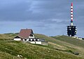
- High points are often the tops of church towers (the tower button under the cross is usually used ) or other clearly visible points on tall buildings, as well as summit crosses , symmetrical factory chimneys and high transmitting antennas . They mostly serve as a target point and only in special cases ( lantern , tower room, eccentric ) as a point of view for a measurement.
- Ground points are marked in the open area by an underground granite or steel plate that is about 1 meter deep and in the middle of which a cross mark is carved. A pillar (long granite stone) with a square cross-section is buried above it as a visible "day mark", the headpiece of which protrudes about 20 cm from the ground and also has a chisel cross or a drill hole located exactly above the cross of the underground slab.
In Germany the pillars usually have a triangle on the north side and the letters "TP" on the south side. In Austria, Hungary etc., on the other hand, “KT” (cadastral triangulation ) is engraved to the north; in the east there are also pyramid-shaped pointed "KF" stones in use.
To ensure security, important TPs are "attached" to additional survey points in the immediate vicinity, i. H. insured controllably by bulky measures . For TPs in the vicinity of buildings , some of the complex marking can be omitted and z. B. be secured by tower bolts on churches or by " twin stones ".
For precise measurements in the TP field, the point on the ground is exposed and then the pillar is again dug centrically above the plate. For all other purposes ("local connection") the cross mark on the stone surface is usually sufficient.
TP are not height control points . In the case of pillars in particular, the height can change as a result of digging in and out. To check the horizontal position, a few securing points are created in the immediate vicinity, the distance to the TP is precisely known. In localities, ground points can also be located on streets or sidewalks in small depressions that are closed by a cover. For TPs with low priority (4th to 5th order, see below), maskable metal tags are also used.
Surveying pillars and signal structures
Some points in the first-order network or important control points e.g. B. in the case of dams instead of granite stones are marketed with surveying pillars that are about 120 cm high. They must be founded at least 80 cm deep or erected directly on natural rock ( frost depth ~ 60 cm). The cross-section is at least 35 × 35 cm, in which a stainless steel or brass plate is embedded at the top , on which the measuring instrument ( universal instrument , theodolite , etc.) is placed exactly in the center. Astronomical and Laplace points have i. A. a larger cross-section to be able to set up a passage instrument or an astrolabe . For particularly delicate measurements - e.g. B. on the portal points of a tunnel - a wooden platform is erected for the observer to avoid even the slightest pillar slope.
In the past, the TP were marked with their own signal structures (raised stands or surveying towers or " pyramids ") made of wood or metal to consolidate and check trigonometric networks for national surveying . These signals were often set up permanently because they had to be aimed at from a greater distance (3 to 30 km) for angle measurements . These signals were erected as towers with a height of up to 40 m on particularly important TP. Because of the good visibility, numerous signal and observation towers were later discovered and expanded as lookout points :
TPs waiting for prospects (selection)
- Ameisberg and Nebelstein in the Mühlviertel and Waldviertel, Austria
- Annaturm on the Bröhn in Deister , Germany
- Aubergwarte on the Auberg , Austria
- Ebersnacken tower on the Ebersnacken , Germany
- Lookout tower on the Eschkopf , Germany
- Lookout tower on the Götzer Berg ( Groß Kreutz , Brandenburg , Germany), new building 2012, TP is a point on the ground next to it
- Hermannskogel -Warte near Vienna (former fundamental point of Austria)
- Lookout tower Müggelturm on the small Müggelberg in ( Berlin-Koepenick , Berlin , Germany), newly built in 1961, TP is a ground point, the fundamental point of Soldner coordinate system 18 of the Prussian real estate cadastre was
- Radspitzturm on the Radspitze , Germany
- Lookout tower on the Sněžník (High Snow Mountain) , Czech Republic / Poland
- Bismarck Tower on the Tanečnice (Tanzplan), Czech Republic
- TV tower on the Kulpenberg in the Kyffhäuser Mountains , the actual TP is next to it as a large stone column. The predecessor of the television tower was a nested TP signal tower typical of its time (nested double tower made of wood above the actual TP),
- In addition, there are numerous TPs on viewing platforms on mountain peaks.

Signal construction (pyramid) at Dallmin in Brandenburg

TP am Barenberg ( Klein Many ) with a concrete column as a finding aid and protection

Pyramid signal ; TP at the base of the pyramid
Pyramid signal , left near the radio tower on the Chasseral

Lookout tower on the Götzer Berg

Lookout tower on the Kleiner Müggelberg

"Wienerblick" triangulation pillar from 1867, on the steep slope west of the city

Triangulation point in Tyrol with information post (marked red and white) and pole signal


Since the coordinates of new points have increasingly been determined with satellite-based methods ( GPS ) in recent years , the signal structures are sometimes unnecessary. Smaller signal structures can still be found here and there, especially as pole signals in mountainous countries . Survey points to hardly accessible mountains in Asia or America are also by " stone men signaled" centrally built cairns, which are up to 40 km wide recognizable in the theodolite.
Monuments at TP

Land surveying with the basic trigonometric points is part of our technical history. Occasionally, there are monuments at TP locations to explain the location and to remember its technical history.
- The TP Rauenberg is the fundamental point of the German Main Triangle Network (DHDN). It was located on the hill formerly known as "Rauenberg" or "Rauhenberg" in the Berlin district of Tempelhof-Schöneberg . A memorial was erected on this site in 1985.
A number of existing TPs have also been placed under monument protection. B. the trigonometric point "Bremerhaufen" near Drolshagen . or the trigonometric point "Engelsberg" near Olpe .
1st to 4th order nets
On the basic network of the 1st order triangulation points - which are about 20–50 km apart - more closely meshed surveying networks are built : from the 2nd order network with a point distance of about 10 km - in the previously common way of working - down to the 4th order in km -Spacing. From the 3rd order onwards, the TPs are less expensive to market because they can be restored more easily if they are destroyed or overgrown. In Austria , Hungary and some neighboring countries, these points are marketed as granite stones about 80 cm deep and called KT stones (after the earlier cadastre - triangulation of Austria-Hungary).
In Lower Saxony some trigonometric points go back to the Hanoverian land survey by Carl Friedrich Gauß . The TP Rauenberg is a special point : It is the fundamental point of the German Main Triangle Network (DHDN) - similar to the Hermannskogel mentioned above for Austria's national survey.
See also
- Fundamental point , vertical deviation point , network adjustment
- Measuring point , switch-on point
- Coordinate system
- Europanetz , European date 1950 , MGI , RETrig
Web links
Individual evidence
- ↑ Monument Trigonometric Point, Essinghausen ( page no longer available , search in web archives ) Info: The link was automatically marked as defective. Please check the link according to the instructions and then remove this notice. Accessed July 31, 2013
- ↑ Ground monument trigonometric point "Engelsberg", Kleusheim ( page no longer available , search in web archives ) Info: The link was automatically marked as defective. Please check the link according to the instructions and then remove this notice. , accessed July 31, 2013