Wheel tip
| Wheel tip | ||
|---|---|---|
|
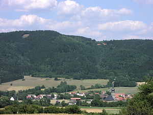
View of the Radspitze and Seibelsdorf in the foreground |
||
| height | 678.4 m above sea level NHN | |
| location | Seibelsdorf district, Bavaria , Germany | |
| Mountains | Franconian Forest | |
| Coordinates | 50 ° 14 '7 " N , 11 ° 26' 7" E | |
|
|
||
| particularities | Radspitzturm ( AT ) | |
The Radspitze in the Seibelsdorf district , near the hamlet of Mittelberg in the Marktrodach market with a height of 678.4 m above sea level. NHN is one of the higher elevations in the Franconian Forest . The difference in altitude between the Radspitze and the Losnitz Valley is the largest in the Franconian Forest.
Geography and geology
The Radspitze is on the southern edge of the Franconian Forest, on the Franconian Line . The summit is made of silica slate .
Radspitzturm
There is a 20 m high observation tower on the mountain . The Radspitzturm in its current form was built in 1955 by the Seibelsdorf group of the Franconian Forest Association . There was a wooden signal on the wheel tip as early as the middle of the 19th century. The first wooden observation tower was built in 1886, but only withstood the weather until 1898.
tourism
Hiking trails
The following hiking trails run by the Franconian Forest Association run over the Radspitze :
- Frankenweg
- Höhenweg
- Almweg
- Radspitzweg
- Kohlbach-Radspitzweg
The marked mountain bike route Rodachtal SÜD also runs over the Radspitze.
Winter sports
In winter, around the Radspitze (between Mittelberg, Oberehesberg and Geuser) trails for classic cross-country skiing and skating style are groomed.
Recreational facilities
- Take-off point for paragliders and hang-gliders on the southwestern edge of the Radspitze
- Grünberg Kneipp facility at the foot of the Radspitze near Seibelsdorf
Historical use by Loewe-Opta
After the end of the Second World War, the Radspitzturm was used as a radio technology laboratory by Loewe-Opta , because the location enabled a direct line of sight to the company's development department in Kronach . In 1953 a television converter was added, with which the television signal from the telecommunications tower on Feldberg im Taunus, about 200 kilometers away, was made available to receivers in Kronach. This use ended with the expiry of the lease in 1965.
literature
- Hans Seiffert u. a .: Special edition (issue 5) on the occasion of the inauguration of the Radspitzturm on September 3rd and 4th, 1955 . In: Frankenwald - Journal of the Frankenwald Association . Issue 5/1955.
Web links
- Frankenwaldverein Seibelsdorf Information about the Radspitze
- Frankenwaldverein: Radspitzturm
- Rennsteig paragliding club starting point at the Radspitze
Individual evidence
- ↑ a b Map services of the Federal Agency for Nature Conservation ( information )
- ↑ Information from the Kronach local association of the German Amateur Radio Club eV (pdf) March 2018, pp. 31–34 , accessed on May 31, 2020 .
- ↑ Hans Stellmacher: Loewe Opta We were the pioneers. September 2001, accessed May 31, 2020 .


