Taunus
| Taunus | |
|---|---|
|
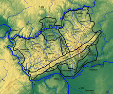
Overview map Taunus |
|
|
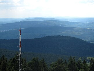
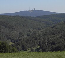
Taunushauptkamm from the observation tower on the Großer Feldberg (view to the southwest) |
|
| Highest peak | Großer Feldberg ( 879 m above sea level ) |
| location | Hesse , Rhineland-Palatinate ( Germany ) |
| part of | Rhenish Slate Mountains |
| Coordinates | 50 ° 14 ′ N , 8 ° 27 ′ E |
| Type | Low mountain range |
| rock | Quartzite ( Taunus quartzite ), sandstone , mudstone , green schist , phyllite, etc. a. |
| surface | 2,700 km² |
The Taunus is in Hesse and Rheinland-Pfalz lying Mountain with the large field Berg ( 879 m above sea level. NHN ) as the highest elevation. As part of the Rhenish Slate Mountains , it is one of the older mountains in Germany, the rocks of which come predominantly from the Devonian and were folded in the course of the Variscan mountain formation. The in some parts quite thin settlement and the abundance of forests make the Taunus a popular excursion destination in the Rhine-Main region .
Location and boundaries
The Taunus is the south-eastern part of the Rhenish Slate Mountains. The low mountain range is on average about 75 km long from southwest to northeast and about 35 km wide from northwest to southeast, it covers an area of around 2700 km². In the west, the upper Middle Rhine Valley borders the Taunus and separates it from the more western Hunsrück . In the north the valley of the Lahn ( Gießen-Koblenzer Lahntal ) with the Limburg basin forms a very sharp boundary to the northern Westerwald . In the east, the Giessen basin (southernmost part of the West Hessian mountains ) borders with Dießenbach and Kleebach , in the south the Wetterau with Wetter and Nidda border the slate mountains; in the south form the Rheingau and the main upstream Main-Taunus foothills natural limits. The last three landscapes mentioned are part of the Rhine-Main lowlands .
On the southern edge are the cities of Rüdesheim am Rhein , Wiesbaden , Hofheim am Taunus and Bad Homburg in front of the height at the seams to the valleys of the Upper Rhine and Main; on the eastern edge, at the interface with the Wetterau, are the cities of Bad Nauheim and Butzbach ; in the north on the Lahn, the towns of Wetzlar , Weilburg , Bad Ems and Lahnstein border the Hintertaunus ; in the west on the Middle Rhine, among other things, Lorch is at the seam (each in a counterclockwise direction).
Natural structure
The Taunus is a heterogeneous landscape, nevertheless it is usually quite distinctly differentiated from the surrounding landscapes and is classified as a natural spatial main unit group . The natural landscape is divided according to morphology, geological structure, climate and, in part, through the predominant vegetation, into partial landscapes that are more uniform in themselves. The cultural landscape , i.e. the natural landscape shaped by humans, traces the structure outlined below in terms of land use, the location and distribution of settlements and the course of the traffic routes.
In the south are the more wooded and higher parts, namely the Vordertaunus (also called the Vortaunus in natural areas ) and the Hohe Taunus ( Taunushauptkamm ), where the highest heights in the Feldberg massif are reached not only in the Taunus but also in the entire Rhenish Slate Mountains. That is why the climate here is rougher than in the upstream landscape - it is on average colder, it rains and in particular it snows more. The moving relief offers little space for settlements and agricultural use. On the mostly poorly deep and fertile soils, which developed from acidic rock, there is predominantly forest. The Voraunus is more inconsistent than the main ridge, it is more morphologically divided and the bays of the foreland structure it more strongly.
Hintertaunus is the name of the area north of the Hohe Taunus up to the Lahn valley. The landscape here is lower and less mountainous than in the southern Taunus. Between the valleys, some of which are deeply cut, there are pronounced plateaus (leveling) with heavy agricultural use. Since mostly only the valley slopes are forested, the Hintertaunus is generally more open. The landscape of the Hintertaunus is more uneven because of its different levels of clods. This is clearly evident in the eastern Hintertaunus. Here there is, for example, the horse head mountain country, a high-lying landscape area with heavier forest cover, a harsher climate and poor soil; but also the Usinger basin , a flat undulating, open basin landscape with productive soils and a balanced climate.
The Idsteiner Senke formed in the Idstein – Bad Camberg area divides the Hintertaunus into the western and eastern Hintertaunus . The Idsteiner Senke widens towards the Lahn valley towards the Limburg basin and is also referred to as the Goldener Grund in the northern area , probably because agriculture found more favorable conditions here. The relief is undulating, the soil is fertile due to the high proportion of loess and the climate is milder due to the location of the basin.
The Taunus (main unit group 30) is naturally structured as follows:
- 300 Vortaunus (218.90 km²)
- 300.0 Rheingau-Wiesbadener Vortaunus (47.04 km²)
- 300.00 Rheingau-Vortaunus (28.00 km²)
- 300.01 Wiesbaden Vortaunus (19.04 km²)
- 300.1 Eppstein-Hornauer Vortaunus (101.66 km²)
- 300.10 Eppsteiner Horst (82.98 km²)
- 300.11 Hornauer Bucht (18.68 km²)
- 300.2 Altkönig preliminary stage (48.49 km²)
- 300.20 Königsteiner Taunusfuß (18.29 km²)
- 300.21 Kronberger Taunusfuß (30.20 km²)
- 300.3 Homburg Vortaunus (21.71 km²)
- 300.0 Rheingau-Wiesbadener Vortaunus (47.04 km²)
- 301 Hoher Taunus (314.92 km²)
- 301.0 Niederwald (12.87 km²)
- 301.1 Rheingau Mountains (76.47 km²)
- 301.2 Wiesbadener Hochtaunus (71.43 km²)
- 301.3 Feldberg-Taunuskamm (96.95 km²)
- 301.4 Winterstein-Taunuskamm (45.80 km²)
- 301.5 Nauheimer Taunussporn (11.40 km²)
- 302 Eastern Hintertaunus (825.66 km²)
- 302.0 Wetzlarer Hintertaunus (165.88 km²)
- 302.1 Weilburger Hintertaunus (with Edelsberger Platte) (131.80 km²)
- 302.2 Ground harvester knolls (52.70 km²)
- 302.3 Hasselbacher Hintertaunus (169.83 km²)
- 302.4 Münster-Maibach threshold (26.30 km²)
- 302.5 Usinger Basin (87.50 km²)
- 302.6 Pferdskopf-Taunus (81.47 km²)
- 302.7 Steinfischbacher Hintertaunus (110.18 km²)
- 303 Idsteiner Senke (82.63 km²)
- 303.0 Goldener Grund (31.74 km²)
- 303.1 Idsteiner Grund (24.39 km²)
- 303.2 Escher Grund (10.19 km²)
- 303.3 Idstein Forest (16.31 km²)
- 304 Western Hintertaunus (908.38 km²)
- 304.0 Wispertaunus (145.05 km²)
- 304.1 Western Aartaunus (82.66 km²)
- 304.2 Bad Schwalbach-Hohensteiner Aartal (22.32 km²)
- 304.20 Aar-Aubach-Grund (0.27 km²)
- 304.3 Eastern Aartaunus (184.56 km²)
- 304.4 Oberaarmulde (23.83 km²)
- 304.5 Zorner plateau (41.64 km²)
- 304.6 Middle Rhine Taunus (109.56 km²)
- 304.7 Unterlahnhöhen (38.19 km²)
- 304.8 Nastätter Mulde (92.58 km²)
- 304.9 Katzenelnbogen plateau (167.99 km²)
- 304.90 Dörsbach / Mühlbach-Wasserscheide (16.24 km²)
- 304.91 Lower Dörsbach-Tiefenbach area (34.42 km²)
- 304.92 Central Katzenelnbogen plateau (104.43 km²)
- 304.93 Schiesheimer Aartal widening (12.90 km²)
Geology and mineral resources
geology
The Taunus is geologically divided from south to north into the units Vordertaunus-unit (also northern phyllic zone or metamorphic southern edge zone ), Taunus ridge -unit and rear Taunus -unit . To the south of the Lahn, the Taunus natural area finally has a share in the Lahnmulde and the Gießen ceiling .
Vordertaunus
The Vordertaunus moiety is a narrow zone weak metamorphic rocks such as phyllite , green shale and sericite - gneiss . They are colored green by chlorite and epidote . The starting products of these rocks were clay stones and volcanic rocks . The rock strata occurring in the Vordertaunus are subdivided from north to south into the metavulcanite sequence , the
Eppsteiner Schiefer and the Lorsbacher Schiefer .
The oldest sedimentary rocks of the Taunus are the Phyllite von Bierstadt from the lower Ordovician, known only from a borehole in Wiesbaden, with an age of around 480 million years, determined by the evidence of spores . The volcanic rocks of the metavulcanite unit are younger; they can be dated to the upper Ordovician and Silurian times using uranium-lead dating . They are overlaid by the Eppstein slates of the Silurian and the Lower Devonian Lorsbach slates. At the very southern edge and in a small deposit near Mühlbach in the east of the Vordertaunus unit, limestones are exposed, which are assigned to the Central Devon .
Taunus ridge
To the north of the Vordertaunus is the Taunuskamm unit - also known as the High Taunus - which consists mainly of clastic rocks from the Lower Devonian. It is made up of the stratigraphic sequences gray phyllite , colored slate , Hermes wedge layers and Taunus quartzite . The sub-camp of the Lower Devonian only emerges in two small outcrops, they are metavolcanites of the type of rocks that occur in the Vordertaunus.
The gray phyllites are made up of slates and sandstones . They contain imprints of brachiopods and corals from the Upper Silurian and were deposited in shallow water. The clay slates of the variegated slate are greenish gray or strikingly purple in color due to finely distributed hematite . Agnathen (jawless fish), which were found in the colorful slates, come from the Gedinne ( Lochkovium ); Just like the rock formation, they show a deposition of the colored slate in rivers or lakes. The rocks of the colored slate are located on the Großer Feldberg , where they were mined in tunnels for the extraction of roofing slate (slate tunnels below the Red Cross ). Quartzitic sandstones are embedded in them, which make up the Brunhildis rock on the summit of the Großer Feldberg. The Hermeskeil strata are exposed below the Großer Feldberg and consist of claystones, weakly consolidated mica-bearing sandstones and quartzites from the Lower Siegen (Lower Pragium ). They are covered by several 100 m thick layers of Taunus quartzite (Middle Siegen, Pragium / Emsium ). The very weather-resistant rock forms many peaks of the Taunus ridge (Altkönig, Kleiner Feldberg, Glaskopf), but also individual rock elevations (such as the Hohle Stein ). The Celtic ramparts and the rubble dump on the "White Wall" on the Altkönig are made of Taunus quartzite. The fissured groundwaters of the Taunus quartzites are of local interest for water extraction . They are dammed by the underlying Hermes' wedge layers and conveyed through groundwater tunnels. For water supply Wiesbaden carry four such basic water tunnel at a significant scale.
Hintertaunus
The largest unit of the Taunus in terms of area, the Hintertaunus unit, consists primarily of the black rock series of the Hunsrück slate and the Singhofen layers of the lower Ems level, often gray-wacky sandstones as well as siltstones and claystones. Younger rocks are only exposed here in small deposits near Usingen and at the very eastern edge of the Hintertaunus in the area of Oberkleen . The geology of the Hintertaunus is not as well known as that of the Vor and Hochtaunus in the south or that of the Lahnmulde in the north due to the often monotonous sandy and schisty rocks that form only a few continuous guide horizons and hardly provide any guide fossils .
The Hunsrück schist refers to a rock facies that occur primarily in the Hunsrück and Hintertaunus and is composed of pure, mostly black claystones and embedded sandstone banks and occurs in stratigraphically different positions in Upper Siegen and the Ems. The main mass of Hunsrück slate is assigned to the elm lower stage . It is known for its extraordinarily well-preserved fossils and locally well suited for use as roofing slate . In the western Hintertaunus, the almost sand-free Hunsrück slate can be easily separated from the sandy rocks of the Singhofen layers, in the east rocks in the facies of the Hunsrück slate recede. Relocated volcanic tuffs and ashes , the so-called porphyroids , are integrated into the Singhofen layers ; some of them can be traced over several tens of kilometers.
The Middle Devon to Lower Carboniferous of the Usinger Mulde is only about 250 m thick and strongly tectonically disturbed, in the Lahnmulde and Dillmulde there are no typical rocks of this time such as scarf stone , mass limestone and deck diabas . The Grauwacken occurring here and in other places in the eastern Hintertaunus cannot or hardly be distinguished from the carbonic Kulm-Grauwacken due to their composition and are considered by some scientists to be remnants of the Giessen Nappe .
Geological construction
The layer sequences of the Taunus were during the Variscan Orogonese geschiefert , imbricated and southwest-northeast trending saddles and troughs folded. The folds are predominantly north-west Vergent . The stone series were spread to the northwest and pushed over to younger ones. So at the fault zone of Taunuskamm- thrust of the southern Taunus in its full length cover like been pushed onto rocks of the younger Devonian. The thrust of the Giessen Nappe on rocks of the Hintertaunus and Lahnmulde, lying flat today, is even greater. Otherwise, their rocks do not occur in the Taunus, they must have been deposited south of the Voraunus and were pushed over at least 25 km over the Taunus and Hintertaunus, possibly significantly more due to large-scale considerations. In addition to the deformation of the layers, they are clearly metamorphic in the Vordertaunus - the latter decreases significantly to the north.
In later phases of uplift between the late Jurassic and the Tertiary , transverse fractures were created perpendicular to the strike. The rift valley of the Idsteiner Senke divides the Hintertaunus into an eastern and western part, in its continuation the Limburg basin divides the Lahnmulde. Some of the fractures are now filled with quartz . The free-standing rocks of the Eschbacher Klippen near Usingen are such a quartz vein exposed by erosion ( Härtling ). This vein, also known as the Usinger quartz vein, can be traced over a length of about 12 km and is therefore one of the longest German quartz veins after the Bavarian pile.
Natural resources
The northwest part of the Eastern Hintertaunus (long Hecker Lahn Taunus) , of the Weilburger Lahntalhotel area leads over belongs geologically to Lahn trough and by its Magmatismus rich in resources from the central Devon such as iron in the form of hematite with up to 50 percent iron content, or flow Eisenstein up 35% iron, as well as silver ore , roofing slate and diabase . As in the Lahn-Dill mining region, the ore was mined in numerous mines; some have been converted into visitor mines. The mining , which operated from the 17th to the 20th century, has ceased today. In the eastern Taunus between Idstein in the west and Usingen in the east, there was a variety of pits in a large number of pits from the late Middle Ages to the early 20th century on post-varistical mining of varying intensity, i.e. only formed after the varistic mountain formation in the late Jurassic or early Cretaceous period Veins. The last active lead and silver ore mine, the Heftrich lead ore mine with the Hannibal and Hasdrubal tunnels, was closed around 1924. Exploratory boreholes carried out by the Hessian State Office for Soil Research in the 1980s no longer provided any indications of deposits worth building.
The Taunus quartzite used to be mined many times due to its hardness, currently only one quarry near Köppern is in operation. In the part of the Lahnmulde belonging to the Taunus, some lime and diabase quarries are still in operation today. In addition, there are countless smaller quarries to supply the local population with building blocks.
Surface shapes
The surface design ( relief ) makes the Taunus appear as a low mountain range, with no pronounced and sharp shapes. The relief is the result of geological development and is closely related to the rocks that make up the mountains. The relief determines other landscape phenomena, primarily the regional climate, the water network and the soil conditions. Cultural landscape elements such as agricultural use, traffic and settlement are also related to the relief.
The Taunus as a whole shows the typical image of a pult , in the south a sharp rise up to the ridge height and a slow decline towards the Lahn valley in a northerly direction. Viewed from the south, it stands out clearly from the foreland, so that it appears as an impressive mountain range when viewed from the Rhine or Main. From the Rheingau or the Main-Taunus foreland (150 m to 250 m), the Taunus quickly reaches heights of 600 to over 800 m , and then slowly drops back to heights of up to 300 m . The main ridge extends in a south-west-north-east direction from the Niederwald near Rüdesheim to Bad Nauheim over a length of 75 km, whereby it reaches the highest heights in the area of the Feldberg massif. The ridge itself is divided into several clods of different heights . In the west are the Rheingau mountains and the Wiesbadener Hochtaunus, which reach heights of just over 600 m . To the east, near Niedernhausen, there is a fault zone that interrupts the ridge line. Here in the area of the Eppsteiner Horstes the ridge clod has sunk to heights of up to 500 m . The ridge continues to the northeast in the Feldberg Taunus - with the Großer Feldberg ( 880 m ) as the highest elevation. Towards the Wetterau, the ridge drops back to a height of 500 m . In many places the ridge line appears clearly divided into two ridges running parallel to the ridge, which are separated from one another by wide valleys. This is shown nicely in the nature reserve Theiss valley of Niedernhausen , which has the shape of a deeply carved valley. Many bodies of water cut deeply into the main ridge following the slope to the foreland, it is only rarely broken through, as impressively shown by the Walluftal near Schlangenbad and the Erlenbachtal near Köppern.
A promontory is attached to the Taunushauptkamm in the south from Wiesbaden to Friedrichsdorf, the central part of which is the Eppsteiner Horst . With heights of 200 to a maximum of 500 m , the Voraunus clearly stands out from the upstream Taunus foreland and is itself strongly divided into many ridges and peaks. The Taunus foreland east of the Eppsteiner Horstes extends with several bays into the Voraunus. This is clearly shown, for example, by the Hornau Bay near Kelkheim and the Homburg Bay near Bad Homburg. The Eppsteiner Horst protrudes far south into the Taunus foreland and clearly stands out from it. Its fault lines continue to the north in the area of the Idsteiner depression.
The part of the mountain that gradually descends from the Taunus ridge to the Lahn is known as the Hintertaunus. When speaking of the hull area , which slowly descends towards the Lahn valley, it refers to the plateaus lying between the valleys, which in the geological past once formed a coherent, undulating plain. These plateaus are located northwest of the main ridge usually at an altitude of 350 m to 450 m and descend towards the Lahn valley to heights of 250 to 300 m . The former hull area is severely divided into ridges, knolls and ridge by the waters of the Hintertaunus. The Wisper and its tributaries have cut deeply into the rump area in the western Hintertaunus and created a dense valley network that separates the barely existing plateaus. The plateaus in the area of the Idsteiner Senke are completely dissolved, as a gently undulating hilly landscape between the eastern and western Hintertaunus.
The old hull surface of the western Hintertaunus is more uniform than that of the eastern Hintertaunus, which is more strongly broken down into clods by several faults running from northwest to southeast . East of the Idsteiner Senke, the landscape at the Emsbach Fault rises in two stages to the Pferdskopf-Bergland, which, as a distinctive high plaice, connects to the Feldberg Taunus in a north-easterly direction and, with heights of 600 m to 700 m , exceeds the Rheingau Mountains in height. The rest of the eastern Hintertaunus is less mountainous and flattens out noticeably to the northeast towards the Lahn and northern Wetterau. To the east of the horse's head clod, the Usinger basin adjoins with a clear fault, which, compared to the surrounding clods, appears to be heavily sunken and less mountainous. Surrounding floes, which are separated from the deep floe by steep slopes, tower over the basin by several 100 m.
climate
The Taunus is characterized by its location in the west wind zone with a relatively mild sub-oceanic climate. Mild winters and cool summer months prevail. Climatically, the low mountain range can be roughly divided into three climatic areas. This is the cooler and precipitation-rich Hochtaunus in the ridge zone, the climatically favored areas of the Vordertaunus, the Main Plain, the Rheingau and the Idsteiner Senke and the more rough to moderate appearing Hintertaunus.
The annual mean temperatures in the Taunus range between 5.5 and 10.5 ° C. If the temperature values in the Hochtaunus are between 5.5 and 7 ° C on an annual average, they increase to 9 to 10 ° C in the Taunus foreland and the Main Plain and the lower Lahn area, and even to 10.5 ° C in the Rheingau. In the Hintertaunus, only 7.5 to 8.6 ° C are measured on an annual average, a value that increases to 8.5 to 9 ° C in the Idsteiner Senke and Limburg basin. The climate in the sub-areas of the Taunus is very different from the temperature data. The Taunus ridge, which presents itself as an open flank to the northwest and north, can be viewed as a kind of climatic divide, with the altitude above all exerting its influence.
The favorable climate of the Vordertaunus, the Main-Taunus plain including the Rheingau and the Lahn estuary, results from the opening of the area to the south and west. The whole Taunus foreland and the Rheingau belong to the Upper Rhine Plain, which continues in the Wetterau.
The number of summer days also shows a clear difference between the Taunus ridge and the Hintertaunus and the Taunus foreland. The area south of the Taunus ridge has 35 to 55 summer days, the Hochtaunus 10 to 30 and the Hintertaunus 20 to 30 on a long-term average. The climatic advantage is also evident in the high number of sunny days, which in the Vordertaunus and the Main-Taunus area is 40 to 50 significantly higher than in the Hintertaunus, where it only reaches 30 to 40 days. The average daily sunshine duration is 7.4 to 7.5 hours in the sub-areas south of the Taunus ridge, but only 6.8 to 7.2 hours in the Hoch- and Hintertaunus.
The Taunus ridge is also a dividing line in terms of rainfall . The area from the Wetterau to the Upper Rhine Plain has more continental features, that is, relatively dry summers and humid, milder winters. There is only about 550 to 600 mm of precipitation here. In the area of the Taunus slopes (Vordertaunus) they rise to 650 to 700 mm. The Hochtaunus, from altitudes above 600 m , has the highest precipitation values of the Taunus with 800 to 1000 mm, which are mainly the result of the uphill , but also frontal rain . In the area of the Hintertaunus, on the northern plateaus of the Lahn, the amount of precipitation is between 650 and 700 mm. In a southerly direction, to the Taunus ridge , the value on the plateaus and high clods of Feldberg-Langhals-Pferdskopf-Scholle ( Pferdskopf-Taunus ) in the eastern Hintertaunus and the Kemeler Ridge ( western Aartaunus ) in the western Hintertaunus increases to 700 to 800 mm. In the central root area of the horse head Taunus, in the area around the horse head , 800 to 900 mm are reached. In the Idsteiner Senke (Goldenen Grund) between the eastern and western Hintertaunus, it is 590 mm.
Waters and healing springs in the Taunus
Important rivers in the eastern Hintertaunus are Weil and Solmsbach towards the Lahn . The Idsteiner Senke is drained to the northwest towards the Lahn through Emsbach and Wörsbach . The Usa drains from the Usinger Basin towards the Wetterau. The western Hintertaunus is cut deep to the north towards the Lahn by its tributaries Aar , Dörsbach and Mühlbach . The valley system of the Wisper , which drains the southern parts of the western Hintertaunus to the west towards the Rhine , is even more pronounced and further developed . Other rivers are Schwarzbach , Fischbach , Liederbach and Erlenbach im Vortaunus , which flow into the Main .
The Taunus is comparatively poor in standing water, ponds and lakes. Larger standing waters in the eastern Hintertaunus are the Bärenfichtenweiher near Schmitten, the Möttauer Weiher near Möttau , the Hattsteinweiher near Usingen, the Meerpfuhl near Merzhausen and the Grünwiesenweiher near Neu-Anspach. The Wispersee is located in the western Hintertaunus valley near Nauroth .
The deposits of mineral and medicinal springs are of great importance . As a result, there are also a number of important therapeutic baths in and around the Taunus. The term Selterswasser (after the springs in Niederselters ) is a synonym for carbonated mineral water all over the world .
The springs in Schlangenbad and Wiesbaden were already used by the Romans. The springs of Bad Schwalbach (formerly Langenschwalbach ) were mentioned for the first time in the 16th century, Bad Ems became one of the most famous spas in Germany since the 17th century, and the springs of Bad Weilbach and Kronberg were at times widely famous. In the 19th century Wiesbaden (since the middle of the 19th century even called a world spa town ), Bad Homburg vor der Höhe , Bad Nauheim , Bad Soden am Taunus and Bad Ems became fashionable health resorts, where the European aristocracy met every year.
Political structure
The low mountain range is mainly on Hessian territory, the northwestern part belongs to Rhineland-Palatinate. The Taunus extends over the districts of Hochtaunuskreis , Limburg-Weilburg , Lahn-Dill-Kreis , Wetteraukreis , Main-Taunus-Kreis , Rheingau-Taunus-Kreis and Rhein-Lahn-Kreis as well as parts of the cities of Wiesbaden and Frankfurt am Main .
The Taunus in history


The earliest signs of human settlement in the Taunus come from the Neolithic Age , such as the remains of the ring wall on the Kapellenberg near Hofheim , which can be assigned to the Michelsberg culture . In Wehrheim are grave hills of the medium to younger urnfield culture (10-11. Century v. Chr. ) Have been discovered. Some of the archaeological finds can be viewed in the local history museum in Wehrheim. Northwest of Bad Homburg is the Bleibeskopf , on which traces of settlement from the turn of the Bronze and Iron Ages were found in a terrain enclosed by a ring wall . Objects found there by archaeologists, which date from the 9th / 8th centuries. Century BC BC are exhibited in the Saalburg Museum and the Vortaunus Museum ( Oberursel (Taunus) ).
Celts later lived in and around the Taunus. Ring ramparts on the Altkönig ( 798.2 m ) were built around 400 BC. Dated. On the Eichelberg near Rod an der Weil , a ring wall, the so-called Rent Wall, has also been preserved, and traces of Celtic settlement have been found on the chicken trumpet . About the same time the old high way of could Rennstraße , chicken road and Hessenstraße on the sides have arisen, often mounds are found. A burial mound field has been archaeologically examined near Wilhelmsdorf bei Usingen . In the late Celtic period around the 2nd and 1st centuries BC The heather drink oppidum near Oberursel was one of the four largest Celtic cities in Europe.
From the 1st to the 3rd century the Upper Germanic-Raetian Limes , still visible in places today, ran along the Taunus ridge and was included in the UNESCO World Heritage List in 2005 as a ground monument . Roman sources tell of the Mattiaker tribe, a sub-tribe of Chatti in this region.
The Franks settled after the fall of the Western Roman Empire from the 4th century the Taunus. In the Vordertaunus some grave fields from the early Merovingian to the Carolingian period were discovered. A little later, the first documentary evidence of settlements there appeared, so that a permanent settlement of the Vordertaunus is likely.
Until the late 18th century, the name of the ridge was simply and completely unspecific “die Höh (e)”, it was retained in the place names Bad Homburg vor der Höhe and Rosbach vor der Höhe . The Latin “Taunus” comes from Tacitus , who wrote in the annals of a “castellum in monte tauno” , which presumably referred to today's Friedberg . Frederick V had ordered the renaming at a time when the upper class was indulging in classicism from antiquity. There is disagreement about the origin and meaning of the name, some assume the Celtic Dün or Tun (height, fence), others believe that the meaning should be sought in * tēu - / * təu . The meaning of the Indo-European language root can be paraphrased as swell or accumulate . The Taunus is mentioned for the first time in a written source in AD 43/44 by Pomponius Mela .
From 1806 to 1866 the majority of the Taunus belonged to the Duchy of Nassau , whose home country was on the Lahn. After the Austro-Prussian War 1866/1867 the Duchy of Nassau and the areas of the first 1866 Hessen-Darmstadt were home fallen and thus the complete Taunus - - Hesse-Homburg to Prussia and became part of the newly formed province of Hesse-Nassau . Most of the Taunus has been located in Hesse since 1946, while other parts belong to Rhineland-Palatinate.
Attractions
nature
Nature parks
In the Taunus, with its diverse landscape, there are a total of three nature parks . The Taunus Nature Park includes the eastern Taunus main ridge with the Großer Feldberg and extends over the eastern Hintertaunus to the Weilburg Lahn valley area to the north. The Hochtaunus Heilklimapark , founded in 2005 and the first of its kind in Germany, is also located on its premises . In the northwest, the Nassau Nature Park comprises parts of the Western Hintertaunus, while the Rhine-Taunus Nature Park is in the west.
Attractions
The Taunusklub has created an extensive network of hiking trails that is particularly popular with day-trippers from the Rhine-Main or Lahn-Dill areas, with the Taunus main ridge with the Großer Feldberg being the most hiked. The 48 km long Weiltalweg is also used a lot, but in its case as a cycle path. In addition, the European long-distance hiking trails E1 and E3 meet on the main ridge near the Großer Feldberg .
On the Großer Feldberg with its telecommunication and observation tower, a wide view over the Taunus and the whole area up to Frankfurt am Main is possible. In addition to the observation tower on the Großer Feldberg, there are also a number of other observation towers in the Taunus. In the High Taunus still on the Herzberg , Atzelberg , Winterstein , Schläferskopf and Hallgarter Zange . In the eastern Hintertaunus on the Pferdskopf , the Hausberg , the Stoppelberg , the Gaulskopf . In the Vordertaunus on the Kellerskopf , the Hardtberg and the Kapellenberg , on which the so-called "Meisterturm" is located.
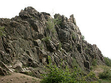
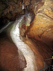
There are some geological sights in the Taunus that are often visited by day trippers: In Eschbach, which belongs to Usingen, there are the Eschbacher Klippen, 12 m high rocks made of quartz. On the edge of the natural Taunus, in the Weilburger Lahn valley area near Kubach near Weilburg, there is the Kubacher crystal cave, the highest German show cave and the only crystal cave in Germany that can be visited by visitors.
Historical buildings and museums
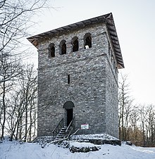


limes
The Upper Germanic-Raetian Limes , which was declared a World Heritage Site in 2005 , is partly still visible over the main ridge through the Taunus. The Saalburg castle is located near Bad Homburg , it is considered the best-researched and most fully reconstructed castle of the Upper German-Raetian Limes . Other forts, such as the Kleiner Feldberg fort, are archaeologically secured and equipped with display boards; a Limes tower near Idstein was reconstructed and also equipped with display boards ( Römerturm Idstein-Dasbach ). Bad Ems to Lindschied leading Limes hiking trail as a subsection of the German Limes hiking trail through the Taunus.
Castles, palaces and ruins
The Taunus has many medieval structures that stem from the turbulent past of this region, here is just a selection:
The castle Braunfels is often referred to as the "Hessian fairytale castle" and the castle ruins Freienfels at Weinbach place every year in May jousting place that are nationally known. The former residence castles in Bad Homburg and Weilburg are also worth seeing.
The castles Eppstein and Kronberg , both near cities of the same name, house museums. The Hohenstein castle ruins near Bad Schwalbach , the Falkenstein and Königstein castle ruins and the Reifenberg castle ruins have in common that, although some of them have been torn down, they can still be visited, some of them still host events today, and there is also one in the Hohenstein ruins Hotel.
The facilities of the Altweilnau castle ruins and Neuweilnau Castle , which are located opposite each other in the Weiltal, can be seen from afar. A valley panorama can be admired on the still standing Bergfried Altweilnau , while the Neuweilnau Castle actually houses the forest administration, but has a rentable rock cellar and a branch of the registry office where weddings are possible.
Old towns and open air museums
In the villages and towns of the Taunus, many old towns have been preserved, especially the village centers / old towns of Idstein , Eppstein , Königstein , Kronberg , Oberursel , Bad Homburg, Hasselbach (Weilrod municipality), Haintchen , Weilburg and Braunfels are noteworthy. The Hessenpark , an open-air museum, is located between Neu-Anspach and Obernhain (municipality of Wehrheim ) .
Zoos and parks
Zoos, animal parks and bird stations
In Hasselbach there is the Vogelburg , a parrot park , in which some very trusting animals are shown and which also serves as a refuge for these birds.
The oldest falconry in Hesse is located on the Großer Feldberg , where some birds fly free and there are guided tours. The Opel Zoo, founded by Georg von Opel in 1956, is located between Kronberg and Königstein . In 2003 it had 600,000 visitors. Four hundred years ago, the Prince of Nassau created an animal park near Weilburg . Today the Weilburg zoo is a popular excursion destination after it reopened in 1970.
Amusement parks
The Lochmühle amusement park , which developed from a pony farm, is located near Wehrheim , and the Taunus Wunderland amusement park is located near Schlangenbad .
Spa gardens
Also worth seeing is the large spa park in Bad Homburg, where all of the city's medicinal water springs, the casino, a small Russian chapel and the Siamese temple are located. All other health resorts also have spa gardens.
Events
Celebrations and parties
In addition to many town and village festivals, of which the Lantern Festival in Bad Homburg is probably the best known, there are some events in the Taunus. On the Great Feldberg, the place every year Feldberg hard place, the oldest mountain Gymnastics Festival in Germany. Halloween is celebrated every year in the Kubach crystal cave . Lighting effects create a special atmosphere in the cave. There is also the Castle Festival in Eppstein regularly .
Sports
The famous Eschborn-Frankfurt bicycle race - around the financial center has most of its route in the so-called Feldberg loop. An international dog sled race has been taking place around the Großer Feldberg since 2004 in February . In spring, the Feldberglauf starts with the goal on the aforementioned mountain from Oberursel . There are also several ski lifts and slopes for winter sports in the Taunus - although the Taunus is not snow-sure in winter.
Others
The Weil valley and the Aar valley (→ Fahr zur Aar ) are closed to motor vehicles independently of each other each year, which in both cases attracts many cyclists and hikers. At the same time, additional activities are usually organized in the valley.
The forest cover of the Taunus, which has evidently varied greatly over the centuries, is also interesting. From the 19th century, for example, it is reported that the citizens of Frankfurt can see the ramparts on the Altkönig when visibility is good, while the Altkönig is now completely forested.
The Taunus is the first mountain range in Germany that was crossed by a balloon. The French balloon pioneer and professional airship operator Jean-Pierre Blanchard sailed from Frankfurt to Weilburg on October 3, 1785 on his first ascent in Germany. This was the first ever air trip in Germany.
The concert series Klassik im Taunus has existed since 2015.
mountains

The mountains and elevations of the Taunus are sorted according to height in meters (m) above sea level (NHN):
→ Main article: List of mountains and elevations of the Taunus
traffic
Streets
Due to the geological formation of the Taunus, the ascent from the Rhine and Main plains to the Taunus ridge is relatively steep, so that for this ascent, real “pass roads” with long ramps have developed over the course of history. The most important routes of this type lead from Wiesbaden over the Hohe Wurzel ( state road 3037, pass height 567.7 m ), over the Eiserne Hand ( federal road 54 , pass height 423.1 m ) and over the Platte ( federal road 417 , pass height 500.8 m) ) as well as from Oberursel on Kanonenstraße via Sandplacken (L 3004) and from Bad Homburg via Saalburg ( Bundesstraße 456 ) into the Hintertaunus.
In terms of traffic, the B 8 from Frankfurt to Limburg crosses the Taunus ridge with peaks of 556.5 m at the junction of the L 3025 to Oberreifenberg and 541.8 m at the junction of the L 3319 to Schloßborn . There is also a lot of traffic on the Bäderstraße ( Bundesstraße 260 ) between Schlangenbad and Nassau (Lahn) as a high road, with its apex at Kemel at an altitude of 537 m .
Significant east-west connections are the federal highway 455 running in the Vordertaunus from Wiesbaden to Friedberg , in the Hintertaunus the section of the federal highway 275 running from Bad Nauheim via Usingen, Idstein and Taunusstein to Bad Schwalbach , furthermore the federal highway 274 from the Aartal to the Middle Rhine Customs house via Katzenelnbogen and Nastätten to Sankt Goarshausen , as well as the federal road 49 that runs along the Lahn .
The federal autobahn 3 runs in a north-south direction through the middle of the Taunus and reaches about 380 m peak height near the Idstein exit at kilometer 134.5 . The federal motorway 5 runs along the eastern edge of the Taunus and crosses the eastern foothills of the Taunus ridge at a height of around 270 m near Bad Nauheim at kilometer 463.5 . Both motorways are among the most important north-south connections in Germany.
train
The two most important north-south connections of the railway through the Taunus use the deep cut in the Taunus ridge between Niedernhausen and Idstein. The coming into two branches of Frankfurt and Wiesbaden Main-Lahn train rises to the association in low Hausen gradually overcomes normal pitch, the watershed at Niederseelbach in 351 m height and then performs the Idsteiner sink and the Golden base of Idstein down to Limburg on the Lahn . The high-speed line Cologne – Rhine / Main , which went into operation in 2002 and has a large number of engineering structures (bridges and tunnels), runs mostly parallel to federal motorway 3 . In addition, there are in the Taunus of Frankfurt on Liederbach and Kelkheim according Königstein -propelled diesel-driven Konigsteiner web , also by Frankfurt via Friedrichsdorf by the Köpperner valley to Grävenwiesbach and Brandoberndorf extending Taunusbahn , as well as the over Bad Schwalbach operated between Wiesbaden and Hohenstein as a museum railway line the Aartalbahn (former Langenschwalbacher Bahn) from Wiesbaden to Diez, which crosses the Taunus ridge at a height of 421 m with a steep section on the southern ramp of the Iron Hand . There is only an east-west connection along the Lahn from Koblenz via Limburg and Weilburg to Wetzlar and on to Gießen .
Other local public transport
The entire Taunus (as far as it is in Hesse) is accessed by a bus network, the volume and frequency of which has improved since the introduction of the Rhein-Main-Verkehrsverbund (RMV). Even the Große Feldberg is regularly approached today.
Taunus songs
Regional and somewhat beyond the border of the Taunus are traditional folk songs , such as “You, my Taunus, my home” written by Hermann Gondlach in 1941 and the “Taunuslied” written in 1973 by Hermann Türck and Ernst Menke with the text “Wo rauschende Forests up to the heights "known. Some folk songs, such as “In the beautiful Wiesbachtal” near Grävenwiesbach or “My wonderful Rheingau-Taunus-Land”, are also typical of the region.
In the area of so-called folk music there are a few songs about the Taunus, such as the commissioned composition sung by Karl Gross on record for the city of Königstein im Taunus "In the beautiful Woogtal near Königstein" or the nationally known popular hit "Das Försterhaus im Taunus" by Slavko Avsenik .
The Taunus in painting
Important painters who captured landscapes of the Taunus as motifs were, for example, Hans Thoma and Carl Peter Burnitz , members of the Kronberg painter colony . Johann Georg Mohr not only painted the landscapes, but also the shepherds' use as a cultural landscape.
The Taunus as namesake
After the Second World War and until 1967, “Taunus” was the sole brand name for cars from Ford -Werke AG in Germany . After that, some models were offered under the name Ford Taunus .
literature
- Ingrid Berg: Heimat Hochtaunus. Waldemar Kramer, Frankfurt am Main 1988, ISBN 3-7829-0375-7 .
- Heinz Biehn : The Taunus. High forests, wide valleys, warm springs. Amorbach 1972.
- Eugen Ernst: The Taunus: A l (i) worthwhile low mountain range. Frankfurt am Main 2009, ISBN 978-3-7973-1146-7 .
- Stefan Etzel: Hiking in the Taunus. Dumont Reiseverlag, Ostfildern 2013, ISBN 978-3-7701-8031-8 .
- Hermin Herr: Lexicon from the High Taunus. Waldemar Kramer, Frankfurt am Main 1993, ISBN 3-7829-0437-0 .
- Ewald A. Hoppen: A nice day. Volume 6: Taunus. Edition Rathscheck, Neuwied / Rhein 2005, ISBN 3-934342-11-6 .
- Otto Klausing: The natural areas of Hesse: with a map of the natural spatial structure 1: 200,000. Environmental planning, work and environmental protection; 67: Landscape planning. Hess. Landesanst. for the environment. Wiesbaden 1988.
- Gerhard Kölsch: The memorable Taunus (...) is worth visiting and sung about. To the literary and artistic discovery of the Taunus. In: Anton Radl 1774–1825. Painter and engraver. Catalog of the exhibition Museum Giersch. Frankfurt am Main 2008, pp. 135–157 → online version
- Gerald PR Martin: Brief geological history of the Taunus landscape. Taunusboten publishing house, Bad Homburg 1963.
- Alfred Pletsch: Hessen. Federal Republic of Germany and Berlin (West). 3. Scientific country customers; 8. Darmstadt. 1989.
- Alexander Stahr, Birgit Bender: The Taunus - A journey through time. Borntraeger, Stuttgart 2007, ISBN 978-3-510-65224-2 .
- Alexander Stahr: 100,000 Taunusstein. Ice age, landscape, soil, history. Lahnbrück-Verlag, 2011, ISBN 978-3-9812777-7-7 .
- Alexander Stahr: The soils of the Taunus ridge. Development, dissemination, use, endangerment. Publishing house Dr. Friedrich Pfeil, Munich 2014, ISBN 978-3-89937-180-2 .
- J.-D. Thews: Explanations for the geological overview map of Hessen 1: 300,000. (= Geol. Abhandlungen Hessen. Volume 96). Hess. L.-A. for soil research, Wiesbaden 1996, ISBN 3-89531-800-0 .
- Julius Wagner: Hessen: with special consideration of social and economic geographic issues. (= Harms regional studies. 1). Munich 1961.
- Roland Walter u. a .: Geology of Central Europe. 5th edition. Schweizerbarth'sche Verlagsbuchhandlung, Stuttgart 1992, ISBN 3-510-65149-9 .
- Alfred Zirwes: Romance in the Aartal. Self-published, Wiesbaden 2007, ISBN 978-3-00-020285-8 .
General sources
-
BfN
- Map services
-
Landscape profiles of the Federal Agency for Nature Conservation ( notes ) - by main units:
- 300 ( Voraunus )
- 301 ( High Taunus )
- 302 ( Eastern Hintertaunus )
- 303 ( Idsteiner Valley )
- 304 ( western Hintertaunus )
References and comments
- ↑ Hessisches Statistisches Landesamt : Statistisches Jahrbuch 2011/12, Volume 2, S. 21; Retrieved January 5, 2014.
- ^ Lexicon Institute Bertelsmann: The modern lexicon in twenty volumes. Volume 18, 1972.
- ↑ Map Taunus & Gießen-Koblenzer Lahntal and legend ( Taunus ) - Attention: Web links without return! - Environmental Atlas Hessen of the Hessian State Office for Environment and Geology: The natural areas of Hesse and their main units.
- ↑ The regional structure of Rhineland-Palatinate. State Office for the Environment, Water Management and Trade Inspection (PDF; 1.8 MB)
- ^ Michaela Winkelmann: Eppsteiner slate series. In: Palynostratigraphic studies on the southern edge of the Rhenish Slate Mountains (southern Taunus, southern Hunsrück). Herbert Utz Verlag, 1997, chapter 1.5.1.2, p. 9.
- ↑ E. Reitz et al. a .: A first record of Lower Ordovician (Arenig) on the southern edge of the Rhenish Slate Mountains in the Vordertaunus: the Bierstadt phyllite (p. 5915 Wiesbaden). In: Geological Yearbook Hessen. 123, Wiesbaden 1995, pp. 25-38.
- ↑ T. Klügel: Geometry and kinematics of a Variscan plate boundary - the southern edge of the Rhenohercynic in the Taunus. Dissertation . University of Würzburg, 1995.
- ↑ Joe-Dietrich Thews: Explanations of the geological overview map of Hessen 1: 300000 (GÜK300 Hessen) Part I: Crystalline, Ordoviz, Silurian, Devonian, Carboniferous. Geological treatises of Hessen . Ed .: Hessian State Office for Environment and Geology. tape 96 . Wiesbaden 1996 ( Geological overview map of Hesse (GÜK300) [accessed on December 22, 2015]).
- ^ A b T. Kirnbauer: Geology, petrography and geochemistry of the pyroclastics of the Lower Ems / Lower Devonian (porphyroids) in the southern Rhenish Slate Mountains. (= Geological treatises Hessen. 92). Wiesbaden 1991.
- ↑ D. Henningsen: On the origin and differentiation of the sandy rocks on the southeastern edge of the Rhenish Slate Mountains. In: New Yearbook for Geology and Paleontology. Monthly books, Stuttgart 1963, pp. 49-67.
-
↑
A compendium of the formerly existing mines is contained in Die Erzgang des Eastern Taunus ;
in R. Jakobus: Geological Yearbook Hessen. Volume 120, Hessian State Office for Soil Research, Wiesbaden 1992. - ^ Reimer Hermann: Comparative Hydrogeography of the Taunus and its southern and southeastern peripheral areas. Wilhelm Schmitz Verlag, Giessen 1965.
- ^ De Chorographia Libri Tres. Liber III, 30, Wissenschaftliche Buchgesellschaft, Darmstadt 1994, ISBN 3-534-12349-2 ; For the history of transmission see Andreas Mengel: Gesucht: Der mons Taunus. In: Egon Schallmayer u. a. (Ed.): The Romans in the Taunus. Frankfurt am Main 2005, ISBN 3-7973-0955-4 , pp. 15-19.
- ^ Hymns of praise for the Taunus. In: Taunus newspaper . August 3, 2010.
Web links
- Literature on Taunus in the Hessian Bibliography
- Environmental Atlas Hesse: → Nature and landscape → The natural areas of Hesse or natural spatial structure - natural area main unit 30 (Taunus) , on atlas.umwelt.hessen.de
- Tourist information , Taunus Touristik Service e. V., on taunus.info
- Taunus Nature Park , at naturpark-taunus.de
- Representation of the circular path Feldbergkastell , on feldbergkastell.de
- Summit in the Taunus for dominance and prominence , on thehighrisepages.de
- Wehrheim, the gateway to the Bronze Age in Usinger Land , information on archaeological finds in Wehrheim, on geschichtsverein-usingen.de
- The Vortaunusmuseum , on vortaunusmuseum.de
- Map / aerial photo of the Taunus with borders, rivers and all important elevations ( Google Earth required), on geographie.giersbeck.de # Taunus Placemarks

