
Butzbach
| coat of arms | Germany map | |
|---|---|---|

|
Coordinates: 50 ° 26 ' N , 8 ° 40' E |
|
| Basic data | ||
| State : | Hesse | |
| Administrative region : | Darmstadt | |
| County : | Wetteraukreis | |
| Height : | 198 m above sea level NHN | |
| Area : | 106.6 km 2 | |
| Residents: | 26,432 (Dec. 31, 2019) | |
| Population density : | 248 inhabitants per km 2 | |
| Postal code : | 35510 | |
| Primaries : | 06033, 06081 , 06085 , 06447 | |
| License plate : | FB, BÜD | |
| Community key : | 06 4 40 005 | |
| LOCODE : | DE BZH | |
| City structure: | 14 districts | |
City administration address : |
Schlossplatz 1 35510 Butzbach |
|
| Website : | ||
| Mayor : | Michael Merle ( SPD ) | |
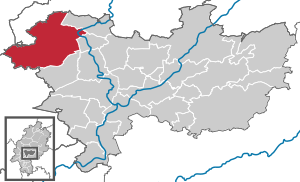
| Location of the city of Butzbach in the Wetterau district | ||
  |
||

Butzbach is a German city in the Hessian Wetteraukreis at the northeastern transition of the Taunus to the Wetterau . Since January 2011 it has been nicknamed Friedrich-Ludwig-Weidig -Stadt .
geography

Neighboring communities
Butzbach borders in the north on the municipality of Langgöns ( district of Gießen ), in the east on the town of Münzenberg and the municipality of Rockenberg , in the south on the municipality of Ober-Mörlen and the town of Usingen ( Hochtaunuskreis ) and in the west on the municipalities of Grävenwiesbach (Hochtaunuskreis) and Waldsolms ( Lahn-Dill district ).
City structure
Butzbach consists of the districts Bodenrod , Butzbach (core city), Ebersgöns , Fauerbach vor der Höhe , Griedel , Hausen-Oes , Hoch-Weisel , Kirch-Göns , Maibach , Münster , Nieder-Weisel , Ostheim , Pohl-Göns and Wiesental .
Residents
(always as of December 31) 1939–1970 without districts, 1975 still without Ebersgöns

|
|
|
Districts
The population of the districts of the city of Butzbach.
| district | Population (2008) | Population (2016) | tendency |
|---|---|---|---|
| Butzbach | 12,227 | 12,884 | ↑ |
| Nieder-Weisel | 2,512 | 3,419 | ↑ |
| Griedel | 1,607 | 1,610 | ↑ |
| Kirch-Göns | 1,418 | 1,443 | ↑ |
| Pohl-Göns | 1,410 | 1,357 | ↓ |
| Hoch-Weisel | 1,379 | 1,380 | - |
| Ostheim | 1,082 | 1,033 | ↓ |
| Fauerbach vdH | 746 | 717 | ↓ |
| Ebersgöns | 735 | 696 | ↓ |
| Muenster | 583 | 596 | ↑ |
| Maibach | 438 | 449 | ↑ |
| Soil dig | 369 | 313 | ↓ |
| Hausen-Oes | 351 | 380 | ↑ |
| Wiesental | 188 | 172 | ↓ |
history
.JPG)

Roman time
From around 90 AD, the Wetterau and with it parts of the area around today's Butzbach became part of the Roman province of Germania superior . This was secured against the non-Roman Germania by the Upper Germanic-Raetian Limes , which cuts Butzbach in the northwest. The border wall is now a UNESCO World Heritage Site . The Romans built a located near the present town center during its nearly 200-year rule cohort fort . In the early modern period it was called Hunneburg . It was still clearly visible in the middle of the 17th century and was mistakenly mistaken for a castle belonging to the Hun king Attila . Used as a cheap quarry, its remains above ground were removed over time. In the city's museum there is a clear model of the facility, which was larger than the restored Saalburg im Taunus. In addition to the Hunneburg , a smaller fort was built in the "Degerfeld" during the time of Emperor Trajan . It was supposed to secure trade between the Roman Empire and the areas beyond the Limes. Nothing can be seen of this fort either.
From the beginning of the 2nd century there was a civil settlement (vicus) west of the cohort fort, the name of which has not been passed down. It lay between the two forts and reached considerable proportions.
During attacks by the Chatti and Alamanni in the 2nd and 3rd centuries, the forts were destroyed, but rebuilt again and again. Both forts remained manned until the Limes was abandoned in 260. After that, both the forts and the settlement fell into disrepair.
Historical place names
Historically documented mentions of the place are:
- Botisphades (773)
- Botinesbach (768-778)
- Butisphaden (805-808)
- Buodesbach (821)
- Bvotesfad (10th century)
- Budesbah (second half of the 12th century)
- Putzpach (1500)
middle Ages
The oldest surviving documentary mention of Butzbach as Botisphaden comes from the year 773. In the High Middle Ages it was first owned by the Reichsministerial von Hagen-Münzenberg . With the Munzenberg inheritance of 1255, the place came to the Lords of Hanau , who sold it to the Lords of Falkenstein soon after 1308 . In 1321, Philip IV von Falkenstein -Münzenberg persuaded Emperor Ludwig the Bavarian to give the place Frankfurt city rights . The new city was soon fortified with walls, ramparts and moats. The administration was the responsibility of a council of 14 councilors, which was divided into an older and a younger council.
City rule


The city rulership over Butzbach was inherited or sold several times: from the Falkensteiners to Eppstein and then to Solms-Braunfels and Solms-Lich . In 1478 the Landgraviate of Hesse acquired 1/4 von Butzbach from the Eppsteiners for 40,000 guilders . After that, at the end of the 16th century, the rule was divided into three parts:
- Landgrave Ludwig IV of Hesse-Marburg (1/4)
- the Counts of Solms (together 1/2)
- Philip of Solms,
- Ernst von Solms and
- Eberhard zu Solms-Lich
- Count Christoph zu Stolberg (1/4)
After the death of Count Christoph zu Stolberg, his stake came to Kurmainz in 1581 , who ceded him to the Landgraviate of Hessen-Marburg in 1595 as part of a settlement in 1595 and against payment of 26,000 guilders. In 1629 the Landgraviate acquired another quarter of Solms-Lich and in 1741 the last quarter (now the Landgraviate of Hessen-Darmstadt ) of Solms-Braunfels.
Early modern age
In 1578 the city rulers issued a city charter for Butzbach, the content of which was strongly based on the Solms land charter . It was considered a particular law until the end of the 19th century, even when Butzbach belonged to the Grand Duchy of Hesse . It was not until 1 January 1900. entered the same across the whole German Reich current Civil Code in force and broke it off.
With an inheritance division carried out in the House of Hessen-Darmstadt, Butzbach became the residential city of the Hessen-Darmstadt secondary school, Landgraviate Hessen-Butzbach, from 1609 to 1643 . Their regent, Philip III. , the city owes the Landgrave Castle . In the associated pleasure garden he had a planetary fountain with a wide range of setting options for zodiac signs, constellations and seasons. Since Philip III. but died childless, Butzbach fell back to Hessen-Darmstadt after his death. The residential palace was later used as barracks and the pleasure garden was removed. A detailed replica of the pleasure garden has existed in the area of the restored castle for some time.
Philip III obtained part of his fortune from the mining of silver and copper in the Philippseck mine near Butzbach- Münster .
Modern
In the Grand Duchy of Hesse, the successor to the Landgraviate of Hesse-Darmstadt, Butzbach was the seat of the Butzbach office and, after the offices were dissolved from 1821 to 1829, temporarily district town. From 1840 to 2004 the city was the seat of the Butzbach regional and district court . In the 19th century, the towers and gates of the medieval city fortifications were laid down. In the former castle , which was converted into barracks and called " Chevaulegers Barracks" in the middle of the 19th century , the Grand Ducal Hessian military was now stationed, and after the Second World War troops of the US Army .
The Ayers barracks, in which US soldiers were also stationed, was located in the Kirch-Göns district. The "Roman Way Housing", a residential area of the American military with more than 1000 apartments, shops, a school and a hospital, was abandoned by the US Army in October 2007. The area on the former Roman fort village was unused until the end of 2011, since then some of the buildings have been demolished and replaced by single-family houses.
The city of Butzbach hosted the 47th Hessentag from June 1 to 10, 2007 . 1.1 million visitors were counted.
On the occasion of the 220th birthday of Friedrich Ludwig Weidig , the co-editor of the Hessischer Landbote , on February 15, 2011, the city of Butzbach was given the addition of Friedrich-Ludwig-Weidig-Stadt by the then Hessian Interior Minister Boris Rhein .
Incorporations
On December 31, 1970 were part of the municipal reform in Hesse , the previously independent municipalities high-Weisel Nieder-Weisel Ostheim and Pohl Gons voluntarily incorporated . On February 1, 1972, Bodenrod and Philippseck (merger of the communities of Fauerbach vor der Höhe and Münster from December 31, 1970) were added. Griedel, Hausen-Oes, Kirch-Göns and Maibach followed by state law on August 1, 1972. Ebersgöns was the last municipality to join Butzbach on January 1, 1977, also by state law. For the districts of Butzbach, Bodenrod, Ebersgöns, Fauerbach vdH, Griedel, Hausen-Oes, Hoch-Weisel, Kirch-Göns, Maibach, Münster, Nieder-Weisel, Ostheim, Pohl-Göns, and Wiesental, local districts with local advisory boards and local councilors have been established.
religion
Christian communities
The Protestant parish as the largest religious community in the city celebrates its services mainly in the St. Mark's Church, which was built in the 13th century and redesigned around 1500 . In addition, the Protestant community has the Degerfeld house with the Café Kanne youth club and a multifunctional community center that houses the community hall, family center and daycare center. There is also a Roman Catholic Church ( St. Gottfried ) in the city, also with an attached kindergarten. Another church in the Fauerbach district belongs to the parish. The Evangelical and Catholic Churches jointly run the Ecumenical Diakoniestation Butzbach-Münzenberg.
The Evangelical City Mission Butzbach / Nieder-Weisel is based at the castle with its community center . There is also a New Apostolic Church congregation in the city center .
Jewish community
In the Middle Ages, Jewish residents are mentioned for the first time in 1332 . After the persecution during the plague of 1348/49 one hears again from Jews in the city in 1371/72. In 1384 a synagogue (prayer room) was mentioned in Butzbach. The Jewish families lived in particular in Judengasse (later Hirschgasse). Their main source of income was pawnbroking. But one also hears from a Jewish doctor and from Jewish scholars. Nothing is known of any expulsion of the Jews at the end of the Middle Ages, but most Jews left the city in the middle of the 15th century. In the 16th and 17th centuries, Jews lived in the city, who lived mainly from retail trade, but also from handicrafts. In 1622 five to eight families were counted, in 1656 ten families with a rabbi . For reasons unknown, the families either moved from Butzbach again or were expelled. A larger influx did not occur again until the 19th century. Around 1848 there were 27 Jewish residents (five families). Since it was foreseeable that more families would follow, they received approval to found an independent religious community a little later . A prayer room was set up in the town hall in August 1848. In 1868 there were 14 families. Due to the influx from the neighboring villages - increased after the First World War - and the arrival of some so-called Eastern Jews , there were around 40 families. The Jewish fathers mainly earned their living as merchants (including shoe merchants, textile merchants), as cattle traders, regional product traders, butchers, tobacco merchants, as watchmakers or shoemakers.
A synagogue was built on August 20, 1926 in Wetzlarer Strasse. After 1933 some of the Jewish community members (1933: 148 people, i.e. 2.6% of the total population) emigrated due to increasing disenfranchisement and reprisals, many of them to the USA (80 people). During the November pogrom of 1938, not only was the synagogue burned down, but Jewish shops and apartments were also completely devastated and Jewish residents were mistreated. In 1941 and 1942, the last 18 Jewish people from Butzbach were deported to extermination camps and murdered, other former Butzbach Jews were deported from other locations. After 1945 there was no longer a Jewish community in the city.
politics
City Council
The local elections on March 6, 2016 produced the following results, compared to previous local elections:
| Parties and constituencies | % 2016 |
Seats 2016 |
% 2011 |
Seats 2011 |
% 2006 |
Seats 2006 |
% 2001 |
Seats 2001 |
||
|---|---|---|---|---|---|---|---|---|---|---|
| SPD | Social Democratic Party of Germany | 27.9 | 10 | 34.1 | 12 | 31.8 | 12 | 39.7 | 15th | |
| CDU | Christian Democratic Union of Germany | 25.5 | 9 | 32.1 | 12 | 40.8 | 15th | 39.9 | 15th | |
| GREEN | Alliance 90 / The Greens | 10.0 | 4th | 16.7 | 6th | 7.0 | 3 | 6.8 | 3 | |
| UWG | Independent voter community Butzbach | 24.1 | 9 | 9.9 | 4th | 6.4 | 2 | - | - | |
| FDP | Free Democratic Party | 12.5 | 5 | 7.2 | 3 | 8.5 | 3 | 6.5 | 2 | |
| Linke.WASG | Die Linke.WASG | - | - | - | - | 3.1 | 1 | - | - | |
| NPD | National Democratic Party of Germany | - | - | - | - | 2.5 | 1 | - | - | |
| PBI | Pro citizen interests | - | - | - | - | - | - | 3.9 | 1 | |
| FWG | Free voter community Butzbach | - | - | - | - | - | - | 3.2 | 1 | |
| total | 100.0 | 37 | 100.0 | 37 | 100.0 | 37 | 100.0 | 37 | ||
| Voter turnout in% | 49.9 | 45.5 | 47.2 | 51.1 | ||||||
mayor
In the runoff election on September 30, 2012, the incumbent mayor Michael Merle (SPD) won again with 62.4% against Benjamin Seliger (CDU) with 32.8%. The turnout was 45.5%.
The first mayor after the Second World War was Bruno Wittig (SPD) from 1945 to 1949 . From 1998 to 2006 Oswin Veith (CDU) was mayor of Butzbach.
Town twinning
-
 Collecchio , Italy
-
 Eilenburg , Saxony , Germany - since October 26, 1990
 -
 Saint-Cyr-l'École , France - since 2008
 -
 Teplá , Czech Republic
Sponsorship
In 1954 the sponsorship for the expelled Sudeten Germans from the city of Tepl in Egerland was taken over.
Economy and Infrastructure
traffic
train
The Butzbach station is on the Main-Weser Railway between Gießen and Friedberg in the area of the Rhein-Main transport association . The Butzbach Ost station was the administrative seat of the Butzbach-Licher Eisenbahn AG , which is now part of the Hessian State Railway . The Butzbach location plays a major role in public transport (bus - HLB Hessenbus) and SPNV (rail - HLB Hessenbahn) in the Wetterau.
Street
There are direct motorway connections to the federal freeway 5 (Hattenbacher Dreieck – Weil am Rhein) and the federal freeway 45 (Sauerland line from Dortmund to Aschaffenburg ), which cross close by at Gambach. Langgöns near Butzbach is also the starting point of the federal motorway 485 to Gießener Nordkreuz and towards Marburg and Kassel . Butzbach is also on the federal highway 3 between Friedberg and Gießen .
On a section of the L 3053 road between Butzbach and Hausen, media and the Internet reported a gravitational anomaly. Bottles, balls and cars are supposed to roll up the mountain without any external influence. However, this is an optical illusion: Measurements and statements by the road traffic authority have shown that the road has a gradient at this point.
Bike trails
Several long-distance cycle paths lead through the urban area of Butzbach .
- The German Limes Cycle Route runs through the city center and the districts of Wiesental , Fauerbach vor der Höhe , Münster and Hoch-Weisel . This follows the Upper German-Raetian Limes over 818 km from Bad Hönningen on the Rhine to Regensburg on the Danube .
- The motto of the Hessian long-distance cycle route R6 is from Waldecker Land to the Rhine Valley. The long-distance cycle path begins in Diemelstadt in the north of Hesse and runs to Lampertheim in the south. The total length is about 380 kilometers.
media
- The Butzbacher Zeitung is the local daily newspaper for Butzbach and the surrounding area. It is published and printed by Druckhaus Gratzfeld.
- Since 1999, the event radio Radio WeWeWe - Welle West Wetterau has been on the air once a year, usually for nine days accompanying a public event. The radio is organized as an association and sees itself as a community radio that makes a media educational contribution to the Wetterau region.
Companies
A department of the Butzbacher Museum is entitled “What Krupp is in Essen, Butzbach is in Hesse!” Butzbach is an important industrial and commercial location that is mainly geared towards mechanical engineering and metalworking . B. turnout of Voestalpine , process engineering , production of machinery for agriculture , abrasives technology , plant engineering in the field of water and wastewater treatment, packaging machinery , instrumentation and control engineering . The number of employees in the manufacturing industry has been decreasing since 1987, while the number of employees in services and trade has increased . For example, the company Hess Natur has its headquarters in Butzbach. A regional company of Aldi Süd is also located.
education
- Weidigschule , grammar school
- Schrenzerschule , integrated comprehensive school
- City school , elementary school , secondary school and secondary school with special needs
- Degerfeld School , elementary school
- Vocational and technical school
Culture and sights
Cultural monuments in Butzbach
See the list of cultural monuments in Butzbach
Museums
In Butzbach there is the museum of the city of Butzbach in the Solms-Braunfelser Hof. The museum gives u. a. Insights into Butzbach's industrial history (tannery, shoemaking and food production).

Butzbach is located on the Deutsche Fachwerkstrasse and on the Limes-Strasse .
The Schrenzer is a hill on the edge of Butzbach and is a popular destination because you get a nice overview of the area. There is also an outdoor swimming pool here.
Buildings


- The market square with the market fountain , the half-timbered town hall from the 16th century and some half-timbered houses; often counted among the most beautiful places in Hesse
- Other half-timbered houses from the 16th to 18th centuries
- Gothic St. Mark's Church from the 15th century
- Small remains of the city wall with typical Schwibbogen houses .
- The Landgrave's Castle - There was a castle in Butzbach as early as 1200, which was expanded into a castle over the years. The Landgraves of Hessen-Butzbach resided here for a short time . Later the castle became a barracks. The Landgrave's Palace was renovated until 2004 and is now used by the magistrate and city administration.
- Also in the area of the former castle is the Solms Castle , which was used as the official and widow's seat of the Counts of Solms .
- The Wendelinskapelle Butzbach is the oldest half-timbered church in Hesse from around 1440
- Komturkirche of the Order of St. John in the Nieder-Weisel district south of Butzbach
- In the city is the Butzbach correctional facility , built from 1890 to 1894 for adult male offenders .
Nieder-Weisel military cemetery
The military cemetery was laid out by the US Army towards the end of the war. 519 soldiers rest on it, 420 of them German and 99 Soviet and Polish war dead. The Germans fell in Hesse in March 1945 and in West Thuringia in April. Today the central commemoration of the city of Butzbach is held every year at the military cemetery on the occasion of the day of national mourning.
Sports
- VFR Butzbach 1910 e. V.
- Nationally known is the TSV 1846 Butzbach , whose handball in the two years Bundesliga played.
- The riding and vaulting club Butzbach e. V., founded in 1927, today has several hundred members. Particular attention is paid to youth work with over 100 young riders and vaulters.
Regular events
- Markets (March: Faselmarkt / October: Katharinenmarkt)
- largest open-air cinema in Hesse
- first weekend in September: Old Town Festival
- End of June: wine festival
- every year at the beginning of December: Christmas market on the market square
nature
Personalities
Honorary citizen
- Emil Vogt (1848–1930), member of the state parliament and pharmacist
- 1933: Ferdinand Werner (1876–1961), State President and Prime Minister of Hesse ( NSDAP ) (later revocation of honorary citizenship)
sons and daughters of the town
- Wendelin Steinbach (1454–1519), theologian, university professor
- Peter Haberkorn (1604–1676), Lutheran theologian
- Johann Jakob Griesbach (1745–1812) was professor for the New Testament in Jena since 1775 and is considered one of the fathers of New Testament textual criticism.
- Lorenz Diefenbach (1806–1883) was a librarian, pastor, Germanist, lexicographer and German national writer.
- Moriz Carrière (1817–1895) was a writer and philosopher born in Griedel .
- Wilhelm Joutz (1850–1916), member of the state parliament and mayor of Butzbach 1890–1900
- Friedrich Schwally (1863-1919), German orientalist
- Ernst Glaeser (1902–1963) was a writer who used the pseudonyms Anton Ditschler, Erich Meschede, Alexander Ruppel and Ernst Töpfer.
- Hermann Treusch (* 1937), actor, general manager and director
- Willi Görlach (* 1940), German politician (SPD)
- Peter Krick (* 1944) was a three-time German champion in figure skating and is Chair Sports Directorate of the International Ice Skating Union .
- Dieter Enders (1946–2019) was a German chemist and pioneer in the field of asymmetric synthesis. Since 1985 he has held the chair for organic chemistry at RWTH Aachen.
- Norbert Kartmann (* 1949) lives in Nieder-Weisel and was President of the State of Hesse from April 2004 to January 2019 .
- Siegfried Zielinski (* 1951), media scientist and university professor
- Günther Zins (* 1951), sculptor
Personalities with connections to the city
- Gabriel Biel (around 1411–1495) was a late medieval theologian and long-time provost of the Brothers of Life Together (also called Fraterherren or Kugelherren ) in Butzbach. The library in the Butzbacher Kugelhaus was mainly built during the time of Gabriel Biel in Butzbach. Most of the manuscripts are now in the Giessen University Library , where they were sent on the orders of Landgrave Ludwig IX. from Hessen-Darmstadt in 1771.
- Friedrich Ludwig Weidig (1791–1837) worked for 22 years as a teacher and principal of the school in Butzbach. Weidig wrote the pamphlet “ Der Hessische Landbote ” together with Georg Büchner , was a gymnast and teacher . The Weidigschule (grammar school) was named after him.
- Martin Holzfuß (1925–2012), major general, politician (FDP) and MEP; lived in Maibach for many years and was an active local politician
- INK, Ingrid Sonntag-Ramirez Ponce , (* 1966), grew up in Butzbach; nationally and internationally awarded German draftsman, painter and project artist
literature
- L. Ewald: Contributions to regional studies . In: Grand Ducal Central Office for State Statistics (ed.): Contributions to the statistics of the Grand Duchy of Hesse . Jonghaus, Darmstadt 1862.
- Ludwig Horst: On the history of Butzbach, from prehistory and early history to the present. published by the city of Butzbach and the Butzbach history association in 1971.
- Arthur Benno Schmidt : The historical foundations of civil law in the Grand Duchy of Hesse . Curt von Münchow, Giessen 1893.
- Dieter Wolf : In the Butzbach area. Employment of foreign workers in factories and businesses or in agriculture. In: Far from home under duress. The use of “foreign workers” during the Second World War in the Wetterau. Wetteraukreis and Geschichtsverein Butzbach, Butzbach 2004, ISBN 978-3-9802328-8-3 , pp. 295-415.
Web links
- Literature about Butzbach in the Hessian Bibliography
- Literature by and about Butzbach in the catalog of the German National Library
- Internet presence of the city of Butzbach
- Information on the Butzbach coat of arms
- Butzbach, Wetterau district. Historical local dictionary for Hessen. In: Landesgeschichtliches Informationssystem Hessen (LAGIS).
- Link catalog on the subject of Butzbach at curlie.org (formerly DMOZ )
Individual evidence
- ↑ Hessian State Statistical Office: Population status on December 31, 2019 (districts and urban districts as well as municipalities, population figures based on the 2011 census) ( help ).
- ^ Hessian State Statistical Office: The population of the Hessian municipalities on December 31, 2017
- ↑ Hessian Statistical Office: The population of the Hessian municipalities on December 31, 2018
- ↑ Numbers, data & facts. In: website. City of Butzbach, accessed August 2020 .
- ↑ Website on Taunus-Wetterau-Lines
- ^ Butzbach, Wetteraukreis. Historical local lexicon for Hesse (as of April 17, 2014). In: Landesgeschichtliches Informationssystem Hessen (LAGIS). Hessian State Office for Historical Cultural Studies (HLGL), accessed on June 22, 2014 .
- ↑ File: Rompilger-Karte (Erhard Etzlaub) .jpg - Erhard Etzlaub's road map oriented to the south for pilgrimages to Rome. The occasion was the Holy Year 1500 (colored woodcut)
- ^ Uta Löwenstein: County Hanau . In: Knights, Counts and Princes - Secular Dominions in the Hessian Area approx. 900–1806 = Handbook of Hessian History 3 = Publications of the Historical Commission for Hesse 63. Marburg 2014, ISBN 978-3-942225-17-5 , p. 196 -230.
- ↑ Handbook of Historic Sites in Germany, Hesse, 3rd revised edition, p. 73
- ↑ Ewald, p. 53, Schmidt, p. 11, note 30.
- ^ Schmidt, p. 80, note 82.
- ↑ Schmidt, p. 11, note 30; Ewald, p. 53.
- ↑ Ewald, p. 54; Schmidt, p. 11, note 30.
- ↑ Schmidt, p. 113.
- ^ Incorporation of the communities Hoch-Weisel, Nieder-Weisel, Ostheim and Pohl-Göns into the town of Butzbach in the Friedberg district on December 10, 1970 . In: The Hessian Minister of the Interior (Ed.): State Gazette for the State of Hesse. 1970 No. 52 , p. 2447 , point 2466 ( online at the information system of the Hessian state parliament [PDF; 4.8 MB ]).
- ↑ Law on the reorganization of the districts of Büdingen and Friedberg (GVBl. II 330-19) of July 11, 1972 . In: The Hessian Minister of the Interior (ed.): Law and Ordinance Gazette for the State of Hesse . 1972 No. 17 , p. 230 , § 1 ( online at the information system of the Hessian state parliament [PDF; 1,2 MB ]).
- ↑ Law on the restructuring of the Dill district, the districts of Gießen and Wetzlar and the city of Gießen (GVBl. II 330–28) of May 13, 1974 . In: The Hessian Minister of the Interior (ed.): Law and Ordinance Gazette for the State of Hesse . 1974 No. 17 , p. 237 , § 28 ( online at the information system of the Hessian state parliament [PDF; 1,2 MB ]).
- ^ Federal Statistical Office (ed.): Historical municipality directory for the Federal Republic of Germany. Name, border and key number changes in municipalities, counties and administrative districts from May 27, 1970 to December 31, 1982 . W. Kohlhammer, Stuttgart / Mainz 1983, ISBN 3-17-003263-1 , p. 360 f .
- ↑ main statute. (PDF; 103 kB) § 5. In: Website. City of Butzbach, accessed February 2019 .
- ^ Building of the St. Mark's Congregation. In: Evangelical Markus Parish Butzbach. Retrieved July 29, 2017 .
- ↑ Butzbach, St. Gottfried
- ^ Evangelical St. Mark Congregation. In: Evangelical Markus Parish Butzbach. Retrieved July 29, 2017 .
- ^ Result of the municipal election on March 6, 2016. Hessian State Statistical Office, accessed in April 2016 .
- ^ Hessian State Statistical Office: Result of the municipal elections on March 27, 2011
- ^ Hessian State Statistical Office: Result of the municipal elections on March 26, 2006
- ↑ Thomas Senkel, Timo Junker: Natural gravitational anomalies in Karpacz Gorny, Poland - Butzbach, Hessen - observations and measurement results with precision GPS , Institute for Gravitational Research, GÖDE Foundation, Waldaschaff 2003.
- ^ Museum Butzbach
- ^ Like caravans on top of each other in FAZ of March 7, 2017, page 39

Altenstadt | Bad Nauheim | Bad Vilbel | Büdingen | Butzbach | Echzell | Florstadt | Friedberg (Hesse) | Gedern | Glauburg | Hirzenhain | Karben | Kefenrod | Limeshain | Munzenberg | Nidda | Niddatal | Ober-Mörlen | Ortenberg | Ranstadt | Reichelsheim (Wetterau) | Rockenberg | Rosbach v. d. Height | Wölfersheim | Wöllstadt
Bodenrod | Ebersgöns | Fauerbach in front of the height | Griedel | Hausen-Oes | Hoch-Weisel | Kirch-Göns | Maibach | Munster | Nieder-Weisel | Ostheim | Pohl-Göns | Wiesental