
Saint-Cyr-l'École
| Saint-Cyr-l'École | ||
|---|---|---|

|
|
|
| region | Île-de-France | |
| Department | Yvelines | |
| Arrondissement | Versailles | |
| Canton | Saint-Cyr-l'École (main town) | |
| Community association | Versailles Grand Parc | |
| Coordinates | 48 ° 48 ' N , 2 ° 4' E | |
| height | 99-174 m | |
| surface | 5.01 km 2 | |
| Residents | 18,795 (January 1, 2017) | |
| Population density | 3,751 inhabitants / km 2 | |
| Post Code | 78210 | |
| INSEE code | 78545 | |
| Website | www.saintcyr78.fr | |

Saint-Cyr-l'Ecole is a French municipality with 18,795 inhabitants (at January 1, 2017) in the department of Yvelines in the region Ile-de-France , just west of Versailles and just over 20 kilometers from the city center of the capital Paris removed.
The community is best known for the Saint-Cyr military school , which has been in Coëtquidan since 1945 .
history
In 1686, at the suggestion of Madame de Maintenon , the Sun King Louis XIV founded a monastery for young women, the Maison Royale de Saint-Louis , to which she later retired. In 1793 a military hospital moved into the building. On May 1, 1802, Napoleon Bonaparte founded a military college in Fontainebleau , the École spéciale militaire , which moved to Saint-Cyr-l'École in 1808. After the Franco-Prussian War (1870/71), the Fort de Saint-Cyr was built, which is now used as a storage facility for important films. On June 13, 1921, the German Zeppelin LZ 121 , which had to be given to France as a reparation payment, reached Saint-Cyr-l'École, which was the destination of its transfer.

Saint-Cyr Military School

town hall
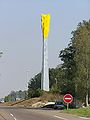
Colonne de l'Épi d'Or


Architectural monuments
See: List of Monuments historiques in Saint-Cyr-l'École
Town twinning
- Butzbach , Germany, since 2008
Personalities
- Charles Couche (1815–1879), railway engineer
- Gérard Laureau (1920–2002), racing car driver and entrepreneur
literature
- Le Patrimoine des Communes des Yvelines. Flohic Editions, Volume 2, Paris 2000, ISBN 2-84234-070-1 , pp. 827-833.