Egerland
The Egerland ( Eghaland , Czech Chebsko ) is in the narrower sense a region in the west of the Czech Republic . It is named after the river Eger (Czech Ohře ). The Egerland in the broader sense also includes neighboring areas of Upper Franconia and the Upper Palatinate .
geography
The area of the historical Egerland lies today in the Czech Republic and Bavaria . The Czech part with an area of almost 1000 km² forms the larger part of the Okres Cheb , without the Ascher tip protruding into Germany . It includes the Eger Basin ( Chebská pánev ) with parts of its peripheral mountains, the Elster Mountains in the north, the Český Les (east side of the Upper Palatinate Forest ) in the southwest and the Kaiserwald ( Slavkovský Les , formerly also Císarský Les ) in the east. The eastern border ran along the Leibitschbach ( Libocký Potok ) and from its confluence with the Eger further south to the Tillenberg ( Dyleň ). Parts of the Sechsämterland as well as the cities of Karlsbad ( Karlovy Vary ), Loket (Elbogen), Sokolov (Falkenau), Marienbad ( Mariánské Lázně ), Teplá (Tepl) and Luditz ( Žlutice ) belonged to the Egerland.
history
In ancient times , the area was inhabited by the Illyrians attributed Naristern (Laristern), who came under Germanic influence in Roman times . It was settled by Slavs during the Migration Period .
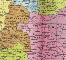
A document from 1061 about the eastern colonization in the neighboring upper Main area also mentions the town of Eger with the trade route leading east from there . The Egire region was first mentioned in 1135 as part of the Bavarian northern district owned by the Counts of Vohburg . Bavarian settlers immigrated in the course of the German colonization in the east. By inheritance, the Egerland came to Emperor Friedrich Barbarossa from the Staufer family in 1167 . Therefore, Eger is the only place in the Czech Republic with an imperial palace . The Hohenstaufen built the Provincia Egrensis into a model country immediately following the empire . After the fall of the Hohenstaufen, the imperial immediate area was divided up.
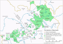
The west of the area with part of the Fichtelgebirge came bit by bit into the rule of Franconian Hohenzollern .
Already after 1268 King Ottokar II illegally appropriated the city of Eger and its surrounding area, which contributed significantly to the conflict with King Rudolf and resulted in the Battle of Dürnkrut . The city of Eger, which has been formally imperial since 1277, and the associated land area were pledged by Emperor Ludwig the Bavarian in 1322 to the Elector and King of Bohemia, John of Luxembourg , “with full independence from the Kingdom of Bohemia guaranteed”. The historical name for the Egerland is therefore Reichspfandschaft Eger . This pledge could never be redeemed by Ludwig and his legal successors. After the crowns of the Holy Roman Empire and the Kingdom of Bohemia were united in one hand under Charles IV , the son of John, there was no longer any reason to redeem the pledge. As a result, the Egerland had its own state parliament for a long time and was not considered a state territory of Bohemia.
During the Thirty Years' War , the Egerland was sometimes treated by the warring parties like a part of Bohemia, and sometimes the powerful emphasized independence out of their interest in power. For example, Rudolf II refused the imperial city of Eger, which was temporarily leaning towards Lutheranism, from the religious tolerance that the Bohemian estates had at that time. In 1628 the state unity of Bavaria was formally restored, the Egerland nevertheless remained as an unredeemed imperial pledge with Bohemia. The formal independence within the Habsburg monarchy lost more and more of its importance. In 1751 the area was assigned to the Elbogen District (Loketský kraj), a subdivision of the Kingdom of Bohemia. With the Reichsdeputationshauptschluss 1806 it became an integral part of the Austrian Crown Land of Bohemia.

When the Danube Monarchy was dissolved at the end of the First World War , the Egerland became part of the First Czechoslovak Republic in 1918/19 . The attempt of the republic of German Austria , which was proclaimed at the same time , to divide Bohemia and Moravia and to bring the border areas predominantly inhabited by German Bohemia to the German Empire failed. The constitution of Czechoslovakia was drawn up without the participation of the German part of the population, the German citizens of the republic were officially equal as citizens, but the nationality policy practiced with preference for the Czechs over the national minorities led to tensions in the country. The confrontations between the mostly German communities and the Czechoslovak state never completely stopped and increased significantly after the NSDAP came to power in Germany. In the Egerland too, Henlein's Sudeten German Party , which fueled tensions between the nationalities, increasingly gained power and influence.
After the Munich Agreement of September 29, 1938 and the invasion of the German Wehrmacht into the Sudetenland on October 1, 1938, the Egerland with its 88,000 inhabitants became part of the German Reich. In the newly created Sudetengau it was assigned to the administrative district of Eger with 800,000 inhabitants on 7466 square kilometers with its seat in Karlovy Vary, which mostly comes from the Old Bohemian area with various traditional regions, such as the Elbow ( Loketský ), Pilsener ( Plzeňský ), Tachauer ( Tachovský ) and Saazer ( Žatecký ) district.
Up until 1945, more than 90 percent of the Egerland was inhabited by German Bohemia , most of which were expropriated, expelled and expelled after the Second World War as a result of the Beneš decrees .
After the war in 1945, increased and state-sponsored immigration began, mainly from Central Bohemia, but also from Moravia and Slovakia. In addition, many repatriates and members of the Roma ethnic minority moved to Egerland. In cities such as Cheb many live Vietnamese , during the time of the CSSR as RGW - contract workers arrived in the country.
Cross-border cooperation
The historical term Regio Egrensis has been reactivated by cross-border regional planning since 1990.
In 1991, a form of cross-border cooperation in Central Europe emerged under the name Euregio Egrensis . The organization became a trailblazer for cooperation between Germany and the Czech Republic. In addition to the Euregio Egrensis, the places near the border around the Vogtland triangle - localities of the Bohemian Vogtland around Aš and the Saxon Vogtland district - have merged to form the Czech-German microregion Friends in the heart of Europe .
Culture
The folk culture of the Egerland was part of the German-speaking culture in Bohemia. Typical for the Egerland are the stately half-timbered courtyards with large storage buildings. Schönbach ( Luby ) was referred to as the Cremona of Austria because of its production of musical instruments . Instrument production lives on and there is a technical college for instrument making in the city. There was also a significant production of instruments in Graslitz . Here, among others, the Koestler company manufactured high quality brass and woodwind instruments.
Ernst Mosch founded the Original Egerländer Musikanten in 1956 .
Until after the Second World War, the Egerland was the last German-speaking area in which the traditional goat , a Bohemian bagpipe, was played.
Associations
In 1907 the Bund der Eghalanda Gmoin e. V. founded, which is dedicated to the maintenance of the Egerland dialect and is continued today from Germany, whereby the term Egerland is extended here to the entire area of the former administrative district of Eger.
See also
- District of Eger
- Okres Cheb
- Egerland Culture House
- Germans in the First Czechoslovak Republic . An overview of the political events surrounding the Germans in the countries of the Bohemian Crown and their successor states (German Austria, Czechoslovak Republic) from 1848 to 1938
literature
- Joseph Sebastian Grüner : Contributions to the history of the royal. City of Eger and the Eger region. From certificates. JG Calve, Prague 1843 ( e-copy ).
- P. Drivok: Older history of the German imperial city of Eger and the imperial territory of Egerland. Shown in their interrelationships to the neighboring German lands and Bohemia using documentary material . Moritz Schäfer, Leipzig 1875 ( e-copy ).
- Heribert Sturm : Districtus Egranus, an originally Bavarian region. (= Historical Atlas of Bavaria. Part of Old Bavaria, Series 2, 2). Munich 1981, ISBN 3-7696-9930-0 .
- Heinrich Gradl : Monumenta Egrana. Egerland monuments as sources for its history. AE Witz, Eger 1884, 1886. (Important sources on the history of the Egerland from the Eger city archivist)
- Jaromír Boháč and Roman Salamanczuk: Zmizelé Chebsko - The disappeared Egerland. Cheb 2007, ISBN 978-80-85018-59-2 . (Czech German)
- Veronika Fišerová: The Egerland - a literary and cultural-historical characterization of the region, diploma thesis, Masarykova Univerzita Brno, 2008, 76 p., See online PDF file (accessed on June 12, 2019)
Web links
- Overview of the history of the city of Eger and the Egerland
- History of the Egerland
- Literature on the history of the city of Eger and the Egerland
- Digitized magazines, yearbooks, calendars and newspapers
- Egerland, annexation plans to Bavaria, 1918/1922 . In: Historical Lexicon of Bavaria
Individual evidence
Coordinates: 47 ° 54 ' N , 20 ° 22' E


