
Ortenberg (Hesse)
| coat of arms | Germany map | |
|---|---|---|
.png)
|
Coordinates: 50 ° 21 ' N , 9 ° 3' E |
|
| Basic data | ||
| State : | Hesse | |
| Administrative region : | Darmstadt | |
| County : | Wetteraukreis | |
| Height : | 136 m above sea level NHN | |
| Area : | 54.69 km 2 | |
| Residents: | 8970 (Dec. 31, 2019) | |
| Population density : | 164 inhabitants per km 2 | |
| Postal code : | 63683 | |
| Primaries : | 06046, 06041, 06049 | |
| License plate : | FB, BÜD | |
| Community key : | 06 4 40 019 | |
| LOCODE : | DE ORB | |
| City structure: | 10 districts | |
City administration address : |
Lauterbacher Str. 2 63683 Ortenberg |
|
| Website : | ||
| Mayoress : | Ulrike Pfeiffer-Pantring ( SPD ) | |
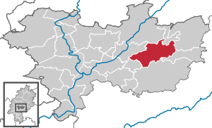
| Location of the city of Ortenberg in the Wetterau district | ||
  |
||

Ortenberg is a town in the Wetterau district in Hesse .
geography
location
Ortenberg is located on the southern foothills of the Vogelsberg in the valley of the Nidder at an altitude of 141 m above sea level , about eight kilometers northwest of Büdingen .
Neighboring communities
Ortenberg borders the city of Nidda in the north, the municipality of Hirzenhain in the northeast, the city of Gedern and the municipality of Kefenrod in the east, the city of Büdingen in the south, the municipality of Glauburg in the southwest and the municipality of Ranstadt in the west .
City structure
Ortenberg consists of the districts Bergheim , Bleichenbach , Eckartsborn , Effolderbach , Gelnhaar , Lißberg , Ortenberg, Selters (with Konradsdorf ), Usenborn and Wippenbach .
history
prehistory
Settlement in the Ortenberg area has been archaeologically proven since the Stone Age . In the Iron Age , Celts settled in the region, followed by the Romans and later Franks settled here.
middle Ages
_Obertor_0420.jpg)
_Rathaus_0429_30_31.jpg)
The Ortenberg district court developed from the old Mark Glauburg . The oldest surviving mentions of Ortenberg come from the years 1166 as Ortenberch and 1176. A Werner and a Heinrich von Ortenberg are named, who probably belonged to a sideline of the Lords of Büdingen . The founding of Ortenberg Castle is attributed to its ancestor Ortwin von Staden , from whom it also got its name. Ortenberg apparently obtained market and town rights in the middle of the 13th century: In land contracts from 1266, witnesses from Ortenberg were referred to as citizens for the first time and the town wall also dates to this time. Both points to city law. Ortenberg became the central point for tithe court , trade fairs and markets for the area. The Oberpfortenturm (Obertor), built in the second half of the 13th century, and the Thief Tower, which previously served as a prison, testify to the city wall.
In the Middle Ages and in the early modern period, the city belonged to the Ortenberg office , a condominium that was formed by three sovereigns from among the members of the Wetterau Counts' Association .
In 1422, the Ortenberg “Cold Market” appeared for the first time in city bills. The Gothic department store (town hall) also dates from this period . After being destroyed, it was rebuilt in 1605–1608 and restored in 1980.
Early modern age
_De_Merian_Hassiae.jpg)
In 1601 there was a real division of the condominium. The "main" city of Ortenberg remained a condominium: ⅔ fell to the county of Stolberg-Roßla and belonged to the local office of Ortenberg, ⅓ to the county of Hanau-Münzenberg , from 1642: county of Hanau , and its office of Ortenberg . The county of Hanau fell in 1736 when the last Hanau count, Johann Reinhard III, died. , on the basis of an inheritance contract to the Landgraviate of Hessen-Kassel .
Ortenberg was one of the places in which the Solms land law of 1571 applied under customary law - to what extent is questionable. In the Stolberg office of Ortenberg, the Solms land law was only partially accepted , in particular the rules on guardianship law , hereditary rights and matrimonial property law . Otherwise common law applied . In the Hanau district of Ortenberg, on the other hand - as in the entire county of Hanau-Münzenberg - the Solms land law was fully applicable. It was not until January 1, 1900, when the Civil Code , which was uniformly valid throughout the German Reich , that the old particular law was suspended .
From 1624 to 1627 major renovations took place in the castle, which is located northeast of the city and which was converted into a palace. In 1634 the town and castle were destroyed by Croats in the Thirty Years' War . Also in 1634, Matthäus Merian drew and described the city. The palace was last rebuilt in the classicist style around 1775 .
Modern times
The Hanau, later Hessian " Amt Ortenberg " formed part of the Grand Ducal Hessian Dominialamt Ortenberg from 1810 , the Stolberg part belonged to the noble Graeflich-Stollberg Amt Ortenberg . In 1821 the Grand Duchy formed the district of Nidda , which from 1832 was called Kreis Nidda . In 1842 the gates and bridges, which had meanwhile become militarily redundant and obstructive to traffic, were demolished. With the revolution of 1848 the administrative district of Nidda was briefly formed, but in 1852 the district of Nidda was revived. In 1874, Ortenberg came to the district of Büdingen , which became part of the Wetterau district with the regional reform in Hesse in 1972 .
Territorial reform
In the course of administrative reform in Hesse , the cities Ortenberg and Lißberg well as a number of smaller surrounding communities (Bergheim, Bleichenbach, Eckartsborn, Usenborn and Wippenbach) voluntarily to the new city Ortenberg joined on 1 July 1971. together . Also on a voluntary basis, Effolderbach was incorporated on July 1, 1971, and Selters was incorporated on December 31, 1971, and Gelnhaar was incorporated on April 1, 1972.
Population development
- 1939: 1013 inhabitants
- 1961: 1645 inhabitants
- 1970: 1810 inhabitants
- 2010: 9016 inhabitants (according to incorporations)
- 2015: 9091 inhabitants
politics
City Council
The local elections on March 6, 2016 produced the following results, compared to previous local elections:
| Parties and constituencies |
% 2016 |
Seats 2016 |
% 2011 |
Seats 2011 |
% 2006 |
Seats 2006 |
% 2001 |
Seats 2001 |
||
|---|---|---|---|---|---|---|---|---|---|---|
| SPD | Social Democratic Party of Germany | 42.4 | 13 | 41.4 | 13 | 40.2 | 13 | 48.6 | 15th | |
| CDU | Christian Democratic Union of Germany | 29.9 | 9 | 29.0 | 9 | 29.8 | 9 | 31.9 | 10 | |
| BiO | Citizens' association in Ortenberg | 8.5 | 3 | 16.3 | 5 | 17.4 | 5 | - | - | |
| FWG | Free voters | 19.1 | 6th | 13.3 | 4th | 12.6 | 4th | 19.4 | 6th | |
| total | 100.0 | 31 | 100.0 | 31 | 100.0 | 31 | 100.0 | 31 | ||
| Voter turnout in% | 49.8 | 47.5 | 58.9 | 53.5 | ||||||
mayor
Ulrike Pfeiffer-Pantring (SPD) has been Ortenberg's mayor since 2000. As incumbent, she prevailed in the runoff election on April 9, 2006 with 58.4% of the votes against Tobias Greilich (CDU). The turnout was 53.0%. In 2012, Pfeiffer-Pantring was re-elected with 71.8% of the vote, while competitor Friedrich Brackmann received 28.2%.
Town twinning
Ortenberg has partnerships with Ortenberg (Baden) in Baden-Württemberg and Roßla in Saxony-Anhalt .
traffic
The federal highway 275 runs through the municipality. The closest motorway connection ( A 45 ) is Florstadt- Nieder-Mockstadt.
On October 1, 1888, the place was connected to the railway by the Oberwaldbahn of the Grand Ducal Hessian State Railways . In 1975 passenger traffic was discontinued , in 1984 also goods traffic and the Oberwaldbahn was dismantled. Today the volcano bike path runs along the former route .
In the districts of Effolderbach and Bleichenbach there are still stops on the Gießen – Nidda – Gelnhausen railway line .
Culture and sights
music
Ortenberg has an active music club that is well known beyond the region. The Ortenberg jazz club organizes jazz concerts of all styles, the focus is on the traditional area. Since 1982 he has presented many prominent jazz musicians and bands, including a. Barrelhouse Jazzband , Trevor Richards , Clark Terry , Kreisjazzwerkerschaft & Rose Nabinger , Herb Ellis and Red Norvo .
Buildings
_Marienkirche_0428.jpg)
_1986,_MiNr_769.jpg)
See also: List of cultural monuments in Ortenberg (Hessen)
In addition to the medieval buildings already mentioned, the following are noteworthy:
- The three-aisled Marienkirche , a Gothic hall church. In the church there is a copy of the important three-part "Ortenberger Altar", which was created in the first third of the 15th century and which is an extraordinary work of Middle Rhine painting. The original is exhibited in the Hessian State Museum in Darmstadt . The painter of the work, the master of the Ortenberg Altar , is named after him.
- The Nidder power plant near Lißberg is a cultural and historical monument.
- The Lißberger Krautfass , the keep of a castle complex from the 12th / 13th centuries. Century, see: Lißberg Castle .
- In the former school building directly in front of the shield wall of Lißberg Castle is a museum of musical instruments that is well worth seeing .
- Also in Lißberg is the Neumühle , built in 1722 , which is still in operation today as a hydroelectric power station.
Regular events
- The nationally important Ortenberger "Kalte Markt" (orig .: Kaale Määrt ). It takes place annually on the last weekend in October.
- Every Saturday there is a flea market in the market square.
Leisure and sports facilities
- The Vulkanradweg runs on the route of the former Oberwaldbahn from Stockheim to Lauterbach through Ortenberg. Today the Vulkanradweg is part of the BahnRadweg Hessen , which runs on former railway lines for approx. 250 km through the Vogelsberg and the Rhön.
- In the center of town there is the Ortenberg open-air pool with an adjoining mini-golf course. There is a nudist area in the outdoor pool itself.
Personalities
- Ludwig Eisenberger (1541–1591), bailiff in Ortenberg
- Johann Martin zu Stolberg (1594–1669), founder of the younger line of the Count's House of Stolberg
- Friedrich Mosler (1831–1911), internist, neuropathologist and university professor
- Reinhard Schaum (1839 – unknown), Hessian economist and politician (NLP) and member of the 2nd Chamber of the Land estates of the Grand Duchy of Hesse
- Renate Klingelhöfer (* 1933), local politician
- Günter Köcher (1948–2020), table tennis player and functionary
- Edgar Itt (* 1967), athlete
- Sandra Minnert (* 1973), soccer player
literature
- Rudolf Knappe: Medieval castles in Hessen. 800 castles, castle ruins and fortifications. 3. Edition. Wartberg-Verlag, Gudensberg-Gleichen 2000, ISBN 3-86134-228-6 , p. 358 f.
- Peter Nieß: Ortenberg. Contributions to history and building history. Ortenberg 1989
- Hans Philippi: Territorial history of the county of Büdingen. = Writings of the Hessian Office for Historical Regional Studies 23. Marburg 1954, pp. 134–144.
- Hans Georg Ruppel (edit.): Historical place directory for the area of the former Grand Duchy and People's State of Hesse with evidence of district and court affiliation from 1820 until the changes in the course of the municipal territorial reform = Darmstädter Archivschriften 2. 1976, p. 169.
- Michael Schroeder: Ortenberg Castle. A guide to Ortenberg Castle and Palace as well as the family history of the Princely House of Stolberg-Roßla. Ortenberg 2010.
- Michael Schroeder: Ortenberg in Hessen. A tour of the old town . Edited by Kulturkreis Altes Rathaus ud Stadt Ortenberg. 96 p., 80 ill. Fb. Koenigstein i. Ts. 2012 Verlag Langewiesche ISBN 978-3-7845-1105-4
- Heinz Wionski: Monument topography Federal Republic of Germany. Cultural monuments in Hessen. Wetteraukreis I. Stuttgart 1999, pp. 358-378.
Web links
- Official website of the city of Ortenberg
- "Ortenberg, Wetteraukreis". Historical local dictionary for Hessen. In: Landesgeschichtliches Informationssystem Hessen (LAGIS).
- Literature on Ortenberg in the Hessian Bibliography
- Link catalog on the subject of Ortenberg at curlie.org (formerly DMOZ )
- Literature on Ortenberg in the catalog of the German National Library
- Picture gallery of the sights of Ortenberg (Hessen)
Individual evidence
- ↑ Hessian State Statistical Office: Population status on December 31, 2019 (districts and urban districts as well as municipalities, population figures based on the 2011 census) ( help ).
- ↑ Valentin Ferdinand Gudenus , Sylloge. Frankfurt am Main 1728. p. 528.
- ^ Hans Philippi : Territorial history of the county of Büdingen. Marburg 1954, pp. 95f .; Klaus-Peter Decker: Gentlemen in the Wetterau. In: Knights, Counts and Princes - secular dominions in the Hessian area approx. 900–1806. Marburg 2014, ISBN 978-3-942225-17-5 (= Handbook of Hessian History 3 = Publications of the Historical Commission for Hesse 63 ), p. 292f.
- ↑ Diebesturm and city wall on the website of the city of Ortenberg ( Memento from April 3, 2016 in the Internet Archive )
- ↑ Arthur Benno Schmidt : The historical foundations of civil law in the Grand Duchy of Hesse . Curt von Münchow, Giessen 1893, p. 108, note 36 and p. 25, note 82, as well as the enclosed map.
- ↑ Arthur Benno Schmidt: The historical foundations of civil law in the Grand Duchy of Hesse . Curt von Münchow, Giessen 1893, p. 105, as well as the enclosed map.
- ^ Municipal reform in Hesse: mergers and integrations of municipalities from June 21, 1971 . In: The Hessian Minister of the Interior (ed.): State Gazette for the State of Hesse. 1971 No. 28 , p. 1117 , item 988; Para. 12. ( Online at the information system of the Hessian State Parliament [PDF; 5.0 MB ]).
- ^ Federal Statistical Office (ed.): Historical municipality directory for the Federal Republic of Germany. Name, border and key number changes in municipalities, counties and administrative districts from May 27, 1970 to December 31, 1982 . W. Kohlhammer, Stuttgart / Mainz 1983, ISBN 3-17-003263-1 , p. 352-353 .
- ^ Result of the municipal election on March 6, 2016. Hessian State Statistical Office, accessed in April 2016 .
- ^ Hessian State Statistical Office: Result of the municipal elections on March 27, 2011
- ^ Hessian State Statistical Office: Result of the municipal elections on March 26, 2006
- ↑ http://www.wahlen.ortenberg.net/

Altenstadt | Bad Nauheim | Bad Vilbel | Büdingen | Butzbach | Echzell | Florstadt | Friedberg (Hesse) | Gedern | Glauburg | Hirzenhain | Karben | Kefenrod | Limeshain | Munzenberg | Nidda | Niddatal | Ober-Mörlen | Ortenberg | Ranstadt | Reichelsheim (Wetterau) | Rockenberg | Rosbach v. d. Height | Wölfersheim | Wöllstadt
Bergheim | Bleichenbach | Eckartsborn | Effolderbach | Gel hair | Lißberg | City of Ortenberg | Seltzer | Usenborn | Wippenbach