
Railway cycle route Hessen
| BahnRadweg Hessen | |
|---|---|
|
|
|
| overall length | 310 km |
| location |
|
| map | |
| Link to map and elevation profile | |
| Starting point | Hanau |
| Target point | Bad Hersfeld |
| Flooring | mostly paved |
| Height difference |
100 m to 580 m, approx. 1700 m ascent |
| difficulty | easy - medium |
| Traffic volume | low |
| Connection to |
Main cycle path , R1 , R2 , R7 , D-Route 9 , Rhön cycle path |
| ADFC certification |
4 out of 5 stars / Description ADFC classifications |
| Website URL | bahnradweg-hessen.de |
The BahnRadweg Hessen is one of the long-distance cycle routes in Hessen . It leads on former railway lines through the Vogelsberg and the Rhön, using for the most part already existing cycle paths. He offers two alternative routes between Hanau and Hartmannshain in Vogelsberg. One uses the Vulkanradweg via the former Vogelsbergbahn and the other leads along the Main and Kinzig to the Vogelsberger Südbahnradweg on the old route of the Vogelsberger Südbahn . Using the Hessian long-distance cycle paths, the route leads via Fulda and the Milseburgradweg , again a former railway line, into the Rhön. Another disused railway line is reached through the Ulstertal . The cycle path ends in Bad Hersfeld above the route of the former Hersfeld circular railway . The route over the volcano cycle path is 240 km and the alternative route is 250 km. The ascent to the Vogelsberg via the volcano cycle path does not have an incline of more than 3%, but, given its length, requires a suitable basic level of fitness.
In September 2012, the Hesse rail cycle route was certified as a quality cycle route with four out of five stars by the ADFC.
Overview of the places on the route
Start: Hanau ( Hbf ) Main
route:
-
Nidderau , ( volcano cycle path ): Altenstadt ( Bf ), Glauburg ( Bf ), Ortenberg , Gedern
Alternative route:
- ( R3 ): Langenselbold ( Bf ), Gelnhausen ( Bf ), Wächtersbach ( Bf ), ( Vogelsberger Südbahnradweg ): Birstein
Together:
- (Vulkanradweg): Hartmannshain , Grebenhain , Ilbeshausen-Hochwaldhausen , Herbstein , Lauterbach ( Bf ), Wartenberg , Bad Salzschlirf ( Bf ), Schlitz , ( Fulda Cycle Path ): Pfordt , Kämmerzell , Fulda ( Bf ), ( Milseburg Cycle Path ): Götzenhof , Hofbieber , Hilders , ( Ulsterradweg ): Tann , Schleid , Geisa , Buttlar , Pferdsdorf , Unterbreizbach , Philippsthal (Werra) , ( Solztalradweg ): Ransbach , Schenklengsfeld , Sorga , Bad Hersfeld ( Bf )
Characteristic
ADFC information
The ADFC states that the Hessian Railway Cycle Path is of excellent quality and states:
For the variant over the Vulkanradweg:
total length 219 km with 1875 m ascent and 1781 m descent. Approx. 62% suitable for racing bikes, a touring bike is recommended for the rest.
Difficulty: approx. 50% easy (0–2%); 48% medium (2-6%); The rest sporty (> 10%).
Traffic load: “no to low”; <1% high.
He recommends 35% of the route as suitable for children.
For the variant on the Vogelsberger Südbahnradweg:
total length 223 km with 1839 m ascent and 1623 m descent. Approx. 60% suitable for racing bikes, a touring bike is recommended for the rest.
Difficulty: approx. 60% easy (0–2%); 38% medium (2-6%); The rest sporty (> 10%).
Traffic load: “no to low”; <1% mean.
He recommends 25% of the route as suitable for children.
Character of the stages
Section Hanau - Glauburg:
- The 31.6 km long section leads mostly over separate cycle paths with an easy-to-use composite surface. The exception is the little-traveled district road in front of Eichen (approx. 1 km). It has little height differences (250 m ascent / 230 m descent). There is a noticeable ascent to the Hohe Straße and a short ascent after leaving Windecken.
Section Glauburg - Schlitz:
- The 85 km long section leads over cycle paths with fine asphalt, quiet local roads and in some places over cycle paths along the road. The ascent to the Vogelsberg takes place on the Vulkanradweg, a former railway line and therefore only has a moderate gradient. Up to Gedern there is only a slight incline, then moderate up to 3% to Hartmannshain. Here is the highest point of the section. The section has a total of 690 m ascent and 587 m descent.
Schlitz-Hilders section: 57 km of gradients, 689 vertical meters; Gradient 495 meters in altitude.
- The 87 km long section leads over paved or paved bike paths. Partly via specially created paths, partly via farm roads. In Fulda, the route is partly on quiet side streets. After Fulda, the route runs along the continuously asphalted Milseburgradweg. On it it goes with only a slight incline into the Rhön. The 1173 m long Milseburg tunnel is located here. Temperatures of 8 to 10 ° C prevail in it and it is officially closed from November to March to protect bats . In practice, the closure depends on the bats' need for rest and can last until mid-April. For example, in 2009 the tunnel was not reopened until April 19. In total, the section has 689 m of inclines and 495 m of descent.
Section Hilders - Philippsthal:
- This 37 km long section leads mostly over quiet back roads and developed bike paths with asphalt or fine gravel. The Tann - Motzlar and Geisa - Buttlar sections run alongside the B278. After Wenigentaft there is an approximately one kilometer long unpaved or gravel path on the former German-German border. Between Räsa and Philippsthal there is a short stretch of unsurfaced on the Ulsterufer. The section runs with the Ulstertal sloping down with almost no inclines. In total, the section has 689 m of inclines and 495 m of descent.
Section Philippsthal - Bad Hersfeld:
- This 28 km long section is paved throughout. The route takes you via specially created or road-accompanying cycle paths, little-traveled streets and a former railway line. In the first half there are some moderate climbs and descents, the second part is largely flat. The section has a total of 249 m ascent and 240 m descent.
Fulda cycle path Bad Hersfeld - Lauterbach as a circular route
- This 50 km long section uses the Fulda cycle path R1 until shortly before Schlitz. Then turn onto the R7a and from Schlitz follow the Glauburg - Schlitz section in the opposite direction. The stage leads over mostly asphalted bike paths and side streets. Up to Schlitz there is only a slight difference in altitude, then slightly hilly. The section has a total of 336 m of inclines and 253 m of descent.
Alternative route Hanau - Hartmannshain
- This 67 km long section can either be used as an alternative approach for ambitious cyclists or for the return trip on a round trip. Between Hanau and Wächtersbach on the R3 flat in the Kinzig valley, then on the Vogelsberger Südbahnradweg for 32 km a difference in altitude of 565 m with up to 10% incline or decline between Birstein and Hartmannshain. The lower section between Wächtersbach and Birstein runs on the former route of the Vogelsberger Südbahn. In total, the section towards Hartmannshain has 760 m of inclines and 265 m of descent.
Route description
The route allocation follows the tour guide published by Region Vogelsberg Touristik GmbH. The information on distances and elevation profiles were taken from the Hesse cycle route planner.
Hanau - Glauburg

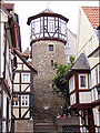
Water tower in Hanau-Kesselstadt

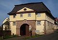
Former spa building in Wilhelmsbad

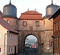
Historic Obertor in Mittelbuchen
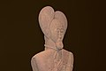
Celtic prince on the Glauberg


Length 31.6 km; Inclines 250 meters in altitude, downward slopes 230 meters in altitude.
The BahnRadweg Hessen starts at Philippsruhe Castle in Hanau-Kesselstadt on the Hessian long-distance cycle route R3 directly on the northern bank of the Main . Hanau-West train station is two kilometers away. From the starting point, the route leads over Burgallee to the historic Wilhelmsbad, where the Hessian Puppet Museum is located. After bypassing the site, the route leads next to the Kesselstädter Straße through a forest area, crosses the A66 and after 7 km reaches Hanau-Mittelbuchen . The rest of the way leads slightly hilly, mainly on farm roads through the fields into the municipality of Nidderau to the B45 . Along the road, the path leads over 34 meters in altitude to the Wartbaum, a linden tree that is more than 400 years old, on the " Hohen Straße ". This historic trade route Frankfurt am Main - Leipzig was an important east-west connection. Today the regional park route Hohe Straße runs here . After a descent to Windecken in the valley of the Nidder , another climb has to be overcome from the village before the train station of Nidderau-Eichen is reached after 12 km through the Niddaauen . Further in the valley of the Nidder, the route runs to Höchst an der Nidder , where the volcano cycle path starts. The route continues on it and after approx. 6 km Altenstadt . Art objects are now set up at regular intervals along the way. It is now 7 km to the train station of the Glauburg stage destination. Until then, the A 45 will be crossed and the village of Altenstadt-Lindheim will be passed. In Glauburg, it is worth taking a detour to Glauberg with the archaeological park " Keltenwelt am Glauberg ". It can be reached via the cycle path, the Celtic routes , 1.6 km away and about 85 meters in altitude. The newly built museum is to show insights into various facets of Celtic culture on the basis of old and new research on the Glauberg. In the village there is the Glauberg Museum, the showpieces of which are a copy of the statue of the Celtic prince and a photo documentation of excavated Celtic princely graves.
Glauburg - slot

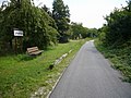
Vulkanradweg at the former Selters train station
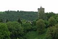
Lißberg Castle

View of Herbstein from the bike path
Volcano bike path behind Herbstein

Eisenbach Castle

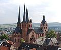
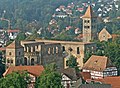
Historic town center of Schlitz


Length 85 km; Gradients 690 meters in altitude; Gradient 587 meters in altitude.
Shortly after the start of the stage in Stockheim , the route follows the route of the former Vogelsbergbahn . This follows the Niddertal and after 6 km and the first 35 meters of altitude, Ortenberg is reached via the former Selters train station . Then the trail leads past Eckartsborn , on the opposite Nidderseite after Lißberg with its castle from the 12th century. The defense tower of the Krautfass castle can be seen from the bike path. After the village, the valley narrows and the route leads along the edge of the forest to Hirzenhain , where another 7 km with 100 meters of ascent have to be mastered. The Iron Art Casting Museum in Hirzenhain can be visited on Sundays. It provides an overview of iron extraction and processing in Hirzenhain, as well as an introduction to the history of iron art casting in the 19th century. The route leads from the Niddertal through Merkenfritz , Hochwald and Wiesen to Gedern. With which a further 7 km and 100 meters in altitude are covered. The cycle path slowly winds in long serpentines with beautiful vantage points up to Ober-Seemen, then dives into an extensive forest area and after 14 km and 288 meters in altitude in Hartmannshain, it reaches the highest point of the volcano cycle path. The alternative route with the Vogelsberger Südbahnradweg meets the volcano cycle path here. This is followed by a pleasant 7 km long descent with an altitude of 156 meters through mostly open meadow terrain that ends just behind Crainfeld . The route leads almost flat on the partly high embankment 7 km through meadows and fields to the village of Ilbeshausen-Hochwaldhausen and another 6 km to the junction to Herbstein . The small town on a hilltop offers a beautiful picture from the bike path. The spa with thermal spring, which has been officially recognized since 2000, is best known for the carnival custom of the Herbsteiner Springerzug . The Terme volcano with its warm magnesium-rich, fluorine-containing calcium-sodium-sulphate medicinal water has given the town its title of medicinal bath. The route now has a downward tendency and after 6 km and 50 meters lower there is a beautiful view of Eisenbach Castle . The privately owned castle is not open to the public, but the associated castle park can be entered. The Eisenbach now accompanies the cycle path and partly through meadows and partly through forest, the now steadily falling route leads to the historic center of Lauterbach after 5 km and 100 meters in altitude. On the outskirts of Lauterbach, the Hessian long-distance cycle route R7 meets the Vulkanradweg and thus also the BahnRadweg. In the historic old town with its half-timbered ensemble there is the Hohhaus Museum in the baroque palace Hohhaus in the former palace of the barons Riedesel zu Eisenbach , the anchor tower as the only remaining tower of the former city wall and landmark of the city as well as the Ev. City church from 1768 can be seen. From the city, the Hessian long-distance cycle route R2 also leads slightly downhill next to the federal road 254 to Wartenberg-Angersbach, 4 km away . Here the cycle routes turn left and follow the valley of the Lauter , the river that Lauterbach owes its name to. The path runs between meadows and pastures in the Lauter valley, past the Wartenberg ruins and then briefly uphill to the southern slope of the Gackenberg. With a slight gradient, it then goes down the river to Bad Salzschlirf, 5 km away. In addition to its spa facilities, the health resort has a historical center. Near the origin of the river Schlitz from Lauter and Altefeld , the route turns left to the north, while the R2 continues into the health resort. Downstream in the valley of the Schlitz, the route only runs at the edge of the forest and later through open, sometimes arable, meadows. After 9.4 km and past the village of Nieder-Stoll , you will reach the town of Schlitz, which is about 50 meters lower, with its high-altitude historic town center.
Schlitz - Hilders

Cathedral of St. Salvator in Fulda

Bieberstein Castle from Langenbieber

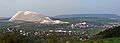
Milseburg

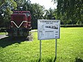
View into the illuminated Milseburg tunnel


Length 57 km gradients 689 meters in altitude; Gradient 495 meters in altitude.
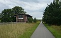
The railway cycle path continues through the Schlitz valley and after a good 2 km reaches the Fulda valley with the accompanying Hessian long-distance cycle path R1 . In the Fulda valley, the next 10 km are almost flat up the river, partly on the edge of the forest, partly through meadows and fields. This is followed by a few small climbs with 10 to 20 meters in altitude before the towers of the Fulda Cathedral can be seen after another 5 km. The remaining 5 km to the cathedral forecourt in Fulda are flat again. Before Fulda, the cycle path leads part of the B254 and then runs on the outskirts before it reaches the center of the episcopal city through the garden ring together with the Hessian long-distance cycle path R3 . Fulda offers a whole range of sights; among others the cathedral , the city palace with park and orangery, the Paulustor , as well as the baroque quarter and many churches. The tourist office offers an audio guide for a one-hour tour . The BahnRadweg now runs together with the R3 to the Hessian-Thuringian border behind Tann . The route leaves the city in a stream valley and reaches the A7 after 5 km . In one kilometer, the path gains 55 meters in altitude. From here in Götzenhof , the route uses the Milseburgradweg , which runs on the route of the former Rhön Railway . The former stops on the railway line are now equipped with shelters. The route is flat at first and then with a slight incline (approx. 2%) and after 17 km it reaches the Milseburg tunnel . The path through meadows and fields follows the course of the Bieber and passes the towns of Almendorf , Melzdorf , Wiesen , Niederbieber and Langenbieber . The baroque castle Bieberstein and the Milseburg , on the highest elevation of the southern Rhön, can be seen from the bike path. After Niederbieber, the path continues to gain altitude in a long S-loop through a forest area before it reaches the tunnel entrance. The illuminated tunnel is 1173 m long and is only open from April 15th to October 31st. Therefore there is a 4 km long bypass route, on which, however, about 150 meters in altitude must be overcome. The tunnel ends in front of the village of Oberbernhards at the former Milseburg station. The R3 together with the Milseburgradweg and the BahnRadweg run for another 7 km and a drop of approx. 150 meters through an open brook valley with the towns of Rupsroth and Eckweisbach to the hamlet of Aura, which belongs to the town of Tann . Here the Milseburgradweg turns south towards Hilders , where it ends after 2 km. The Rhön Cycle Path and the Ulstertal Cycle Path join the route here.
Hilders - Philippsthal

Former train station in Pferdsdorf
Overburden dump in Philippsthal

Klosterkirche Schloss Philippsthal
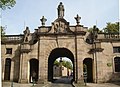
Archway house at Philippsthal Palace


Length 37 km gradients 111 vertical meters; Gradient 315 meters.
The long way leads mostly on the old route of the former Ulstertalbahn through the Ulstertal with open meadows and fields sloping towards the north. After approx. 9 km you will reach the town of Tann, which is 43 meters lower, with its renovated town gate and Tann Castle . The BahnRadweg then continues along with the cycle paths: R3, Ulstertalradweg and Rhönradweg for about 5 km to the Hessian border, where the R3 ends. The other cycle paths continue to follow Ulster towards Geisa in Thuringia . Behind Tann, the route leads first left and then right next to the B278 on a separate cycle path to Motzlar , then left of the main road and before the Ulster on farm roads towards Schleid and Geisa which is 6 km behind the state border. From Geisa you can take a 3.5 km detour (350 meters ascent) to the Point Alpha reminder, memorial and meeting place , the former observation base of the US armed forces on the inner-German border. There is also a museum on this subject in the city. Behind Geisa, the route runs about 5 km next to the main road to the village of Buttlar on the former embankment of the Oechsenbahn, a section of the Ulstertalbahn. At the former train station in Wenigentaft , signs provide information about the so-called Ulstersack . Here the railway line was interrupted for both sides by the former zone border, which led to some political peculiarities (see history of the Ulstertal Railway ). To the north you can already see the huge white-gray waste dump of the potash works in Philippsthal . In Buttlar, the vicinity of the main road will be left and the route will continue about 9 km on the former railway line near Ulster, past the former train stations of Pferdsdorf and Räsa, a district of Unterbreizbach . The place is dominated by the spoil dump of the potash works located here. From here the route runs 3 km alongside the railway line that is still active for freight traffic to the stage destination Philippsthal on the Werra , which is again in Hesse. The Ulster Cycle Path ends here while the Rhön Cycle Path leaves the common route and the Werra leads upwards. On the other hand, the route meets the Werra cycle path , which it follows for 3.7 km before leaving it again via the Werra bridge in the Heimboldshausen district. After approx. 500 m on the Rhönradweg you come to Schloss Philippsthal , in whose archway there is a border museum to the former inner German border .
Philippsthal - Bad Hersfeld
formerly the Lampertsfeld stop

Old town Bad Hersfeld


Length 28 km; Gradients 219 meters in altitude; Gradient 240 meters in altitude.
The first part of the section to Schenklengsfeld leads over quiet side streets and farm tracks. Along the B62 , the route leaves Heimboldshausen and, together with the Solztalradweg, leads left onto the road towards Ransbach. The Werra valley is left with a slight incline (approx. 2%). First it goes along a stream valley with meadows and groups of trees to Ausbach and then through arable land to Ransbach. The plateau allows a good overview of the landscape shaped by potash mining. Shortly after the village, 10 km behind Heimboldshausen, the highest point is reached and it is now 4 km and 55 meters downhill to Schenklengsfeld in the Solz valley . From the exit of the village, the route uses a separate cycle path on the former route of the Hersfeld circular railway . Following the meanders of the river, it mainly goes through meadow terrain to its confluence with the Fulda north of Bad Hersfeld. After 14 km, the route reaches Bad Hersfeld train station, 136 m below, with an information board. Here you have reached the end of the BahnRadweg. On the way you pass a historic water mill at Hermannshof, before Sorga the Hessian long-distance cycle path R7 meets the route, the A4 motorway is crossed under and with the Fulda valley the route follows the Hessian long-distance cycle path R1 .
Alternative route via the Vogelsberger Südbahnradweg

Old Town Hall, Hanau

Obermarkt, Gelnhausen
Locomotive monument in Birstein

Birstein Castle


Hanau - Hartmannshain route on the volcano cycle path:
length 67 km; Gradients 760 meters in altitude; Gradient 265 meters in altitude.
The alternative route follows the Hessian long-distance cycle route R3 from the start at Philippsruhe Castle in Hanau-Kesselstadt . At the mouth of the Kinzig , the cycle path leaves the Main and runs through Hanau near the river. The path leads only a few meters past the Hanauer Goldschmiedehaus , the former town hall on the Old Town Market . Then he follows the Kinzig before he leaves it together with the expressway heading south into a forest area. The route crosses the A66 and continues on the street (now Leipziger Straße) to the outskirts of Erlensee , which is approx. 17 km behind Philippsruhe Castle. The route now runs through the wide Kinzig valley, mostly between the river and the A66 motorway. Forests, fields and meadows alternate. In Langenselbold you can either follow the route through the city or alternatively use the signs to the south past the city. After approx. 22 km the Kaiserpfalz in Gelnhausen is reached. It is worth paying a visit to the Barbarossastadt with the interesting Unter- and Ober-Markt, as well as the Marienkirche with its eventful architectural history. After Gelnhausen, the railway cycle path still follows the R3 to Wächtersbach, where after 14 km it turns onto the well-developed Vogelsberger Südbahnradweg towards Vogelsberg. After the first still flat approx. 7 km we reach Hellstein , where the ascent through a forest area to Birstein begins with the first 90 meters of altitude for a good 3 km. The castle can be visited here. There is also a locomotive monument here, which is reminiscent of the former railway line. After a further two kilometers and an altitude of 43 meters above meadow terrain, the Unterreichenbach district with the so-called Vogelsberg Cathedral is reached. Alternating through meadows and short wooded areas, the route continues up to the village of Lichenroth, approx. 12 km away and 200 m higher . The route gained almost the entire height over the first 12 km. Up to the volcano cycle path in Hartmannshain there are another 6 km and 150 meters of altitude, mainly through meadow terrain and the village of Völzberg .
The Hessian Railway Cycle Path as a round trip
It is possible to combine the Hessian Railway Cycle Path with the Fulda Cycle Path to a 400 km long round trip. From the start in Hanau the sections "Hanau - Glauburg - Schlitz - Hilders - Philippsthal - Bad Hersfeld" are followed to the end of the Hessian Railway Cycle Path, from Bad Hersfeld then the Fulda Cycle Path R1 to the junction to Schlitz ( R7 ) and from here the well-known route Schlitz - Lauterbach. Then back on the volcano cycle path to Hartmannshain where the Vogelsberger Südbahn cycle path starts. From here on via the alternative route to Gelnhausen and back to the starting point in Hanau. From Bad Hersfeld, the tour guide of "Vogelsberg Touristik GmbH" recommends the stage division:
- Bad Hersfeld - Lauterbach (approx. 50 km)
- Lauterbach - Birstein (approx. 51 km)
- Birstein - Hanau (approx. 56 km).
Connecting cycle paths
- The BahnRadweg Hessen and the Hessische Radfernweg R3 use the same route from Philippsruhe Castle in Hanau to Wächtersbach (alternative route) and from Fulda to Tann.
- Between Hanau and Altenstadt, the regional park routes circular route and Hohe Straße cross the BahnRadweg.
- The German Limes Cycle Path crosses the alternative route at Erlensee in the Main-Kinzig district and the main route of the BahnRadweg in Altenstadt.
- The Vogelsberger Südbahnradweg and the variant of the BahnRadweg use the same route between Wächtersbach and Hartmannshain . This creates a 35 km long connection between the volcano cycle path in Vogelsberg and the Kinzig valley.
- The summit tour , the connection between Hoherodskopf and Wasserkuppe, and the BahnRadweg run over 40 km on the same route between Hartmannshain and Bad Salzschlirf .
- The Hessian long- distance cycle path R7 meets the BahnRadweg shortly before Lauterbach and accompanies it to Schlitz. It connects Werra and Taunus via the Vogelsberg.
- The Hessian long-distance cycle route R2 meets the BahnRadweg in Lauterbach and accompanies it to Bad Salzschlirf before the two routes meet again in Fulda. The R2 (The Four Rivers Tour) starts in Biedenkopf and leads over 202 km through the river valleys of Lahn , Lauter , Lüder and Fulda to Sinntal in the Spessart .
- Behind Schlitz an der Fulda, the railway cycle path meets the Hessian long -distance cycle path R1 (Fulda cycle path) and the D-route 9. The R1 leads over 250 km from the heights of the Rhön along the Fulda to Bad Karlshafen an der Weser . The D-Route 9 Weser-Romantic Road leads from the North Sea via Bremen, Kassel, Fulda and the Taubertal to Füssen in Allgäu (1,197 km).
- The regional themed route Milseburgradweg is part of the BahnRadweg between Fulda and Hilders.
- The BahnRadweg, Rhönradweg and Ulstertalradweg run on the same route between Tann and Philippsthal .
- In Philippsthal, the railway cycle path meets the Werra cycle path and again the Hessian R7.
- The regional themed route Solztalradweg is part of the BahnRadweg from Philippsthal to Bad Hersfeld, over the former route of the Hersfeld Kreisbahn.
Train and bus connections
Both endpoints of the route are on the station Hanau West to and Bad Hersfeld Station to the network of Deutsche Bahn tethered. In addition, there are several connection options up to the beginning of the Vulkanradweg to the Niddertalbahn on the Frankfurt - Glauburg-Stockheim route from Nidderau station . As far as Wächtersbach, the alternative route has several connection options to the Kinzig Valley Railway, which runs to Fulda. In the further course there are again rail connections on the section Lauterbach - Bad Salzschlirf on the Vogelsbergbahn where the line RB 35 runs between Gießen and Fulda. After that, there is only a connection to the railway network again at Fulda station . In the last section of the BahnRadweg through the Rhön there are no more active passenger stations before Bad Hersfeld. (See also section overview of places )
With the Vogelsberger Vulkan-Express, there are transport options on Saturdays, Sundays and public holidays from May 1st to October 28th 2012 with the bike bus along the Vulkanradweg and the Vogelsberger Südbahnradweg. There are also bus connections between Fulda and Hilders from May to September on Sundays and public holidays with the RhönRadbus, which has a trailer for transporting bicycles. It runs every two hours between Fulda and Gersfeld and has stops in Langenbieber and Hilders. After Hilders there are no more stops.
Landscape culture and landmarks
After starting in Hanau, the main path leads first to the historic Wilhelmsbad and then through the cultural landscape of the Wetterau to the beginning of the volcano cycle path. The historic trade route " Hohen Strasse " crosses on the way . As an important east-west connection, it led from Frankfurt am Main to Leipzig . What follows is the legacy of the Celts with the excavation of a richly decorated princely grave near Glauburg. The route reaches its apex near Hartmannshain via the volcano cycle path through the southern Vogelsberg. The highest station in Hesse was located there on the Oberwaldbahn line, which was inaugurated in 1906. The alternative route that starts through the wide Kinzig valley with its extensive meadows also leads here. In it, the nearby motorway still gives an idea of the nearby urban region. The alternative route continues to the Barbarossa town of Gelnhausen with the Kaiserpfalz, the two marketplaces and the lovely Marienkirche. Still near the A60 motorway, the cycle path continues through the Kinzig valley to Wächtersbach. There the ascent begins on the Vogelsberger Südbahnradweg through meadows, forests and fields into the Vogelsberg natural landscape, interrupted by Birstein with its castle and the so-called "Vogelsberg Cathedral" in the Unterreichenbach district. The two variants then meet at Hartmannshain and lead past Herbstein with its high-altitude historic town center and thermal baths, as well as Eisenbach Castle through the valleys of Eisenbach and Lauter into the medieval town of Lauterbach. The Hoher Vogelsberg Nature Park extends to the left of the route and to the right of the route there are beautiful views of the Vogelsberg hill country. Then it goes through the valleys of Lauter and Schlitz past the spa towns of Bad Salzschlirf to the town of Schlitz with its medieval town center located on a hill. Here are the market square, the Gothic town church and the castle with the back tower (36 m high), which is converted into the “largest candle” in the world during Advent and can be accessed by elevator.
The path then continues through the wide, flat valley of the Fulda to the city of Fulda. The baroque and episcopal city of Fulda is certainly a cultural highlight on the railway cycle path. Of the many churches, the St. Salvator Cathedral in Fulda is certainly the best known. The city palace and many baroque buildings can also be visited. After leaving Fulda, the railway cycle path crosses the rural area of the Rhön and climbs its heights via the Milseburgradweg on a disused railway line. The line, which was put into operation in 1890, served to transport lignite from the Melpers mine , to connect quarries to the rail network, and to promote Rhön tourism. The 1173 m long Milseburg tunnel is reached with a view of the mountain tops of the Rhön and the characteristic silhouette of the Milseburg. A bypass must be used in winter as the tunnel is closed to protect the bats. Before Hilders, the cycle path changes to the route of the former Ulstertalbahn. The route, built between 1891 and 1909, should help to revitalize the Ulstertal economically. After 1945 it was shut down due to the division of Germany. The Hessian-Thuringian border is reached via the Rhönstädten Tann with its castle, historic town center and the renovated town gate from 1563. The valley name “Ulster” is said to be traced back to the monks who settled here, who named the water that flows past their settlement after their home province in Northern Ireland. The area on the border is characterized by potash mining and is therefore called the "land of the white mountains". The Werra is then reached at Philippsthal. Philippsthal Palace can be visited here. The baroque residence of the Landgraves of Hesse-Philippsthal was built from 1685 to 1735 on the basis of the Kreuzberg monastery in Hersfeld, which was repealed during the Reformation . From the Werra Valley, the BahnRadweg on the Solztalradweg partly follows the route of the former Hersfelder Kreisbahn and reaches the end point of the BahnRadweg in Bad Hersfeld with the Hersfeld Senke , which is formed here by the confluence of the Fulda and the Haune . The festival and spa town of Bad Hersfeld is known nationwide primarily for the Bad Hersfeld Festival , which has been taking place every year since 1951 . These are held in the monastery ruins . It is considered to be the largest Romanesque church ruin in Europe.

Attractions

Marienkirche Hanau

Brothers Grimm monument in Hanau

Museum building on Glauberg

Kaiserpfalz Gelnhausen
Marienkirche Gelnhausen

Hexenturm in Gelnhausen
Lauterbach anchor tower
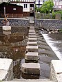
Step stones over the Lauter

Schlitz market

Back tower in Schlitz
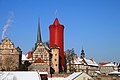
Castle view in Schlitz (Advent decorations)

High altar of the Fulda Cathedral

Noble palace in the baroque district of Fulda

Old town hall in Fulda
Paulustor in Fulda
City gate in Tann
Point Alpha Memorial

East side of the Werra bridge Vacha
Abbey ruins with Bad Hersfeld town church
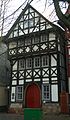
Oldest half-timbered house from 1452 in Bad Hersfeld


-
Hanau the Brothers Grimm City is located at the confluence of the Kinzig in the Main. The city offers:
- In the old town the German Goldsmith's House (formerly the old town hall), the Marienkirche , outbuildings of the otherwise destroyed town palace Hanau and the castle garden Hanau in the old town;
- In the Neustadt the Walloon-Dutch Church , the place where the German Gymnastics Federation was founded , the Brothers Grimm National Monument , right in front of the Neustadt town hall
- In the outskirts: Philippsruhe Castle on the banks of the Main with the Hanau Historical Museum and a paper theater museum as well as the historic Wilhelmsbad spa complex
- The community of Glauburg is all about the Celtic prince , whose grave complex was reconstructed on the nearby Glauberg and can be visited today. A life-size stele of a Celtic warrior, the so-called “Prince of Glauberg”, was also found there.
- There is the “Glauberg Museum” in the village. Its focus is the settlement history of various Neolithic cultures , the Ice Age, as well as the period between the Celts and the High Middle Ages at the time of the Hohenstaufen . A copy of the “Prince of Glauberg” as well as photo documentation of the excavations of the princely graves are shown from the Glauberg. However, the museum is only open on Sunday afternoons.
- On the Glauberg there is the Celtic world on the Glauberg . It consists of an archaeological park and a museum. A circular path leads through the park, which shows the 7000-year history of settlement in the Glauberg. In addition to the reconstruction of a Celtic prince's burial mound with parts of a processional street, a replica of a Celtic calendar can be seen. The museum has been showing the outstanding finds from Glauberg in a permanent exhibition since 2001. The museum is open all day Tuesday through Sunday.
- The Barbarossastadt Gelnhausen is the district town of the Main-Kinzig-Kreis . With the elongated lower and upper market, five preserved gate towers and parts of the old city fortifications, the former imperial city has retained its medieval character. The city of Gelnhausen was founded in 1170 by Emperor Friedrich I (Barbarossa) , which gave it the nickname it is known today. The city offers:
- The Kaiserpfalz (also called "Barbarossaburg") was built on a Kinziginsel, southeast of Gelnhausen, immediately after the city was founded. It was one of the smaller palatinate buildings by Friedrich I.
- The Hexenturm is an originally preserved turret from the middle of the 15th century. In the first time of its existence it was called Fratzenstein . It got its current name from the fact that alleged witches were imprisoned there during the witch hunts.
- The Marienkirche in Gelnhausen is the former church of the Premonstratensian monastery Langenselbold. It probably dates from the late 12th century and was first documented in 1223 in a letter of protection from Pope Honorius III. mentioned for the monastery Selbold .
- In Birstein there is Birstein Castle , the residence of the Princes of Isenburg-Birstein since 1517 , as well as the "Vogelsberg Cathedral" in the Unterreichenbach district.
- Lauterbach offers many half-timbered houses in the historic town center, especially around the market square. The anchor tower is the only remaining tower in the city fortifications. Step stones make it possible to cross the Lauter on foot in a shallow place. There is also the bronze monument of the "Lauterbacher Strolch", a landmark of the city created in 1905. The memorial shows a curly boy walking with an umbrella and a bare foot. The "Strolch" owes its creation to the Lauterbacher Strumpflied ("In Lauterbach I lost my stocking"). Eisenbach Castle is located in the Fischborn district, within sight of the volcano cycle path . It is the main castle of the Riedesel Freiherrn zu Eisenbach , which is still inhabited today . The associated park is open to the public. The complex consists of an old inner bailey and a fore bailey separated by a moat and dates from the 16th century in its current form. In addition to the ring wall, the pentagonal keep and parts of the wall in the core castle have been preserved from the original castle.
- The town of Schlitz was first mentioned in a document in 812. With its five castles, it is known beyond Hesse and is therefore also known as the "Romantic Castle Town of Schlitz". A special feature is the so-called Burgenring - the inner city area of the town of Schlitz, which, lying on a hill, with its collection of castles, towers, mansions, the town church and many half-timbered houses, represents a well-preserved, closed historical ensemble. Are worth seeing among other things
- the Ev. City church (formerly St. Margarethen), was consecrated in 812 as a three-aisled, Romanesque columned basilica
- the market square with its half-timbered houses
- the back tower which can be accessed by elevator and which allows a very good view of the entire old town. During Advent it is transformed into the largest “candle” in the world. He is wrapped in a red silk cloth and given a candle tip made of several hundred light bulbs.
- Seeburg Castle (near Hartershausen district)
- Hallenburg Castle was the residence of the Counts von Schlitz and emerged from an estate. The late baroque castle was built in the years 1706–1712. In 1954, the count's family donated the castle and park to the town of Schlitz.
-
Fulda was the seat of the Fulda Monastery , is a baroque and episcopal city with the episcopal seat of the eponymous diocese . The city's landmark is the Fulda Cathedral of St. Salvator. The city offers a whole range of attractions. Among other:
- The Vonderau Museum is named after the local researcher Prof. Joseph Vonderau . There are numerous finds from prehistoric times, as well as pieces from the Celtic settlement of the Fulda area . A planetarium is part of the museum .
- The German Fire Brigade Museum in Fulda-Neuenberg shows the history of German fire extinguishing on 1,600 m² of exhibition space.
- In addition to the St. Salvator Cathedral, there are many other churches. For example the parish church of St. Blaise , the Holy Spirit Church and the Severikirche
- The city palace with park and orangery
- Baroque buildings are the Paulustor , the old town hall, the old university and the noble palace.
- The state-approved climatic health resort of Tann is located in the middle Ulster valley . Are worth seeing among other things
- the renovated city gate from 1557
- the city fountain from 1710
- the Elf-Apostel-Haus (oldest town house from the beginning of the 16th century)
- the St. Nicholas Church from 1741
- the castle complexes of the barons von und zu der Tann from the beginning of the 16th and 18th centuries
- A statue of General Ludwig Samson Arthur von und zu der Tann-Rathsamhausen has stood on the market square since 1900 .
-
Geisa is best known for the Point Alpha , a reminder, memorial and meeting place on the former observation base of the US armed forces on the inner-German border. In addition, there are some interesting buildings like in the city
- the Catholic parish church of St. Philip and James, built between 1489 and 1504
- the town hall built in neo-Gothic style on the southeast corner of the market square
- the castle built by the Fuldas prince Adalbert von Schleifras from 1700 to 1714. His coat of arms marks the entrance portal. It is located on the Geisaer Gangolfiberg next to the district court.
- the district court building, built in 1540, initially served as a cellar and granary. Under the prince abbots Placidus von Droste (1678–1700) and Konstantin von Buttlar (1714–1726) it was converted into an office and court seat. Today the Rhön species protection station and the Geisa local history museum with its own border museum are located in the district court building.
- Philippsthal (Werra) is a foundation of the Benedictine order and is in 1191 in a letter of protection from Pope Celestine III. mentioned for the first time to the Hersfeld Abbey . The Philippsthal Castle is well worth seeing . The baroque residence of the Landgraves of Hesse-Philippsthal was built from 1685 to 1735 on the basis of the Kreuzberg monastery in Hersfeld, which was repealed during the Reformation. The castle has three wings that are grouped around a trapezoidal inner courtyard. The archway house in the east was the representative main entrance to the castle, as only about two kilometers upstream, over the old Werra bridge Vacha , the busy trading route Via Regia between Frankfurt and Leipzig passed. The arched house with its mansard roof was built in 1734. Until 1998 an information point for the border customs service was located here. Then the border museum was housed here. The main building was the three-story south wing. Today the town hall of the market town of Philippsthal is located here. The building runs about 50 meters to the east, where it leans against the north aisle of the former monastery church. A castle park with an orangery is connected to the complex.
- Bad Hersfeld the festival and spa town of Bad Hersfeld is known nationwide, especially for the Bad Hersfeld Festival, which has been taking place every year since 1951. These are held in the monastery ruins, which are considered the largest Romanesque church ruins in Europe. There are 216 listed buildings in the old town. The ruins of the collegiate church are located on the western side of the old town. In the monastery district there is also the Katharinenturm, in which the Lullus bell, the oldest dated bell in Germany, hangs. In the center of the old town is the Gothic town church , its church tower from the 14th century is the town's landmark. There are many patrician houses from the Gothic period on the market square (including the old coin). They were rebuilt during the Renaissance and, with their gables, like the half-timbered houses opposite, bear witness to the last building bloom of the Hersfeld monastery.
literature
- BikeLine Radtourenbuch BahnRadweg Hessen Along disused railway lines through Vogelsberg and Rhön , 1: 50,000, Verlag Esterbauer, ISBN 978-3-85000-270-7
- Bike map Wetteraukreis 1: 50,000, district committee of the Wetteraukreis, ISBN 978-3-00-026968-4
- Compact Spiralo-Radführer Rhönradweg, 1: 50,000, Bielefelder Verlagsanstalt (BVA), ISBN 978-3-87073-403-9
- Compact Spiralo-Radführer Fulda-Radweg, 1: 50,000, Bielefelder Verlagsanstalt (BVA), ISBN 978-3-87073-419-0
- BahnRadweg Hessen - On railway lines from Bad Hersfeld to Hanau . Compact spiral 1: 50,000, BVA Bielefelder Verlag 2011, ISBN 978-3-87073-480-0
Web links
- Milseburg bike path , Ulsterradweg and Solztalradweg In: www.achim-bartoschek.de.de
- Bahnradweg Hessen In: www.bahntrassenradwege.de
- Bahnradweg Hessen In: Cycle route planner Hessen.
- Brochures with detailed descriptions In: www.bahnradweg-hessen.de
swell
- Wikipedia pages and websites of the villages along the route. Accessed July 2012
Individual evidence
- ↑ Dariusz Hopek: rail routes, rail bike routes. In: radwege-in-deutschland.de. Retrieved October 16, 2018 .
- ↑ 2009 cycling map of the Hessian Ministry of Economics, Transport and Rural Development, Press and Public Relations Department, Wiesbaden
- ^ Hesse railway cycle path. In: radroutenplaner.hessen.de. April 25, 2017. Retrieved October 16, 2018 .
- ↑ Milseburgradweg. Hilders parish, accessed on August 11, 2019 .
Coordinates: 50 ° 28 ′ 8 ″ N , 9 ° 16 ′ 34 ″ E