
Lüder (river)
| Lüder | ||
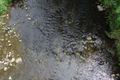
 Lüderquelle in the Hohen Vogelsberg |
||
| Data | ||
| Water code | EN : 4236 | |
| location | Vogelsbergkreis and District of Fulda , Hessen ( Germany ) | |
| River system | Weser | |
| Drain over | Fulda → Weser → North Sea | |
| Lüderquelle | Left Lüder: in Vogelsberg west of Bermuthshain 50 ° 28 ′ 34 ″ N , 9 ° 17 ′ 13 ″ E |
|
| Source height | approx. 557 m above sea level NHN right Lüder: south-southwest of Bermuthshain Association (left and right Lüder) east-northeast of Bermuthshain |
|
| muzzle | near Lüdermünd in the Fulda coordinates: 50 ° 36 '14 " N , 9 ° 36' 41" E 50 ° 36 '14 " N , 9 ° 36' 41" E |
|
| Mouth height | approx. 232 m above sea level NHN | |
| Height difference | approx. 325 m | |
| Bottom slope | approx. 8.9 ‰ | |
| length | 36.4 km | |
| Catchment area | 190.001 km² | |
| Discharge at the gauge Lütterz A Eo : 182 km² Location: 3 km above the mouth |
NNQ (12/10/1959) MNQ 1960/2012 MQ 1960/2012 Mq 1960/2012 MHQ 1960/2012 HHQ (01/23/1995) |
140 l / s 337 l / s 2.23 m³ / s 12.3 l / (s km²) 59.7 m³ / s 125 m³ / s |
| Left tributaries | see below | |
| Right tributaries | see below | |

The Lüder , also called Lüderbach , is a 36.4 km long, southwest and orographically left tributary of the Fulda from the Vogelsberg in the Vogelsbergkreis and the district of Fulda in Hesse . The river is the namesake for the villages of Kleinlüder , Großenlüder and Lüdermünd .
geography
course
The Lüder has two source streams, each known as Lüder , both of which begin in the Hohen Vogelsberg and the Hoher Vogelsberg Nature Park - near the Rhine-Weser watershed and near Bermuthshain in the Grebenhain municipal area . Its sources are in the Vogelsbergkreis: the Lüder on the right rises in a source area on the Völzberger Köpfchen ( 570.8 m ) south-southwest of Bermuthshain and northeast of the Völzberg district in the neighboring Main-Kinzig district and belonging to the municipality of Birstein - at an altitude of around 517 m . The Lüder on the left has its sources - near the towns of Herchenhain and Hartmannshain , which are part of Grebenhain - west of Bermuthshain between the Herchenhainer Höhe ( 733.1 m ) in the north-northwest and the White Stone ( 607 m ) in the south-southeast; a source there, which is about 100 m southeast of the federal highway 275 and directly on the volcano cycle path , was called Lüderquelle at about 557 m height.
The Lüder on the left, which rises from the Lüderquelle, flows roughly in a west-east direction through the northern parts of Bermuthshain, through which a small stream with a mill ditch ran until 1963. This originated on the weed , near the Hofreite Heckert. Two mills were powered by the water in this ditch. The two watercourses in the village were drained when the local sewer system was built in 1963 and have since disappeared without a trace. Lüder on the right passes Bermuthshain a few hundred meters to the east.
After the union of the two source brooks east-northeast of Bermuthshain at an altitude of about 436 m , the Lüder, which runs mainly northeast, flows directly southeast past Crainfeld and then through Bannerod and Heisters . The Moosbach coming from the direction of Zahmen then flows into the river, followed by the Schwarza flowing from Steinfurt . Then the river runs in the district of Fulda through Blankenau , after which it receives the Jossa coming from Schletzenhausen .
The Lüder then flows through Hainzell , after which the Kalte Lüder flows into it, through Kleinlüder and directly east past Uffhausen in the direction of Großenlüder .
Immediately after crossing under federal highway 254, it bends south of the town it has passed to east-southeast. While Lüder the railway Fulda-casting (Vogelsberg Railway) passes under, it passes Bimbach just north where the by Malkes coming Erbach opens. Then it turns again to the northeast and flows through Lütterz .
Ultimately , the Lüder flows into a loop of the Weser source river Fulda at an altitude of about 232 m ; About 500 m northeast of its confluence lies beyond the Fulda with Lüdermünd a northwest part of Fulda .

The Lüder with a pedestrian bridge in Bannerod (viewed downstream)

Mouth of the Moosbach (right) into the Lüder - below Heisters
The Lüder from the bridge over the Lüder with low water at the entrance to Hainzell

The Lüderaue near Hainzell

Lüderfurt near Kleinlüder

The Lüderlauf near Uffhausen


Catchment area and tributaries
The Lüder catchment area is 190.001 km². Their main tributaries are:
| Surname | page | Length ( km ) |
Spring location ( natural area ) |
Estuary at Lüder km |
EZG km² |
DGKZ |
|---|---|---|---|---|---|---|
| Moosbach | right | 11.8 | High Vogelsberg | 13.4 | 23.199 | 4236-14 |
| Schwarza | Left | 18.3 | High Vogelsberg | 15.0 | 30.239 | 4236-2 |
| Jossa | right | 11.7 | Lower Vogelsberg | 18.3 | 23.501 | 4236-32 |
| Cold Lüder | right | 8.8 | Gieseler Forest | 20.7 | 23,952 | 4236-4 |
| Erbach | right | 3.3 | Gieseler Forest | 31.3 | 12,315 | 4236-6 |
The Schwarza (the Black Bach ), which is also called Waagbach (Waaggraben) and Ahlbach in sections, flows northwest parallel to the Lüder. It rises in the Grebenhain district northwest of Oberwald (also) on the Herchenhainer Höhe at an altitude of about 682 m . In a predominantly northeastern direction it flows through Grebenhain , past Vaitshain , through Nösberts-Weidmoos and through Steinfurt . It flows into the Lüder between Steinfurt and Blankenau near the border of the Vogelsberg district with the Fulda district (former Hessian-Prussian state border).
Traffic and walking
The federal highway 275 runs near the Lüderquelle (left Lüder) and at Großenlüder the Lüder crosses the federal highway 254 . Several state and district roads run along or crossing the river . The volcano cycle path runs directly past the Lüder spring and on the northern flank of the Lüdertal above Bermuthshain and Crainfeld on the route of the disused Oberwaldbahn (Glauburg-Stockheim-Lauterbach Nord) . Between Großenlüder and Bimbach, the Lüder passes under the Fulda-Gießen railway line (Vogelsbergbahn) . The Fulda cycle path and the Hessian long -distance cycle paths R2 , R3 and R8 run along the river or cross it .
Web links
- Water profile and program of measures 4236.1 ( Memento from January 1, 2013 in the web archive archive.today ) ( Notes ) → Overview of all Hessian river systems (PDF, 1.7 MB) lower Lüder
- Water profile and program of measures 4236.2 ( Memento from January 1, 2013 in the web archive archive.today ) ( Notes ) → Overview of all Hessian river systems (PDF, 1.7 MB) Obere Lüder
References and comments
- ↑ a b c d e f g h i Map services of the Federal Agency for Nature Conservation ( information )
- ↑ a b c d e f g Water map service of the Hessian Ministry for the Environment, Climate Protection, Agriculture and Consumer Protection ( information )
- ↑ a b At the Lüderquelle there is a sign with the inscription: "Lüderquelle" - "Length: 40 km" ; the length given there does not match the river length of 36.4 km stated according to the referenced river map service.
- ^ Deutsches Gewässerkundliches Jahrbuch Weser-Ems 2012. Lower Saxony State Agency for Water Management, Coastal Protection and Nature Conservation, p. 131, accessed on October 4, 2017 (PDF, German, 6523 kB).
- ↑ For a better overview and for sorting downstream , a hyphen has been inserted for each river in the river code number (DGKZ) after the "4236", which stands for Lüder.
- ↑ The Lüder km mentioned in the mouth column are calculated from the difference between the 36.4 km total length of Lüder, which comes from the referenced waterway map service, to the respective mouth distance that can be read off there.