
District of Fulda
| coat of arms | Germany map |
|---|---|

|

Coordinates: 50 ° 34 ' N , 9 ° 41' E |
| Basic data | |
| State : | Hesse |
| Administrative region : | kassel |
| Administrative headquarters : | Fulda |
| Area : | 1,380.4 km 2 |
| Residents: | 223,145 (Dec. 31, 2019) |
| Population density : | 162 inhabitants per km 2 |
| License plate : | FD |
| Circle key : | 06 6 31 |
| NUTS : | DE732 |
| Circle structure: | 23 municipalities |
| Address of the district administration: |
Wörthstrasse 15 36037 Fulda |
| Website : | |
| District Administrator : | Bernd Woide ( CDU ) |
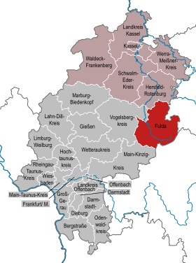
| Location of the district of Fulda in Hesse | |
  |
|
The district of Fulda is located in the administrative district of Kassel in East Hesse on the eastern edge of the Rhine-Main metropolitan region .
geography
location
The core area of the district of Fulda includes the so-called Fulda basin . To the east of it lies the low mountain range of the Hohe Rhön with Hesse's highest mountain, the Wasserkuppe . In the west of the district there are still foothills of the Vogelsberg . The name of the district is derived from the river Fulda and the district town of Fulda .
The district of Fulda is the easternmost district of the Rhine-Main area .
Neighboring areas
The district borders clockwise in the north, beginning with the districts of Hersfeld-Rotenburg (in Hesse), Wartburg district and district of Schmalkalden-Meiningen (both in Thuringia ), Rhön-Grabfeld and Bad Kissingen (both in Bavaria ) as well as Main-Kinzig district and Vogelsberg district (both again in Hessen).
history

The Fulda district was created in 1821 after the Grand Duchy of Fulda came to the Electorate of Hesse in 1816 and was divided into four districts. In 1856, the Rödergrund community moved from the Hünfeld district to the Fulda district and became part of the Rödergrund-Egelmes community . When the Electorate of Hesse and the Bavarian districts of Gersfeld and Orb were annexed by Prussia in 1866 , this area became the new administrative district of Kassel in the Prussian province of Hesse-Nassau . Today's district area was divided into the districts of Fulda, Gersfeld and Hünfeld .
In 1927 the city of Fulda left the Fulda district and became a district. In 1932, the Fulda district was merged with the Gersfeld district. As part of the Hessian municipal reform on December 31, 1971, April 1 and August 1, 1972, the numerous smaller communities in the old district area were united to a total of 17 large communities.
Due to the law on the reorganization of the districts of Fulda and Hünfeld and the city of Fulda , the scope of the district of Fulda was changed significantly on August 1, 1972:
- The five communities Burghaun , Eiterfeld , Hünfeld , Nüsttal and Rasdorf were added to the Fulda district from the dissolved district of Hünfeld . The community of Haunetal in the district of Hünfeld came to the district of Hersfeld-Rotenburg.
- The communities of Oberkalbach and Uttrichshausen of the dissolved district of Schlüchtern were incorporated into the community of Kalbach in the district of Fulda.
- 24 communities left the district of Fulda and were incorporated into the independent city of Fulda.
- The Weidenau community left the Fulda district and was incorporated into the Freiensteinau community of the new Vogelsberg district.
On July 1, 1974, the city of Fulda lost its status as an independent city and was incorporated into the Fulda district, which means that it has reached its current size with a total of 23 communities.
Population development
| year | Residents | source |
|---|---|---|
| 1871 | 44,475 | |
| 1890 | 49.168 | |
| 1900 | 53,438 | |
| 1910 | 63.199 | |
| 1925 | 71,637 | |
| 1933 | 70,985 | |
| 1939 | 69,963 | |
| 1950 | 94,928 | |
| 1960 | 95,200 | |
| 1970 | 108,800 | |
| 1980 | 190,300 | |
| 1990 | 197,300 | |
| 2000 | 217.710 | |
| 2010 | 217,408 | |
| 2015 | 217,584 |
Religions
According to the 2011 census, 62.2% of the population belonged to the Catholic Church and 20.0% to the Protestant Church . 17.7% of the population were of another religion or denomination (including Muslims , Orthodox Christians ) or were non-denominational .
politics
District council
The local elections on March 6, 2016 produced the following results, compared to previous local elections:
| Diagram showing the election results and the distribution of seats | |
|---|---|
| Nominations | % 2016 |
Seats 2016 |
% 2011 |
Seats 2011 |
% 2006 |
Seats 2006 |
% 2001 |
Seats 2001 |
%
1997 |
Seats
1997 |
|
|---|---|---|---|---|---|---|---|---|---|---|---|
| CDU | Christian Democratic Union of Germany | 46.5 | 38 | 53.0 | 43 | 57.8 | 47 | 58.6 | 48 | 49.9 | 42 |
| SPD | Social Democratic Party of Germany | 15.5 | 13 | 19.1 | 15th | 20.6 | 17th | 23.3 | 19th | 25.8 | 22nd |
| AfD | Alternative for Germany | 14.3 | 12 | - | - | - | - | - | - | - | - |
| GREEN | Alliance 90 / The Greens | 8.1 | 6th | 14.4 | 12 | 5.3 | 4th | 5.2 | 4th | 7.3 | 6th |
| CWE | Christian voter unity | 6.4 | 5 | 6.3 | 5 | 5.3 | 4th | 4.4 | 4th | ||
| FDP | Free Democratic Party | 5.5 | 4th | 3.7 | 3 | 4.0 | 3 | 2.9 | 2 | 3.0 | |
| DIE LINKE.OL | DIE LINKE: Open list | 2.8 | 2 | 1.9 | 2 | 1.6 | 1 | - | - | - | - |
| REP | The Republicans | 1.0 | 1 | 1.7 | 1 | 2.2 | 2 | 2.7 | 2 | 5.9 | 6th |
| FWG | Free voter communities of the district of Fulda | - | - | - | - | 3.3 | 3 | 2.7 | 2 | ||
| DP | German party | - | - | - | - | - | - | 0.2 | - | - | - |
| PDS | Democratic Socialism Party | - | - | - | - | - | - | - | - | 0.9 | - |
| total | 100.0 | 81 | 100.0 | 81 | 100.0 | 81 | 100.0 | 81 | 100.0 | 81 | |
| Voter turnout in% | 54.5 | 51.2 | 47.7 | 57.1 | 70.7 | ||||||
District administrators of the Fulda district from 1821 to 1972
| Surname | from | to |
|---|---|---|
| Friedrich Fondy | 1821 | 1841 |
| Karl von Benning | 1841 | 1844 |
| Heinrich Karl Joachim von Loßberg | 1844 | 1847 |
| Jakob Hippolyt Braun | 1847 | 1851 |
| Carl Theodor Giller | 1851 | 1854 |
| Heinrich Wilhelm Emil Schmidt | 1854 | 1866 |
| August Wagner | 1866 | 1868 |
| Friedrich August Wilhelm Cornelius | 1868 | 1883 |
| Friedrich von Trott zu Solz | 1883 | 1891 |
| Max Friedrich Martin Georg Fliedner | 1891 | 1894 |
| Kurt Steffens | 1895 | 1903 |
| Gustav Springorum | 1903 | 1912 |
| Karl von Dörnberg | 1912 | 1921 |
| Heinrich von Gagern | 1921 | 1933 |
| Hans Burkhardt (NSDAP) | 1933 | 1940 |
| Otto Feuerborn (NSDAP) | 1940 | 1945 |
| Franz Danzebrink | 1945 | 1945 |
| Johannes Kramer | 1945 | 1945 |
| Georg Stieler (CDU) | 1945 | 1953 |
| Eduard Stieler (CDU) | 1953 | 1972 |
(Sources below)
District administrators of the Fulda district since the regional reform in 1972
| Surname | from | to |
|---|---|---|
| Eduard Stieler (CDU) | 1972 | 1973 |
| Fritz Kramer (CDU) | 1973 | 2006 |
| Bernd Woide (CDU) | 2006 | today |
(Sources below)
Since 1 February 2006, Bernd Woide (CDU) district administrator of the district of Fulda. His last re-election took place on September 24, 2017 with a share of the vote of 65.0 percent and a voter turnout of 71.6 percent.
Coat of arms, flag and banner

Hoist flag

banner

The district of Fulda has a coat of arms, a flag and a banner .
|
|
Blazon : “Split by silver and blue; in front the black continuous Fulda cross, behind the Hessian lion. " |
| Justification of the coat of arms: The coat of arms thus expresses the old affiliation of today's district area to the Fulda Abbey and the later affiliation to the Electorate or State of Hesse. The coat of arms was first awarded on December 11, 1936 and again on July 9, 1973. |
Description of the flag: “The flag shows on a white strip bordered by two red stripes in a ratio of 1: 4: 1, with the coat of arms in the half of the leech. The banner shows on a white strip bordered by two red side stripes in a ratio of 1: 4: 1, the center of the coat of arms clearly offset upwards. "
Sponsorships
In 1962 the sponsorship for the expelled Sudeten Germans from the Friedland district was taken over. 1965 also for those from the Leitmeritz district .
Economy and Transport
In the Future Atlas 2016 , the Fulda district was ranked 89th out of 402 districts, municipal associations and independent cities in Germany, making it one of the places with "high future prospects". In the 2019 edition, it was ranked 114th out of 401.
traffic
The Fulda station is an important railway junction and stop on the Hanover-Würzburg high-speed railway . The railway lines Fulda – Frankfurt , Fulda – Bebra , Fulda – Gersfeld and Fulda – Gießen run through the district . The federal motorway 7 (Kassel – Würzburg) and federal motorway 66 (Frankfurt – Fulda) open up the district in long-distance road traffic. The federal highways B 27 , B 84 , B 254 , B 279 and B 458 are part of the network of federal roads , state roads and district roads .
The Weimarer Straße tunnel in Fulda is part of the Fulda city ring road and the Neuhof motorway tunnel on federal motorway 66 also runs through the district and is of supraregional importance.
Local public transport is provided by trains and buses. The district of Fulda is in the tariff area of the Rhein-Main-Verkehrsverbund .
Communities
(Residents on December 31, 2019)


|
|
Former parishes
The following list contains all former municipalities that ever belonged to the district of Fulda.
License Plate
On July 1, 1956, the district was assigned the distinctive sign FD when the vehicle registration number that is still valid today was introduced . It is still issued today.
literature
- District committee of the district of Fulda: History and tasks of the district of Fulda: Monograph on the 175th anniversary of the district: Parzeller , Fulda * Michael Mott : Monuments in the district of Fulda and in the old monastery: Rhön-Verlag Hohmann, Hünfeld, Rindt-Druck, Fulda 1996, ISBN 3- 931796-13-2 .
- Diana Ascher: The place names of the district of Fulda . In: Archive for Middle Rhine Church History 70 (2018), pp. 29–49.
- Michael Mott: A circle with culture: "Checkered - the history of the Fulda region" Once home to Stone Age hunters, saints, regents and godly subjects. In: “Landkreis Fulda”, book series “Portrait of German districts”: Fachverlag Kommunikation & Wirtschaft GmbH, Oldenburg, fourth edition 2009, ISBN 978-3-88363-301-5 ; fifth completely new edition 2014, ISBN 978-3-88363-356-5 .
Web links
- Official website of the district of Fulda
- District of Fulda. Historical local dictionary. In: Landesgeschichtliches Informationssystem Hessen (LAGIS).
- Website of the Fulda region
- Link catalog on the subject of the Fulda district at curlie.org (formerly DMOZ )
- District of Fulda in Territorial changes in Germany and German administered areas 1874–1945
Individual evidence
- ↑ Hessian State Statistical Office: Population status on December 31, 2019 (districts and urban districts as well as municipalities, population figures based on the 2011 census) ( help ).
- ↑ Ulrich Reuling : Administrative division 1821-1955. (PDF) In: Historical Atlas of Hesse. Landesgeschichtliches Informationssystem Hessen (LAGIS), p. 176 , accessed on March 19, 2016 .
- ↑ a b Law on the reorganization of the districts of Fulda and Hünfeld and the city of Fulda (GVBl. II 330-14) of July 11, 1972 . In: The Hessian Minister of the Interior (ed.): Law and Ordinance Gazette for the State of Hesse . 1972 No. 17 , p. 220 ( online at the information system of the Hessian state parliament [PDF; 1,2 MB ]).
- ^ Federal Statistical Office (ed.): Historical municipality directory for the Federal Republic of Germany. Name, border and key number changes in municipalities, counties and administrative districts from May 27, 1970 to December 31, 1982 . W. Kohlhammer, Stuttgart / Mainz 1983, ISBN 3-17-003263-1 , p. 395 f .
- ^ The municipalities and manor districts of the Hesse-Nassau province and their population in 1871
- ↑ a b c d e f g h i j Michael Rademacher: German administrative history from the unification of the empire in 1871 to the reunification in 1990. Fulda district. (Online material for the dissertation, Osnabrück 2006).
- ↑ Statistical Yearbook for the Federal Republic of Germany 1972
- ↑ Hessian State Statistical Office.
- ↑ Population in the administrative districts on September 30, 2010 and population processes in the 3rd quarter of 2010. Hessian State Statistical Office, archived from the original on May 10, 2011 ; accessed on May 31, 2019 .
- ↑ Population in the administrative districts on June 30, 2015 and change in population in the 2nd quarter of 2015. Hessian State Statistical Office, archived from the original on March 24, 2016 ; accessed on May 31, 2019 .
- ↑ Population in a regional comparison by religion -in% - counting from the adjusted register inventory , last seen on October 13, 2017.
- ^ Hessian State Statistical Office: Results of the district elections of 2016 and 2011
- ^ Hessian State Statistical Office: Results of the district elections of 2011 and 2006
- ^ Hessian State Statistical Office: Results of the district elections of 2006 and 2001
- ^ Hessian State Statistical Office: Results of the district elections of 2001 and 1997
- ^ Hessisches Statistisches Landesamt Wiesbaden: The municipal elections on March 18, 2001. In: Results of the municipal elections and the district elections. Hessian Statistical Office Wiesbaden, 2001, accessed on April 24, 2020 (German).
- ↑ There are no separate figures for the CWE and FWG for 2001, as the contributions to Hesse's statistics no. 356 mention a total of 5 district council members and 6.1% for the CWE and FWG.
- ↑ There are no separate figures for the CWE and FWG for 2001, as the contributions to Hesse's statistics no. 356 mention a total of 5 district council members and 6.1% for the CWE and FWG.
- ↑ In the contributions to Hesse's statistics no. 356 there is no information about the number of district council members of the FDP that resulted from the 1997 local elections.
- ↑ There are no separate figures for the CWE and FWG for 2001, as the contributions to Hesse's statistics no. 356 mention a total of 5 district council members and 6.1% for the CWE and FWG.
- ↑ There are no separate figures for the CWE and FWG for 2001, as the contributions to Hesse's statistics no. 356 mention a total of 5 district council members and 6.1% for the CWE and FWG.
- ↑ The DP won no seat in 2001, but 0.2% of the vote.
- ↑ In the contributions to Hesse's statistics no. 356, 0.7 is shown for other in 1997, although no details are given as to which party or electoral association it is.
- ↑ Fuldaer Zeitung from August 15, 2011 ( page no longer available , search in web archives ) Info: The link was automatically marked as defective. Please check the link according to the instructions and then remove this notice.
- ↑ https://www.fulda.de/rathaus-politik/partnerstaedte-patenschaften/patenschaften/
- ↑ Zukunftsatlas 2016. Archived from the original ; accessed on March 23, 2018 .
- ↑ PROGNOS future atlas. Handelsblatt, accessed on December 10, 2019 .
- ↑ Hessian State Statistical Office: Population status on December 31, 2019 (districts and urban districts as well as municipalities, population figures based on the 2011 census) ( help ).
- ↑ District of Fulda. Historical local dictionary. In: Landesgeschichtliches Informationssystem Hessen (LAGIS).
Counties: Bergstrasse | Darmstadt-Dieburg | Fulda | Casting | Gross-Gerau | Hersfeld-Rotenburg | Hochtaunuskreis | Kassel (Country) | Lahn-Dill-Kreis | Limburg-Weilburg | Main-Kinzig-Kreis | Main-Taunus-Kreis | Marburg-Biedenkopf | Odenwaldkreis | Offenbach (State) | Rheingau-Taunus-Kreis | Schwalm-Eder district | Vogelsbergkreis | Waldeck-Frankenberg | Werra-Meißner district | Wetteraukreis
Independent cities: Darmstadt | Frankfurt am Main | Kassel | Offenbach am Main | Wiesbaden
Bad Salzschlirf | Burghaun | Dipperz | Ebersburg | Ehrenberg (Rhön) | Oak cell | Pus field | Lilacs | Fulda | Gersfeld (Rhön) | Grossenlüder | Hilders | Hofbieber | Hosenfeld | Hünfeld | Kalbach | Künzell | Neuhof | Nüsttal | Petersberg | Poppenhausen (Wasserkuppe) | Rasdorf | Tann (Rhön)
Eschwege | Frankenberg | Fritzlar-Homberg | Fulda | Gelnhausen | Hanau | Hersfeld | Hofgeismar | Hünfeld | Kassel | Marburg | Melsungen | Rotenburg | Schluechtern | Waldeck | Witzenhausen | Wolfhagen | Goat grove
Disbanded in 1932 : Fritzlar | Gersfeld | Homberg | Kirchhain | Released in 1932 : Grafschaft Schaumburg
Disbanded in 1942 : District of the Eder | District of Eisenberg | District of Twiste | Released in 1944 : Reign of Schmalkalden